brooklynwx99
-
Posts
6,233 -
Joined
-
Last visited
Content Type
Profiles
Blogs
Forums
American Weather
Media Demo
Store
Gallery
Everything posted by brooklynwx99
-
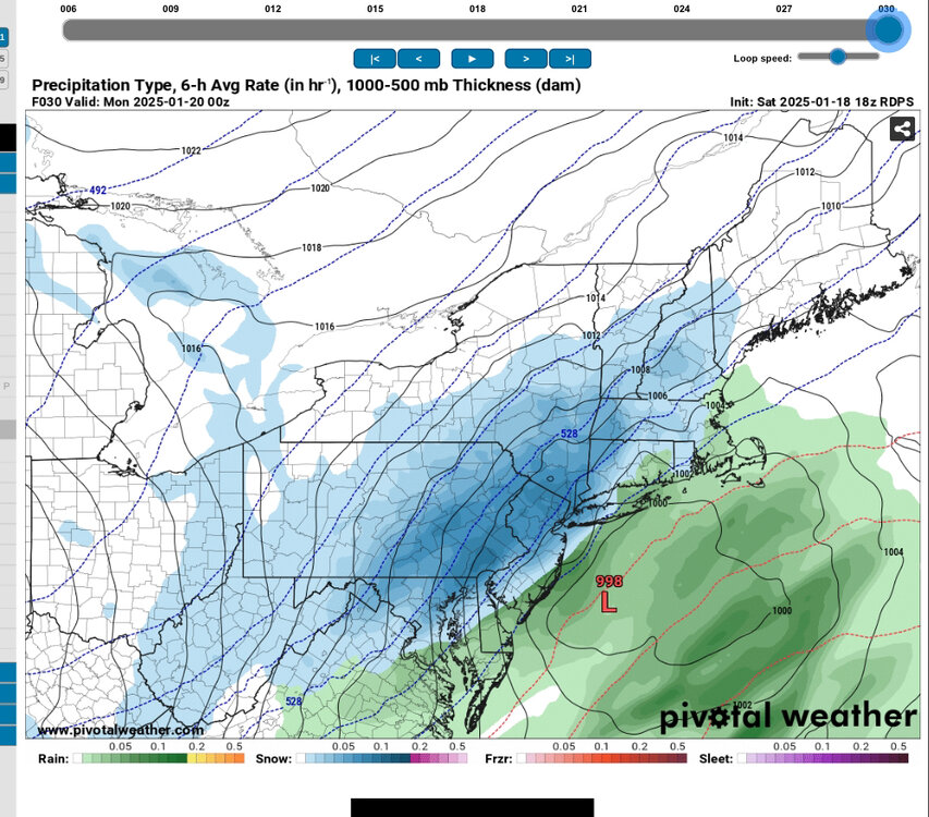
 the heavier precip down in E PA will pivot in over the next few hours. most of the accumulations were always going to be between 21-03z… it’ll rip this evening into the metro
 -
first plowable to potentially significant event for most on here in a while. excited! could see some nice rates this evening
-
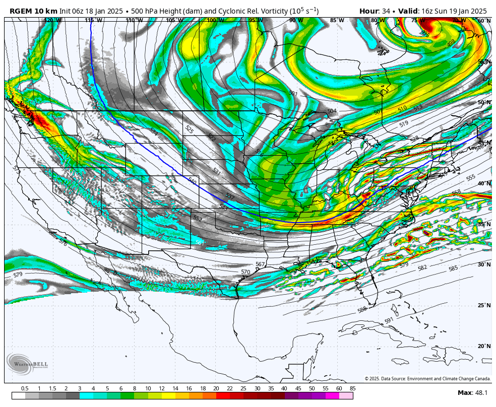
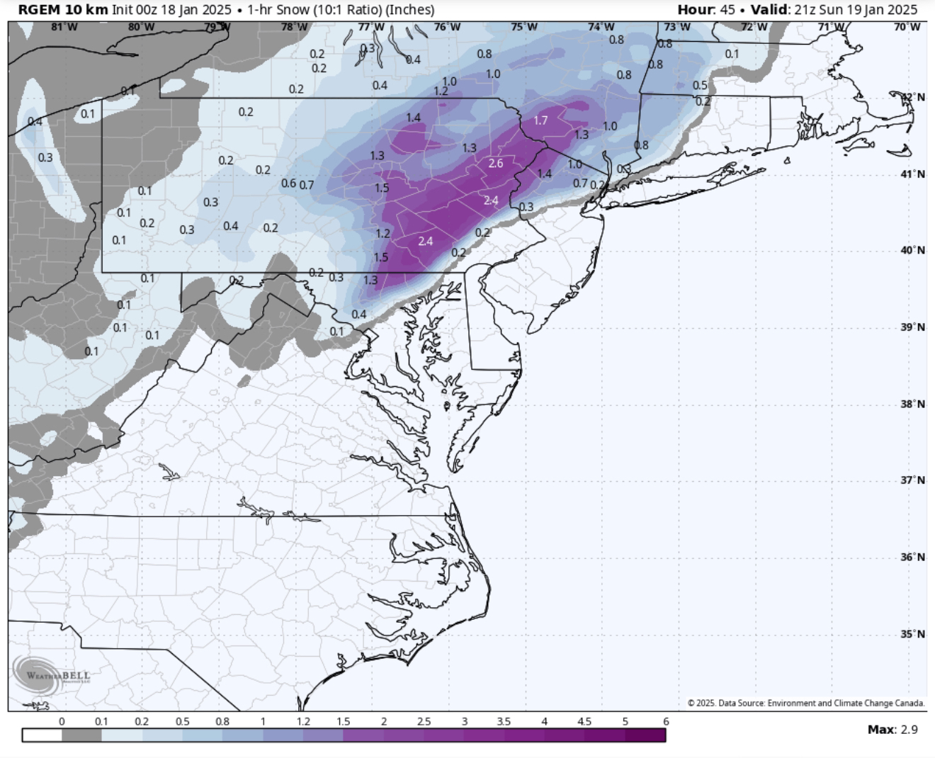
it spitting out 3”/hr rates in E PA was a big red flag. just not happening in this setup
-
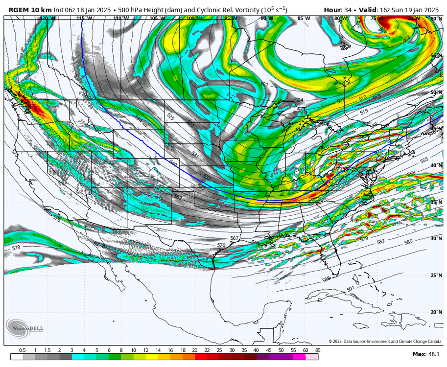
lol RGEM has totally caved
-
straight up cave from the RGEM
-
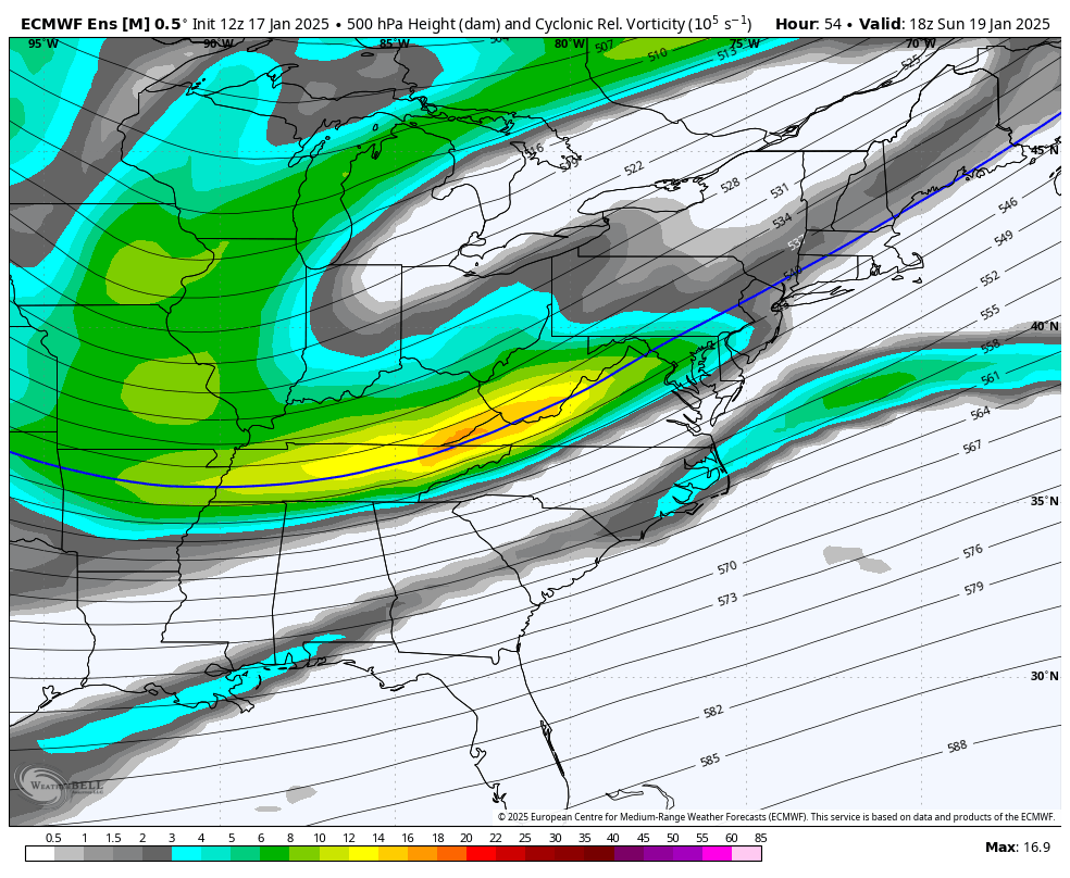
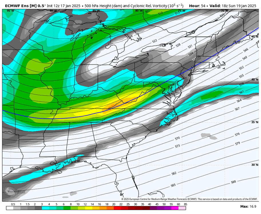
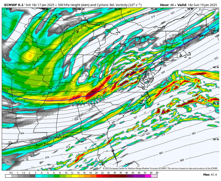
lol this is a wild trend from the EPS at this range
-
really nice trend to sharpen the vort on the EPS
-
to be fair, it was very washed out a couple of days ago
-
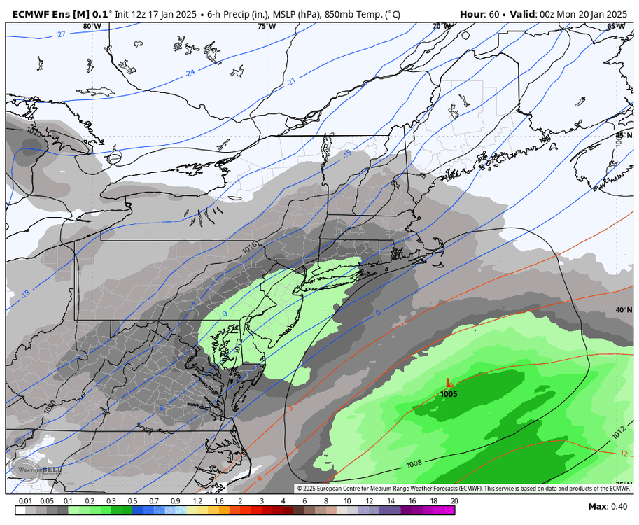
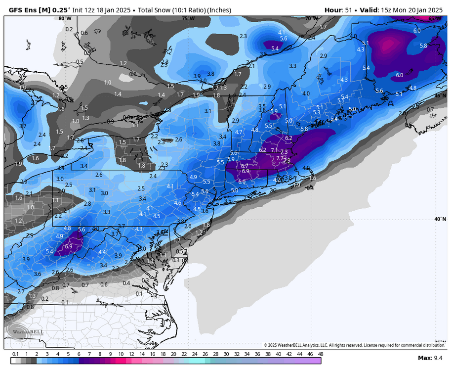
ECMWF is a really nice hit. 3-6" area wide
-
GEFS shifted SE with the snowfall axis from 06z pretty notably
-
RGEM finally coming back down to earth. vort is a good bit less amped
-
RGEM is finally coming back down to earth
-
January Medium/Long Range: A snowy January ahead?
brooklynwx99 replied to mappy's topic in Mid Atlantic
this is concerning for midweek. needs to be monitored
-
this is pretty concerning for midweek
-
GFS crushes the metro again
-
the RGEM has 3”/hr rates over E PA. i’m almost tossing on that alone. this system isn’t capable of that

-
the RGEM has 3”/hr rates over E PA. i’m almost tossing on that alone. this system isn’t capable of that

-
lemme show you a couple of three solutions
-
kinda hilarious that this is the difference between the RGEM, ECWMF, and GFS
-
kinda hilarious that this is the difference between the RGEM, ECWMF, and GFS

-
EPS basically held serve. maybe a bit more precip NW
-
conventional wisdom would have you blend, bringing you to an AIFS/GFS type solution, but who knows
-
conventional wisdom would have you blend, bringing you to an AIFS/GFS type solution, but who knows
-
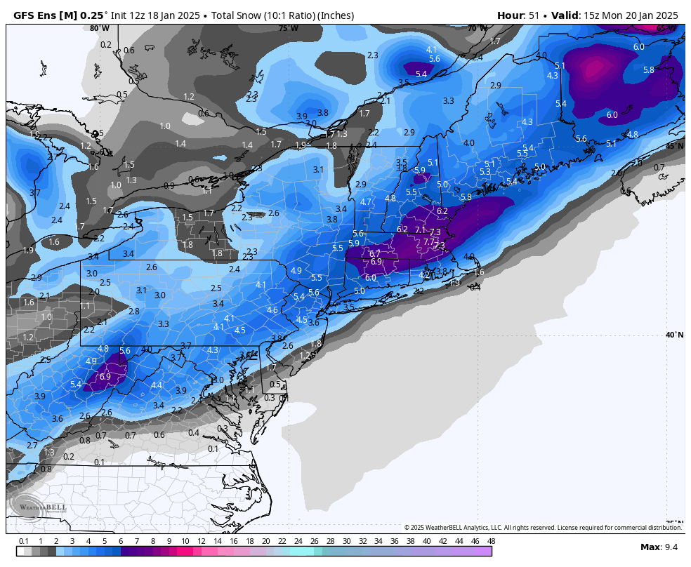
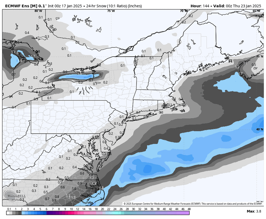
ECMWF is 2-4" for all. not bad whatsoever