brooklynwx99
-
Posts
6,233 -
Joined
-
Last visited
Content Type
Profiles
Blogs
Forums
American Weather
Media Demo
Store
Gallery
Everything posted by brooklynwx99
-
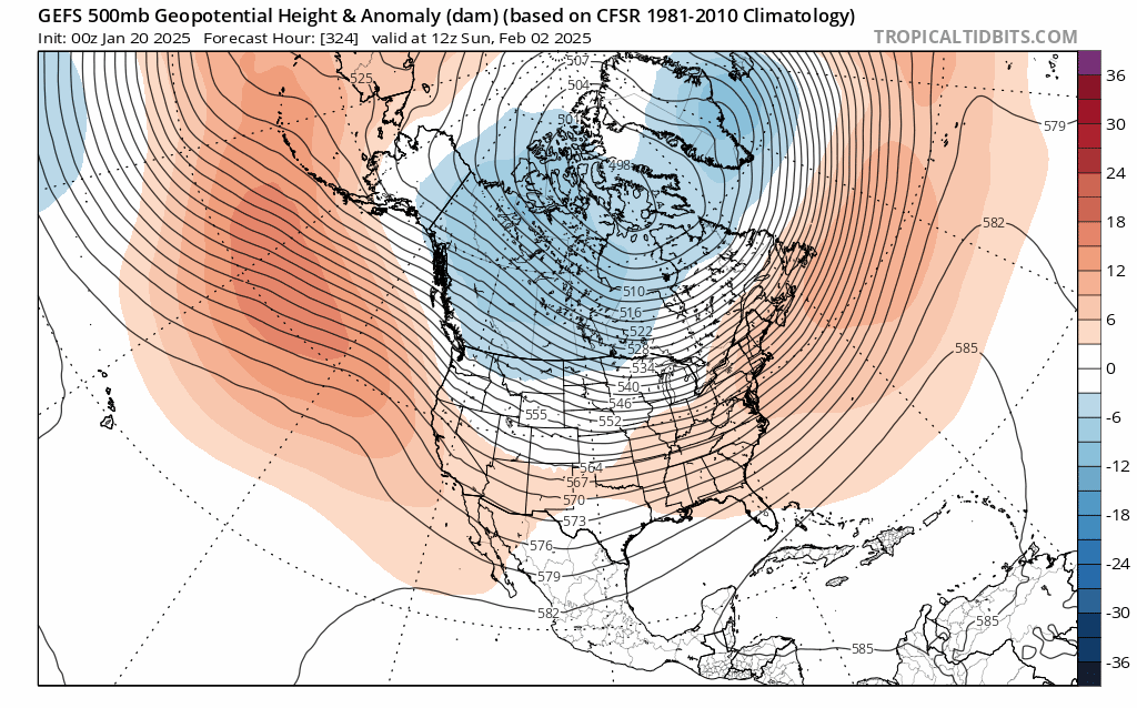
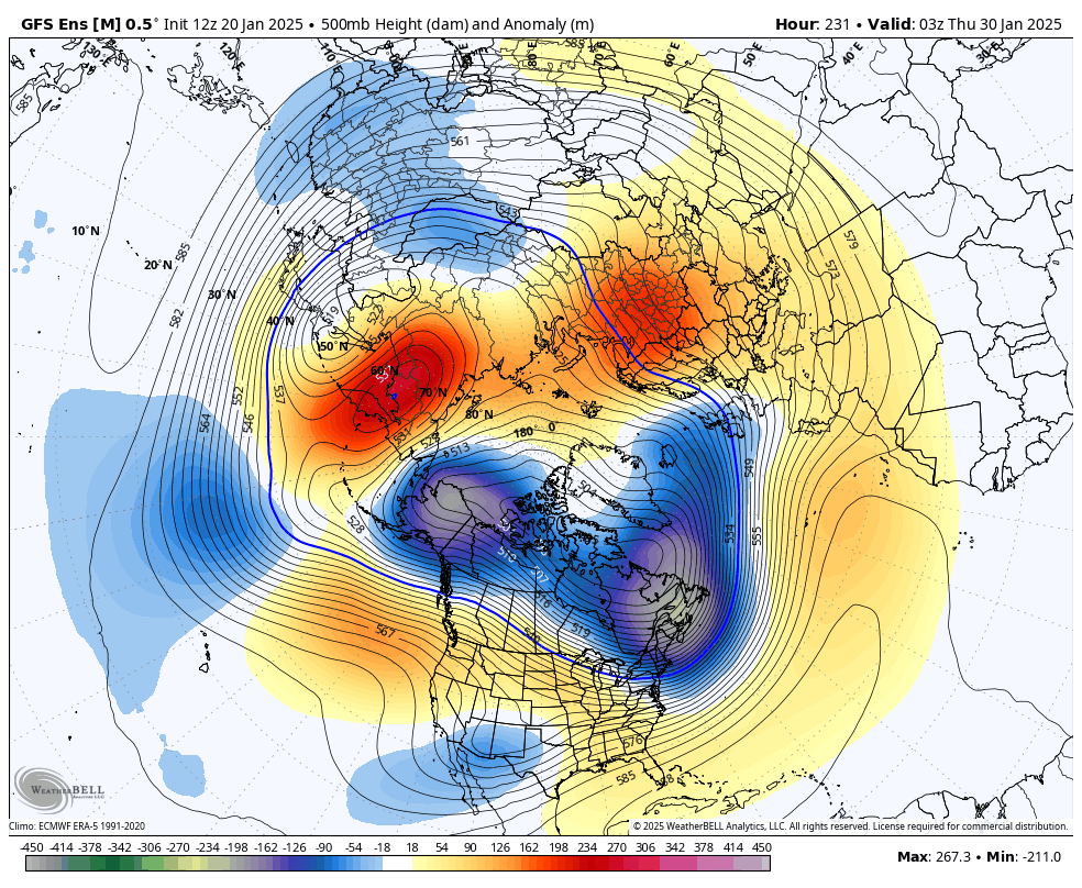
posted this elsewhere. extended guidance has done such a bad job with the Pacific jet all winter

-
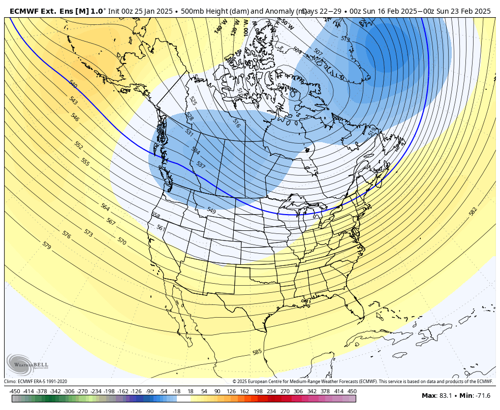
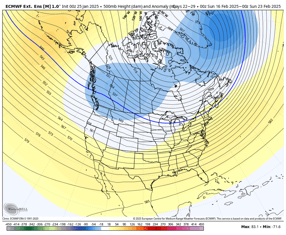
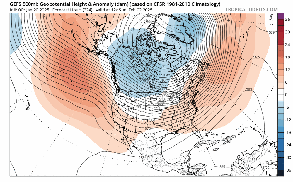
seems like we get into some solid -EPO once into the second week of the month. guidance has been underdoing the Pacific jet as well, so it wouldn't be surprising to see an improvement in the PNA as we move forward. overall, it at least looks more active with lots of cold air in Canada... EPS looks pretty nice today after the 7-8th or so
-
lol how predictable

-
so predictable. this is like the third time this has happened this winter

-
extended guidance underdoing the Pacific jet again
-
to be fair, this winter was supposed to be another warm one and that has busted tremendously. even I called for a warm year and it's been anything but. wouldn't be shocked if the upcoming warm spell just ended up near normal
-

January Medium/Long Range: Chasing more snow to close out the month
brooklynwx99 replied to mappy's topic in Mid Atlantic
lmao
-
wouldn't be shocking if it popped up again in March, but blocking is a wildcard. I wasn't expecting it to be nearly as blocky as it has been so far this year. if you told me that the Mid-Atlantic and South would do the best through late Jan I would have laughed
-
no, it isn't, though I could see a cutter dragging down cold air nearby and establishing a baroclinic zone farther south for a second wave to take advantage of. it's going to be quite changeable but will present chances... doubt it's persistently cold or warm
-
you are never going to get a warm pattern with the TPV on this side of the globe and -EPO. not happening
-
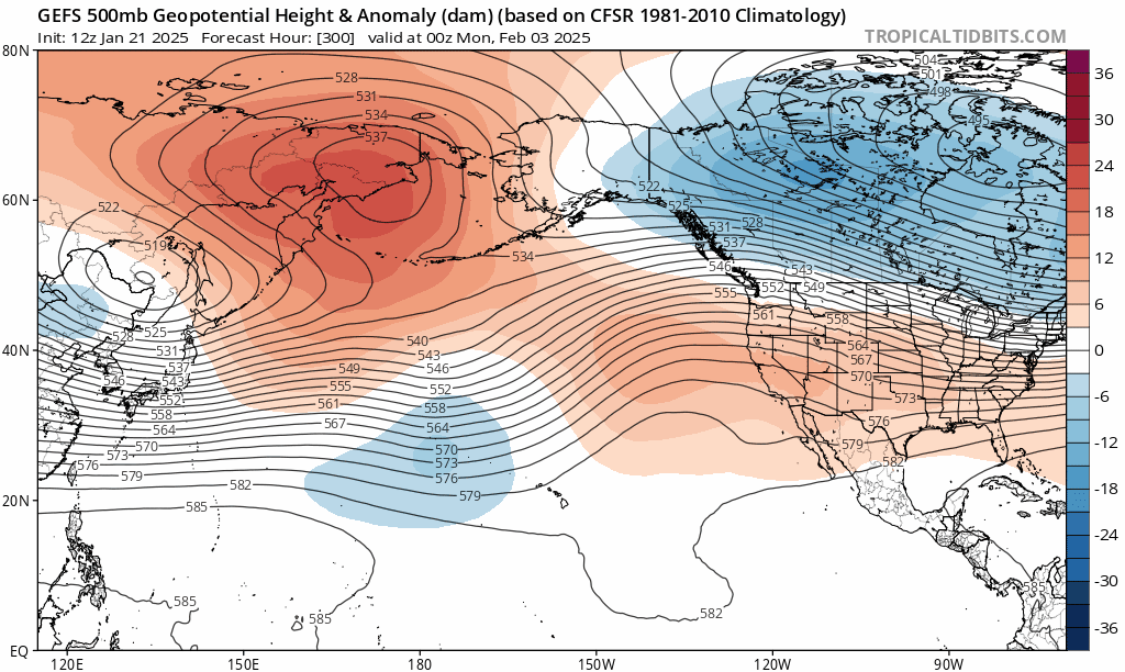
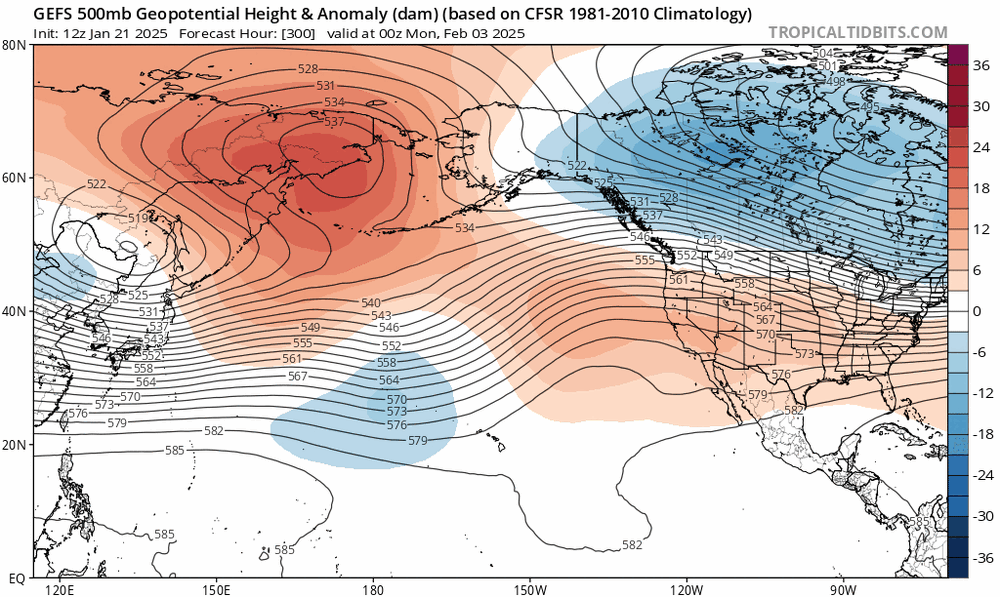
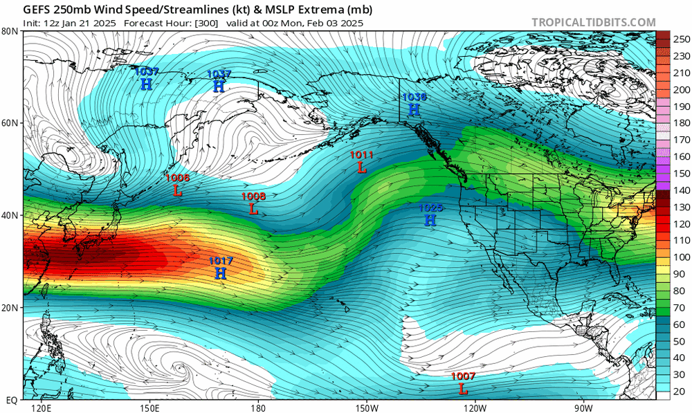
notice the trend for a stronger Pacific jet as we move forward in time, which has been common this year... this helps push the Aleutian ridging closer to AK, allowing the trough in the Rockies to push east a bit more. would be nice to see this keep going

-
January Medium/Long Range: A snowy January ahead?
brooklynwx99 replied to mappy's topic in Mid Atlantic
notice the trend for a stronger Pacific jet as we move forward in time, which has been common this year... this helps push the Aleutian ridging closer to AK, allowing the trough in the Rockies to push east a bit more. would be nice to see this keep going
-
January Medium/Long Range: A snowy January ahead?
brooklynwx99 replied to mappy's topic in Mid Atlantic
-
January Medium/Long Range: A snowy January ahead?
brooklynwx99 replied to mappy's topic in Mid Atlantic
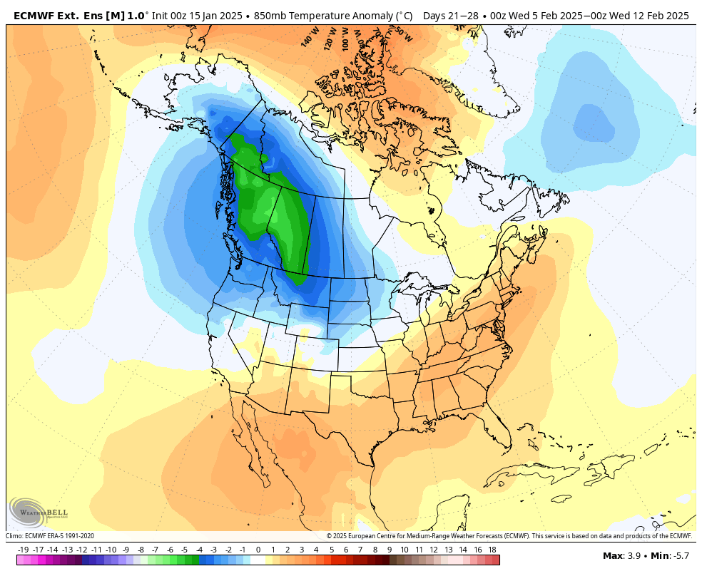
meh, that AK trough is from a strong -WPO. it's just modified Arctic air, not nearly the same as a Pacific blowtorch. the pattern moderates but it never really gets all that warm. weird looking, though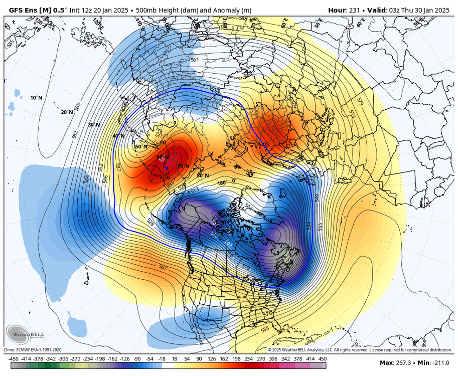
-
January Medium/Long Range: A snowy January ahead?
brooklynwx99 replied to mappy's topic in Mid Atlantic
SE ridge continues to be overmodeled in time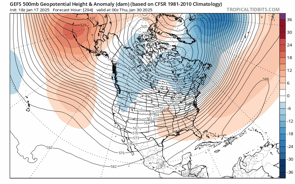
-
SE ridge getting squashed again

-
easily could have been very snowy up here, but we have had shit luck with kickers... one a couple of weeks ago and another this coming week. things just aren't coming together. however, the MA is going to be AN on the year through the end of Jan
-
i mean, it should take years between each KU. we've been spoiled with one every 1-2 years
-
southern stream vort into TPV is a good way to get snow. hopefully it works out
-
true. out of all the years that I thought were analogous, 13-14 might look the most similar at 500mb. we'll see if late Jan into Feb/Mar is any better for snow. it'll get wetter at least
-
January Medium/Long Range: A snowy January ahead?
brooklynwx99 replied to mappy's topic in Mid Atlantic
although we get a bit more Nina-ish into the end of the month, it never really looks all that warm with the TPV nearby. we'll have chances -
snowfall is much harder to predict at long lead times
-
Morristown
-
0.8 here as of half an hour ago, probably close to 1” now… expecting around 6”