brooklynwx99
-
Posts
6,233 -
Joined
-
Last visited
Content Type
Profiles
Blogs
Forums
American Weather
Media Demo
Store
Gallery
Everything posted by brooklynwx99
-
lol what the fuck

-
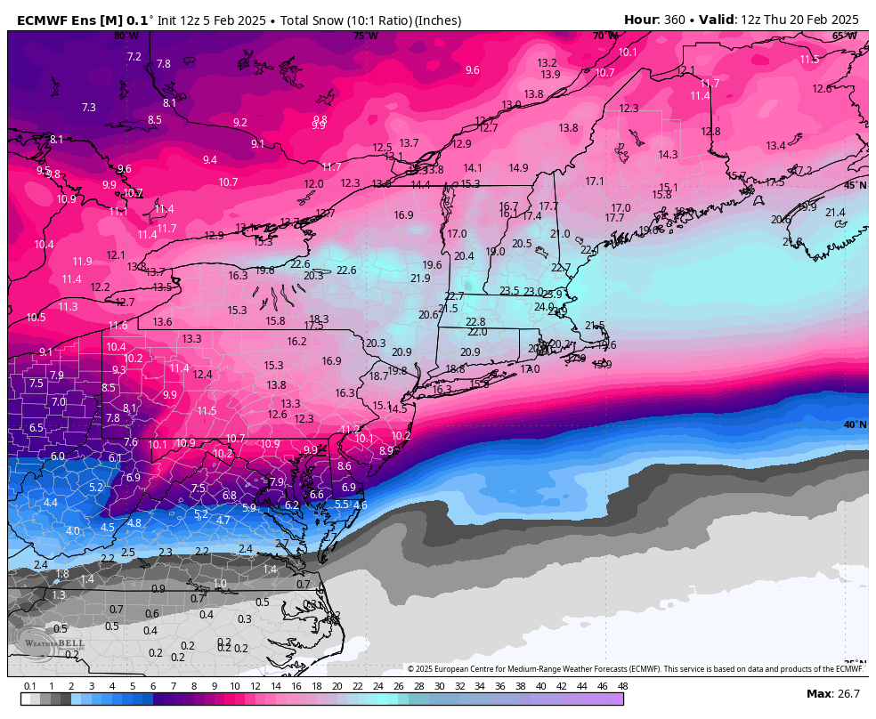
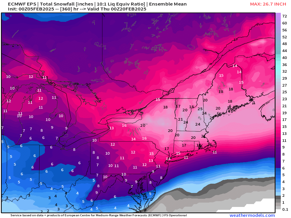
EPS has 24” mean snowfall for BOS
-
this is with like 12-18” on the mean already btw

-
absolutely obscene

-
and this is before this pattern sets up. absurd

-
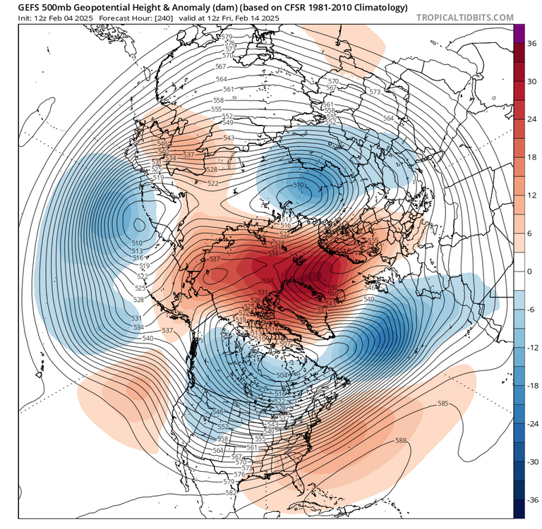
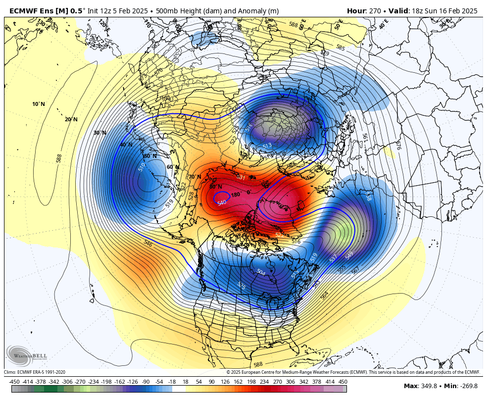
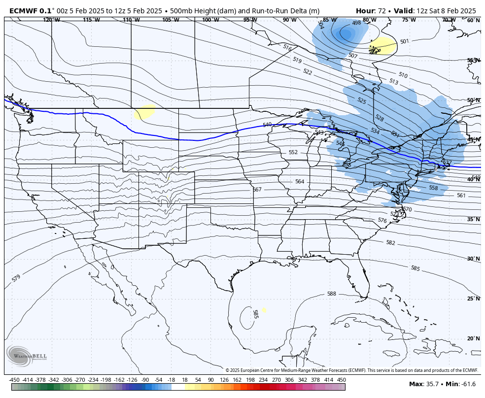
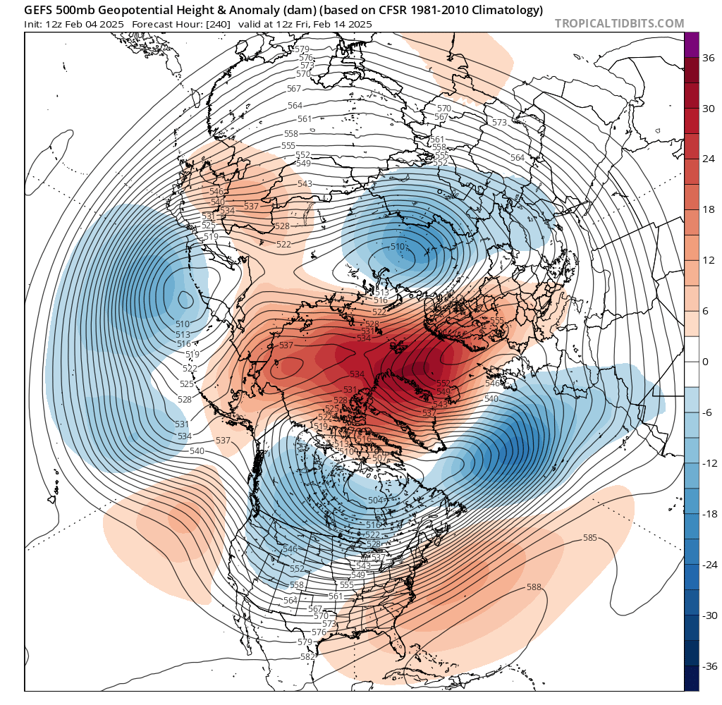
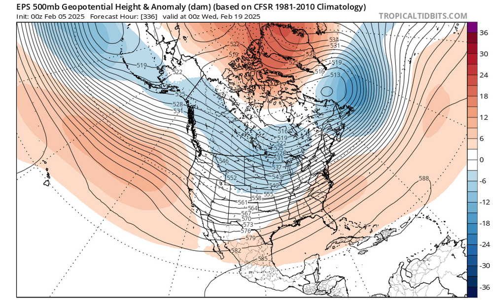
absolutely locked in on the GEPS and GEFS. rotting block in place over the Davis Strait and elongated TPV in SE Canada

-
trying not to be hyperbolic but it's insane. how is the mean that lit up with the block not even having decayed yet? that's when you usually get the big dog
-
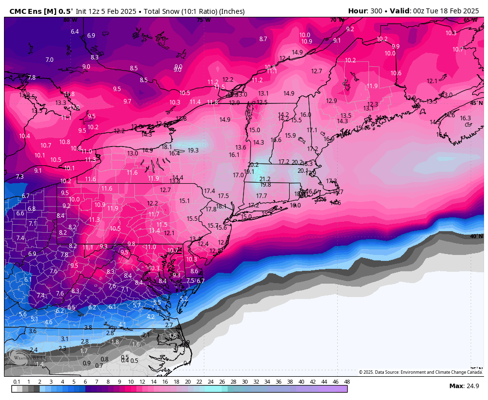
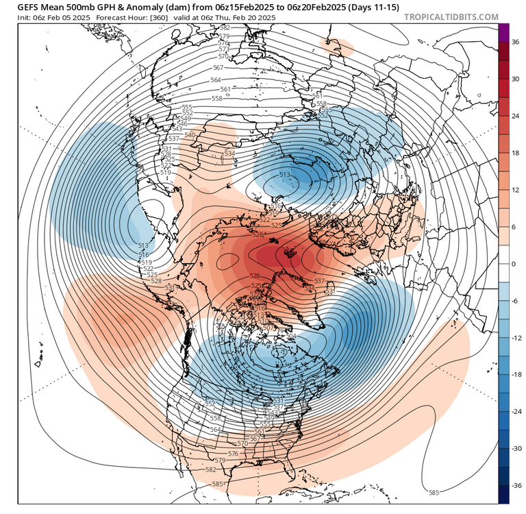
just so people understand how absurd modeling is getting for mid-late month, this is the GEPS through 300. insane amounts of snow this is the pattern during that mean. the block is still strong over the Davis Strait. the largest storm from this pattern likely hasn't even occurred yet and NYC/BOS still have 18" on the mean. wild


-
just so people understand how absurd modeling is getting for mid-late month, this is the GEPS through 300. insane amounts of snow this is the pattern during that snowfall mean. not after the block breaks down, which is when you'd probably get your largest storm. it's beyond lmao

-
if this is "not bad" then expectations have gotten ever so slightly inflated
-
GEPS is ridiculous. has 15" on the mean with this pattern still in place

-
 the shift in confluence is pretty notable. the evolution is much more similar to that of a Miller B than a SWFE at this point
-
euro keeps weakening
-
the CPC forecast is based on the GEFS, which looks the same. those indices aren't really that useful since they provide no context
-
why use your eyeballs and your brain to analyze the pattern when you can doom over some pressure calculation developed like 40 years ago?
-
those index charts are such bullshit. this is a -NAO, full stop

-
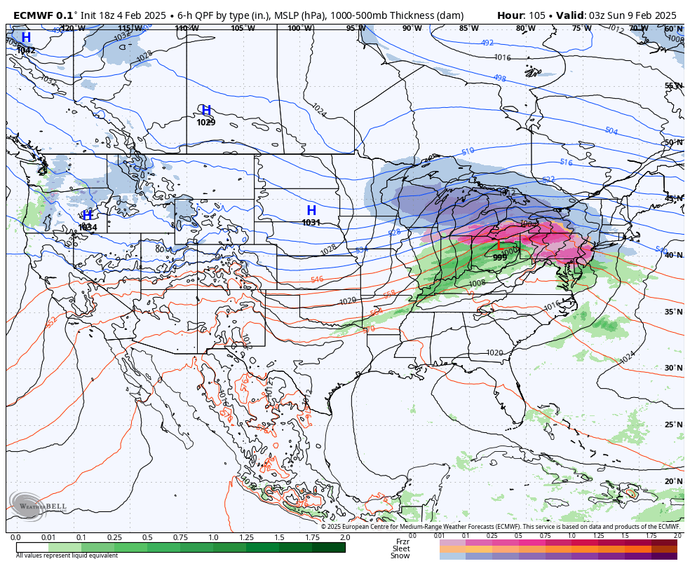
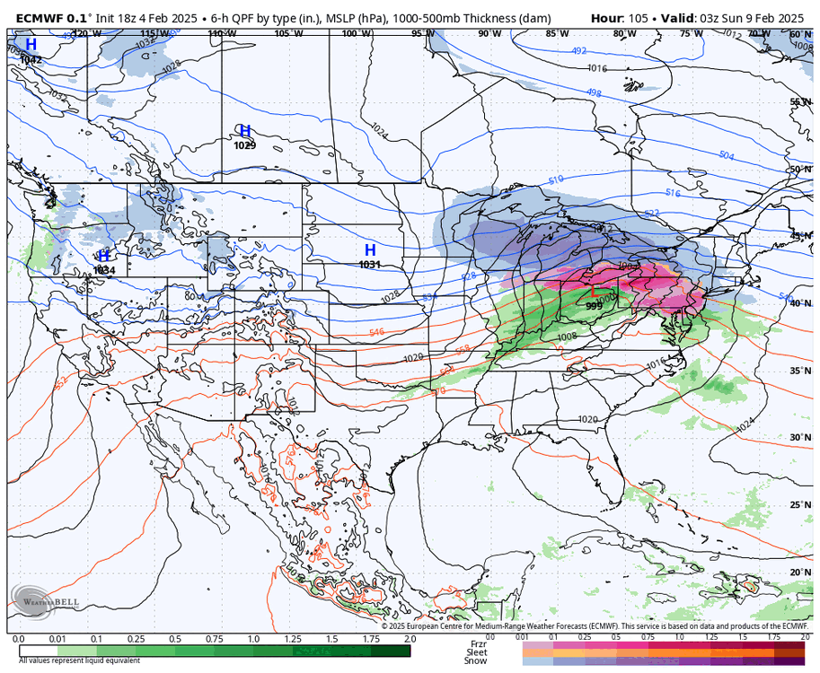
absolutely sickening weenie behavior. not all that much has changed since yesterday... there remains elevated potential for a significant storm from DC-NYC basically. details TBD
-
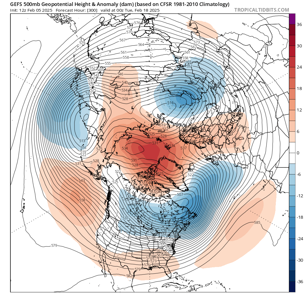
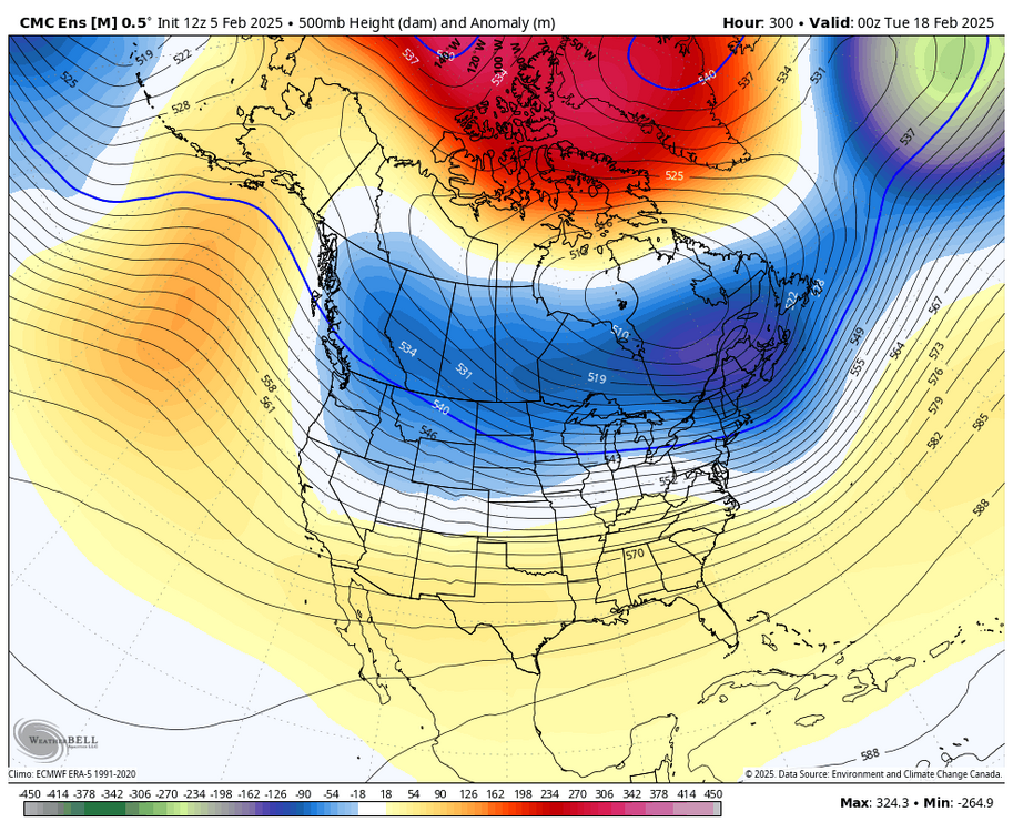
looks like a Weeklies run lmao also the pattern is still well established at that time. block is maturing
-
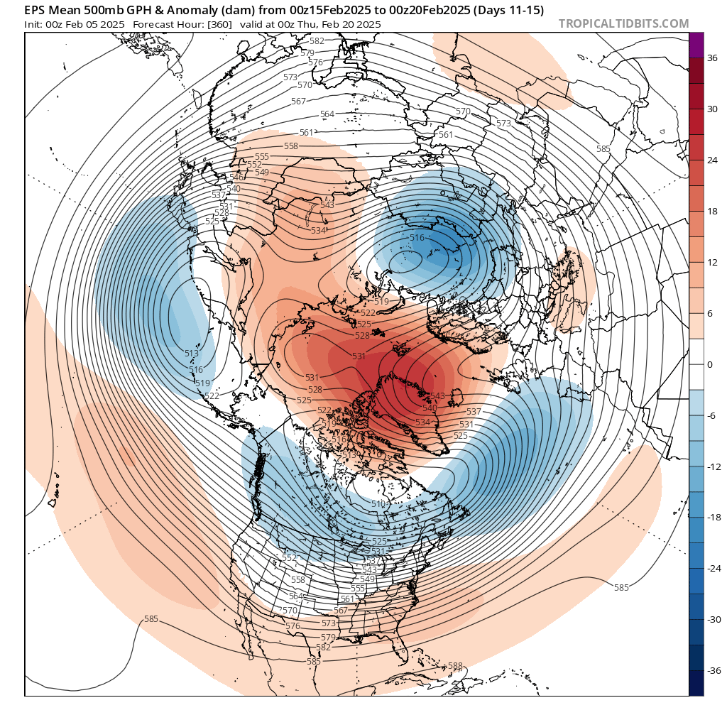
this is as robust as you will ever see the EPS
-
comparing the two setups, this one is more favorable for a more potent storm. lower downstream heights in SE Canada help foster coastal redevelopment and a better thump
-
comparing the two setups, this one is more favorable for front end snow for NYC. lower downstream heights in SE Canada help

-
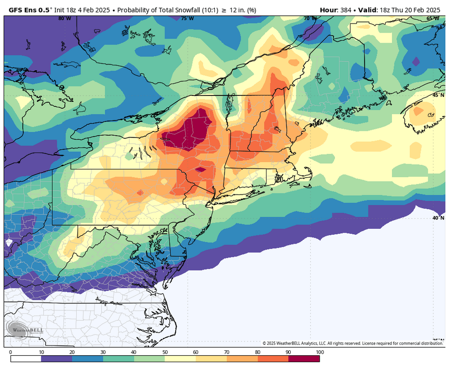
i mean yeah i get the skepticism but these probabilities are objectively ridiculous
-
yeah, moves towards the typical KU pattern at that point
-
ridiculous Arctic blocking on the GEFS