

brooklynwx99
-
Posts
6,233 -
Joined
-
Last visited
Content Type
Profiles
Blogs
Forums
American Weather
Media Demo
Store
Gallery
Everything posted by brooklynwx99
-
lol this is much more fitting for the NYC subforum than the MA subforum where you often post
-
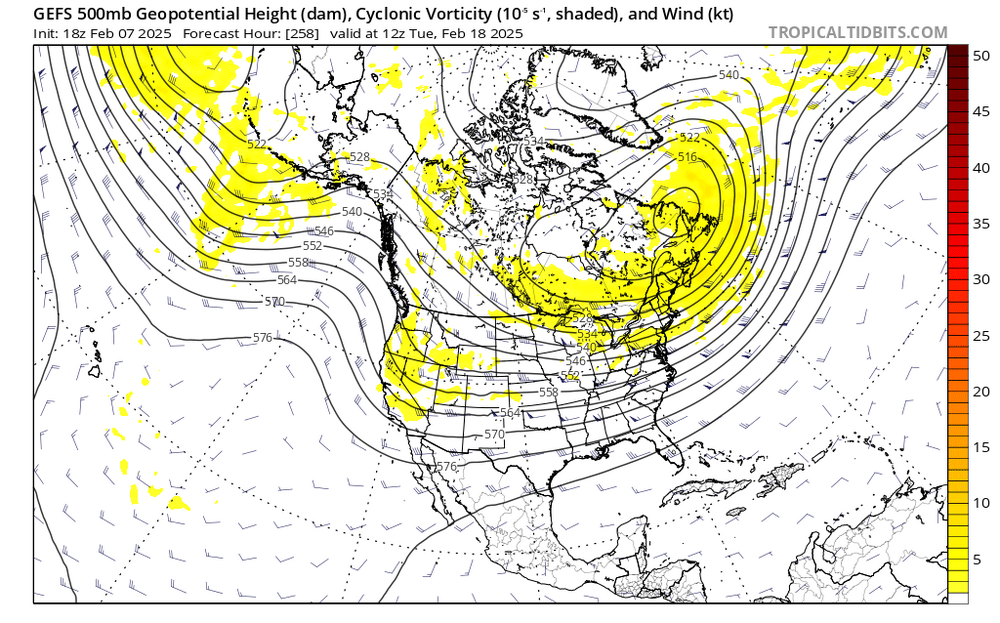
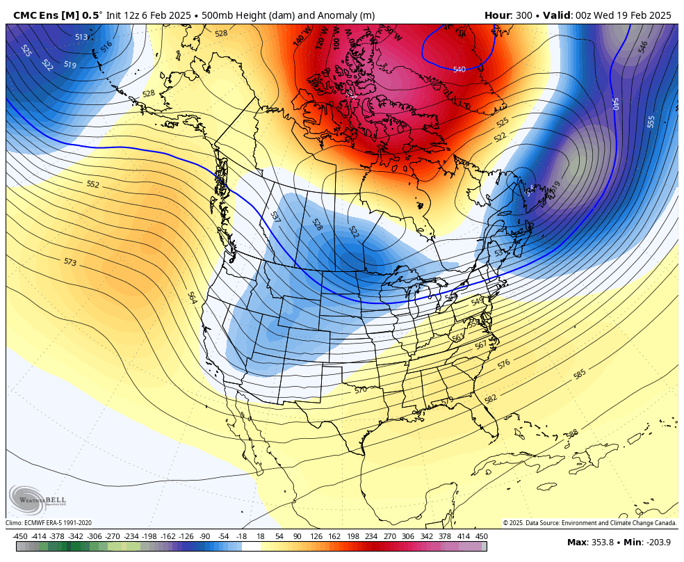
I still think the greatest potential with this pattern exists around the 20th as the block fully retrogrades and weakens. just drool worthy synoptics with the TPV in SE Canada, west based -NAO ridging, and a vort showing up in the Rockies

-
I still think the greatest potential with this pattern exists around the 20th as the block fully retrogrades and weakens. just drool worthy synoptics with the TPV in SE Canada, west based -NAO ridging, and a vort showing up in the Rockies

-
I still think the greatest potential with this pattern exists around the 20th as the block fully retrogrades and weakens. just drool worthy synoptics with the TPV in SE Canada, west based -NAO ridging, and a vort showing up in the Rockies
-
amazing Irish pub
-
block is really doing its dirty work here. fits the pattern honestly

-
the GEFS is a fancy OP 80% of the time so this is not surprising
-
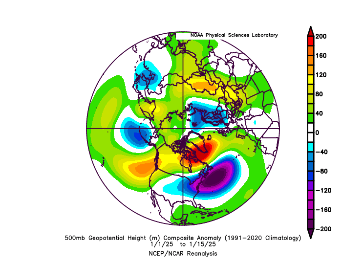
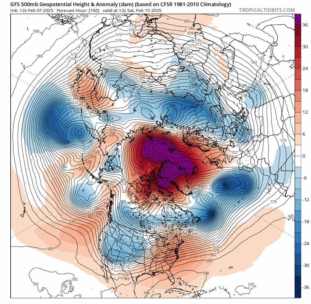
for anybody worried about suppression like what happened in Jan after the 15th or so, this is a much more classic block caused by a retrograding Scandi ridge... it's where it should be over the northern Davis Strait rather than south of Greenland. this is why those retrograding Scandi highs are so favorable - the orientation of the block is better with the TPV elongated over SE Canada rather than the N ATL


-
can't believe that we have three legit chances for snowfall before the most favorable part of the pattern even sets in. pretty nuts and I'm excited
-
for anybody worried about suppression like what happened in Jan after the 15th or so, this is a much more classic block caused by a retrograding Scandi ridge... it's where it should be over the northern Davis Strait rather than south of Greenland. this is why those retrograding Scandi highs are so favorable - the orientation of the block is better with the TPV elongated over SE Canada rather than the N ATL

-
kinda wild that the rippage on the GFS is while the block is still maintaining strength. the big dog isn't even popping up yet
-
luckily there is potential beforehand for snowfall. that's just when the pattern ends which is a ways away
-
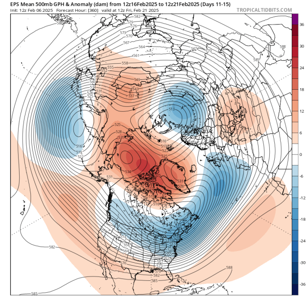
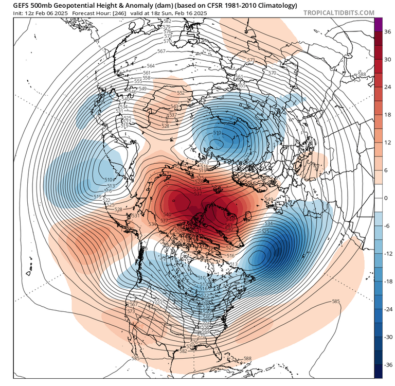
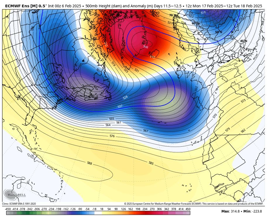
very good agreement on an anomalous, west-based -NAO, 50/50 ULL, and vort digging into the Rockies. if you're looking for a bigger storm, this is the timeframe to watch. makes sense, as retrograding Scandinavian blocks often lead to larger storms when they decay

-
pretty stunning blocking signal around that time. vort digging into the Rockies, confluence in place, and a rotting west based block

-
you tell me. rotting west based -NAO, huge 50/50 signal, and vort digging through the Rockies
-
just going to leave this here
.thumb.png.9f06295ebafa0d6ed617ab42f526325b.png)
-
i get your point, but could you imagine the weenies thrown if the ensembles showed the TPV west and a ridge popping over the east and someone posted a loop of the D12-15 OP showing a cold pattern? they would get clowned
-
yeah, why use the ensembles when you can use a random OP run
-
the -PNA is temporary. that trough in the west swings through and it's full steam ahead
-
Arctic blocking going insane on the GEFS
.thumb.gif.a8e94404deb7303b4be8dd1ded41de6b.gif)
-
Arctic blocking going insane on the GEFS
.thumb.gif.1e26b5a0e7e4bdcd810f35ea68f0a57c.gif)
-
Arctic blocking going insane on the GEFS
.thumb.gif.95f2a8bb4efdc9bf11f85e2fa24cec6d.gif)
-
excuse me, you said that's a +NAO? in what world is this a +NAO
-
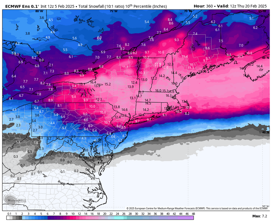
the 10th percentile for NYC on the EPS is like 10”. anything but skewed high


.png.51d5c8bf67ed7e2059aa01f313558f1f.png)


.gif.f7d86f5108a8493a5eb4c76aff668825.gif)
.gif.b858190f60c6016a7ba169ce4fba0bf0.gif)
.gif.a32bbc3f1b9a7842c6cfe9eaf12e23bb.gif)

