brooklynwx99
-
Posts
6,233 -
Joined
-
Last visited
Content Type
Profiles
Blogs
Forums
American Weather
Media Demo
Store
Gallery
Everything posted by brooklynwx99
-
 lol you have got to be kidding me
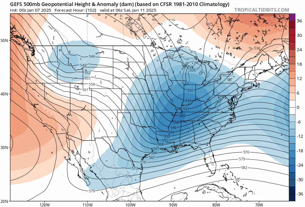
-
Jan 11th-12th Super Bomb or Super Bummed?
brooklynwx99 replied to Rjay's topic in New York City Metro
the last thing i would worry about right now is coastal p-type. let’s get a storm first please- 993 replies
-
- 12
-

-

-

-

-
- metsfan vs snowman
- bomb
- (and 2 more)
-
yeah, I would agree the GEFS has more support than the EPS
-
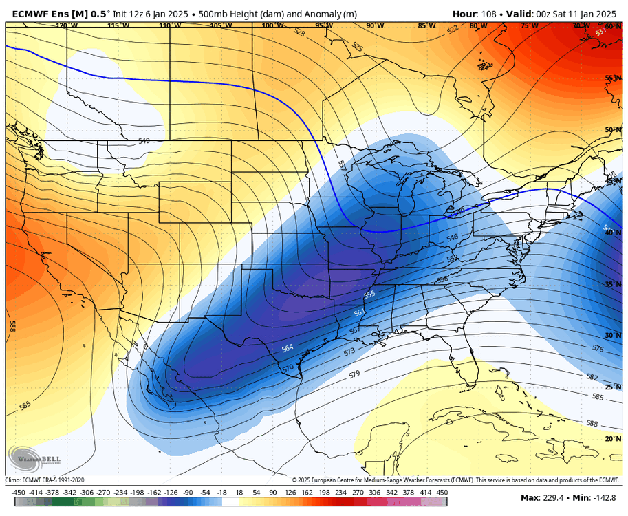
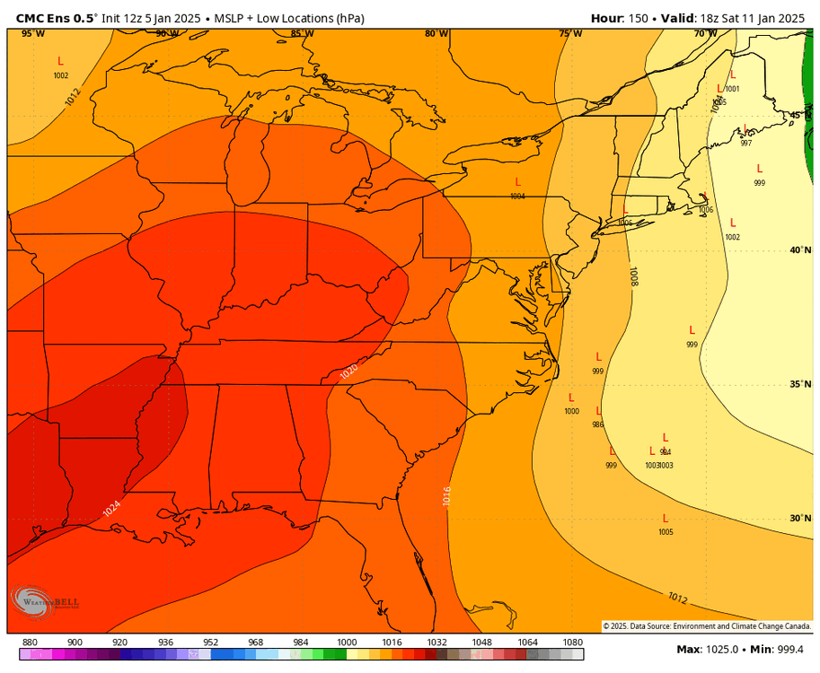
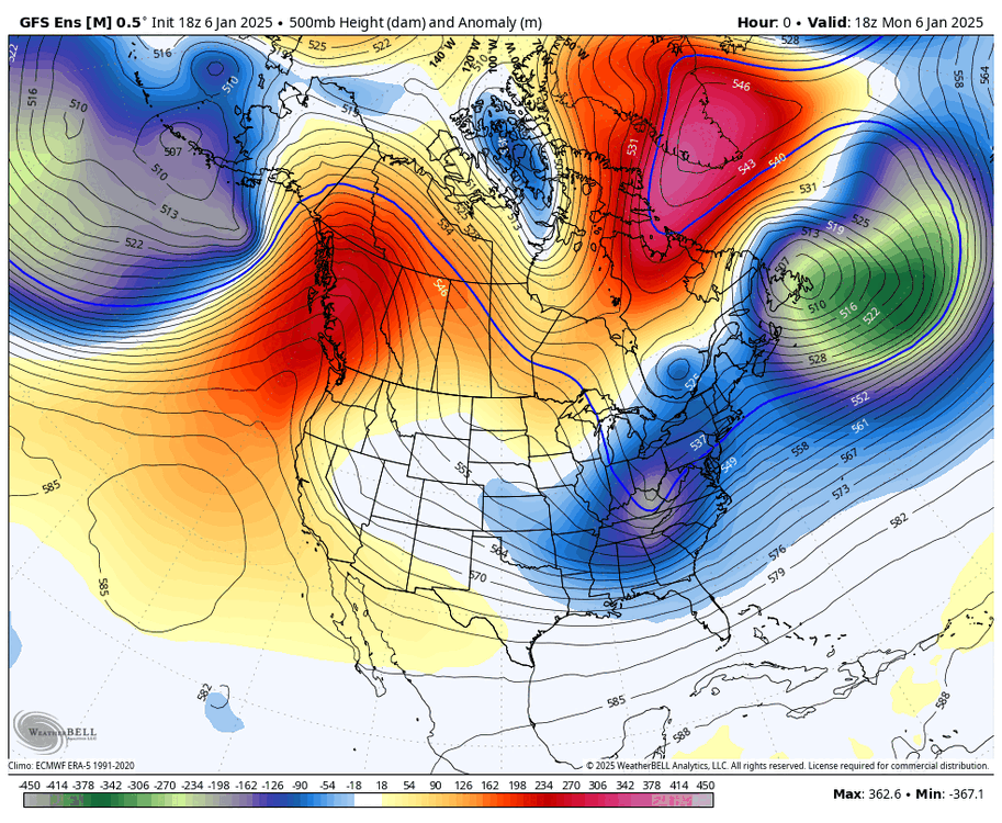
how else is one to show a trend without posting 12 consecutive images haha
-
January Medium/Long Range: A snowy January ahead?
brooklynwx99 replied to mappy's topic in Mid Atlantic
anybody notice a trend?


-
Jan 11th-12th Super Bomb or Super Bummed?
brooklynwx99 replied to Rjay's topic in New York City Metro
anybody notice a trend?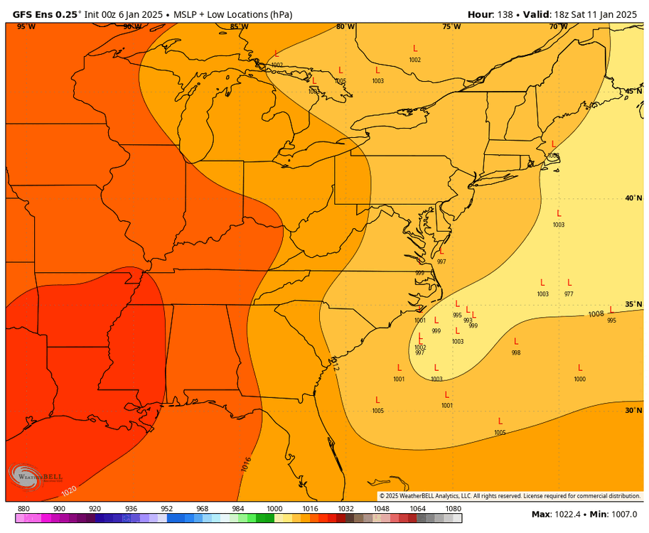


- 993 replies
-
- 15
-
-
-
-

-

-
- metsfan vs snowman
- bomb
- (and 2 more)
-
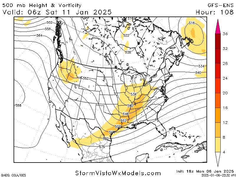
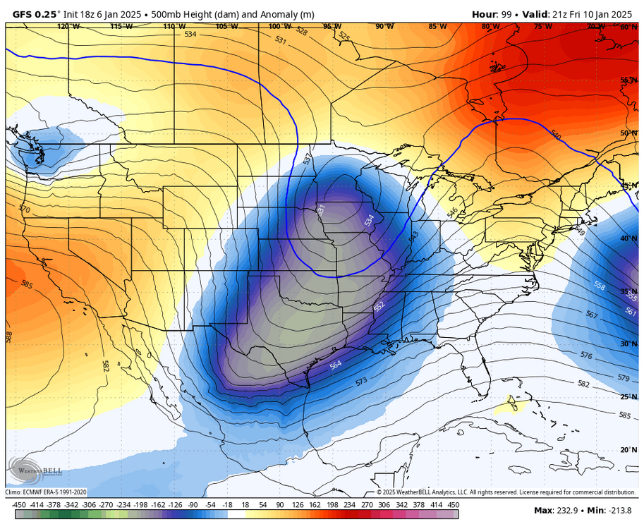
this is pretty solid across all ensembles

-
it’s a significant improvement. there are multiple sub 990 members close to the coast
-
Jan 11th-12th Super Bomb or Super Bummed?
brooklynwx99 replied to Rjay's topic in New York City Metro
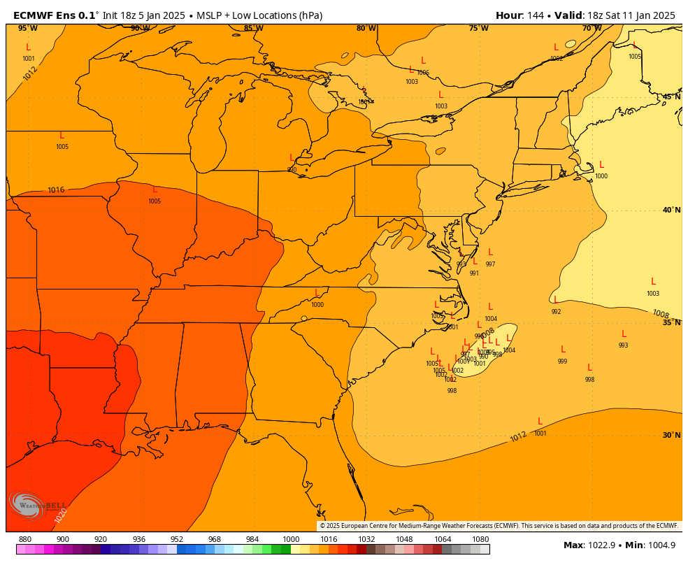
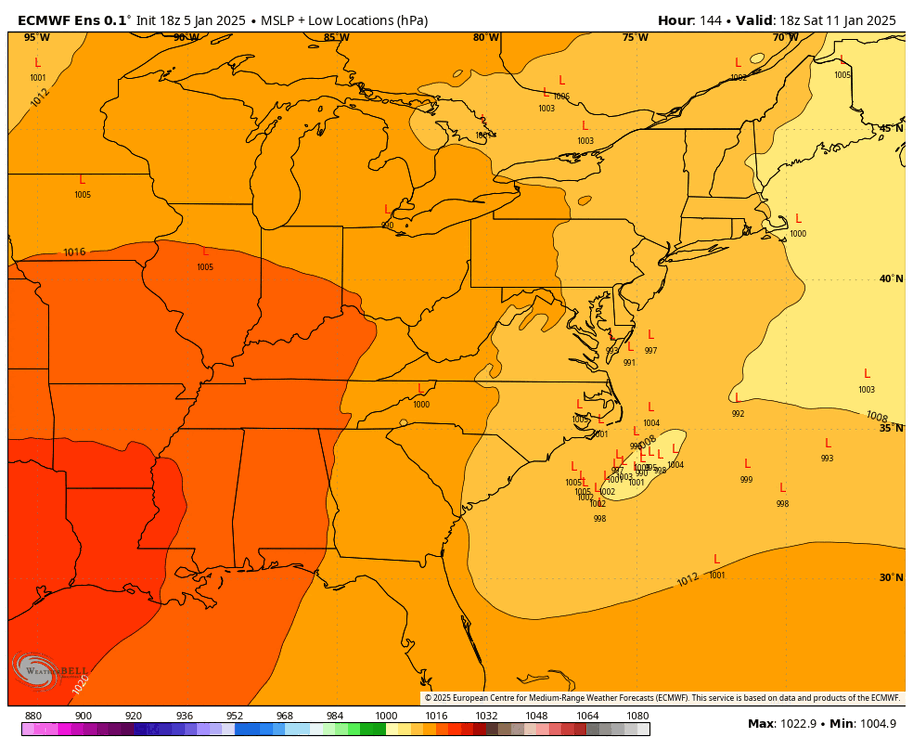
EPS is better. hangs less crap back
-
i would ask what your thoughts on this are but i think i have an idea
-
EPS is better. hangs less crap back

-
EPS has hits!!!
-
lol there’s even a big difference at initialization. what the hell
-
if the ECMWF isn’t going to play ball whatsoever i’m just gonna assume the GFS is on crack
-
the discrepancy 4 days out is laughable
-
January Medium/Long Range: A snowy January ahead?
brooklynwx99 replied to mappy's topic in Mid Atlantic
they’re only good in marginal setups -
January Medium/Long Range: A snowy January ahead?
brooklynwx99 replied to mappy's topic in Mid Atlantic
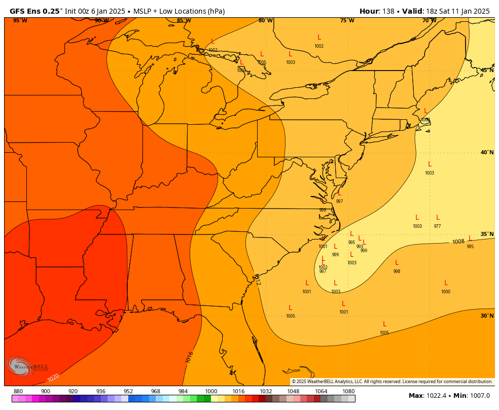
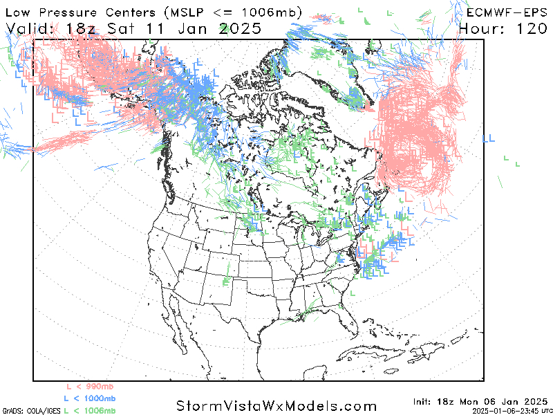
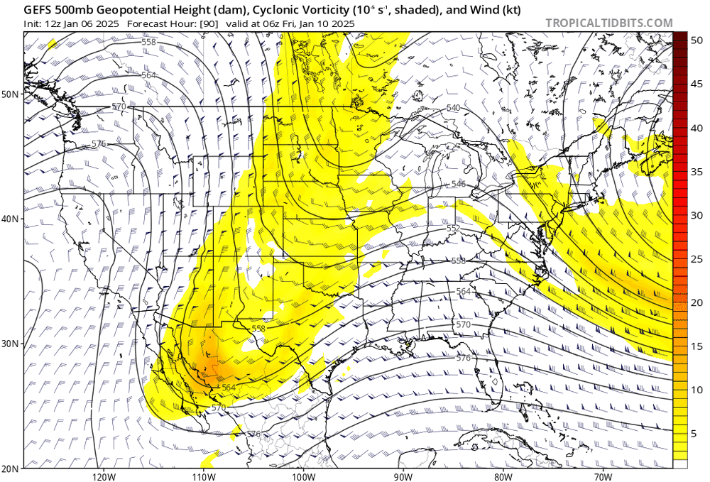
GEFS is going all in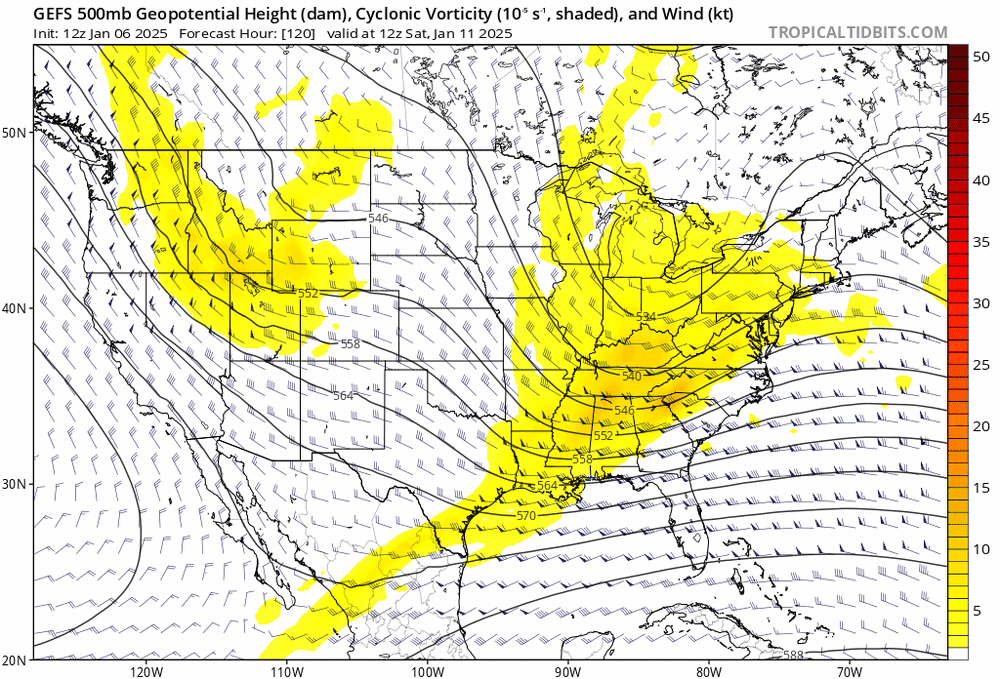
-
well, here you go
-
Jan 11th-12th Super Bomb or Super Bummed?
brooklynwx99 replied to Rjay's topic in New York City Metro
GEFS has way more phasing
- 993 replies
-
- 7
-
-
-
- metsfan vs snowman
- bomb
- (and 2 more)
-
holy crap GEFS. way more phasing
-
Jan 11th-12th Super Bomb or Super Bummed?
brooklynwx99 replied to Rjay's topic in New York City Metro
if you guys go from worrying from it being OTS to worrying about rain i swear to god- 993 replies
-
- 22
-

-
-
-
-
-
- metsfan vs snowman
- bomb
- (and 2 more)
-
GFS is doubling down
-
Jan 11th-12th Super Bomb or Super Bummed?
brooklynwx99 replied to Rjay's topic in New York City Metro
GFS is doubling down
-
everything better aligned

-
January Medium/Long Range: A snowy January ahead?
brooklynwx99 replied to mappy's topic in Mid Atlantic
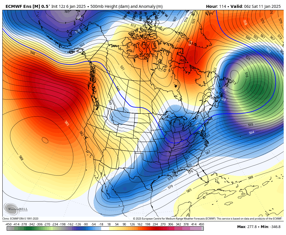
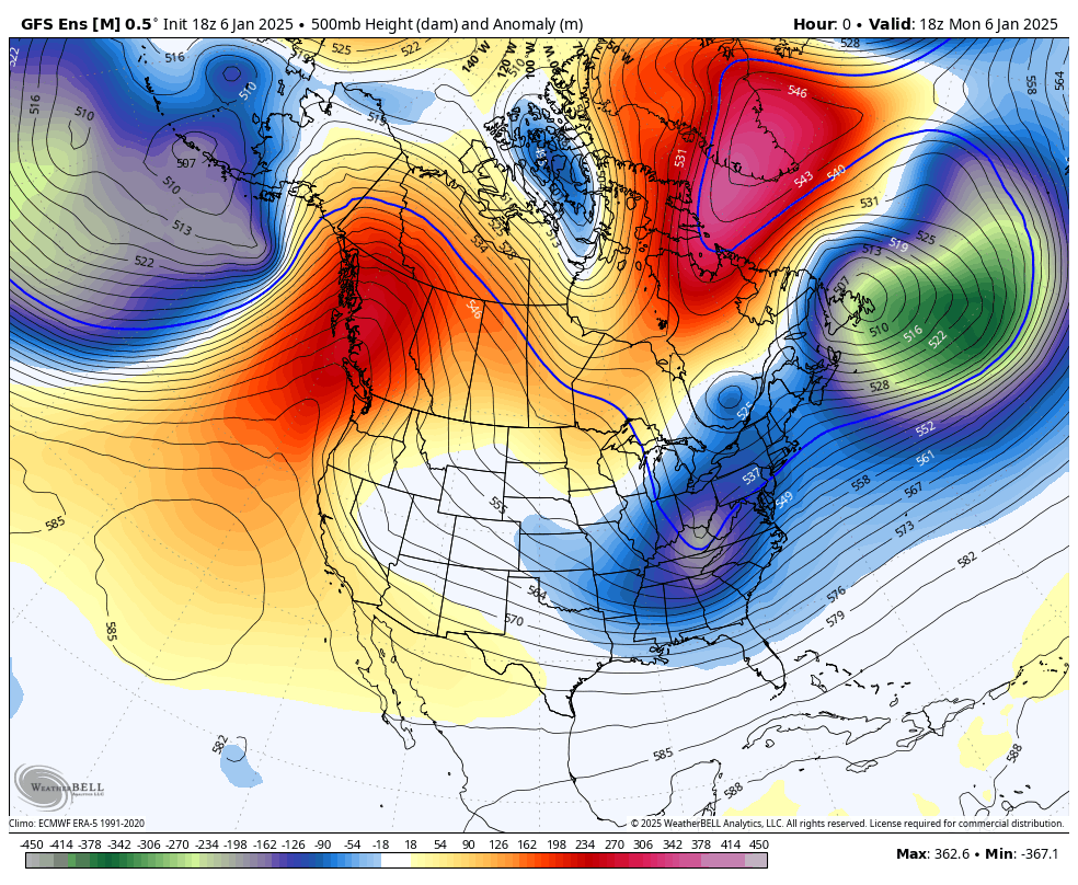
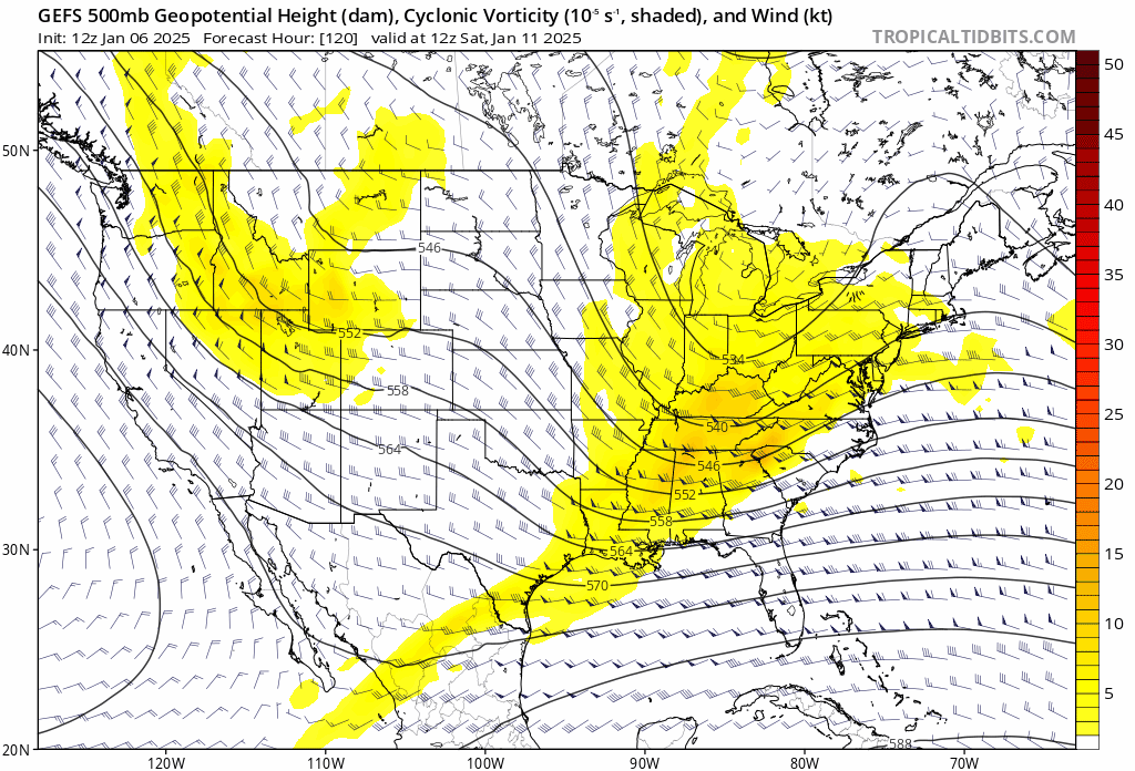
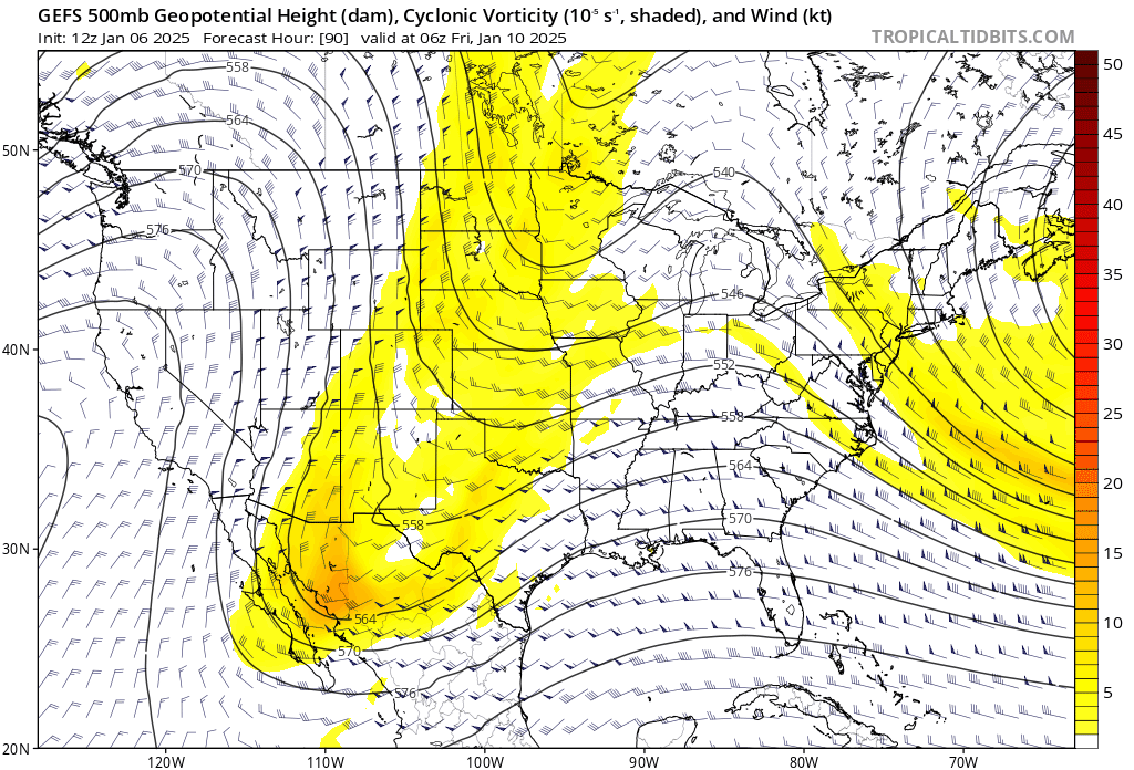
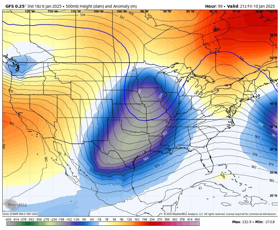
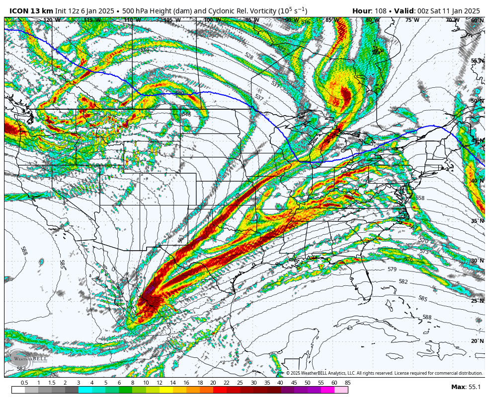
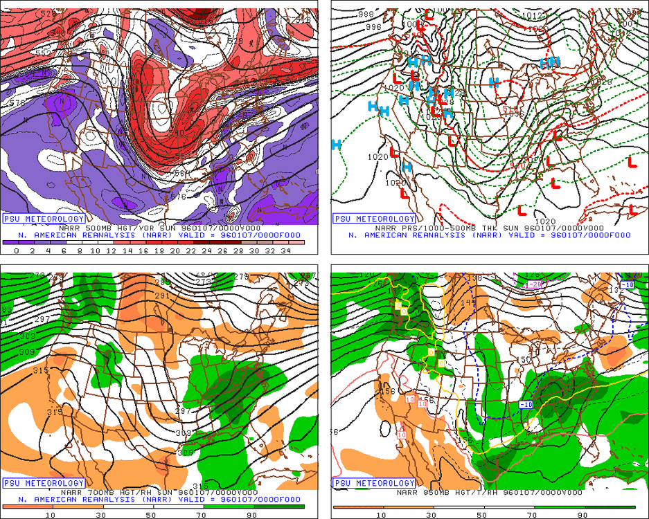
here are the three major ensembles. none of them are really THAT different, they just have different degrees of phasing... and I couldn't tell you which is correct. just going to have to get things sorted over the next few days