

brooklynwx99
-
Posts
6,233 -
Joined
-
Last visited
Content Type
Profiles
Blogs
Forums
American Weather
Media Demo
Store
Gallery
Everything posted by brooklynwx99
-

Snowfall NYC subforum Jan 6 and OBS if needed
brooklynwx99 replied to wdrag's topic in New York City Metro
pretty much splits the difference between 12/18z. about what I would expect -
Snowfall NYC subforum Jan 6 and OBS if needed
brooklynwx99 replied to wdrag's topic in New York City Metro
i would urge caution at this point given that it’s just one run with a jump like this but the 12z GEPS also shot north and the ICON had a similar evolution with a lobe of the TPV tilting the trough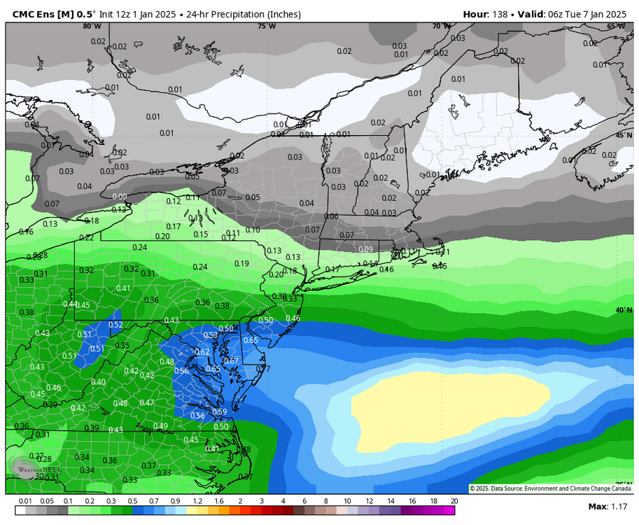
-
i didn’t want to ruffle any feathers with that stuff lmao
-
Snowfall NYC subforum Jan 6 and OBS if needed
brooklynwx99 replied to wdrag's topic in New York City Metro
trend with the confluence is clear as day on the EPS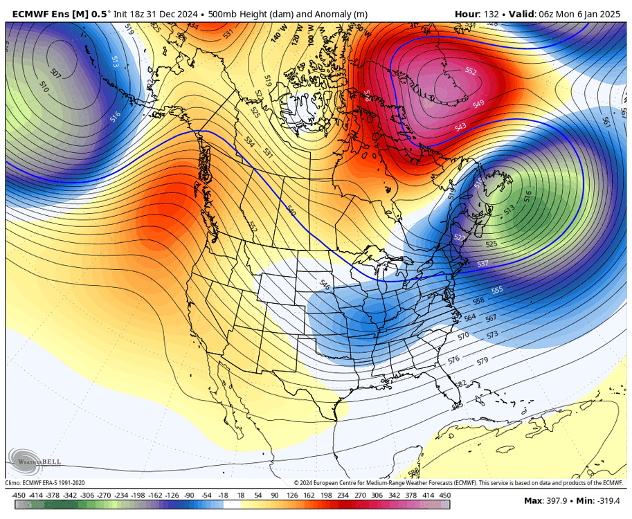
-
Snowfall NYC subforum Jan 6 and OBS if needed
brooklynwx99 replied to wdrag's topic in New York City Metro
EPS with a huge shift. much less confluence and a stronger vort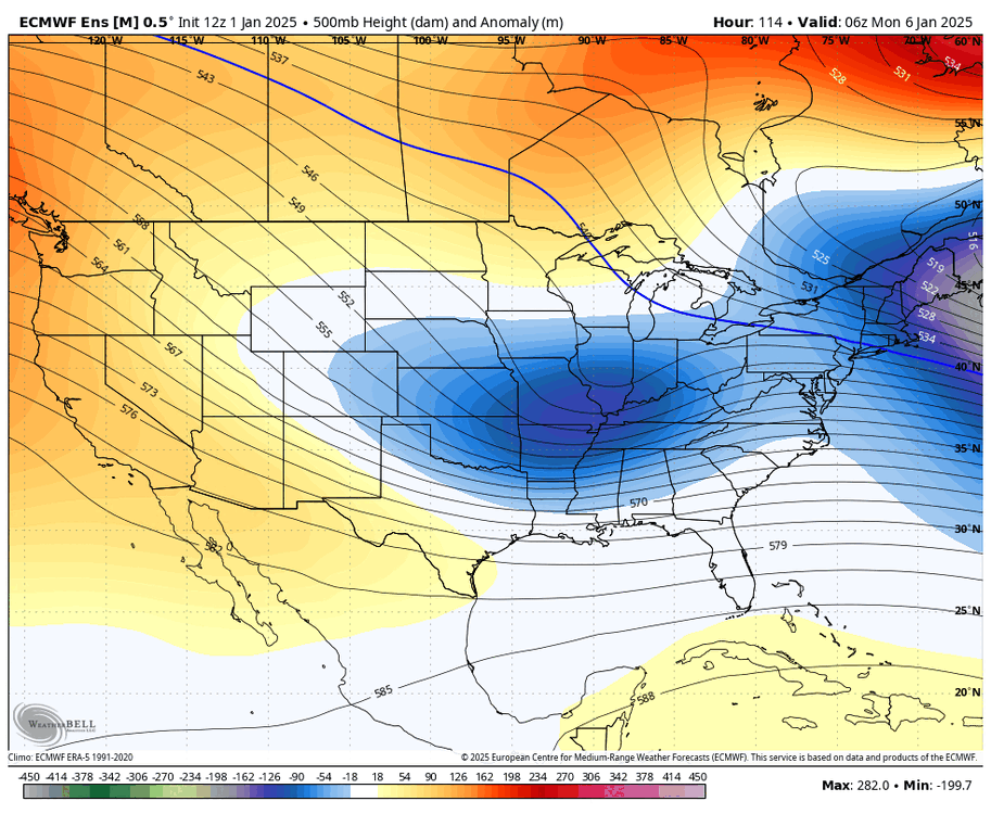
-
Snowfall NYC subforum Jan 6 and OBS if needed
brooklynwx99 replied to wdrag's topic in New York City Metro
wow ECMWF. significant change with the confluence
-
my thoughts haven’t changed all that much
-
if i'm going to be in your head this much you could at least ask me to pay you rent
-
January: Medium/ Long Range: May the Force be with Us....
brooklynwx99 replied to Weather Will's topic in Mid Atlantic
exactly, amped means something. better than a weak POS -
January: Medium/ Long Range: May the Force be with Us....
brooklynwx99 replied to Weather Will's topic in Mid Atlantic
honestly, even if this amps more and confluence ticks north, there's enough cold in place that I don't see how you guys wouldn't at least get a front end +SN thump to usher in the pattern. the antecedent airmass is very cold -
January: Medium/ Long Range: May the Force be with Us....
brooklynwx99 replied to Weather Will's topic in Mid Atlantic
straight out of the MA weenie handbook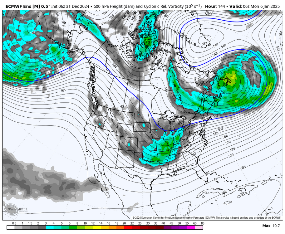
-
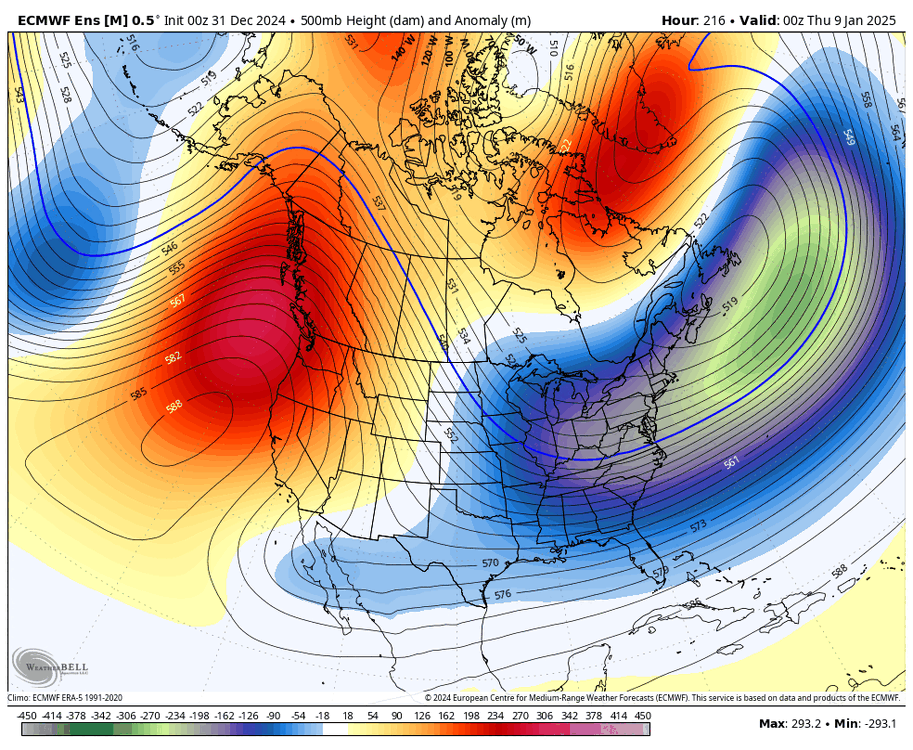
those are heights, not thicknesses. it’s a very cold setup
-
straight out of the Mid-Atlantic weenie handbook

-
yeah, this is a pretty sick hemispheric signal as the block decays and PNA spikes around that time. definitely the larger scale threat
-
NE doesn't need a -NAO whatsoever... most of BOS's major storms have no correlation with the NAO. they're all -EPO/+PNA driven
-
-
this is why blocking patterns are so favorable... watch how everything slows way down and allows for a phase, albeit messy. a +NAO pattern wouldn't even be close to one
-
January: Medium/ Long Range: May the Force be with Us....
brooklynwx99 replied to Weather Will's topic in Mid Atlantic
this is why blocking patterns are so favorable... watch how everything slows way down and allows for a phase, albeit messy. a +NAO pattern wouldn't even be close to one
-
yeah, this is really impressive agreement on a cold and stormy pattern on all ensembles
-
January: Medium/ Long Range: May the Force be with Us....
brooklynwx99 replied to Weather Will's topic in Mid Atlantic
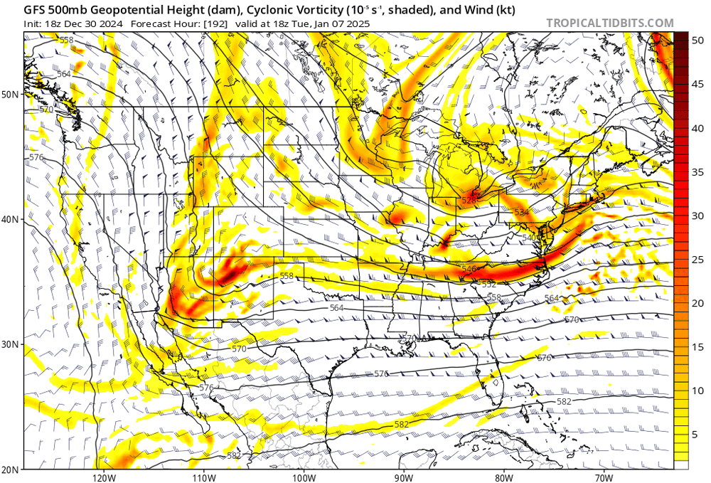
this same thing happened last year in mid-Feb where ABE got 12" of snow on like 20-30:1 ratios from a clipper with a FGEN band -
i think the 6th might present suppression issues with the 50/50 ULL so close by, but I can see SNE getting in on it if that trends weaker or if the S/W trends stronger (the latter seems more likely)... overall this presents as a DC-NYC type event but it's still out there afterwards, the ensembles are definitely honking for a larger trough amplification as the +PNA pumps somewhere between the 8-11th as Tip mentioned. there is certainly the potential for something significant to major in this window... the pattern also persists through the 15th, so you'll have multiple opportunities to cash in, especially as the blocking eases
-
January: Medium/ Long Range: May the Force be with Us....
brooklynwx99 replied to Weather Will's topic in Mid Atlantic
I'm starting to like the 6th... the longwave pattern is such that if you get a decent wave, it'll just launch into the confluence and lead to a nice gradient with FGEN. 50/50 is locked in, so pretty much no risk of a cutter, would just be a Miller B if the wave is super amped or a thump to drizzle at worst. pretty much a snow or nothing kind of setup. unlikely to see anything major, but a 3-6" or 4-8" event is certainly on the table. this is a pretty typical DC-NYC setup (probably favoring PHL south) -
I'm starting to like the 6th... the longwave pattern is such that if you get a decent wave, it'll just launch into the confluence and lead to a nice gradient with FGEN. 50/50 is locked in, so pretty much no risk of a cutter, would just be a Miller B if the wave is super amped or a thump to drizzle at worst. pretty much a snow or nothing kind of setup. unlikely to see anything major, but a 3-6" or 4-8" event is certainly on the table
-
January: Medium/ Long Range: May the Force be with Us....
brooklynwx99 replied to Weather Will's topic in Mid Atlantic
yeah I think the OP is a bit much with the suppression but it's a possibility in these patterns. gotta deal with the risk of suppression if you want larger storms, though -
January: Medium/ Long Range: May the Force be with Us....
brooklynwx99 replied to Weather Will's topic in Mid Atlantic
that's around the 5-6th, though. moves into the more ideal 50/50 position around the 8-9th, which is probably the first shot at a big one


