brooklynwx99
-
Posts
6,233 -
Joined
-
Last visited
Content Type
Profiles
Blogs
Forums
American Weather
Media Demo
Store
Gallery
Everything posted by brooklynwx99
-

Jan 11th-12th Super Bomb or Super Bummed?
brooklynwx99 replied to Rjay's topic in New York City Metro
the EPS is probably right? but this is a volatile setup and it could easily be messing one of the streams up. no point in mailing any outcome in- 993 replies
-
- 4
-

-
- metsfan vs snowman
- bomb
- (and 2 more)
-
Jan 11th-12th Super Bomb or Super Bummed?
brooklynwx99 replied to Rjay's topic in New York City Metro
also, the GEPS is much closer to the GEFS than the EPS. it's not like the GEFS has zero support- 993 replies
-
- 2
-
-

-
- metsfan vs snowman
- bomb
- (and 2 more)
-
Jan 11th-12th Super Bomb or Super Bummed?
brooklynwx99 replied to Rjay's topic in New York City Metro
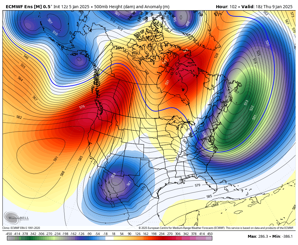
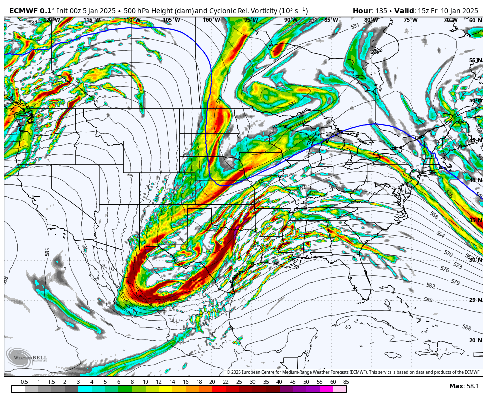
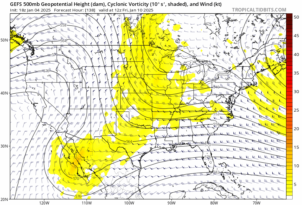
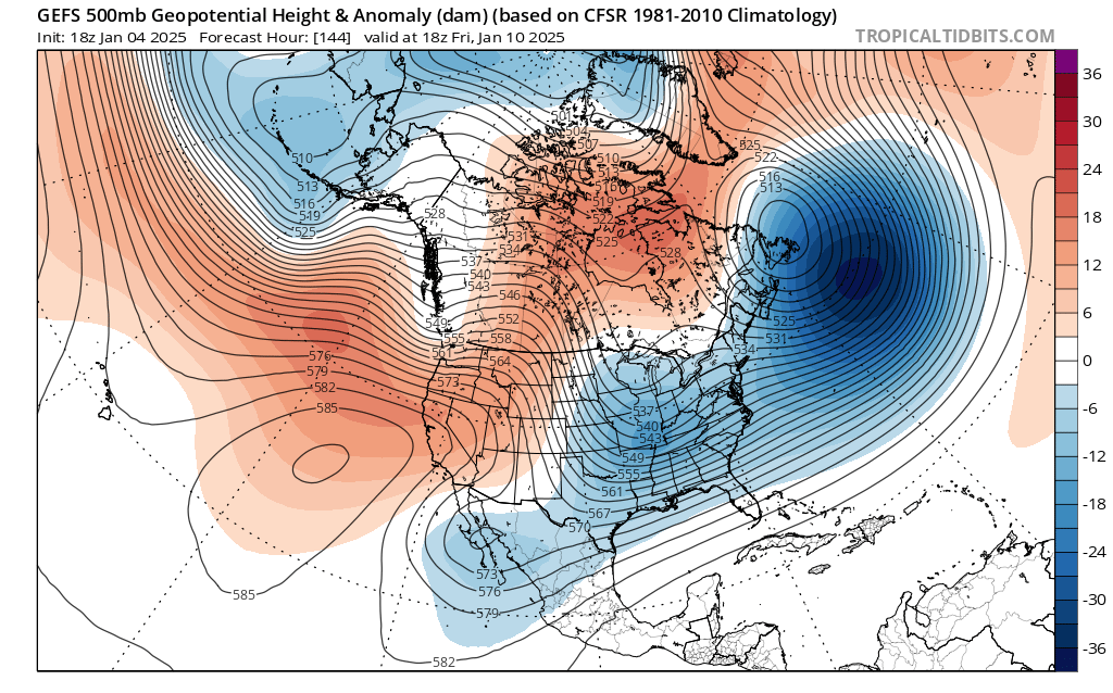
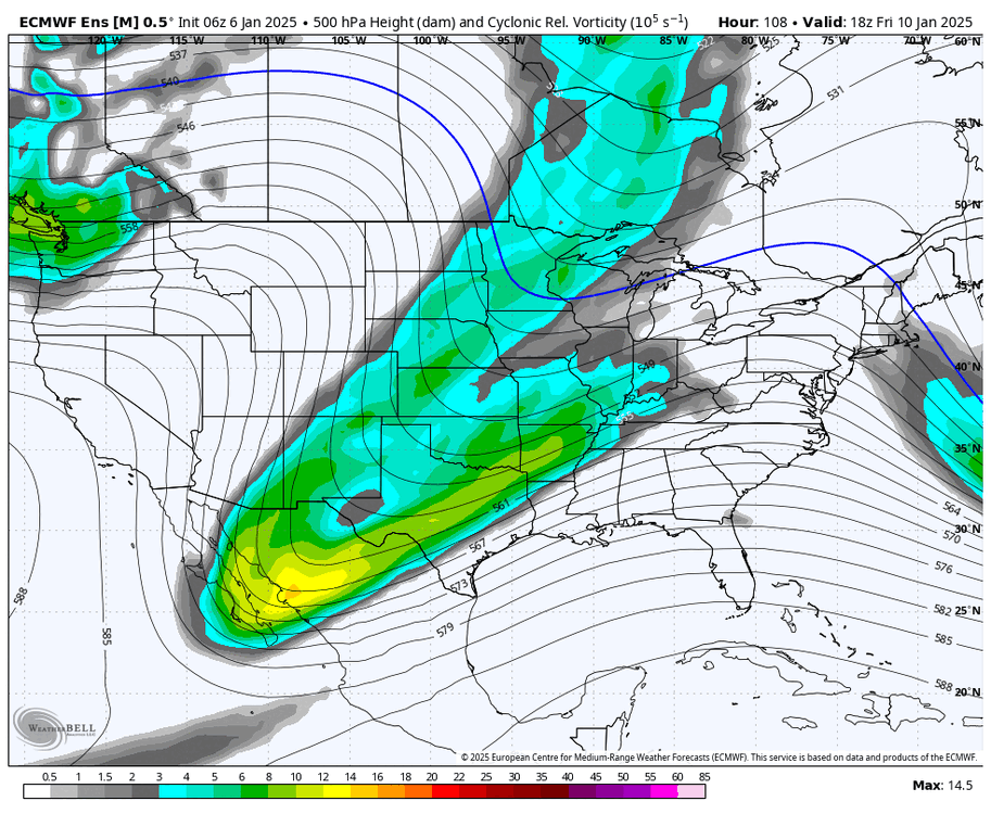
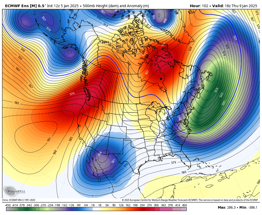
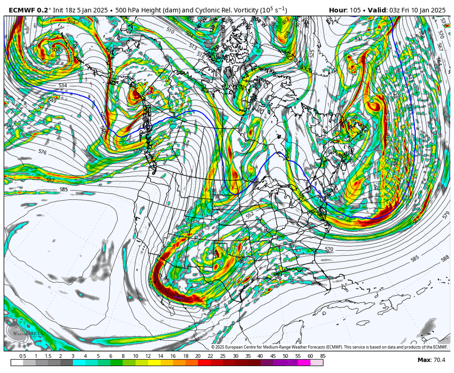
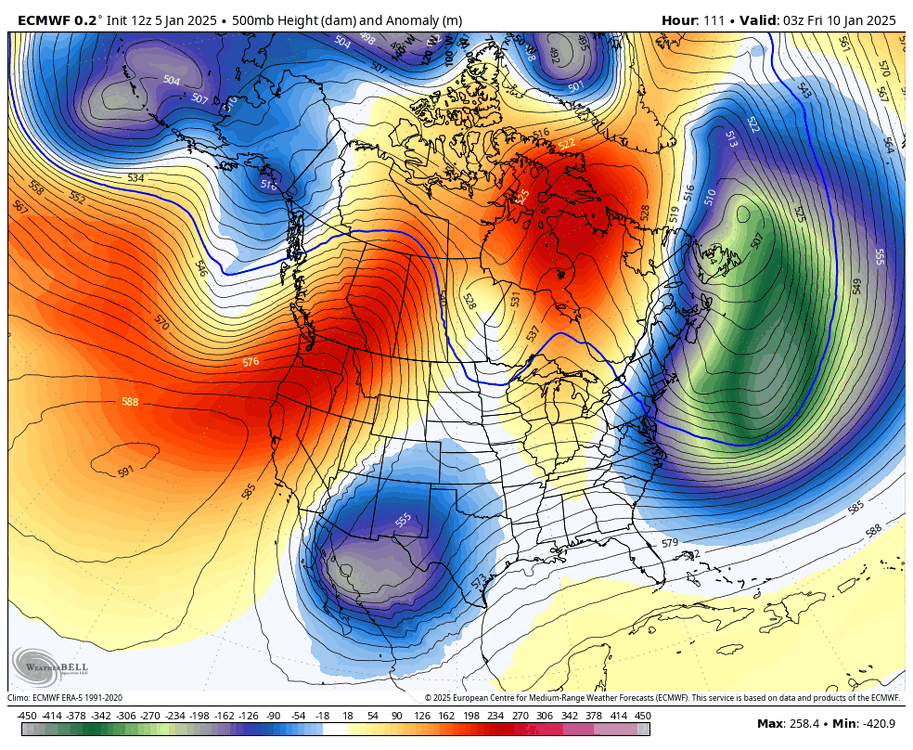
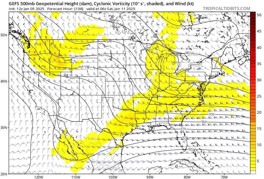
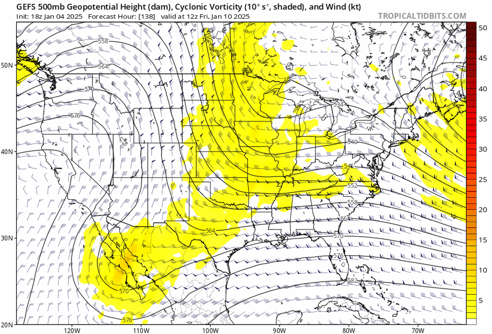
here are the three major ensembles. none of them are really THAT different, they just have different degrees of phasing... and I couldn't tell you which is correct. just going to have to get things sorted over the next few days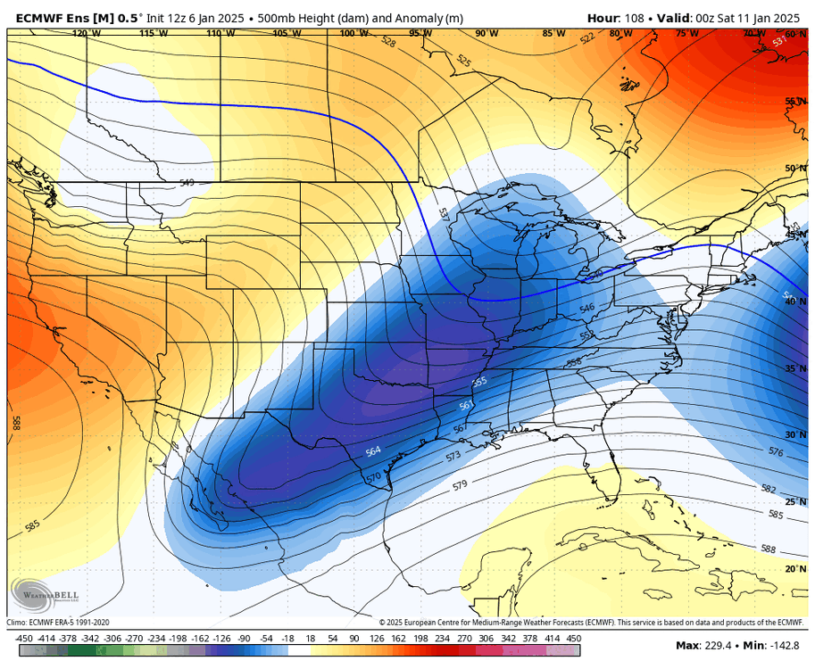
- 993 replies
-
- 3
-
-
- metsfan vs snowman
- bomb
- (and 2 more)
-
here are the three major ensembles. none of them are really THAT different, they just have different degrees of phasing... and I couldn't tell you which is correct. just going to have to get things sorted over the next few days

-
this is really on a knife's edge. the GEPS shifting that much gives the GFS camp some credence
-
northern stream is trying more
-
Jan 11th-12th Super Bomb or Super Bummed?
brooklynwx99 replied to Rjay's topic in New York City Metro
GEFS looks better too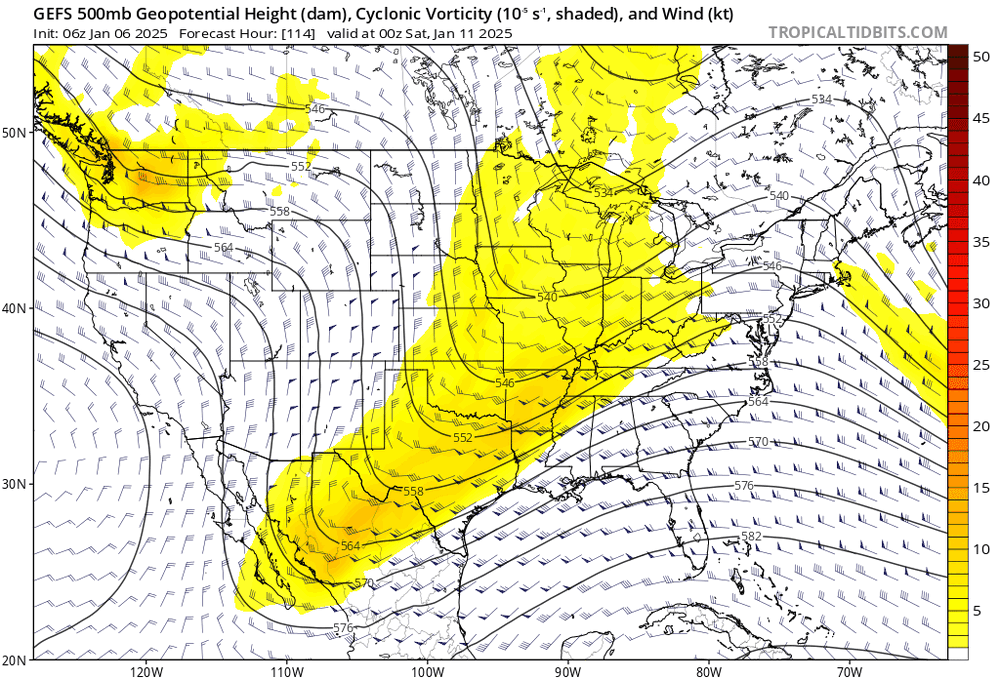
- 993 replies
-
- 3
-
-
- metsfan vs snowman
- bomb
- (and 2 more)
-
Jan 11th-12th Super Bomb or Super Bummed?
brooklynwx99 replied to Rjay's topic in New York City Metro
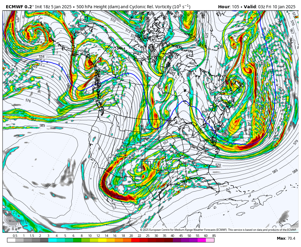
GFS is phasing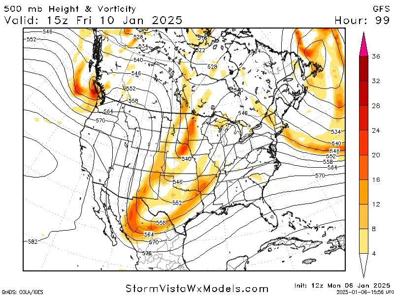
- 993 replies
-
- 2
-
-
- metsfan vs snowman
- bomb
- (and 2 more)
-
GFS is phasing
-
CMC with the fattest cave i’ve seen in a while
-
Jan 11th-12th Super Bomb or Super Bummed?
brooklynwx99 replied to Rjay's topic in New York City Metro
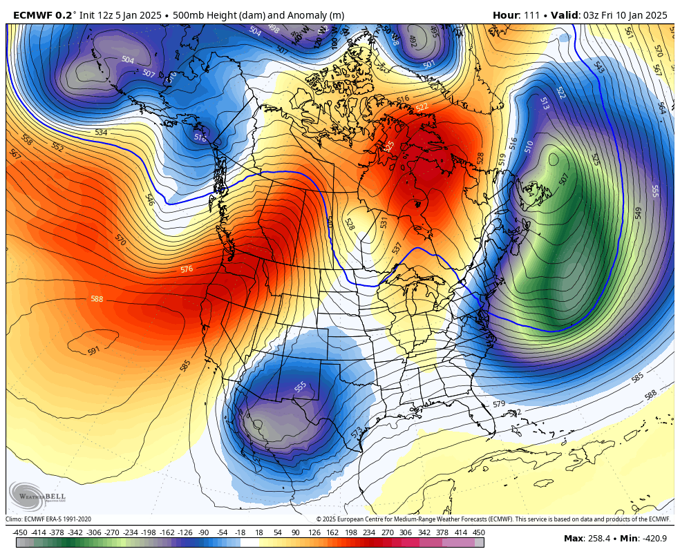
pretty phased here. going to bomb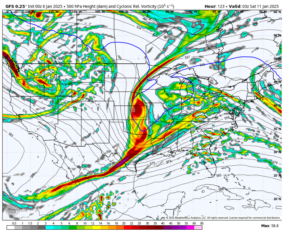
- 993 replies
-
- 4
-
-

-
- metsfan vs snowman
- bomb
- (and 2 more)
-
Jan 11th-12th Super Bomb or Super Bummed?
brooklynwx99 replied to Rjay's topic in New York City Metro
lol you couldn’t be more incorrect- 993 replies
-
- 4
-
-

-
-
- metsfan vs snowman
- bomb
- (and 2 more)
-
why would that one very specific interaction be a result of climate change directly?
-
EPS is making good changes here
-
they aren’t all that different… can easily get the ECMWF to a GFS-like bomb
-
yup, stronger block is leading to more of that last NS piece getting displaced south
-
January Medium/Long Range: A snowy January ahead?
brooklynwx99 replied to mappy's topic in Mid Atlantic
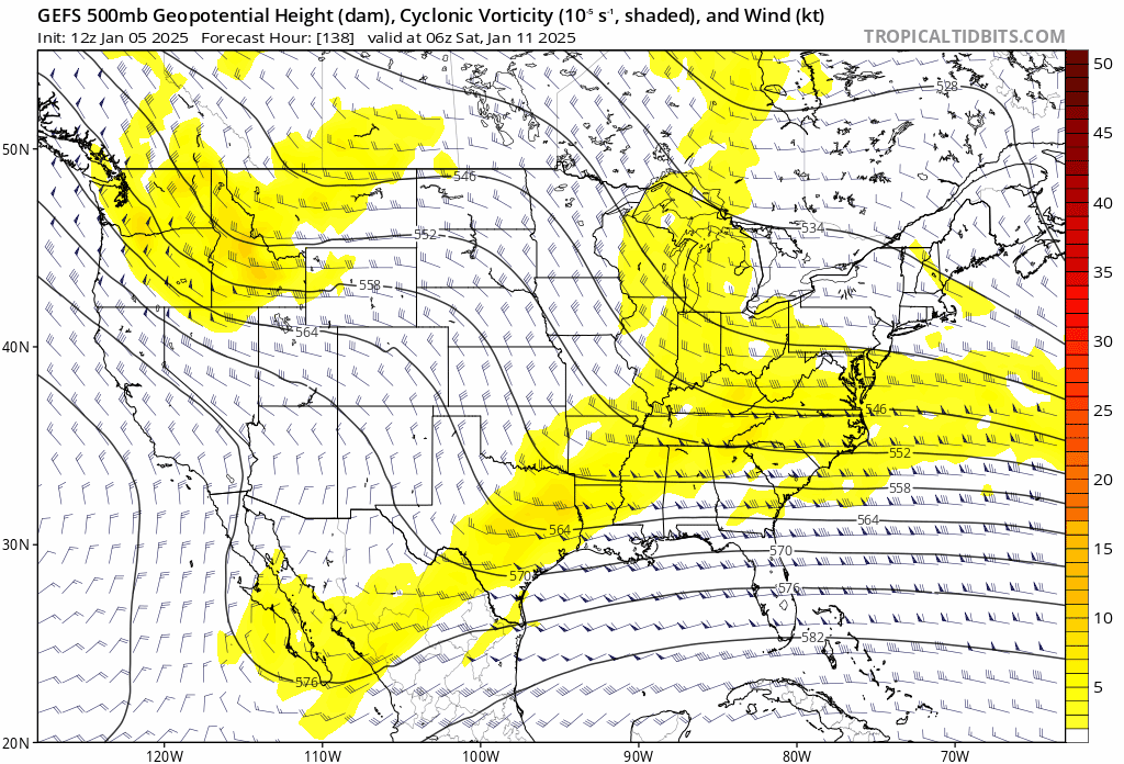
way more consolidated. this is an even lower than normal confidence setup when even the ENS are flopping around like this
-
way more consolidated. this is an even lower than normal confidence setup when even the ENS are flopping around like this
-
way more consolidated. this is an even lower than normal confidence setup when even the ENS are flopping around like this

-
not all that different, just disjointed. within the range of error at this lead time

-
I guess. this kind of setup with confluence leading in along with a 50/50 offshore argue against a true cutter. maybe a runner / transfer, but even that will still bring potentially heavy snow at some point in the evolution. especially with a bomb
-
cutter? the 06z GFS is a cutter to you?
-
indeed… better than the 18z run as well. disregarding the OP shift for now, though it definitely remains in the envelope of solutions
-
January Medium/Long Range: A snowy January ahead?
brooklynwx99 replied to mappy's topic in Mid Atlantic
this has pretty much every box checked off synoptically: phasing trough over the OH Valley, decaying west based -NAO, huge, slow moving 50/50, and antecedent cold air just a matter of how it all comes together
-
this has pretty much every box checked off synoptically: phasing trough over the OH Valley, decaying west based -NAO, huge, slow moving 50/50, and antecedent cold air just a matter of how it all comes together