TWCCraig
-
Posts
2,659 -
Joined
-
Last visited
Content Type
Profiles
Blogs
Forums
American Weather
Media Demo
Store
Gallery
Everything posted by TWCCraig
-
Correct me if I'm wrong, but I believe those cold anomalies have more to do with where the Gulf stream is at the moment. The Gulf stream isn't stationary and moves over time, sometimes it's further north or south than normal and those anomalies are indicating just that. The Gulf stream is further south than it usually is right now, which is why you have large positive anomalies just south of the cold anomalies. The shelf water near the coast is actually above normal. Looking at SST maps, the same thing was happening this time last year, by June the cold anomalies were gone
-
You're right, averages don't paint the whole picture, but I was bringing them up to make a point that it's typically a lot cooler when you're right near the water in the spring. In April 2020, the warmest day was only 64 at ISP, so it has happened before if you get a below average April. Even when we do hit 70+ in April, it usually doesn't last long before a sea breeze comes through unless you have solid offshore flow. As for the ocean making weather boring, I hear ya, but it can make weather interesting in some respects imo. I love extremes too. We've missed out on 100 degrees temps in the summer because of ocean influence.
-
I think if you polled the general public they would probably say that temps have been near "normal" for March. However, today's average high for ISP is only 48, and were going near 60 today. So 50's and 60's is above average for LI in March. The average high for Islip does not reach 60 degrees until April 19th; 70 degrees until May 22nd. If you lived right on the water, it would never seem warm unless you have a good offshore wind. For example, there could be a day where it gets pretty warm briefly in the morning (I.E. 65°), but by the afternoon the sea breeze comes through making it much colder. The official high would be 65, even though the temp at 3pm would be closer to 55, closer to "normal". In other words, the ocean is great at modulating
-
Speaking of dust storms, there's one ongoing right now you can see on the visible satellite
-
Agree, there's no need for the sun to be up at 4am in the summer and twilight would begin around 3am. That gets lost a lot in these conversations about permanent standard time. Personally, I'd much rather have that light in the evening when the vast majority of people are awake. I don't mind an 8am sunrise in the winter, we're already waking up and going to work in the dark. I'd much rather have the daylight when I get home. It would help if you're doing anything outside. Everyone has their preferences, there's nothing wrong with what anyone prefers. This debate will resurface again come November lol I digress, it's 45 and partly cloudy, another windy day on tap
-
 2" here roughly Light snow still falling
 -
Snow/graupel mix, starting to get a coating finally
-
Latest HRRR is still 2-3" NYC and east. Barely any accumulating snow before 6pm, most falls after 6pm. This is inline with what most models had (timing wise)
-
Most models didn't have any steady precip until about 5/6pm out here on Long Island so it's going as planned. 2-4" out this way
-
Steady graupel here with some flakes, no rain so far!
-
I remember Stony Brook's MM5! Though it's more for storm surge forecasting Expecting 2-4" here on the south shore
-
Best thunderstorm in years and it's basically January. Tons of ctg strikes
-
Seems like we get better thunderstorms in the winter than in the summer, at least here!
-
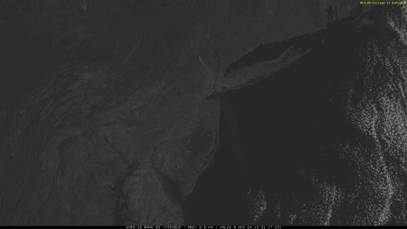
Couple fires in NJ sending a smoke plume over Manhattan

-
Unfortunately the dry streak in NYC is over picking up 0.01", but if no more rain falls through Thursday it should still be the driest month all-time behind June 1949 where 0.02" fell
-
If the rain chances this upcoming week don't pan out, there's a chance for many spots to have their driest September on record. This could also end up being one of the driest months ever. ISP currently only has 0.06" of precip for September, record for the driest month is 0.18" set in October 2000 and August 1964. NYC is currently tied for 5th driest month ever NYC: Click column heading to sort ascending, click again to sort descending. Rank Year-Month Total Precipitation Missing Count 1 1949-06 0.02 0 2 1963-10 0.14 0 3 1995-08 0.18 0 4 1884-09 0.21 0 5 2024-09 0.24 9 - 1964-08 0.24 0 ISP: Click column heading to sort ascending, click again to sort descending. Rank Year-Month Total Precipitation Missing Count 1 2024-09 0.06 9 2 2000-10 0.18 0 - 1964-08 0.18 0 4 2013-10 0.22 0 5 1963-10 0.24 0
-
Been mostly sunny here all day. 81
-
85/77 Dew points went up with the sea breeze
-
Not much since June 27th
-
Haven't seen the sun in how long? Feels like forever. We've been locked in with these clouds. These clouds will probably clear just in time for Monday lol
-
Central Park at 73, hottest spot in the whole area as it should be. Amazing what a lack of foliage can do this time of year for that station 69 on the island
-
Beautiful day, the HRDPS or the GEM-LAM hinted 80 degree temps briefly even for the island. Wouldn't be achievable without the offshore flow. Absolutely loves days like this!
-
Something interesting I've noticed during the last solar eclipse in 2017 is how much the temperatures drop during the eclipse. I was in SC for that one, you were able to notice the temperature drop a couple degrees simply due to the lack of sun. I'm curious to see how the eclipse will effect high temps today, I can see temps peaking early. Most weather models do not take into account the loss of heating from a solar eclipse.