TWCCraig
-
Posts
2,652 -
Joined
-
Last visited
Content Type
Profiles
Blogs
Forums
American Weather
Media Demo
Store
Gallery
Everything posted by TWCCraig
-
 Nice to finally have some snow! Turned to rain here now but temp is 30.9 so it's freezing rain
 -
Two Mdt to high impact events NYC subforum; wknd Jan 6-7 Incl OBS, and mid week Jan 9-10 (incl OBS). Total water equiv by 00z/11 general 2", possibly 6" includes snow-ice mainly interior. RVR flood potential increases Jan 10 and beyond. Damaging wind.
TWCCraig replied to wdrag's topic in New York City Metro
Snowing.. temp of 35, warmer than most on the island. Nothing sticking -
Two Mdt to high impact events NYC subforum; wknd Jan 6-7 Incl OBS, and mid week Jan 9-10 (incl OBS). Total water equiv by 00z/11 general 2", possibly 6" includes snow-ice mainly interior. RVR flood potential increases Jan 10 and beyond. Damaging wind.
TWCCraig replied to wdrag's topic in New York City Metro
Big wet flakes coming down now, after all the rain. 36 with the temp dropping. Not expecting any accumulation -
High of 82. Awesome weather. Might sneak in another warm day Monday. Some models are as warm as the mid 70's like the RGEM, and other models like the GFS are in the mid 50's. Crazy differences for a 48 hour forecast
-
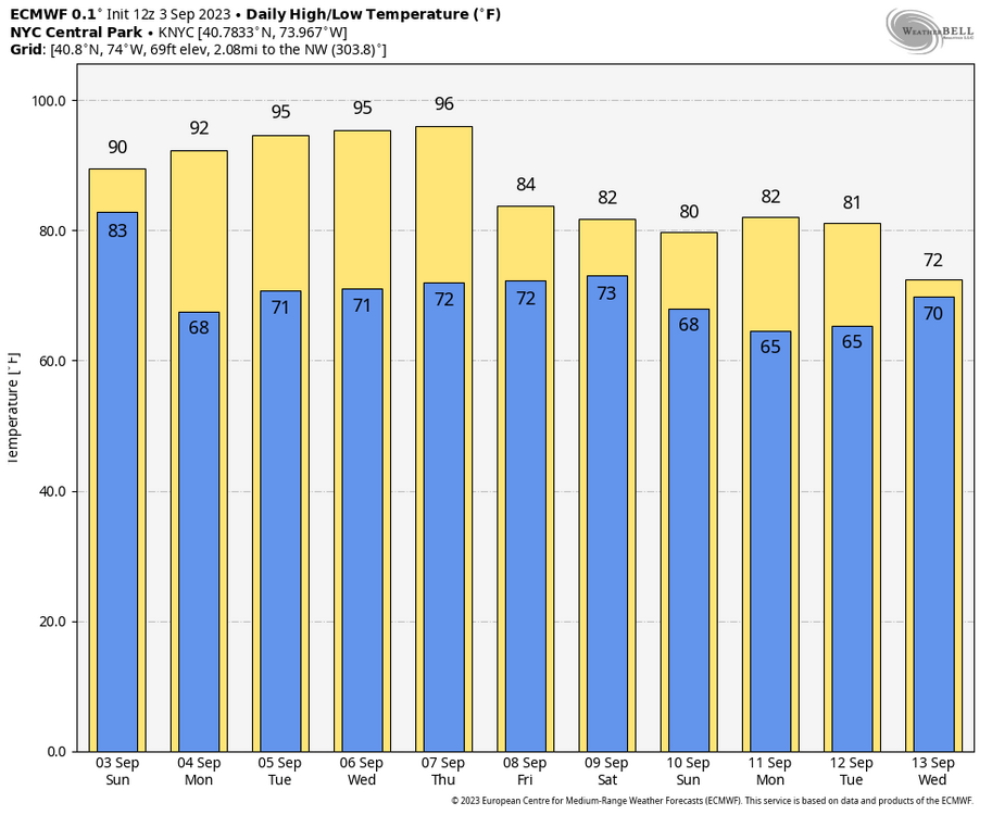
NYC had its warmest coolest temperature to date for the season on record until this morning. Similar situation at ISP though we should drop below these temperatures tonight NYC: Click column heading to sort ascending, click again to sort descending. Rank Ending Date Lowest Min Temperature Sep 1 to Oct 23 Missing Count 1 2023-10-23 48 1 - 1949-10-23 48 0 3 2021-10-23 47 0 - 2011-10-23 47 0 - 1903-10-23 47 1 6 2016-10-23 45 0 - 2013-10-23 45 0 - 2007-10-23 45 0 - 2005-10-23 45 0 ISP: Click column heading to sort ascending, click again to sort descending. Rank Ending Date Lowest Min Temperature Sep 1 to Oct 23 Missing Count 1 2023-10-23 44 1 2 1967-10-23 43 0 3 2021-10-23 42 0 4 2017-10-23 40 0 - 2011-10-23 40 0
-
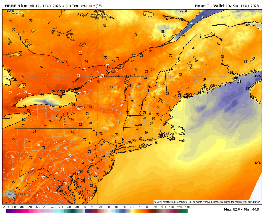
The HRRR is one of the few models I know that takes into account the smoke in the column and the effect it has on surface warming. HRRR has us barely going above 70 today and tomorrow solely based on the smoke. Most forecasts have mid 70's for us on LI, I think we fall well short of that unfortunately. Struggling to make it out of the low 60's so far
-
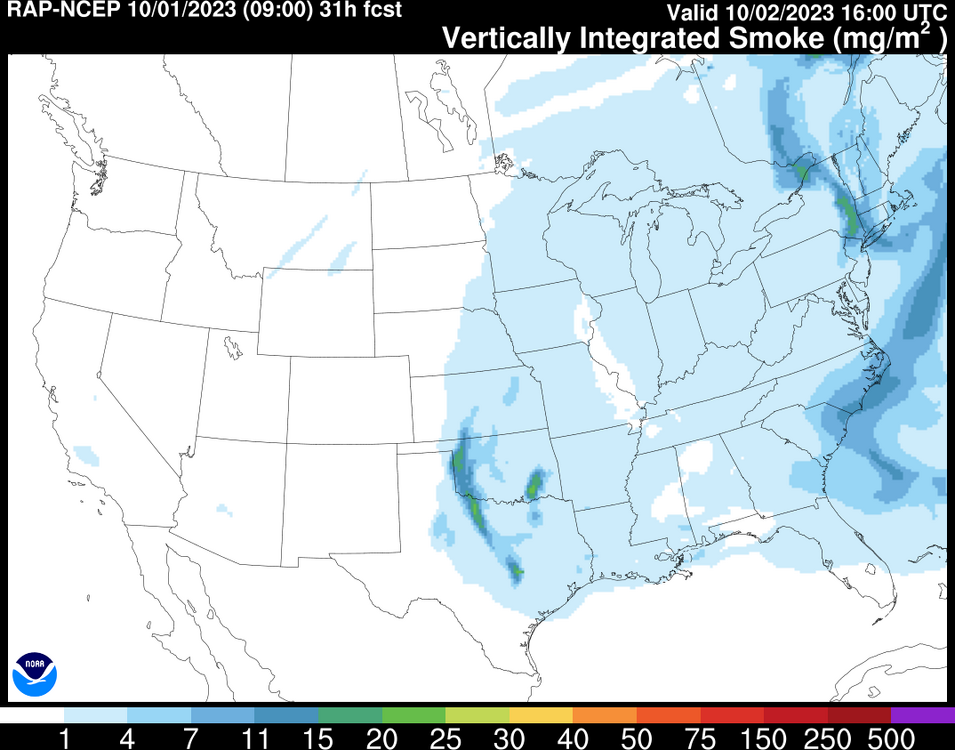
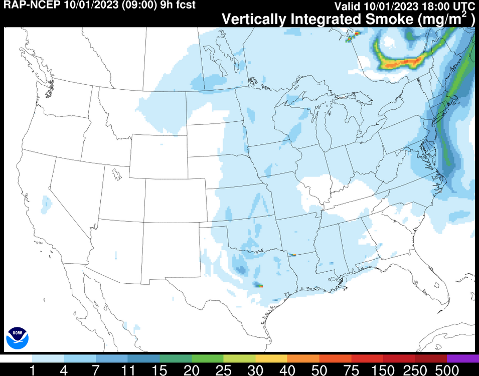
Those of us out on Long Island will be stuck in the smoke all day today and tomorrow too
-
Unbelievable. After several days of miserable skies and weather, as soon as the clouds clear, the smoke is back! I can't believe it's October and there's fires still raging in Quebec, arguably they never really got extinguished. Was hoping for a nice day with blue skies but that will have to wait You can't make this stuff up!
-
The Southern Pine Beatle has been wreaking havoc on Pitch Pines, which is the dominate native pine tree found on Long Island and in the New Jersey Pine Barrens, for a couple years now. The drought last summer really amplified the destruction and the warm winter last year didn't kill off any bugs, so this summer was set for another round of outbreaks. Activists have criticized the NYDEC for not doing enough and there maybe some validity to that. While efforts to combat the bug have stepped up over the past year, some feel that the state has been neglecting these conservation areas far too long. Precautionary measures include prescribed fires and early removal of trees that are under stress, potentially from the bug. Some of these outbreaks have gotten so bad that it's too late in some spots. It's just another unfortunate thing, the pine barrens out east remind me of the south, places like the Carolinas that have tons of pine trees. Would hate to see that go away
-
87/72 now, max of 91 earlier. Officially a heatwave here!
-
88/73, max of 91 Today's certainly hotter than yesterday. Combined with dewpoints in the 70's it genuinely felt hot today
-
91/74 on the home station, looks like the sea breeze is trying to move north
-
90/73 Feels like 98 First 90 since July
-
86 degrees here. Hit a high of 87 before the sea breeze. Clouds really hurting temps today. Yesterday's GEM-LAM and a few runs of the HRRR picked up the clouds and showers for today
-
ISP has been in a sea breeze most of the summer compared to FRG. The days where FRG is several degrees higher than ISP is when ISP is in a sea breeze and FRG isn't. Yesterday had a southerly wind at ISP, FRG was NW most of the day, that's why FRG is hotter. ISP is very accurate, my highest temp in July was 91, ISP was also 91. My highest in August was 87, ISP was 88. It's been very accurate. The sea breeze has been a prominent feature for those on the south shore and east.
-
ISP, and places south & east were in a sea breeze most of the day. Most stations out east barely made it out of the low 80's. My high was only 86 before the sea breeze. The stations are not off at all lol FOK was only 81
-
84 here, high of 86. NYC might have fallen just short of 90 today. Looking hotter as we head into the week, NYC could have its first heatwave of the year. Wednesday may be the hottest for those closest to the coast with some offshore flow early in the day.
-
I noticed this too. Black soot floating on top of the water in the pool filter intake, and it only occurs after it rains. Not sure what it is
-
Non stop lightning! Torrential rains, some gusts up to 35mph
-
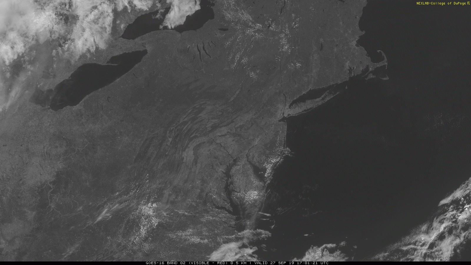
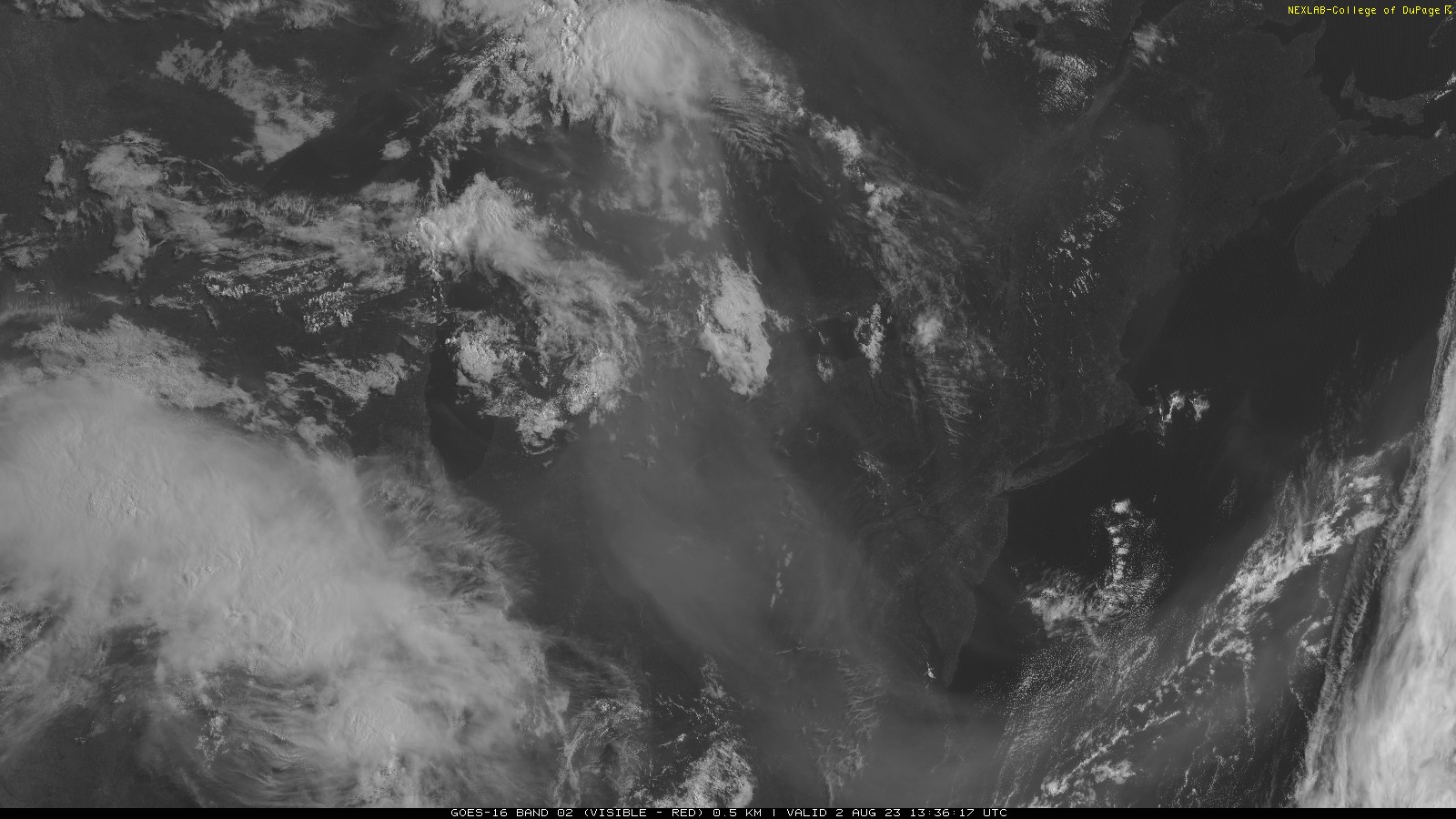
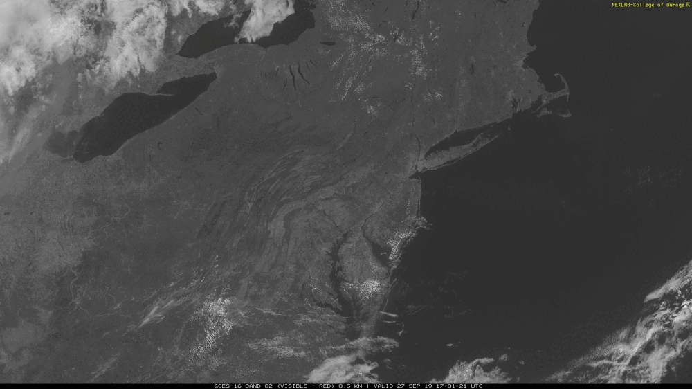
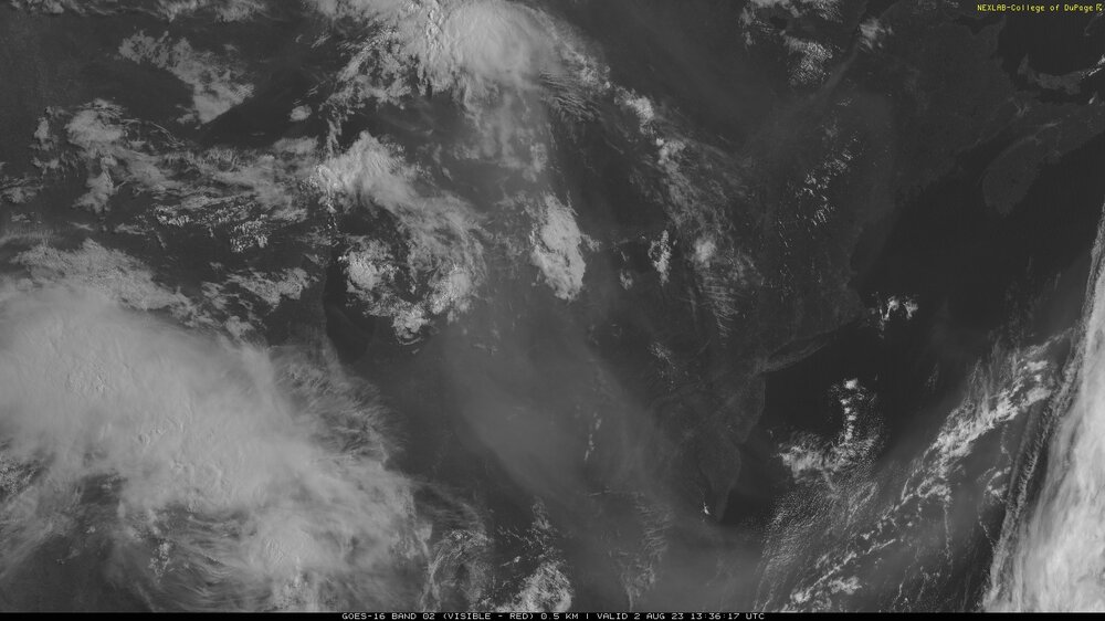
You can barely make out the surface over NJ and the Delmarva with upper level smoke that thick. On a clear day, you can easily see surface features such as the shore. An example of a mostly clear day back in Sep 2019:

-
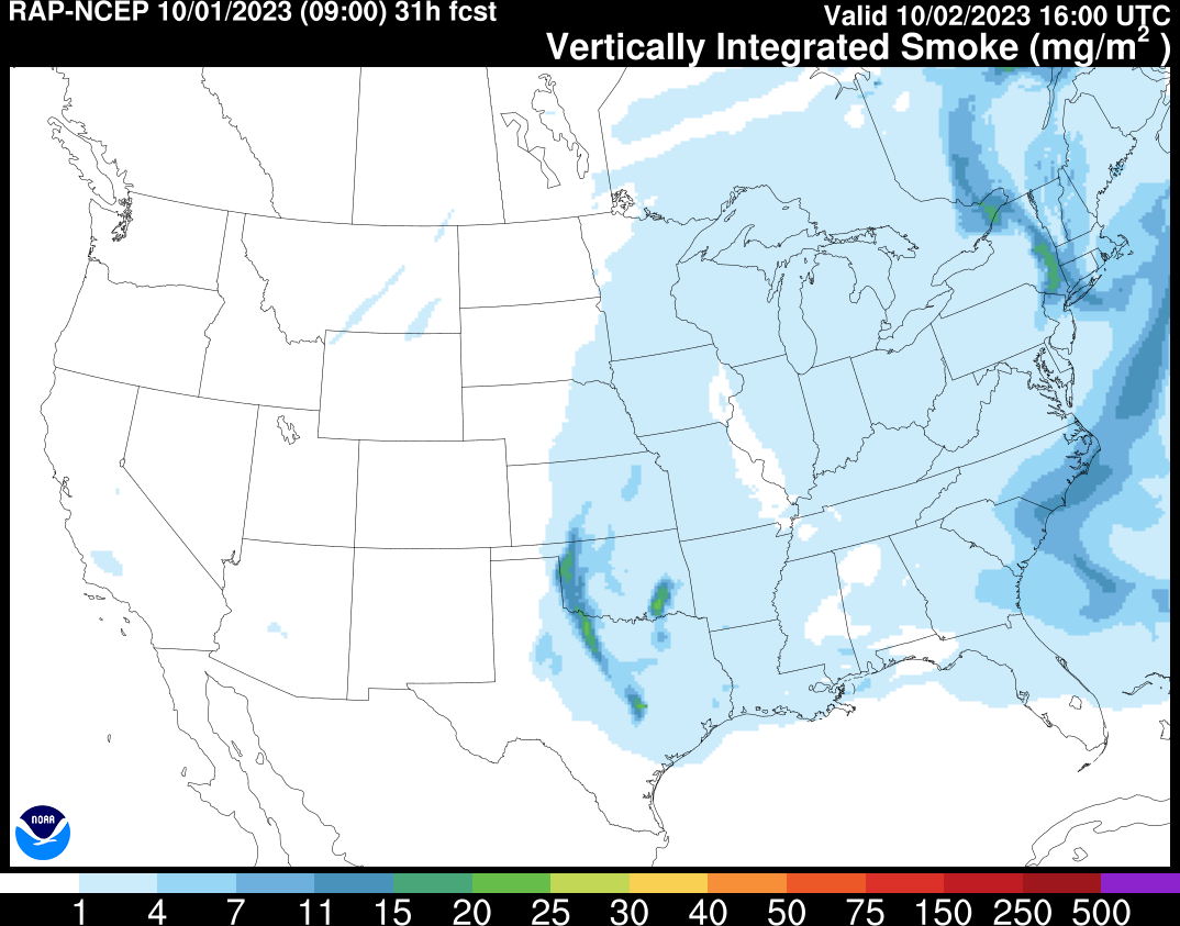
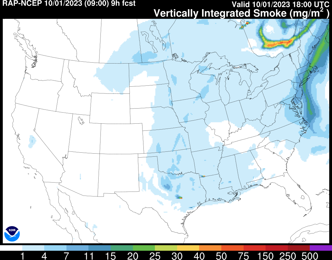
Love how most of the smoke went around us. It's mostly elevated, but the RAP has the smoke to our west moving over the area tomorrow. Skies will be noticeably gray tomorrow
-
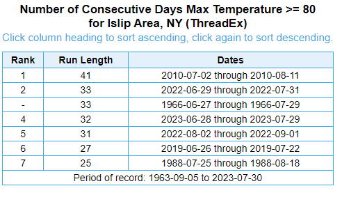
4th longest streak of 80+ days came to an end yesterday. It's been more uncomfortably humid this past July than most
-
It was 56 degrees at ISP on this day just 2 years ago in 2021 50's in July aren't that abnormal. Used to have as many sub 60 degree nights as 90 degree days
-
Nice lightning storm to my south!
-
Gusting to about 35mph, moderate rain still very windy. Cool orange skies