TWCCraig
-
Posts
2,644 -
Joined
-
Last visited
Content Type
Profiles
Blogs
Forums
American Weather
Media Demo
Store
Gallery
Everything posted by TWCCraig
-
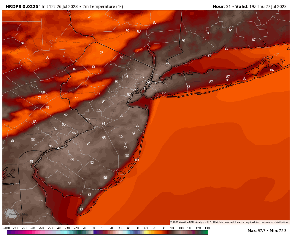
The GEM-LAM spitting out 85 for FOK and 95 for LGA says it all. N&W parts of LI will be an absolute inferno tomorrow, at least it'll be breezy
-
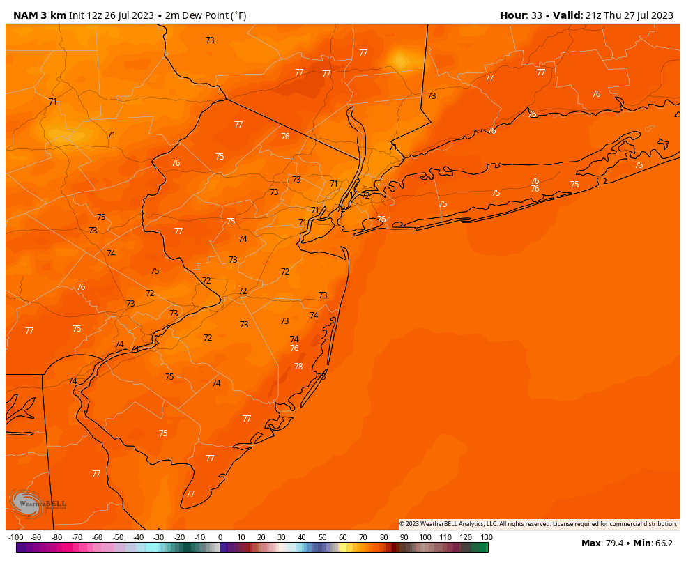
Tomorrow will feature oppressive dew points in the mid 70's with slightly lower DPs along the I95 corridor where mixing and temperatures are expected to be their greatest. Strong onshore flow and breezy conditions tomorrow will keep most of Long Island below 90 at the expense of higher humidity. Some storms will fire to the NW and will make their way east in the afternoon Breezy conditions tomorrow will make the heat slightly more bearable.

-
Found this interesting. ISP has hit 80° or above 25 days in a row now, today will be 26, which is the 6th longest streak on record. By Saturday, it will be at least 31 days. That'll make it tied with last year for 4th place. Last year's would have been the longest on record with 65 days in a row, however, just one day, August 1st, 2022, was below 80°. It's interesting that we have a streak this year this long considering there was only one 90 degree day with a max of 91°. All other years had heat 95°+. Number of Consecutive Days Max Temperature >= 80 for Islip Area, NY (ThreadEx) Click column heading to sort ascending, click again to sort descending. Rank Run Length Dates 1 41 2010-07-02 through 2010-08-11 2 33 2022-06-29 through 2022-07-31 - 33 1966-06-27 through 1966-07-29 4 31 2022-08-02 through 2022-09-01 5 27 2019-06-26 through 2019-07-22 6 25 2023-06-28 through 2023-07-22 - 25 1988-07-25 through 1988-08-18
-
What a difference this July is compared to last July. We couldn't buy a single rain shower last summer, took almost an entire summer to reach 1" of rain. Downpour after downpour here. About 5" in just the past week
-
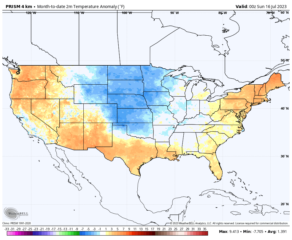
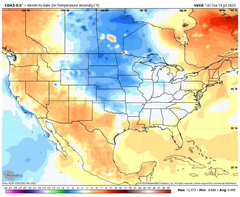
Only the middle section of the country has been below normal. 2 different data sets below. NYC is +2.3 for July so far. No 95+ heat yet, but plenty of days near 90 and high dews has made us above normal.

-
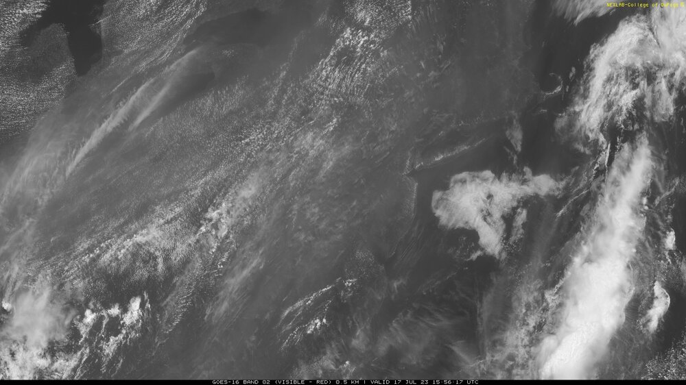
Smokey gray skies again
-
ISP over 3" now! Maybe they get to 5", 6" today? If it keeps raining like this
-
Over 2" here and still coming down
-
Deluge here. Non stop lightning and thunder. Largest puddles I've seen in a while. Actually the whole street is flooded with how fast it's coming down now
-
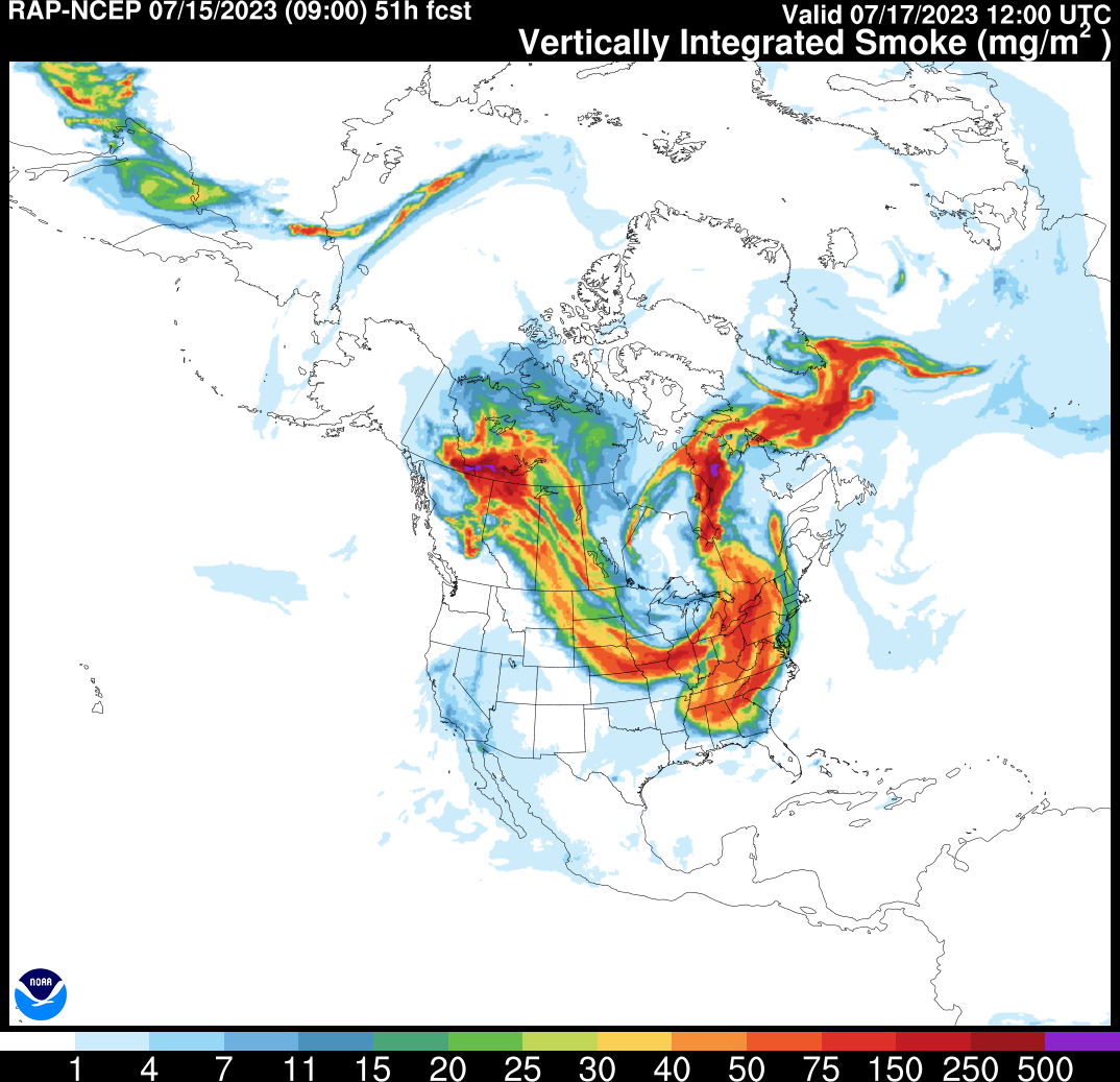
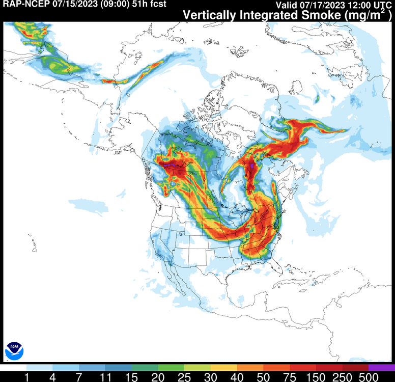
Aware, just noting the fact it returns here Monday aloft. I don't like our days being hazed over with smoke. It blocks out the sun, makes the sky look dull and gray as if it was cloudy, and actually keeps temps down a little.
-
Smoke returns to the skies starting Monday according to the RAP. I hate this stuff!
-
Barely got to 0.05" last night. Everything missed to my east. This was always a possible outcome though. Some models had no rain at all. It should almost be expected this time of year out here.
-
Yep, getting some rain now with these pop up showers. The best should come later tonight for Long Island
-

Extended summer stormlover74 future snow hole banter thread 23
TWCCraig replied to BxEngine's topic in New York City Metro
From what I'm seeing, most of the rain was always forecast to come tonight out here, yet everyone thinks it's a bust because it's not raining yet -
Hi-res models have some rain coming in overnight tonight into early tomorrow morning, looks like that will be the main event out here if it unfolds. I don't think we see much during the day today or tomorrow afternoon other than isolated showers
-
It's always a thing. The south shore is typically more stable with onshore flow than the north shore. The north shore averages more rain in the summer. Clouds and storms will fire along the sea breeze boundary which will often be near the LIE or just north of it.
-
Actually, the Euro has upper 80's and 90's Tuesday-Thursday. GFS is 90+ Tuesday through Friday, for the city of course.
-
Noticable gust front came through. Might see a quick little shower before it's over
-
Storms are always going to be hit or miss this time of year. I expect a thunderstorm or two but not an all day washout. Maybe the sea breeze front saves the south shore today. Not the most ideal weather for the 4th but I think it's crazy to constantly cancel things because of the chance of rain. There's a chance of rain in Florida everyday, that doesn't stop them!
-
2PM: EWR: 91 LGA: 89 NYC: 87 FRG: 87 JFK: 86
-
The models, as of yesterday, had a period of sun for today, some had places in NJ hitting 90 like yesterday's 18z HRRR. We knew there was going to be an initial batch of showers this morning associated with the warm front, and we knew there is potential for decent convection in the evening hours. To be fair, it's not really a bust.
-
Raining... again!
-
Beautiful day out here. Temps upper 70's and low 80's and bright sunshine with a sea breeze. Cloudy this morning, but sunny all day with towering cumulonimbus clouds to my north. Almost a typical summertime day minus a couple degrees
-
Huge difference between you and me and were only a mile or two apart. Full sunshine here
-
Fully clear here, no daytime heating clouds with the sea breeze, though I expect clouds and fog to return this evening