TWCCraig
-
Posts
2,652 -
Joined
-
Last visited
Content Type
Profiles
Blogs
Forums
American Weather
Media Demo
Store
Gallery
Everything posted by TWCCraig
-
Models still all over the place. GFS is pretty cool for Sunday with low to mid 80's, rains Sunday AM and clouds stick around; while the 18z Euro is now roasting hot Sunday with good offshore flow and temps in the mid 90's. Euro is still very hot Monday but places right along the coast have a sea breeze and therefore cooler. GFS has a good sea breeze for most on Monday, about 10 degrees cooler than the Euro.
-
Too far out to know exacts but the latest GFS has more onshore flow than the Euro next week, so it has lower temps (mid to upper 90's) with higher humidity. Unfortunately it's been the theme of a lot of our heat waves in recent times
-
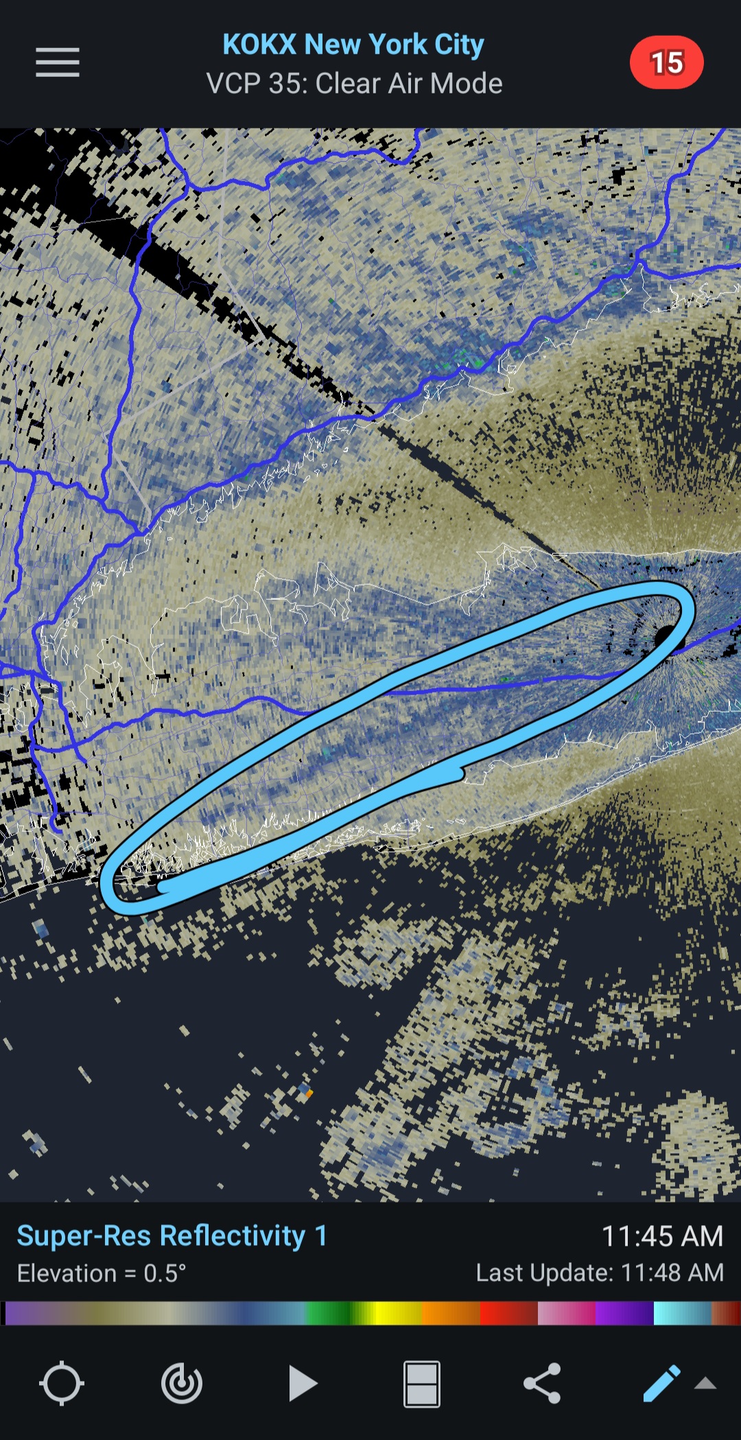
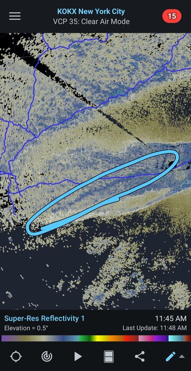
Sea breeze boundary is visible on KOKX radar, slicing through LI southwest to northeast. Dew points have gone back up at places like ISP thanks to the sea breeze. The initial westerly wind this morning that brought in some drier air has subsided
-
I saw lots of white oak along Nicolls road (CR-97) refoliating this week after being completely eaten bare by gypsy moth caterpillars
-
That's probably happening naturally already. Boreal forest being replaced by deciduous forest. These high latitudes are warming faster than other places on the planet and if rainfall doesn't increase as well you get fires. Pine, fir, and spruce burn very easily. I don't know if boreal forests are expanding northward as fast as were losing them fires, drought etc.
-
ISP had a trace of precip over the 5/10-5/11th weekend and 0.01" on 5/17-5/18. So those weekends dont count as dry even though they were, at least at Islip. Not surprised by upstate though. But it has been very rainy and dreary over the past month, were paying for last fall
-
Lawns were pretty brown last fall, they didn't green up until December ironically. It wasn't long lasting, but last fall was the driest stretch of weather this region has ever seen
-
Not as much as the other day thankfully. Some of it is near surface
-
Weatherbell has a great color scheme. Only downsides are there's no 32°F isotherm and the temperature anomaly maps will make you think -4°F is just as significant +9°F. They're skewed to make below average temps look even more below average. Pivotal is hilarious though, making 60 degrees look like it's 90 lol
-
The smoke put a damper on temps out here, thankfully it's clearing out now. High of only 75 at ISP so far, actually cooler than yesterday's high of 78.
-
Pretty smoky sunrise this morning. I noticed temps were a little slower to rise this morning than usual due to the smoke. Lowest temp this morning came after 6am, despite the sun being up for over 40 minutes
-
It shouldn't. I wonder if people are even aware of it though. It should be mentioned in forecasts but most of the time it gets disregarded as just "haze" which isn't truly accurate. It's a shame that most outlets don't even mention the smoke at all. People who use weather apps probably think tomorrow will be mostly sunny when it'll probably be more gray with all the smoke. I can see the majority of this upcoming week being ruined with smoke yet the forecasts will have people expecting blue skies
-
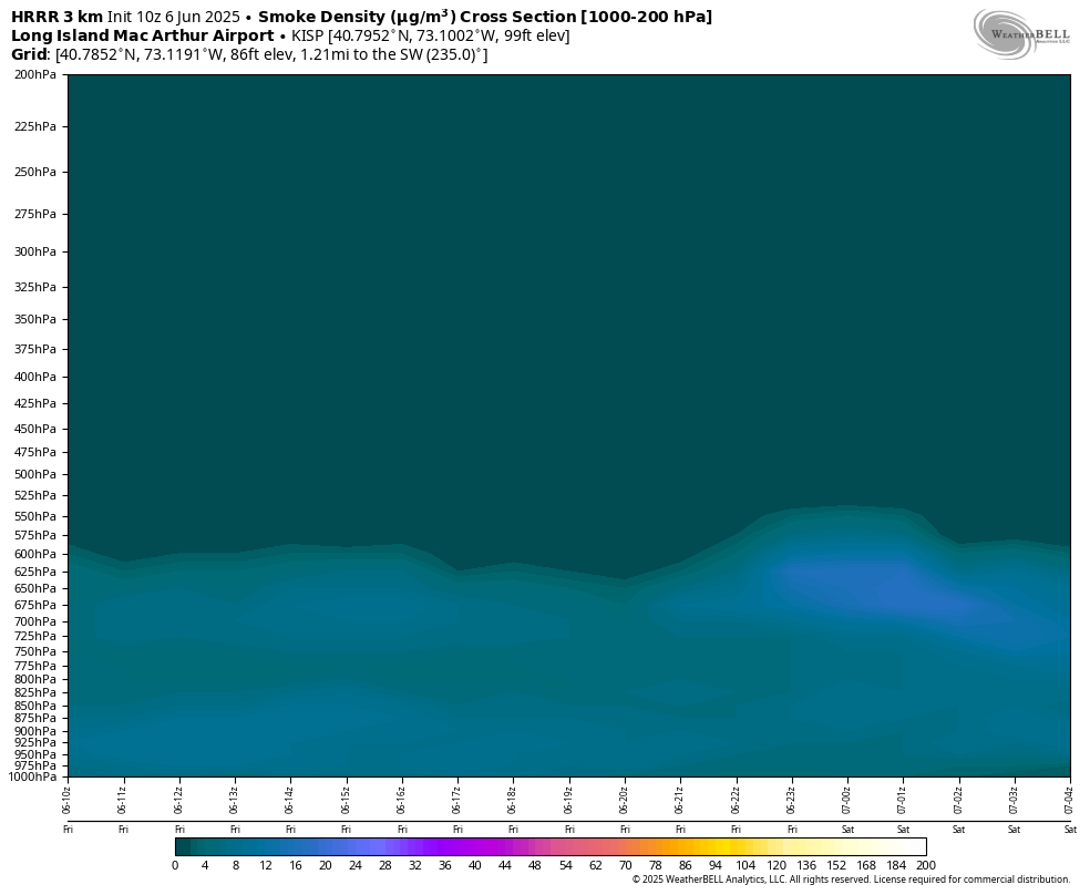
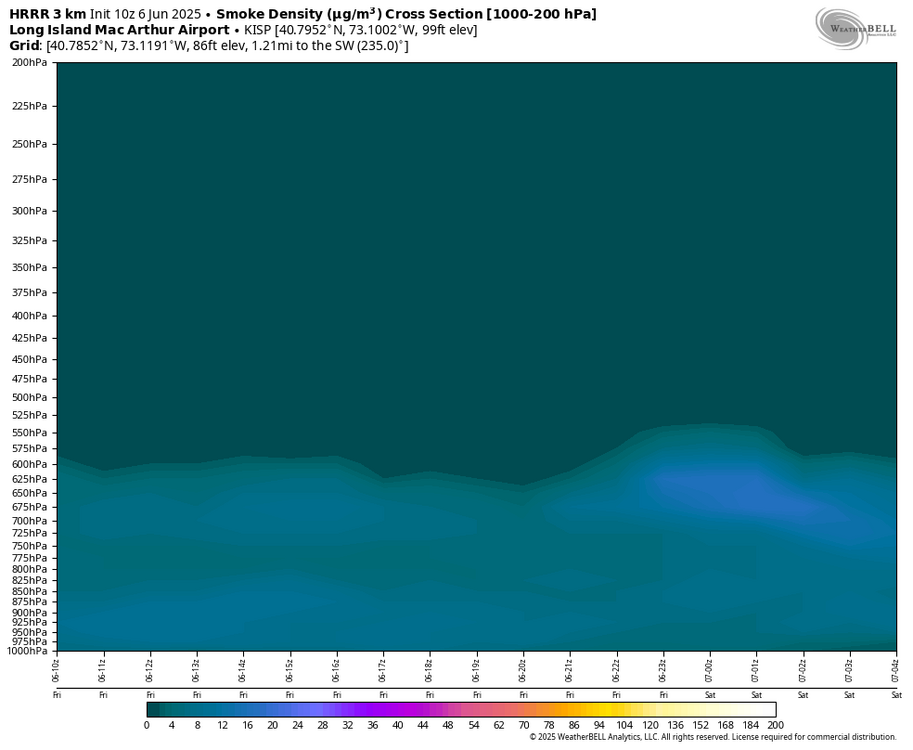
Different winds at different heights. The smoke is mostly elevated, between 300-400mb
-
Beautiful out, for now. Little chilly for June but I'd take it over swamp weather. These clear blue skies won't last long unfortunately. Some models have that band of smoke moving north into our area by the afternoon
-
Probably 70s out here, but I agree it should be nice. This week was always supposed to be iffy. We'll probably get good weather just in time for the smoke to ruin it
-
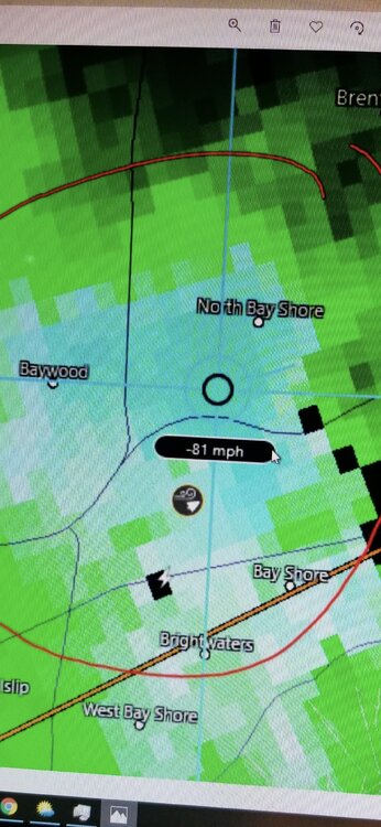
81mph on the radar velocities (elevated). Crazy storm
-
Departures from normal through May 25th: NYC: -0.2 LGA: +0.4 JFK: +2.9 ISP: +2.6 BDR: +0.7 EWR: +1.7 Interesting spread
-
NYC's average monthly low for May is 44 degrees (1991-2020). NYC had their coldest temperature of the month yesterday 3+ weeks in at 47 degrees. The average lowest temperature from 5/20-5/31 is 51.4 (1991-2020)
-
Despite the wind, the past couple of days had near perfect weather. Feels like a fall morning but with the bonus of a longer day and higher sun angle. Someone the other day mentioned Gypsy moths, you can see where they're taking over. Lots of defoliation occurring in some areas
-
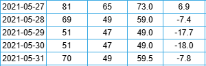
In 2021, NYC had back to back days with high temps of only 51 on May 29th and 30th, happens.
-
Here we had two separate downburst thunderstorms come through in 2019, one in late June and one in August. Both caused extensive damage in the area. Radar estimated 80mph winds. Two severe storms in one season and it's been quiet ever since. I remember we got a decent thunderstorm in December last year lol
-
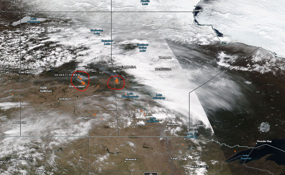
Couple ongoing right now in Saskatchewan and Manitoba, this satellite pic was taken yesterday, fires circled in red, orange dots
-
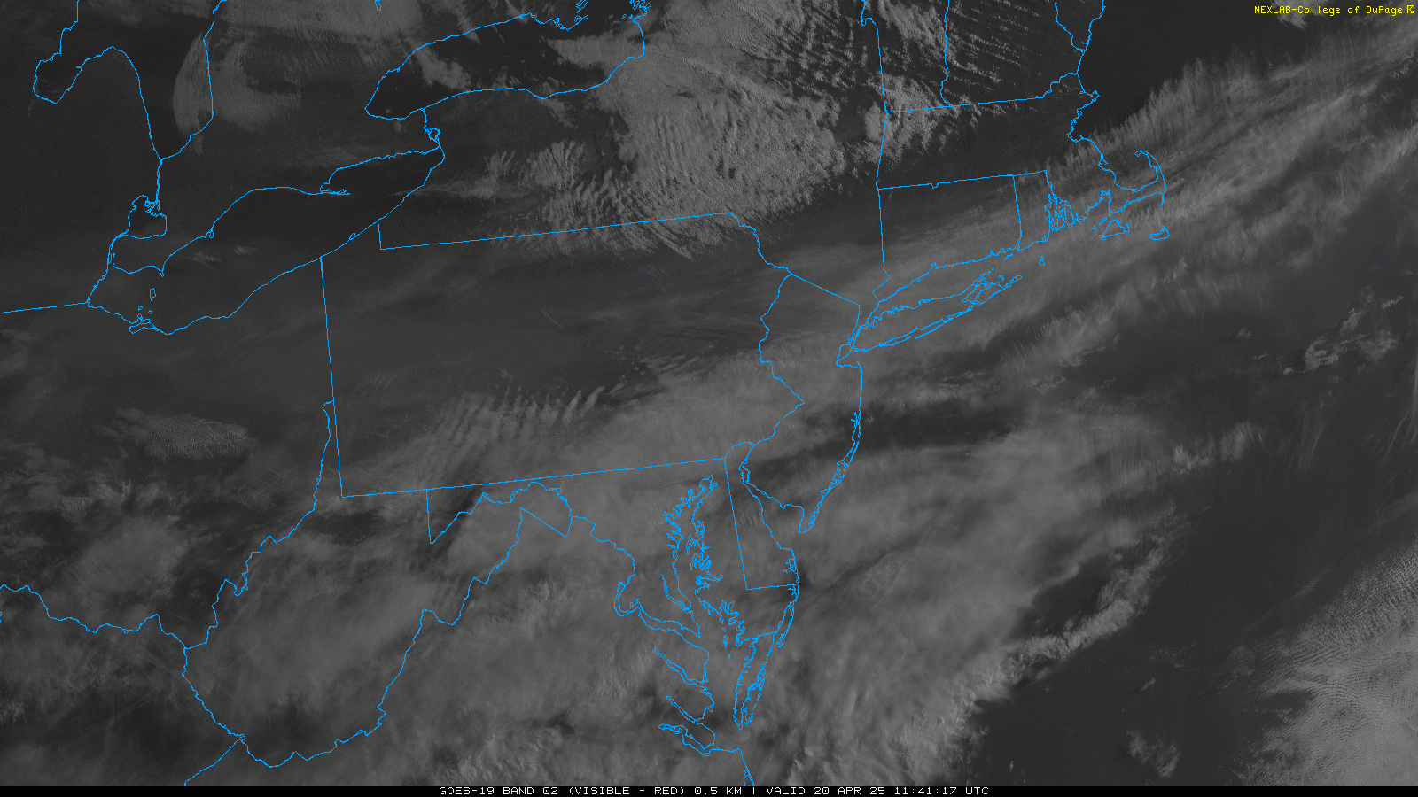
Little bit of elevated smoke from Canadian wildfires this morning. Thankfully not more
-
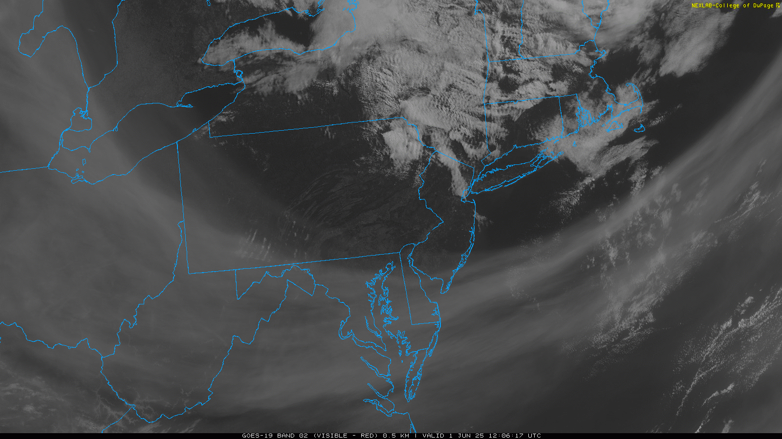
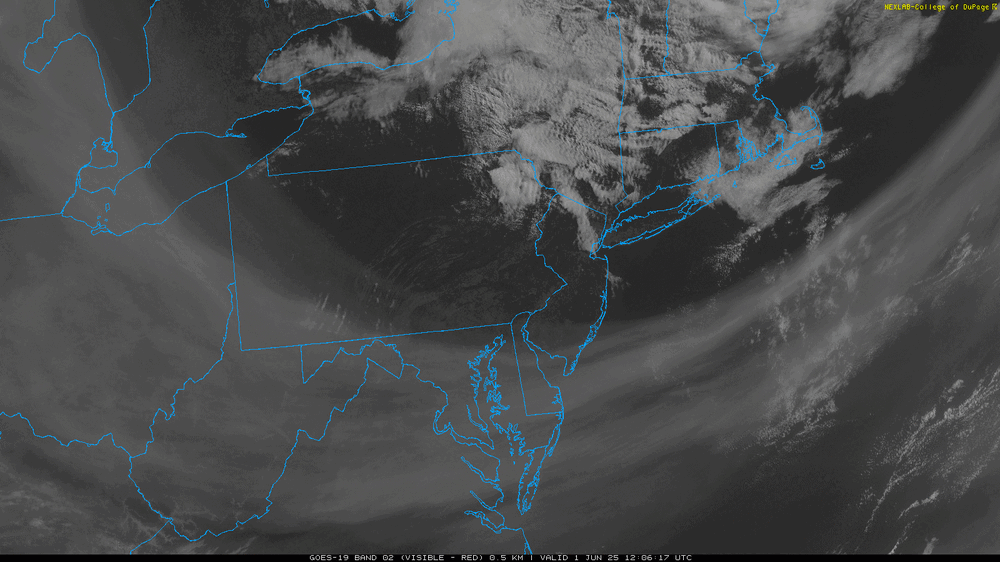
Always interesting when a "cold" front comes through in the spring on LI, temps went from the upper 50's last night to near 70 in the early morning once the front passed. There's a bit of elevated smoke in the sky on the visible satellite, noticeable over PA. It is moving south with clearer air to our north

-
Down to 70 already after a high of 79. Sea breeze cooling off the south shore fast