AfewUniversesBelowNormal
-
Posts
4,753 -
Joined
-
Last visited
Content Type
Profiles
Blogs
Forums
American Weather
Media Demo
Store
Gallery
Everything posted by AfewUniversesBelowNormal
-
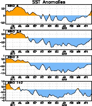
When will this even out? Do we continue on a trend or stabilize somewhere soon? (I think it stabilizes but there is still room to move, we are maybe 60% of the way there since 2013)
-

Mid to Long Term Discussion 2018
AfewUniversesBelowNormal replied to Cary_Snow95's topic in Southeastern States
24" of rain is pretty extreme.. STJ going Strong Nino, at least Nino for the last month -
West-based El Nino, about the best case scenario for snow If anyone is interested
-
Current NTA favors El Nino because of OLR

-
2013 was major climate change
AfewUniversesBelowNormal replied to AfewUniversesBelowNormal's topic in Climate Change
Highest Hemisphere +anomaly will be in the Gulf of Alaska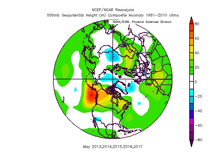
-
2018 Mid-Atlantic General Severe Discussion
AfewUniversesBelowNormal replied to Kmlwx's topic in Mid Atlantic
We need the opposite of this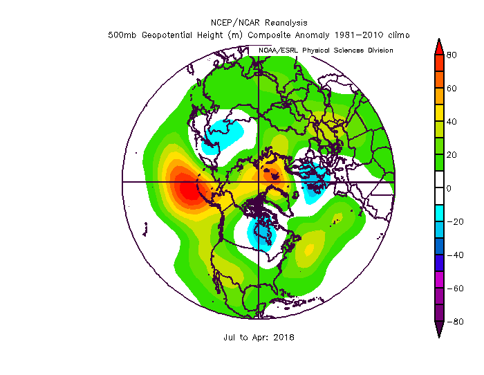
-
2018 Mid-Atlantic General Severe Discussion
AfewUniversesBelowNormal replied to Kmlwx's topic in Mid Atlantic
Not really a good pattern for severe weather general. The Atlantic tropical ridge is too strong. We need a Lower Midwest heat ridge, Southwest cutoff Low, or something like the late '90s where it gets really warm like upper 90s to 100 in July, coming from the dusty Upper Midwest. This pattern is tropical. -
-
Mid to Long Term Discussion 2018
AfewUniversesBelowNormal replied to Cary_Snow95's topic in Southeastern States
I think this is the most important image in long range forecasting El Nino incoming -
Arctic Sea Ice Extent, Area, and Volume
AfewUniversesBelowNormal replied to ORH_wxman's topic in Climate Change
It looks now like it may go into a stronger Nino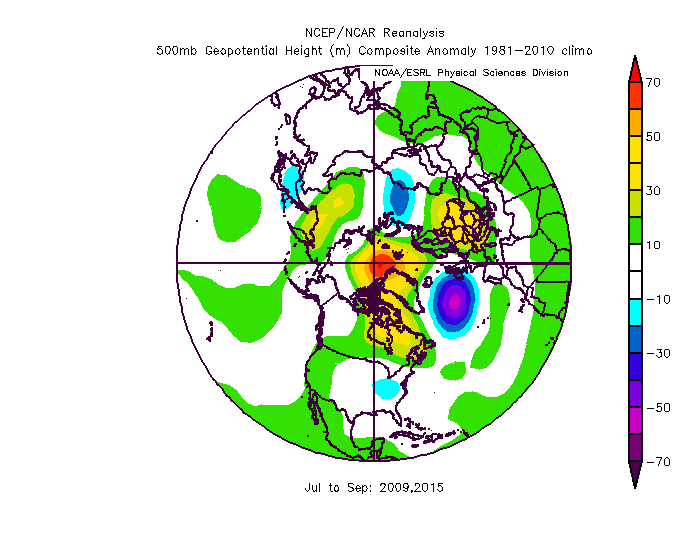
-
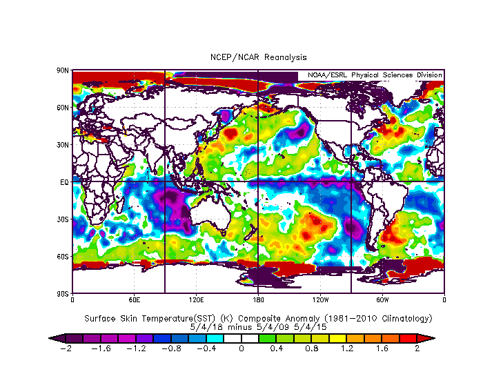
Look at this substantial warming in Nino 4. There is a chance this could be a Strong Nino.
-
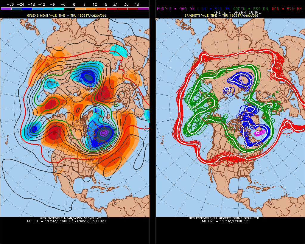
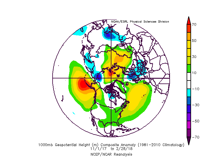
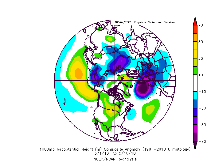
Tendency for high heights in the Arctic circle has been strong. If this holds, favors a lot of Atlantic recurving storms. 2009,2010,2011,2014,2015 Central Atlantic ridge at 850mb was strongest ever this Winter, up to +30% of mean average (Dec-Feb)! It reversed March with -NAO and has generally been NAO driven through April and early May. My guess is it would come back for the Summer.
-
Arctic Sea Ice Extent, Area, and Volume
AfewUniversesBelowNormal replied to ORH_wxman's topic in Climate Change
Ok.. look at how this filled in in the north part of Greenland then become an arctic circle block (models were consistently negative anomaly here until a day ago). I think this is the same trend from the Winter and it will be a large arctic ice melt season -
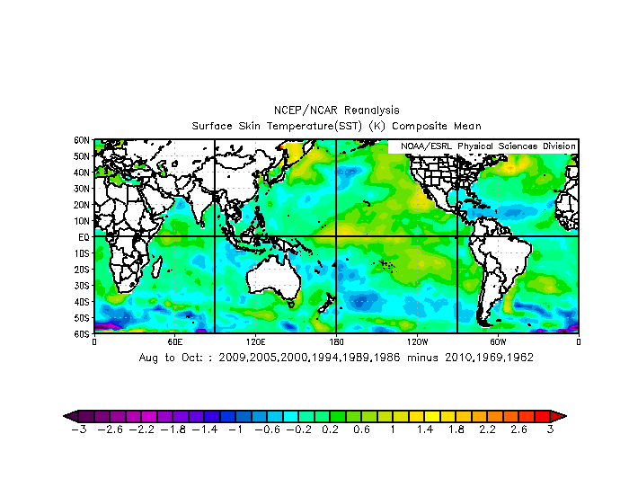
Where we are behind the 2 Strongest El Nino's since 1997
-
These only started appearing in the last few weeks. It was opposite every day Summer - March.
-
Mid to Long Term Discussion 2018
AfewUniversesBelowNormal replied to Cary_Snow95's topic in Southeastern States
Actually all the way back to 1998 there isn't one higher than +2.4 (today is ~+2.7) -
Mid to Long Term Discussion 2018
AfewUniversesBelowNormal replied to Cary_Snow95's topic in Southeastern States
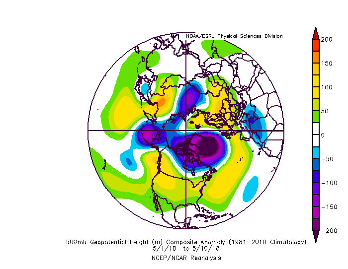
Highest NAO today since 2013... 5 years -
Apr 29 - May 16 looks to have the most +NAO on record for that time (and all 18-day periods between April and September actually.) The only other time Apr 29 - May 16 has had +NAO since 1997 are 2009 and 2015, interestingly, the 2 strongest El Nino's since 1997.
-
2018 Mid-Atlantic General Severe Discussion
AfewUniversesBelowNormal replied to Kmlwx's topic in Mid Atlantic
Weak storms though. They always blow up humid airmasses severe wx threat.- 1,302 replies
-
- 1
-

-
- severe
- thunderstorms
- (and 3 more)
-
This is pretty interesting. Nino 4 usually doesn't rise this fast, first. When Mar -> Apr is 0.4 difference or greater: 1997, Neutral - Strong El Nino 1987, El Nino - El Nino 1973, Strong El Nino -> Strong La Nina 1972, La Nina -> Strong El Nino 1966, El Nino -> Neutral 1958, El Nino -> Neutral When coming from Neutral or La Nina it goes to Strong El Nino 2/2, 2 of the 4 events since 1950, but the other regions are also rising fast by now. I wouldn't forecast Strong El Nino this year. (None of the events listed above Nino 4 led Nino 3) In 2015 Nino 4 led Nino 3 (Strong El Nino). Maybe it's just a sign of the times.
-
Mid to Long Term Discussion 2018
AfewUniversesBelowNormal replied to Cary_Snow95's topic in Southeastern States
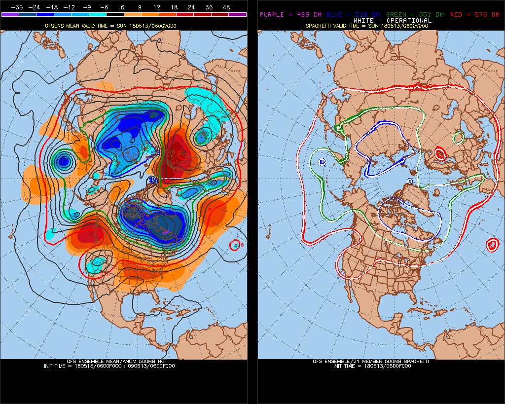
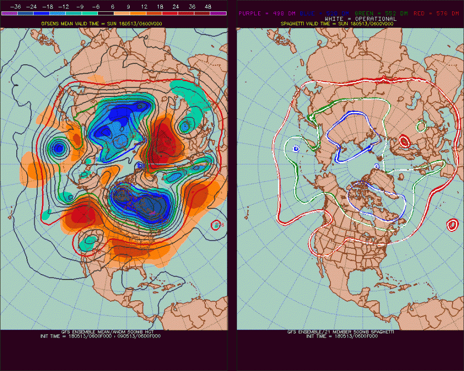
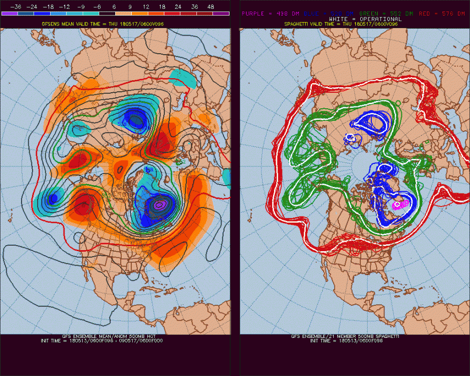
Pretty incredible happening right now with the strength of these ridges. Strongest +NAO in 2.5 years now has 3 bursts, next being Day 5 and Day 9. By the end it's downright hot. -
MAM will be +0.3 or greater higher than FMA. Since 1950, this difference has happened 21 times, 13 (61.5%) went into the opposite ENSO state, El Nino or La Nina. Per this, 60% chance we go into El Nino but since it's not still La Nina, maybe 65%. (2016 was the strongest difference)
-
Mid to Long Term Discussion 2018
AfewUniversesBelowNormal replied to Cary_Snow95's topic in Southeastern States
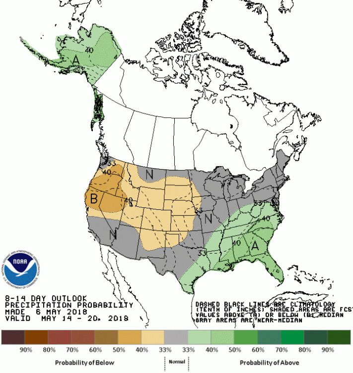
It's hard the imagine the jet stream would be anything but north this Summer -
Clouds - 2018
AfewUniversesBelowNormal replied to bowtie`'s topic in Outdoor and Weather Photography
It seems like the clouds where you are, are 20 years in the future or something. I've always had this feeling about Detroit area. -
Mid to Long Term Discussion 2018
AfewUniversesBelowNormal replied to Cary_Snow95's topic in Southeastern States
+NAO is max today - 5/4. Highest since Dec 2015