AfewUniversesBelowNormal
-
Posts
4,753 -
Joined
-
Last visited
Content Type
Profiles
Blogs
Forums
American Weather
Media Demo
Store
Gallery
Everything posted by AfewUniversesBelowNormal
-

Mid to Long Term Discussion 2018
AfewUniversesBelowNormal replied to Cary_Snow95's topic in Southeastern States
A below average cold season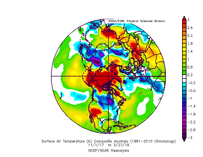
-
Mid to Long Term Discussion 2018
AfewUniversesBelowNormal replied to Cary_Snow95's topic in Southeastern States
The +PNA is legit with ENSO subsurface right now. -
Central/Western Medium-Long Range Discussion
AfewUniversesBelowNormal replied to andyhb's topic in Central/Western States
This is some pretty awesome cold for April. Wonder if it verifies. -
Mid to Long Term Discussion 2018
AfewUniversesBelowNormal replied to Cary_Snow95's topic in Southeastern States
NAO is being subborn now on medium term models (meaning no neg NAO). Stratosphere warmings are followed by 2 -NAO bursts. This could be a sign for long regime +NAO phase still.. -
Don't want to upload because of image size, but these images are so cool
-
Mid to Long Term Discussion 2018
AfewUniversesBelowNormal replied to Cary_Snow95's topic in Southeastern States
-PNA is just too strong on models. +500dm day 6. It's just really rare for this to go away -
98-99, 99-00, 00-01. It's not too uncommon. 54-56 had a nice streak. 73-76 http://origin.cpc.ncep.noaa.gov/products/analysis_monitoring/ensostuff/ONI_v5.php I think a 3rd Nina year would be weird because of Global warming bias right now. 1 center El Nino event since 2010 in this exponentially warming climate?
-
Don't expect it to go El Nino anytime soon.. subsurface for this late in the Winter may even support a Nina rebound in the Summer if it doesn't persist at the surface
-
Mid to Long Term Discussion 2018
AfewUniversesBelowNormal replied to Cary_Snow95's topic in Southeastern States
10 or11 days away? Come on man. You're better than that. It has model agreement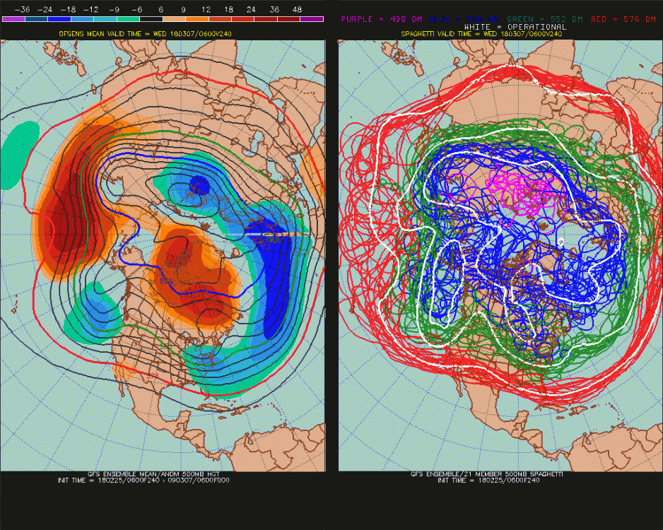
-
http://sites.uci.edu/zlabe/arctic-temperatures/
-
Mid to Long Term Discussion 2018
AfewUniversesBelowNormal replied to Cary_Snow95's topic in Southeastern States
Storm potential March 6-8.. starting to look like -PNA may not be as modeled -
Mid to Long Term Discussion 2018
AfewUniversesBelowNormal replied to Cary_Snow95's topic in Southeastern States
Since 2000, everytime we have had a strong -NAO block March 1-7, -NAO is through the rest of the month on a strong magnitude of at least +150dm at 500mb over Greenland for the March 8-31 period. 5/5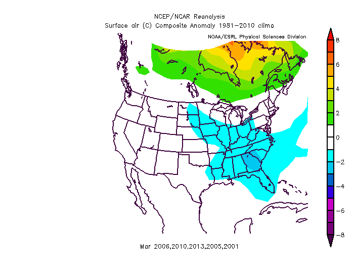
-
Southeast Sanitarium - A Place to Vent
AfewUniversesBelowNormal replied to Jonathan's topic in Southeastern States
You'll love this one, Global warming is another way of saying dimension split.. we are on really really low end here. Almost to the point of not going back but not quite yet but we are heading that way -
Good morning February
-
Mid to Long Term Discussion 2018
AfewUniversesBelowNormal replied to Cary_Snow95's topic in Southeastern States
backdoor fronts this far south on a 588 ridge in February -
The SST movement changes direction next few weeks. This is when you'll see it change or not, some people say a Kelvin wave like we had is a preceding mark. Those +subsurface in the western regions are impressive. I think it's strengthening versus climo is a strong signal for North Pacific -PNA, like we are seeing now. The whole pattern has shifted north 200 miles so you aren't going to see severe wx setups like early 2000s
-
-
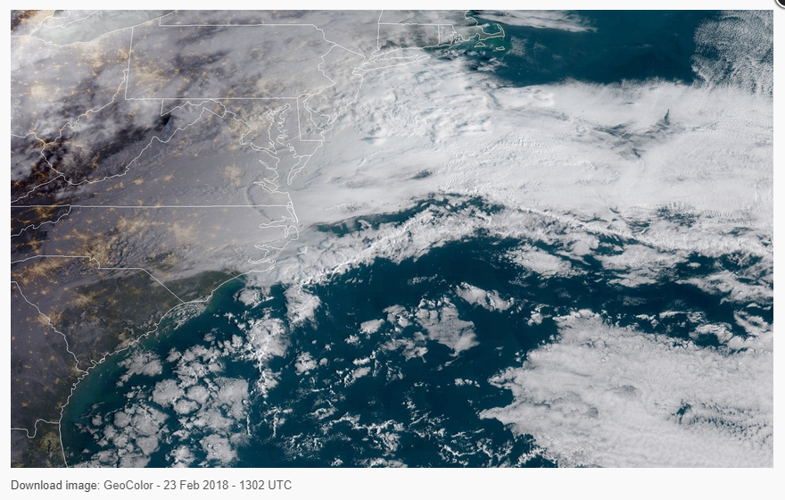
GOES Satellite
-
What a happening in Texas in February!
-
I mean, they've all but shut down this board. It's amazing to see the differences in 10 years and the energy is same!
-
Mid to Long Term Discussion 2018
AfewUniversesBelowNormal replied to Cary_Snow95's topic in Southeastern States
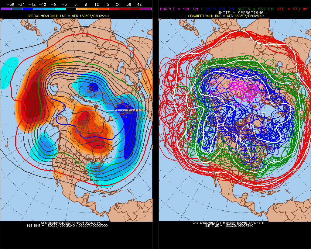
-PNA on long range models is a signal that doesn't go away, it's so far southwest and strong. The models may be having feedback issues with -NAO picking up a blocking signal that's really over the Pacific. Stratosphere warming downwelled to -NAO could happen and probably will, but much later than models have right now at 168-240hrs -
Mid to Long Term Discussion 2018
AfewUniversesBelowNormal replied to Cary_Snow95's topic in Southeastern States
Northern Hemisphere pattern to the Pole is really ripe right now. Nice flow of waves, in balance with good things I think. This means the 7-14 day period could be more organic with higher snow chances. There is nice oversight right now http://mp1.met.psu.edu/~fxg1/ENSHGTAVGNH_6z/ensloopmref.html -
CPCs subsurface were substantially more Nina last month, TAO/Triton this is most extreme of event now. imo TAO is better
-
Mid to Long Term Discussion 2018
AfewUniversesBelowNormal replied to Cary_Snow95's topic in Southeastern States
Are you sure about this? Many times the Atlantic pattern has not switched although it was on long term models going into March. NAO has been positive every day since Dec 1 and is most positive now. The blocking could occur, but it would be over Europe the arctic or something -
I don't know much about the QBO. QBO, MJO, AAM sound like new age terms. It was so cool to see precip patterns change when the SOI went negative Check out the NOI or SOI*