NJHurricane
-
Posts
2,176 -
Joined
-
Last visited
Content Type
Profiles
Blogs
Forums
American Weather
Media Demo
Store
Gallery
Everything posted by NJHurricane
-
Congrats and thank you for the description….pulled off the highway an hour south of Plattsburgh NY….plenty of stars but no aurora….lol at a complete loss now that I’m out of the clouds as to why
-
And what’s it look like to the naked eye?
-
Nearing Lake George NY, and even though I’ve got crescent moon and a few stars….nothing?
-
Wife just asked if we can head north to see what we see….any opinions on cloud cover tonight around the northern end of Lake Champlain? This is what I get for successfully getting us to a good location for the eclipse a few weeks ago
-
Aiming for that area myself but can’t leave until 5pm Sunday after I work. No idea what to expect traffic wise. Got a toddler with us so not sure just pushing through without a sleep stop is in the cards.
-
A few small flakes dancing in the streetlights here in National Park NJ
-
January 19, 2024 Powder Snow Event
NJHurricane replied to Ralph Wiggum's topic in Philadelphia Region
steady light snow continues in National Park NJ across from PHL…..yard snowpack refreshing and snow making inroads on my street working it’s way in from the curbs. Not a terrible start in spite of the dry air. -
It’s gonna be close with this dry air and latest modeling has the ivt just south….I think northeast Maryland does better than my location of National Park NJ across from PHL. Fighting the fizzle for now but dp and rh have been dropping as the first round of steady light snow gained a foothold last 35 minutes
-
January 19, 2024 Powder Snow Event
NJHurricane replied to Ralph Wiggum's topic in Philadelphia Region
First tiny flakes in National Park NJ across from PHL. -
E PA/NJ/DE Winter 2023-2024 OBS/Discussion
NJHurricane replied to The Iceman's topic in Philadelphia Region
A lot riding on Mt Holly’s ratio rationale….. My reaction to that part of the afternoon AFD…. -
January 19, 2024 Powder Snow Event
NJHurricane replied to Ralph Wiggum's topic in Philadelphia Region
If we only get an inch in the warning zone, at least it will be a disappointment worthy of the term. -
E PA/NJ/DE Winter 2023-2024 OBS/Discussion
NJHurricane replied to The Iceman's topic in Philadelphia Region
When the Winter Storm Warning notification came across….
-
January 15-16 winter storm OBS
NJHurricane replied to Hurricane Agnes's topic in Philadelphia Region
Very light snow consisting of very fine tiny flakes has begun in National Park NJ across from PHL -
Two Mdt to high impact events NYC subforum; wknd Jan 6-7 Incl OBS, and mid week Jan 9-10 (incl OBS). Total water equiv by 00z/11 general 2", possibly 6" includes snow-ice mainly interior. RVR flood potential increases Jan 10 and beyond. Damaging wind.
NJHurricane replied to wdrag's topic in New York City Metro
I’m in AC at the Hard Rock hotel….even by 5pm small branches were coming down on the one side street I cut across and loose construction signs were taking flight. Surf was definitely up 90 minutes ago when I poked my head out on the deck near the buffet.- 3,610 replies
-
- 1
-

-
- snow
- heavy rain
- (and 5 more)
-
E PA/NJ/DE Spring 2023 OBS Thread
NJHurricane replied to Hurricane Agnes's topic in Philadelphia Region
Almost seems like there could be a dry line in the mix to help ignite things. -
Half of the non weather population struggles to remember what county they are in, I guarantee you hardly any are aware of what specific elevation they are at in this part of the country. It is a weird communication dynamic for sure. I live in south Jersey but often work in Union county…3 coworkers live in Sussex county. When I relay the latest forecast evolution I always mention “higher amounts for the hill people….you know who you are.” And they do lol.
-

-
Lurking in y’all subforum to help a friend in Macomb Michigan track this….any Michigan posters have any local tv meteorologists you recommend? My friend isn’t completely weather illiterate but doesn’t track stuff like we do. Good luck to you all and thanks for the information.
-
January 28th/29th Event Obs - From KU to FU?
NJHurricane replied to JTA66's topic in Philadelphia Region
https://www.spc.noaa.gov/products/md/2022/md0097.html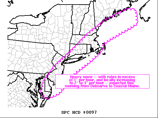
-
January 28th/29th Event Obs - From KU to FU?
NJHurricane replied to JTA66's topic in Philadelphia Region
Normally I’d agree but down here at Hard Rock Casino in AC I’ve been in moderate to heavy for a while, drifting, sideways snow….snow accumulations right to the crashing surf. Wouldn’t trade this one for playing the fringe game at home again.
-
January 28th/29th Event Obs - From KU to FU?
NJHurricane replied to JTA66's topic in Philadelphia Region
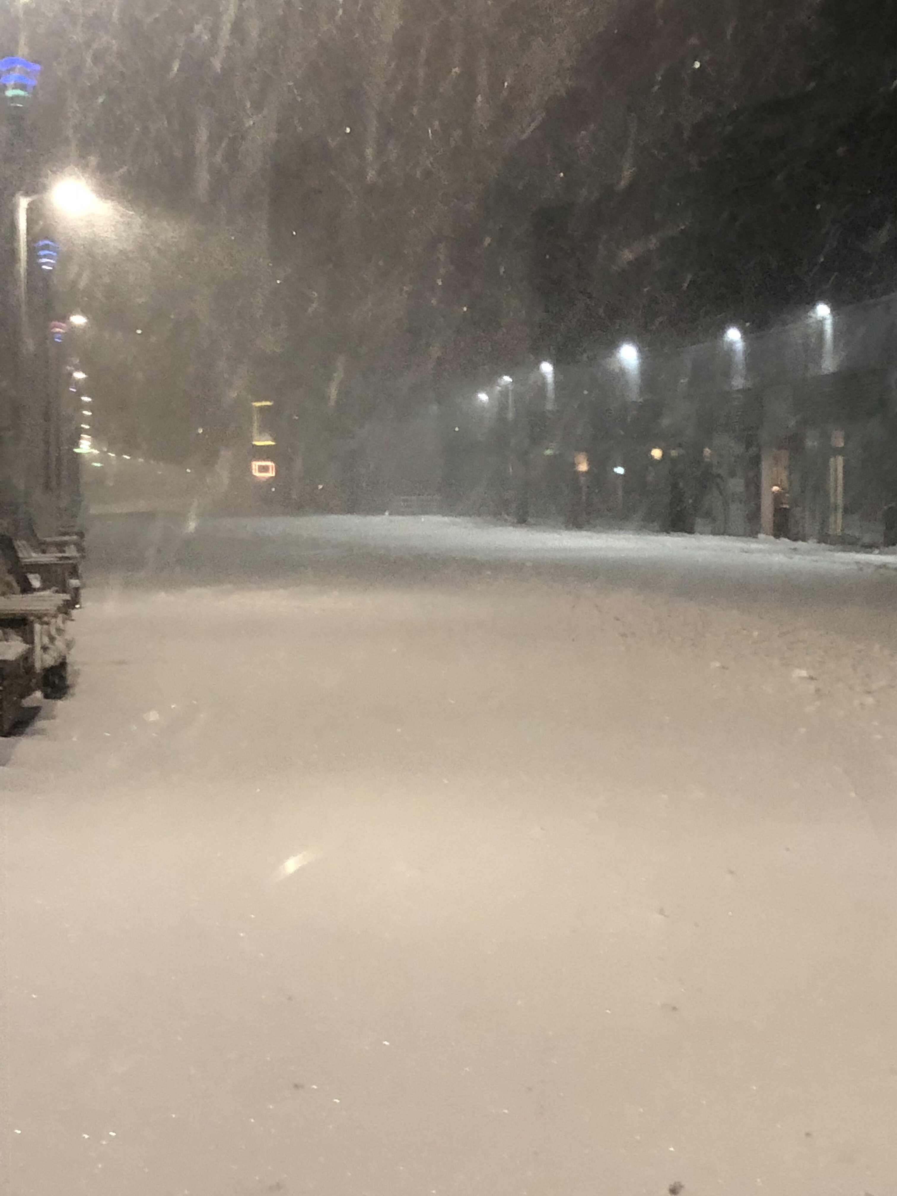
Wind driven snow, approaching moderate, at Hard Rock casino in Atlantic City….impressive start here. -
January 28th/29th Event Obs - From KU to FU?
NJHurricane replied to JTA66's topic in Philadelphia Region
First snow “chase” in years….hoping to jackpot at the Hard Rock Casino in AC lol…good luck Philly. -
January 28-29, 2022 Miller abcdefu Storm Threat
NJHurricane replied to WxUSAF's topic in Mid Atlantic
Need some more special upper air obs….
-
Don’t come a knocking if the ‘Lantic ain’t a blocking.
-
If this suite produces a miracle you’ve set a precedent….wine and taxes to save every threat. Need to crack open a vintage closed 500h.