
tdp146
-
Posts
1,232 -
Joined
-
Last visited
Content Type
Profiles
Blogs
Forums
American Weather
Media Demo
Store
Gallery
Everything posted by tdp146
-
79.3 max dew point today. Hitting 75 is getting easy but 80 still remains elusive.
-
90/77. Heat sucks…. Oh wait, not if you live near the beach and play hooky from work
-
 3.10 on my weather flow but it’s almost certainly too low. The wantagh mesonet is 4.5” and that lines up with the radar estimates. I do like the weather flow devices for everything else beside the way it measures rain. It’s some sort of algorithm based on the size of the rain drops. Sorry, but no technology beats measuring water in a bucket.
 -
Sitting on the beach in Suffolk and everyone’s phones just blasted with the hurricane warning.
- 1,603 replies
-
- 2
-

-
- hurricane gusts
- flooding rains
- (and 2 more)
-
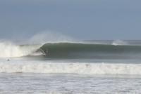
swell already building on the south shore
- 1,603 replies
-
- 6
-
-
- hurricane gusts
- flooding rains
- (and 2 more)
-
This could easily be Fixed
-
SVR-PRE (ELSA) potential NYC subforum Tue-Fri morning July 6-9, 2021
tdp146 replied to wdrag's topic in New York City Metro
Take a look at some of the local weather flow stations in the area. Must have been something that came up around 5:30-6:00AM. A couple stations in Levittown up to 40mph plus and I gusted to 52 in Seaford. Most of these weather stations are probably very sheltered and not at 10M, so 40-50mph readings are pretty high. https://tempestwx.com/map/40.8322/-97.097/3 -
SVR-PRE (ELSA) potential NYC subforum Tue-Fri morning July 6-9, 2021
tdp146 replied to wdrag's topic in New York City Metro
Must of had some very localized cell that came over my area just before 6AM. Had a couple gusts over 50 and sustained in the 30s for about 10 minutes which is wild because my station is at a height of 23 feet but the house in general is sheltered from good wind readings. My two closest official stations at FRG and the mesonet at wantagh didn’t show it. However, two other weather flow stations within a mile of me had the same thing -
Funny, I was just looking at this. The Buoy outside the harbor entrance is ~65. Lower than the ~67 yesterday. The buoy 30 miles south Islip is ~71. It looks like there is some nearshore upwelling you can see on the satellite images. I am assuming that is from waves/chop along the beaches. 15 years ago I would say 70 is warm for late June. Now I feel like its expected.
-
84/75. Mine too
-
90/76 at 2pm. A much more comfortable 87/75 now.
-
I hate to say it but I gave in and have the mosquito guys come and spray every couple weeks. It’s the only thing that works. I tried growing lemon grass, I tired using one of those propane powered traps. None of it worked. It got so bad I would get 3-4 bites just walking the garbage to the curb.
-
Few Tstms with hail-gust 40-45KT 1P-6P especially NJ/se NYS/w LI
tdp146 replied to wdrag's topic in New York City Metro
Pea sized hail in Seaford earlier. We don’t get much hail here. That was pretty intense for a couple minutes. Funny thing is the last time I saw any Hail was in April as well. -
I thought my home weather station was broken when I saw the spike.
-
I've gone from 62 at 3:30 to 78 now at 4:05 and winds gusting over 25.
-
Couple sleet pellets mixed in along the south shore too.
-
Yesterday was probably the last day I could say there was a snowpack here. Now its piles and lawns that are in the shade. The Mesonet images give a good idea of true snowcover. Wantagh on the South Shore: Stonybrook on the North Shore: Suffern- still deep winter!
-
OBS and nowcast 10A-5P both Mon and Tue 2/22-23
tdp146 replied to wdrag's topic in New York City Metro
Rain in Seaford. There is your rain/snow line lol. -
OBS and nowcast 10A-5P both Mon and Tue 2/22-23
tdp146 replied to wdrag's topic in New York City Metro
Actually getting fat wet flakes mixed in here too now -
OBS and nowcast 10A-5P both Mon and Tue 2/22-23
tdp146 replied to wdrag's topic in New York City Metro
Plain rain here just north of sunrise hwy in Seaford. -
OBS and nowcast Thursday morning 2/18 - 11PM Friday 2/19/21
tdp146 replied to wdrag's topic in New York City Metro
The past 3 weeks have reminded me of Vermont in march -
OBS and nowcast Thursday morning 2/18 - 11PM Friday 2/19/21
tdp146 replied to wdrag's topic in New York City Metro
And now down to sand grain flakes -
OBS and nowcast Thursday morning 2/18 - 11PM Friday 2/19/21
tdp146 replied to wdrag's topic in New York City Metro
Seems like flake consistency changes every 10 mins. Right now its big fat silver dollar bombers -
Feb 18-19 long duration manageable snow and ice event
tdp146 replied to wdrag's topic in New York City Metro
Couple more weeks and it will that time of year again when a 9 SD block sits on top of us until Memorial day. -
I've got a friend down in Dallas. He grew up on LI but as you could imagine, people are freaking out down there


