Superstorm93
-
Posts
8,256 -
Joined
-
Last visited
Content Type
Profiles
Blogs
Forums
American Weather
Media Demo
Store
Gallery
Everything posted by Superstorm93
-
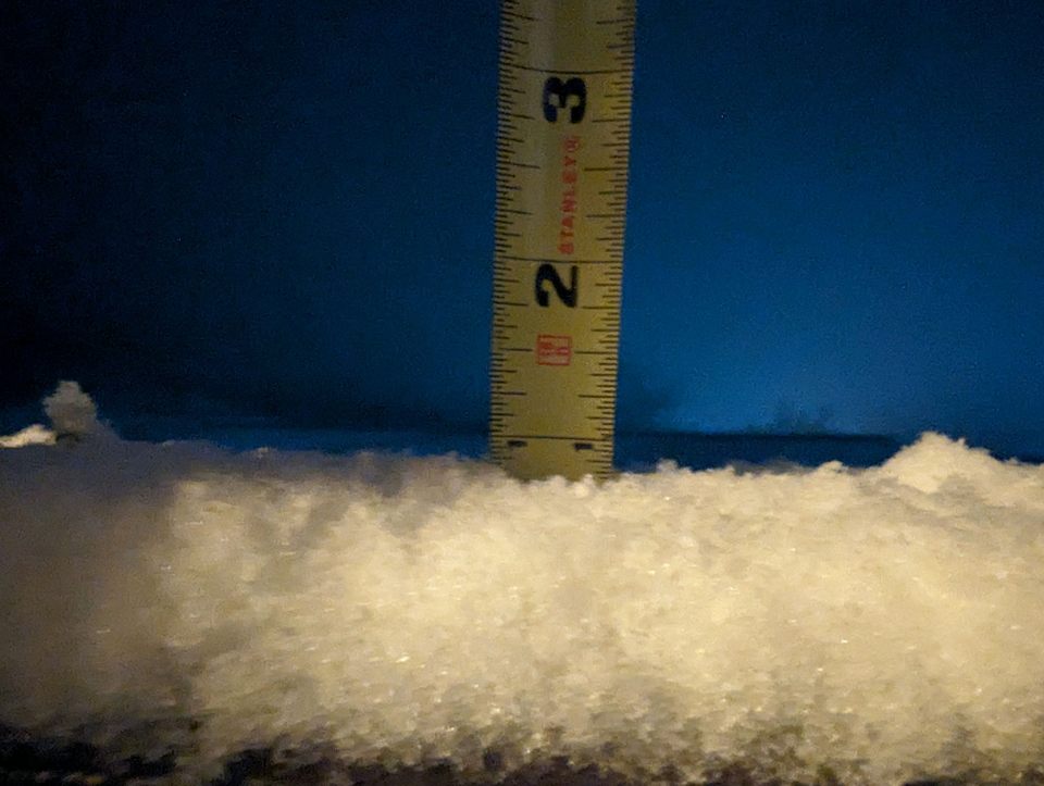
0.8" in Budd Lake. Gross.
-
Some thundah reports out in PA with this slug of cold rain. These dreary days are the absolute worst.
-
On every run of the ECMWF weeklies in the extended range
-
At least we won't have dead brush spontaneously combusting like last year
-
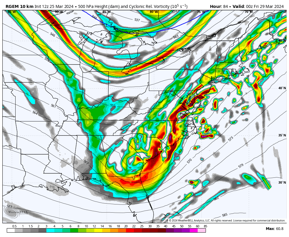
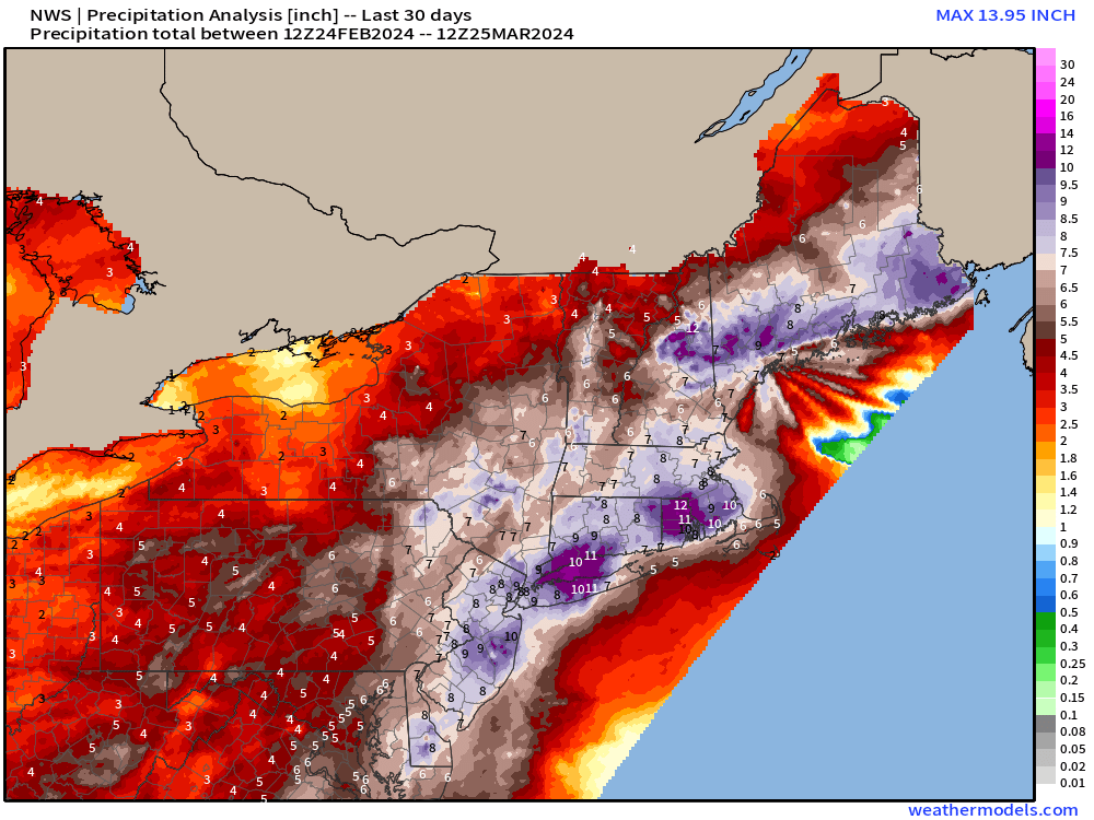
RGEM isn't far off from another soaker too. Really, really not a fan of these Thursday - Saturday rain events over the last few weeks.
-
 Clown show
-
HRRR was god awful with the northern extent...how much do you think you have OTG now?
-
Perfect. Thank you!
-
Any obs from around West Milford or Greenwood Lake? I've heard rumors of coatings to basically nothing. Some clarity would be nice lol
-
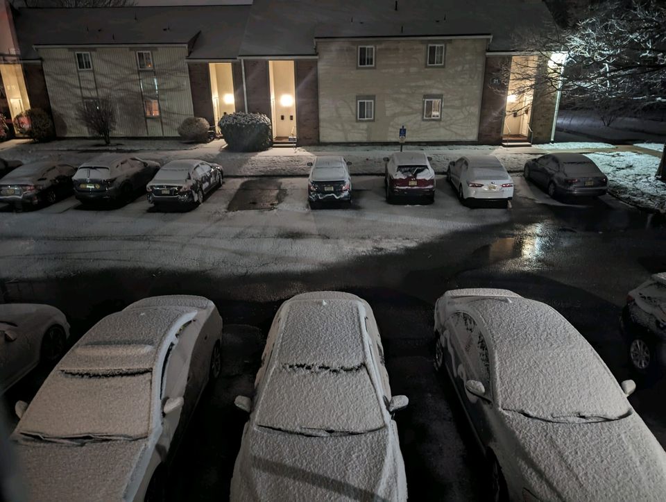
Still sitting under 2" in Budd Lake, NJ with virtually no flakes. Almost looks like mist 21 degrees
-
Anyone seeing any freezing drizzle this AM?
-
It's the Custom CWOP/APRS Stations from AllisonHouse
-
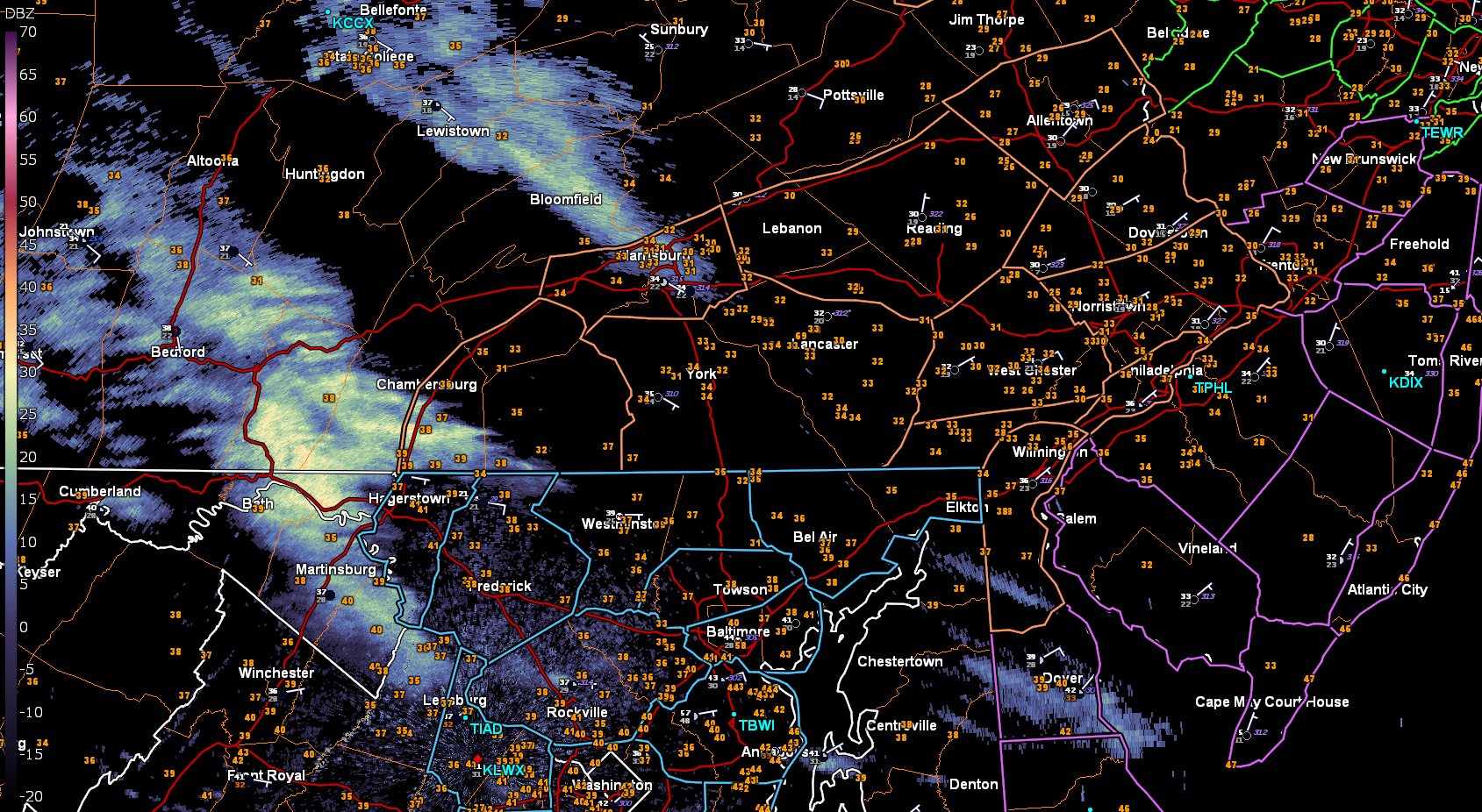
Anyone seeing anything from the junk near HGR? Would appreciate some obs (if possible)

-
15 and 97 both had a similar decline, so really not sure what's the culprit here
-
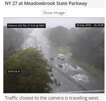
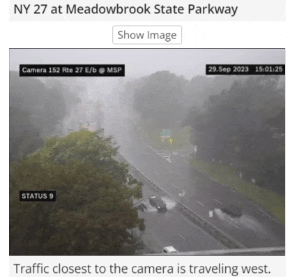
Getting really bad in spots https://511ny.org/#:Alerts
- 886 replies
-
- 1
-

-
- heavy rain
- flooding potential
- (and 2 more)
-
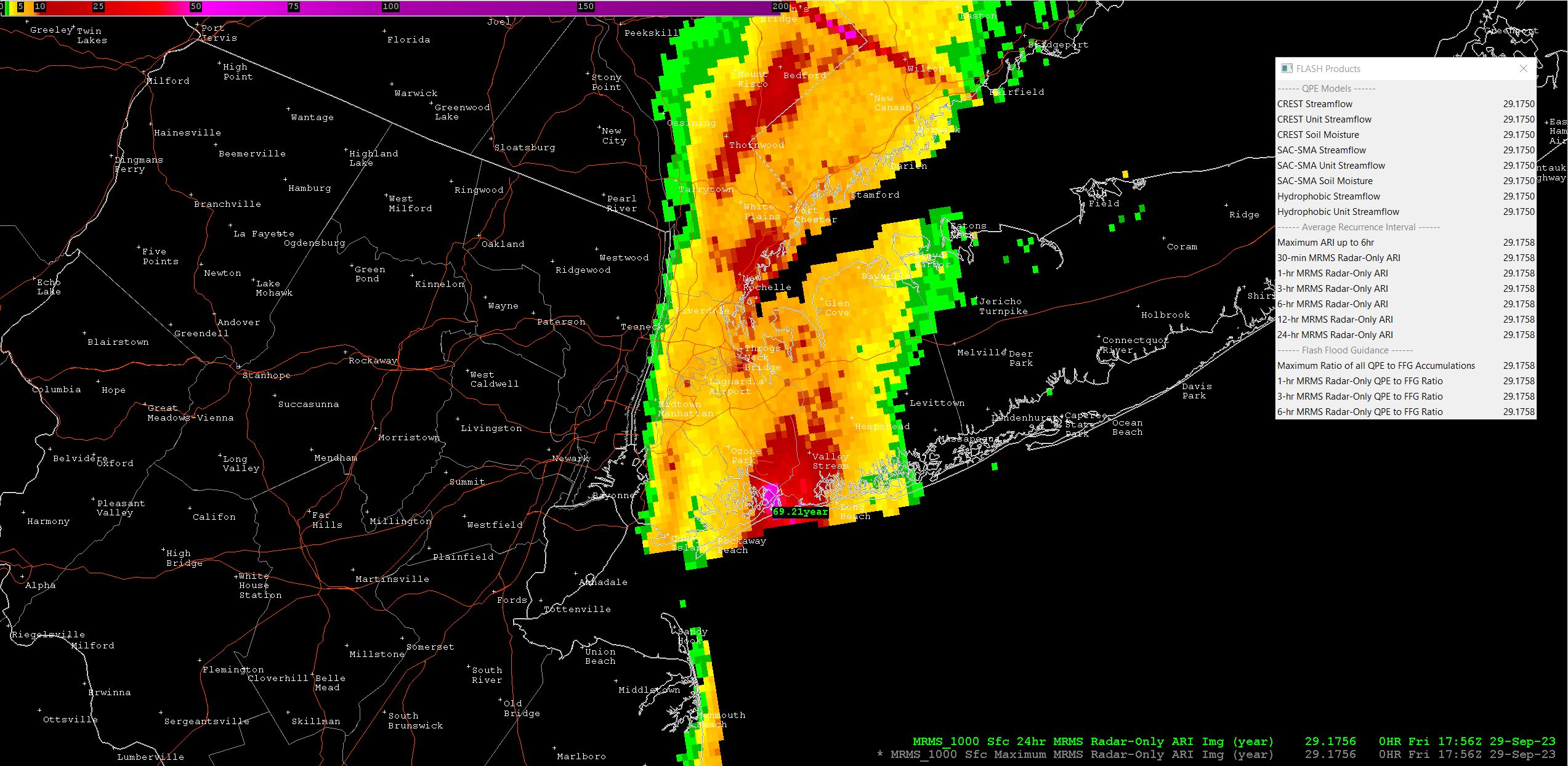
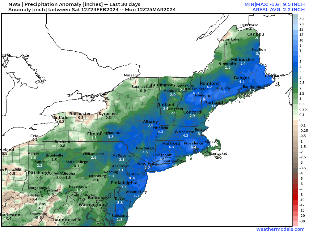
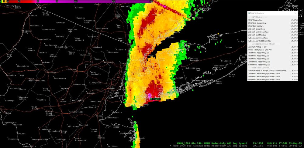
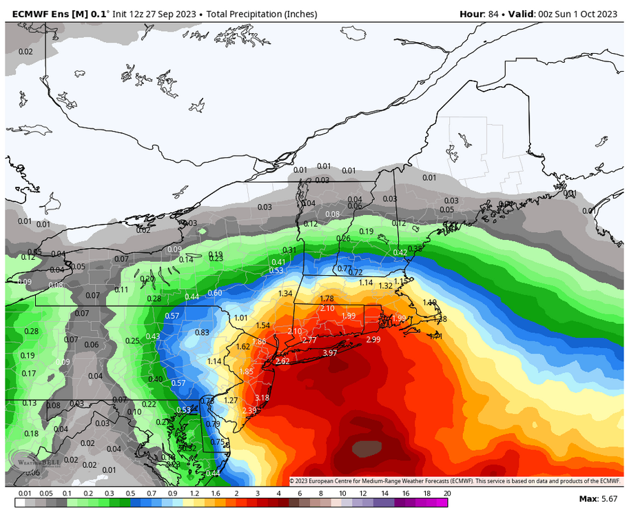
Extremely impressive ARI numbers showing up south of JFK Same areas are 300-400x their FFG at this point
- 886 replies
-
- 1
-
-
- heavy rain
- flooding potential
- (and 2 more)
-
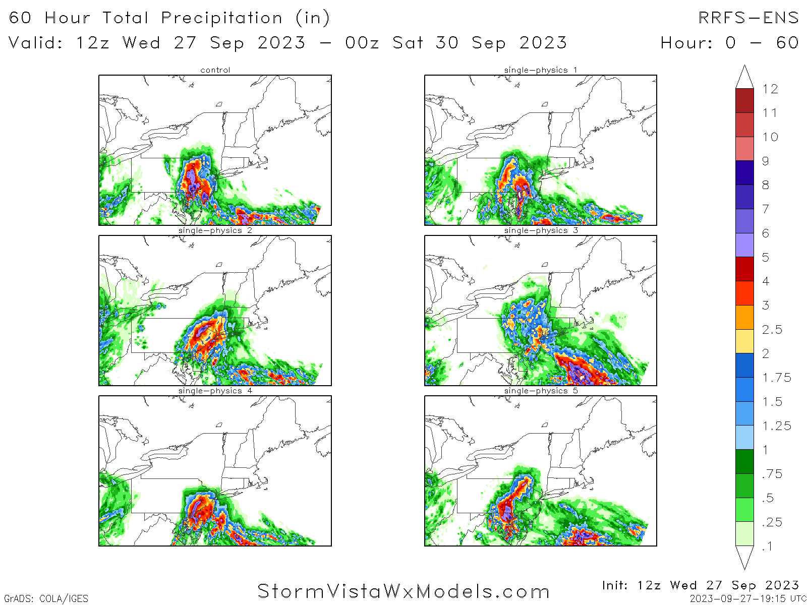
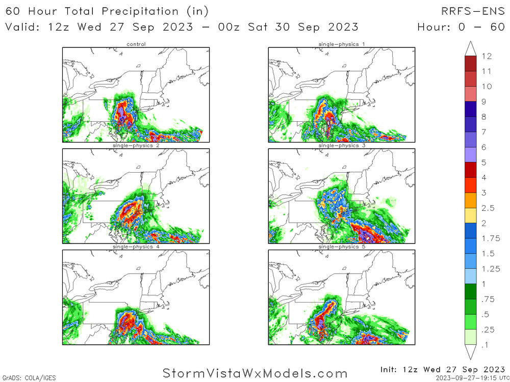
RRFS Ensembles (new HREF soon) all show significant events...just depends where at this time
- 886 replies
-
- 4
-
-
- heavy rain
- flooding potential
- (and 2 more)
-
Still going...

-
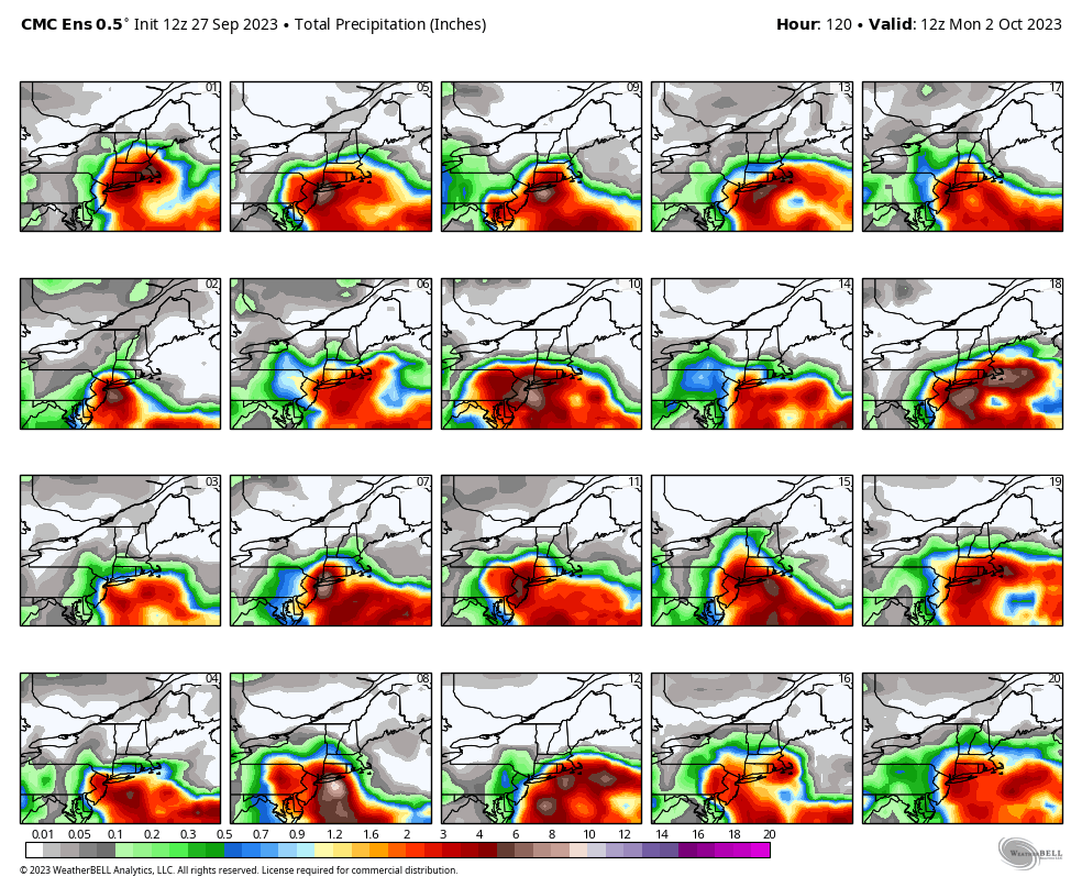
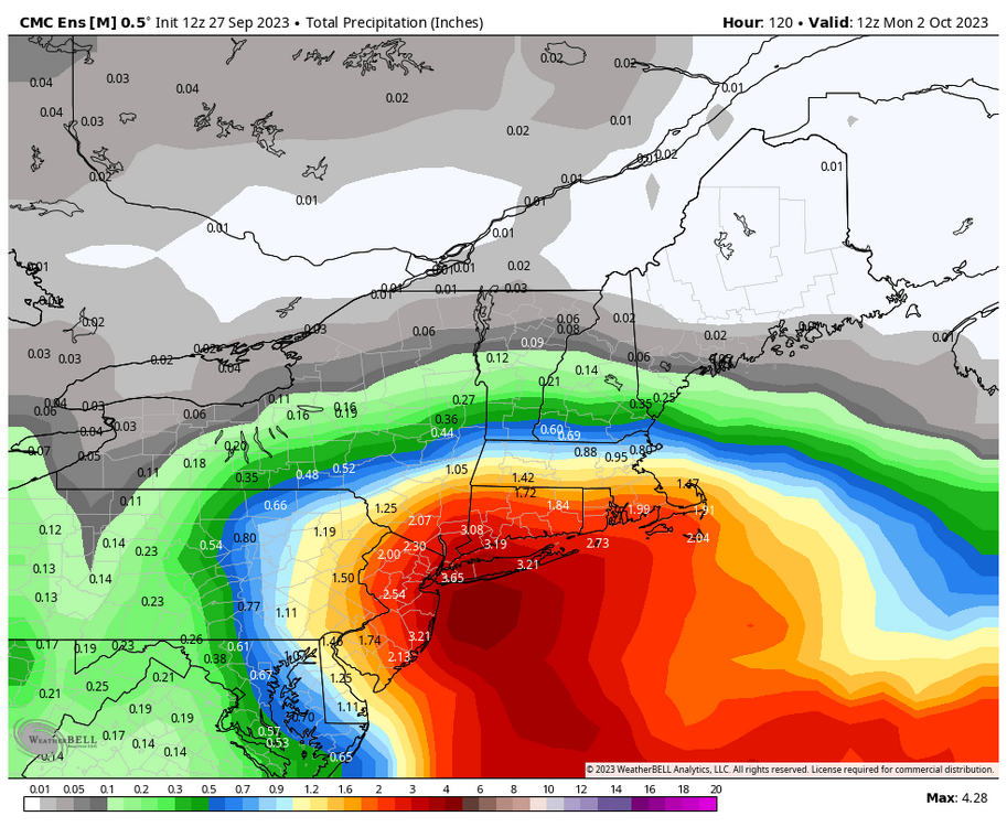
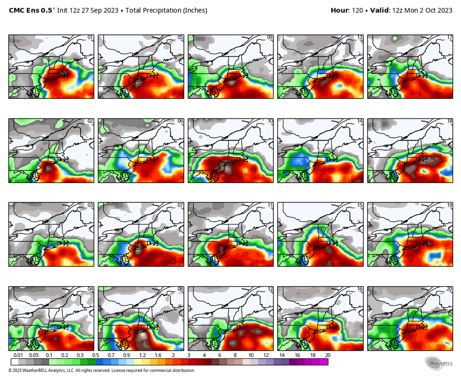
12z Canadian ensembles as well
-
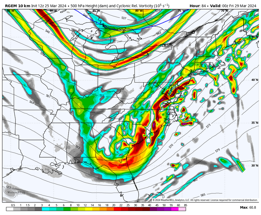
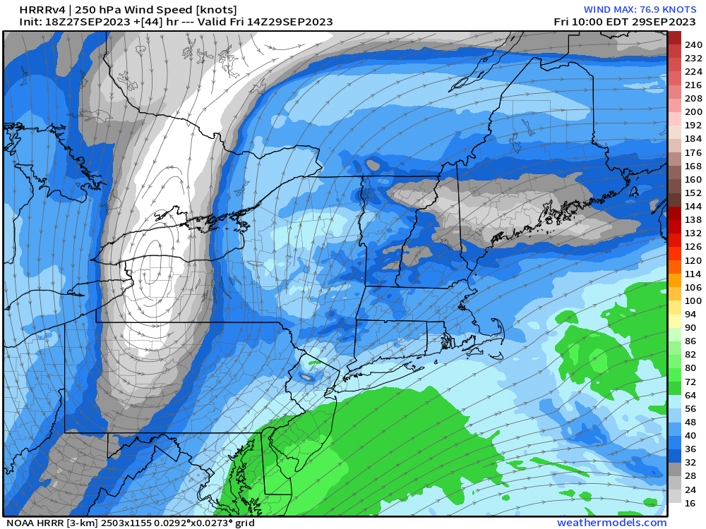
And now the HRRR is absolutely nuts as well. Ton of divergence aloft with convection rolling in from the coast
-
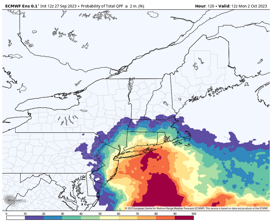
EPS is absolutely JUICED for Friday now, with high probs of >2" and even some 4"+! Rather concerning uptick
-
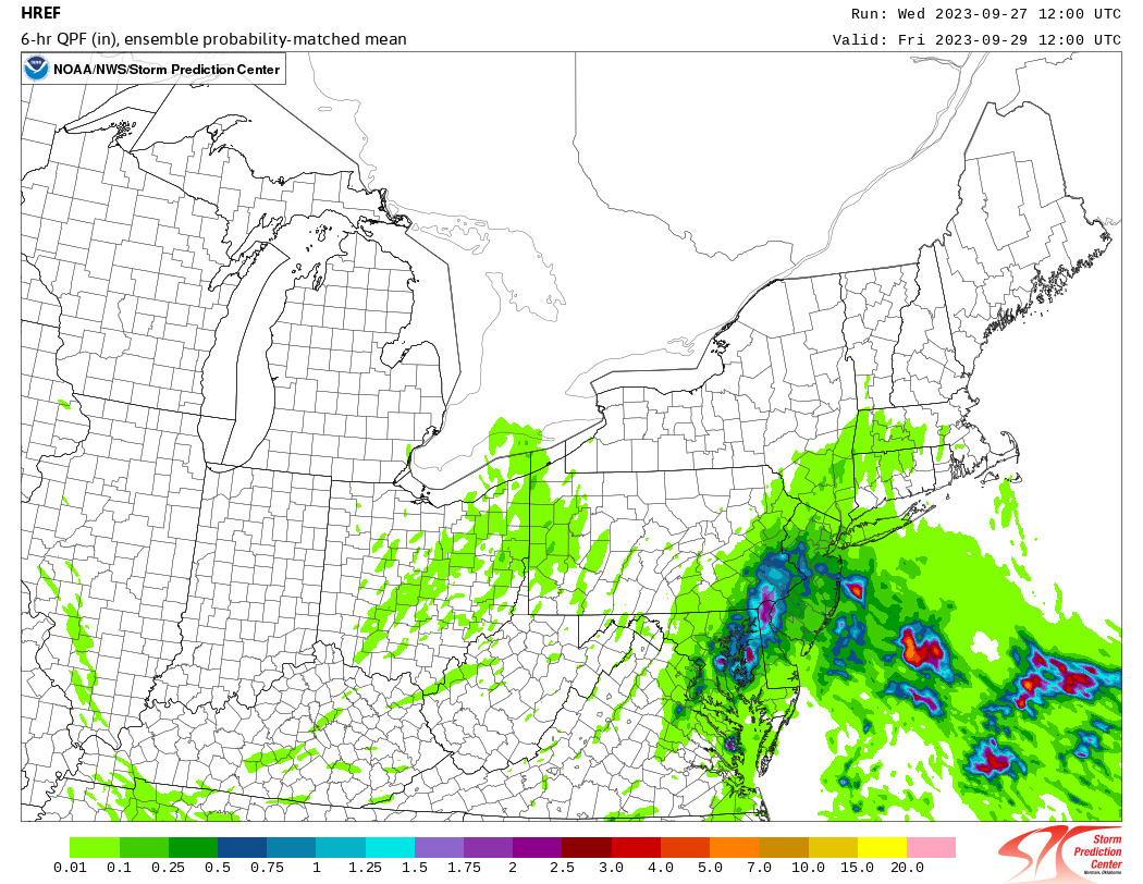
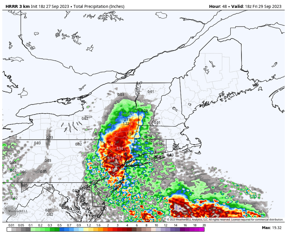
12z HREF shows some pretty impressive totals already for Friday morning. FFG is really low from this weekend so I'm starting to get a little concerned for at least some pockets of poor drainage and perhaps stream/creek flooding.

-
I was mainly referring to the track and speed when it was near the area, but yes. You are right!