Superstorm93
-
Posts
8,256 -
Joined
-
Last visited
Content Type
Profiles
Blogs
Forums
American Weather
Media Demo
Store
Gallery
Everything posted by Superstorm93
-
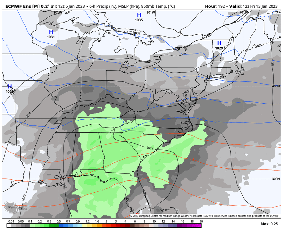
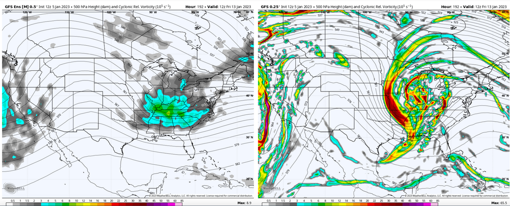
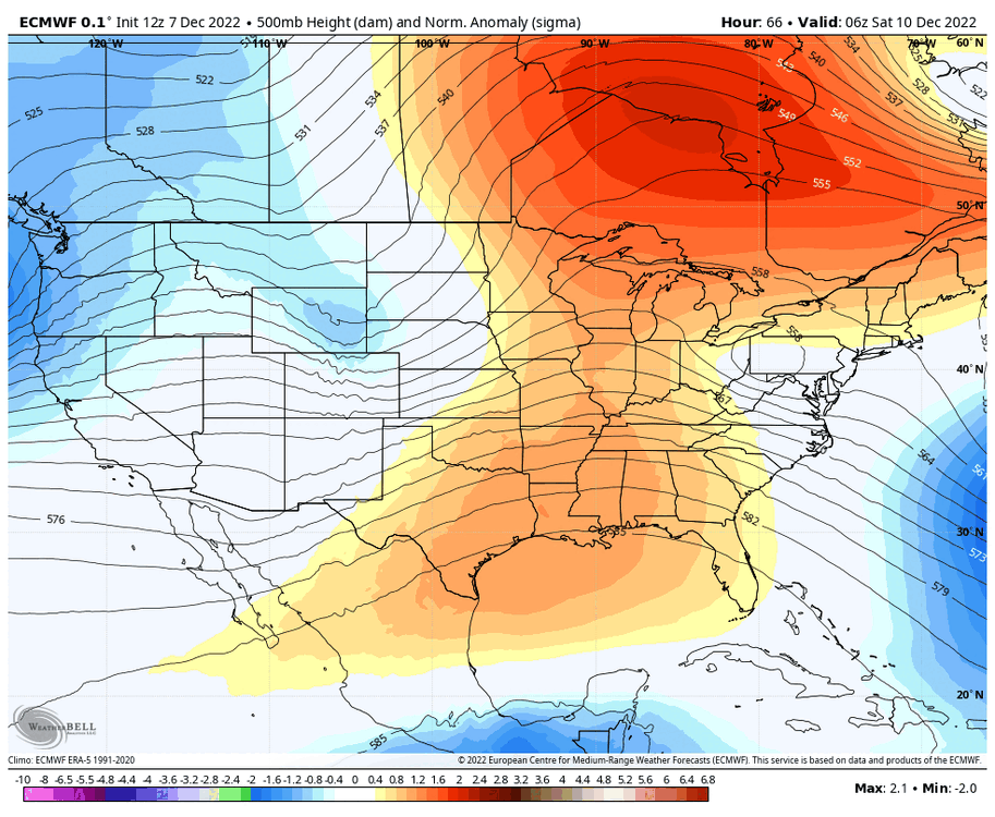
We also have *this* which I would have never expected to show up Way out there, but still interesting to look at.
-
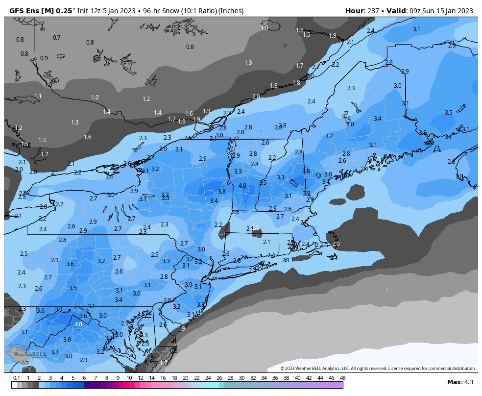
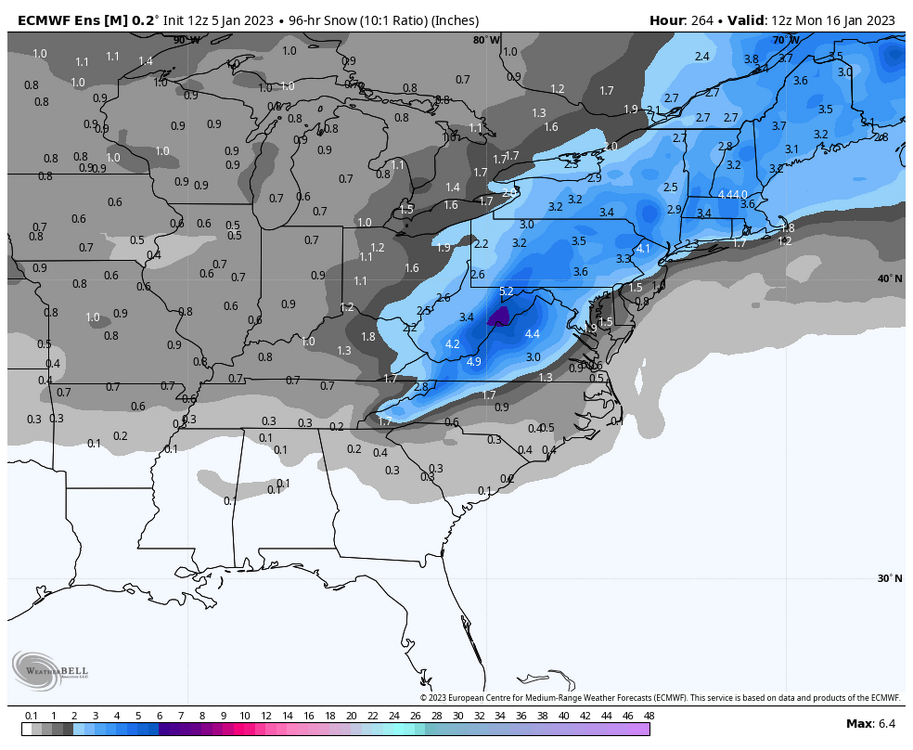
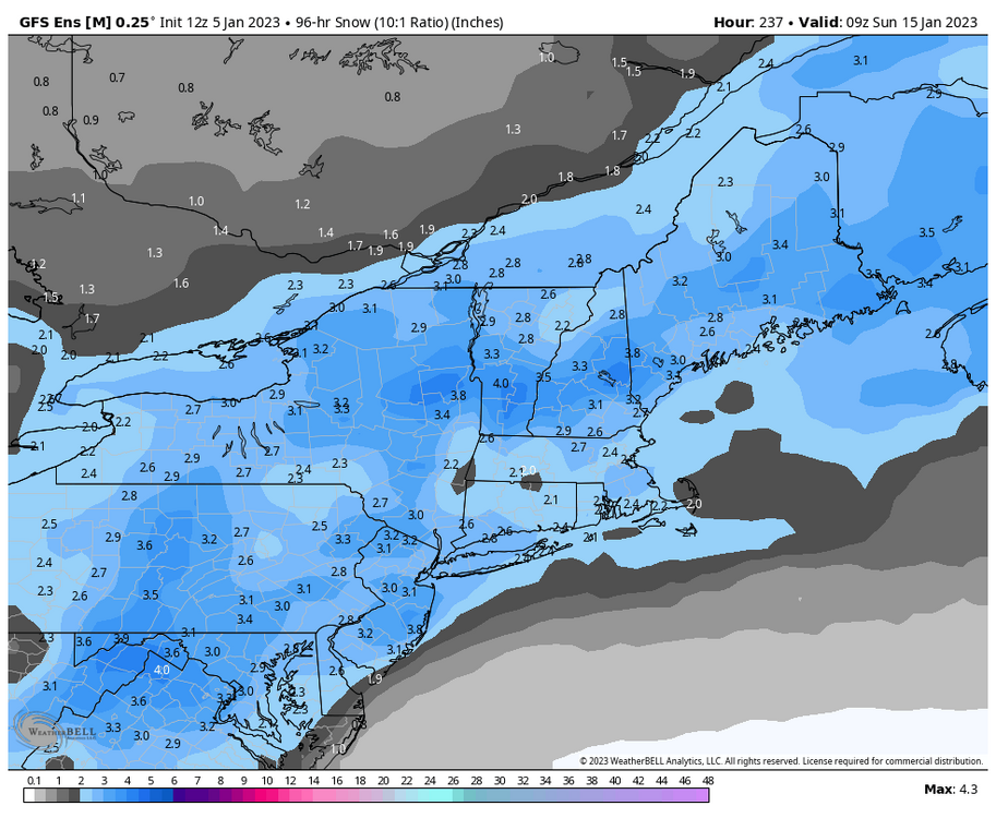
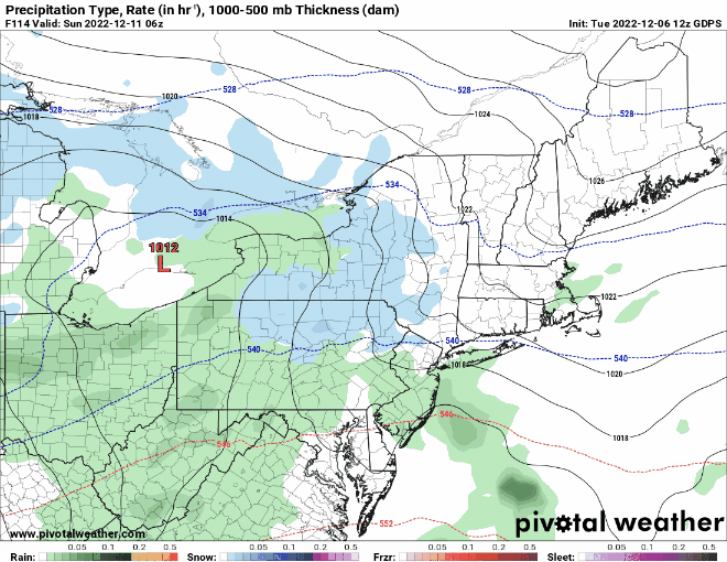
Indies have snow all the way to Maine...
-
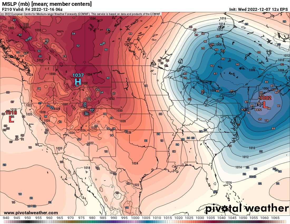
EPS indies are pretty darn wild for this far out...the mean is just about as good as you can ask for at this point.

-
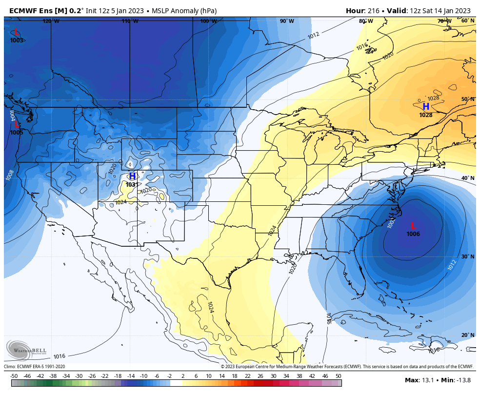
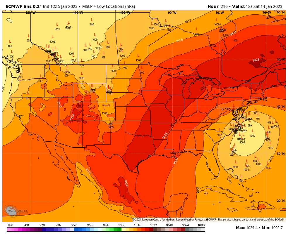
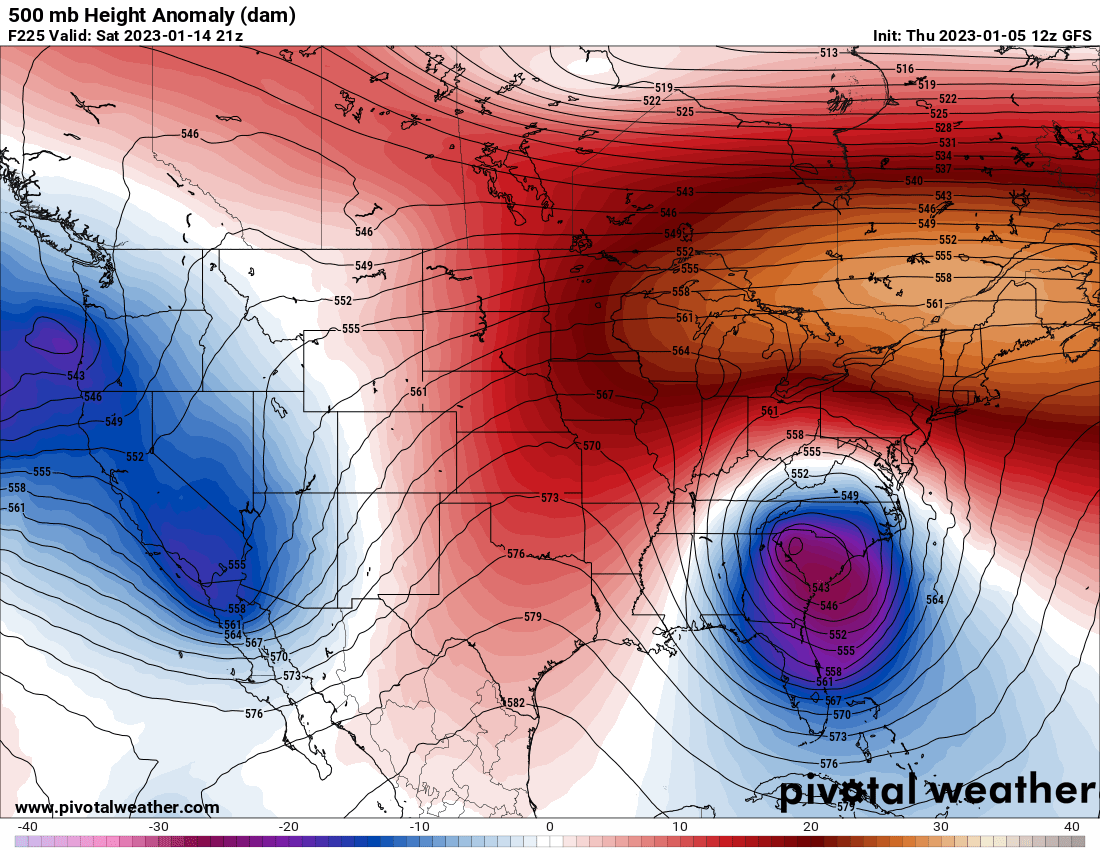
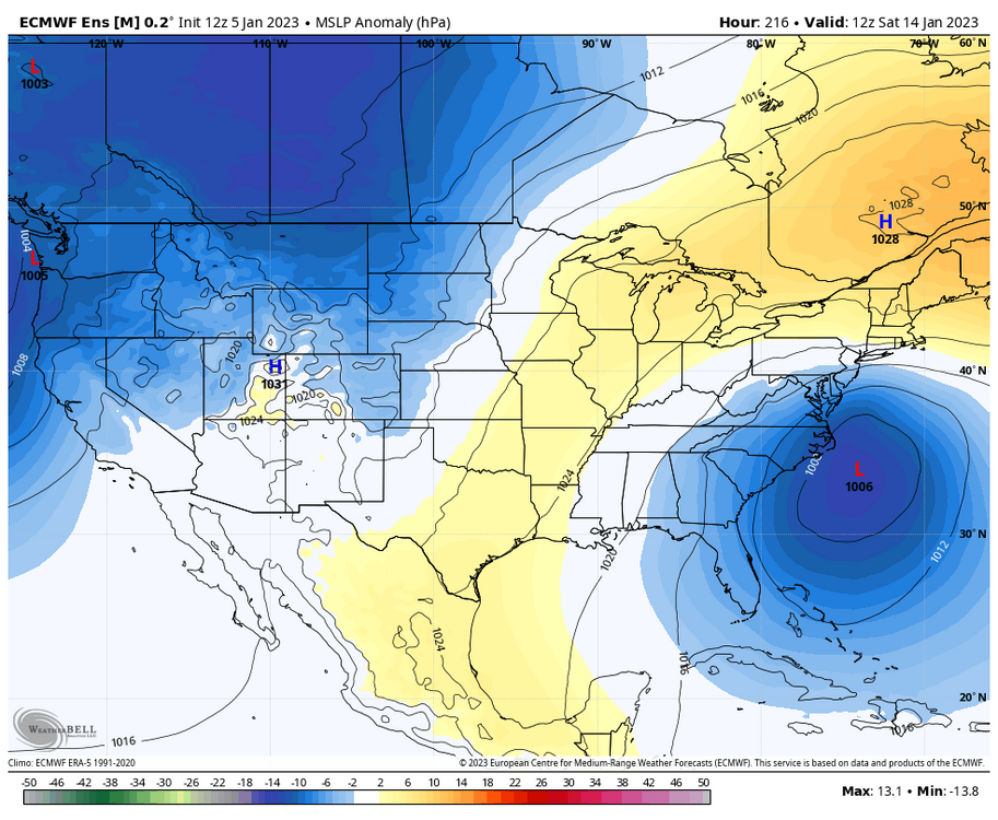
I know we're not allowed to use ensembles here, but closed low and increased confluence Should have some interesting members for all
-
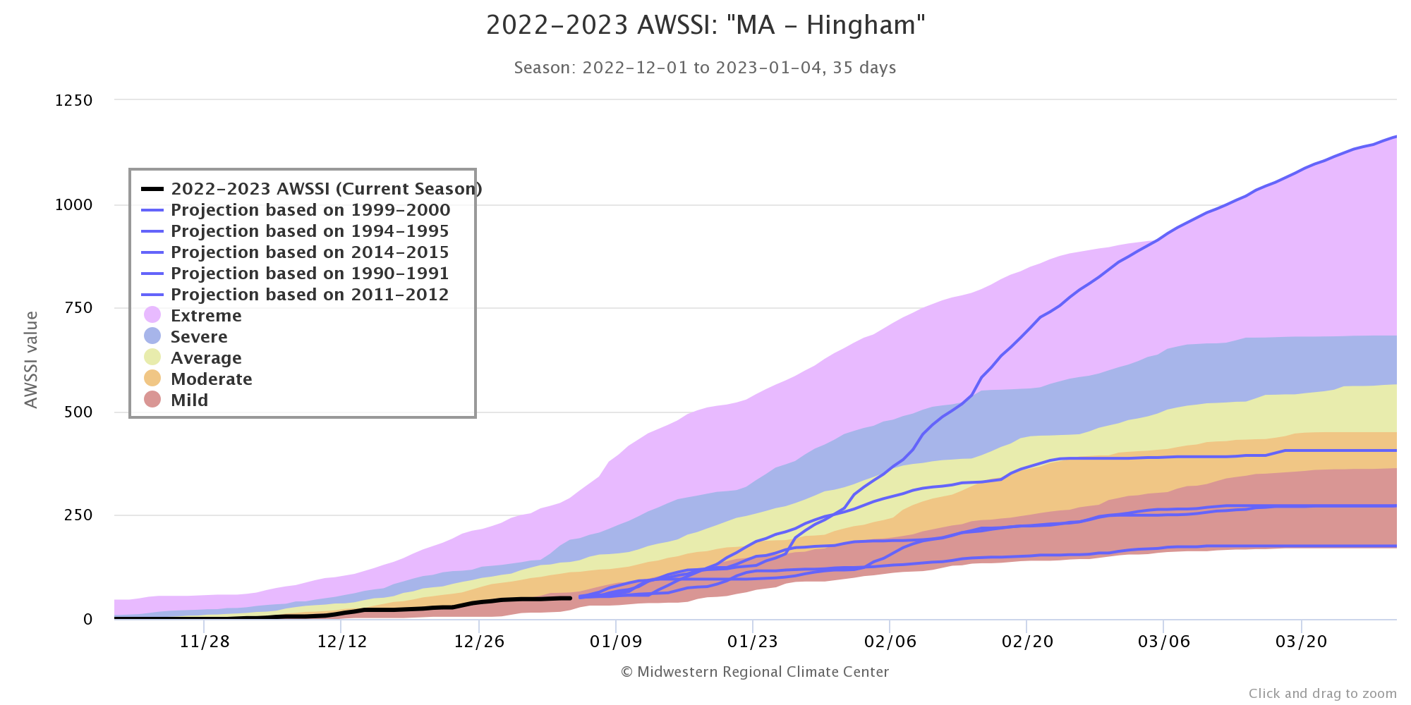
Still some late bloomers on the AWSSI (..though not great) https://mrcc.purdue.edu/research/awssi/indexAwssi.jsp

-
Really weird flex to admit that you don't use ensemble guidance at D9 lol
-
What time will the SE Ridge hit my house?
-
Ah yes, lets just all shut up about literally the only threat in the next 15 days.
-
Really is laughable how bad the OP has become
-
The worst global model in the NHEM has rain in nine days. It's over.
-
How's you SE ridge doing?

-
Very stable model
-

-
Trend has been...not great
-
Glock it in!
-
https://www.weathernerds.org/ https://www.weathernerds.org/models/field_definitions/Snowfall.pdf
-
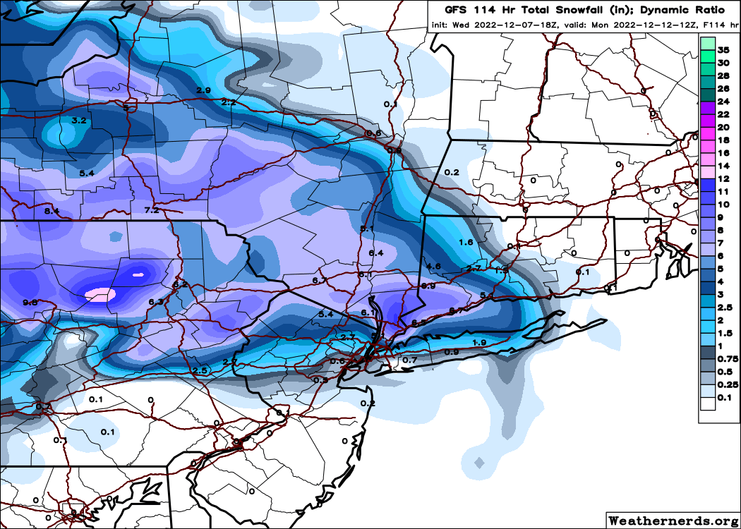
Because it's a dynamic ratio map and not a weenie Kuchi or 10:1
-
Best thing to happen to Yonkers since Tyler The Creator

-
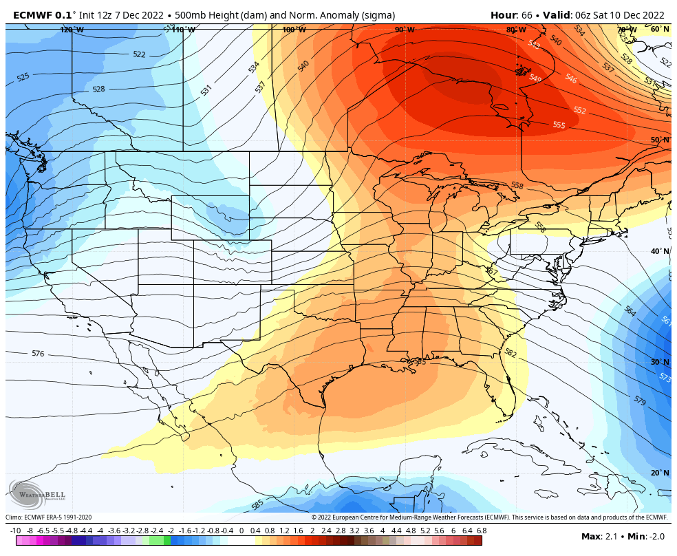
Definitely a cold pattern on the 12z EPS

-
Not a bad signal at all

-
12z EURO joins the OP GFS idea of bullying the "cutter" underneath the block now We've entered the shenanigans phase of the models
-
Retrograding blizzard to appease the masses
-
-
drunken accounts of Wolfpack games while 4 40s deep.
-
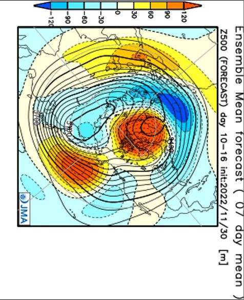
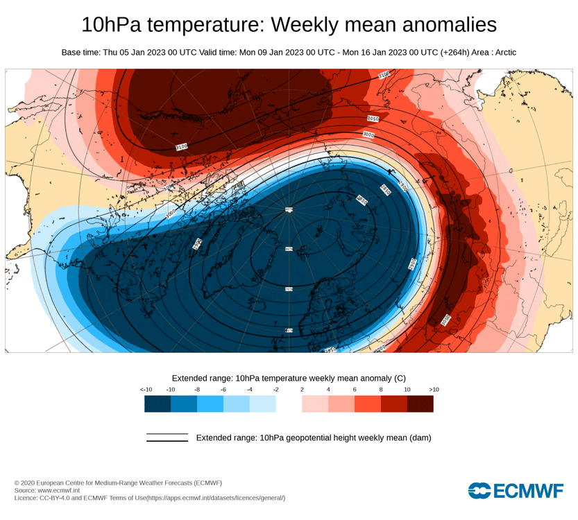
New JMA weeklies for the middle of the month