Superstorm93
-
Posts
8,256 -
Joined
-
Last visited
Content Type
Profiles
Blogs
Forums
American Weather
Media Demo
Store
Gallery
Everything posted by Superstorm93
-
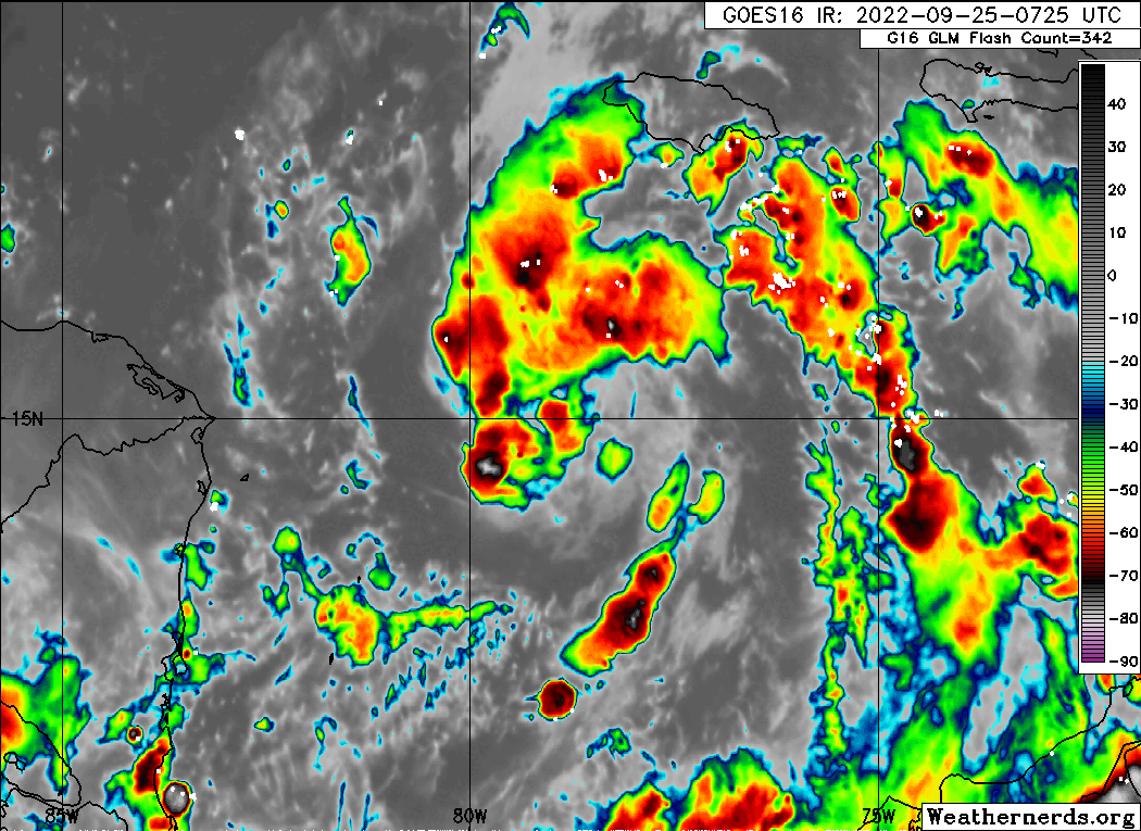
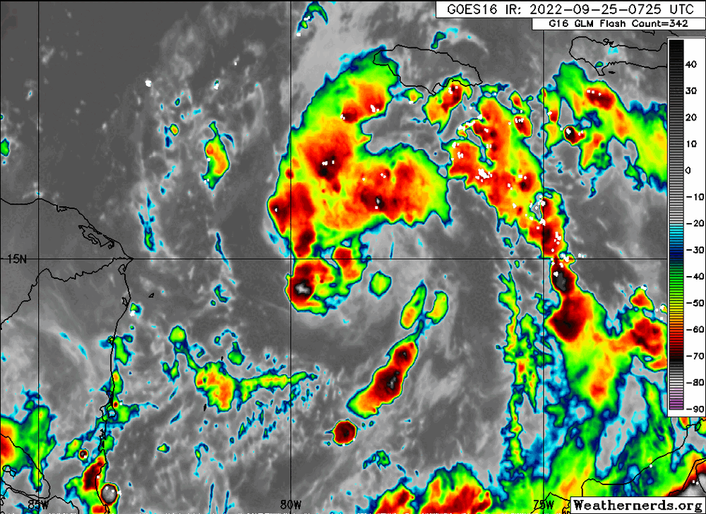
Look at IR. Just a bunch of warm convection sloshing around. We will likely have to wait until after sunset to get something going near the center. This one has certainly been an interesting case to show how delicate some of these weak systems can be to sneaky dry air and stability.
-
That's certainly possible. Also, I believe most thought that Ian would be a more "closed" system (literally and figuratively) by now, so some dry air/subsidence makes sense at the moment. Could change in a hurry if we see deep convection pop over that center.
-
I like this hypothesis
-
Early models are focused in the Panhandle once again

-
I'm actually quite surprised how awful Ian looks this morning. Really has a good amount of work to do before it can intensify at anything more than a gradual rate.
-
The only thing limiting the storm right now is the lack of an organized surface circulation.
-
That's the old low-res map.
-
Hate to be that guy, but the 18z has been out. https://www.tropicaltidbits.com/analysis/models/?model=hwrf®ion=98L&pkg=mslp_wind&runtime=2022092218&fh=126
-
I've seen enough. PTC
-
Could make a solid argument for a PTC at this point. It's too close.
-
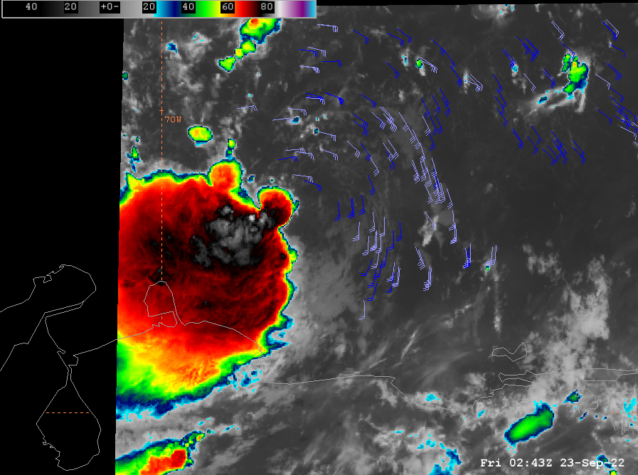
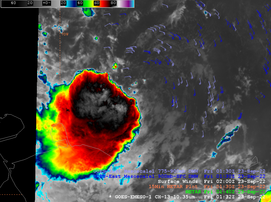
Even better view
-
Here ya go, ya freaks.
-
I mean, this looks pretty damn closed just based on derived motion winds
-
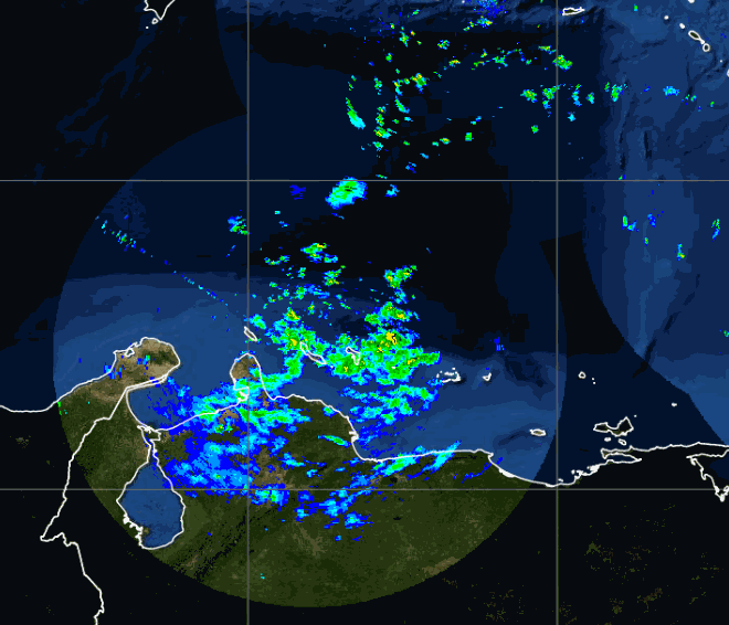
Radar out of Curaçao
-
We're gonna be east of FL by the 6z runs if this continues
-
UKMET has been strangely conservative in the tropics over the last year or so. Not sure if they changed something with the model...
-
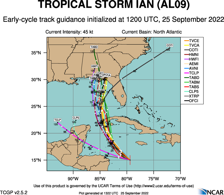
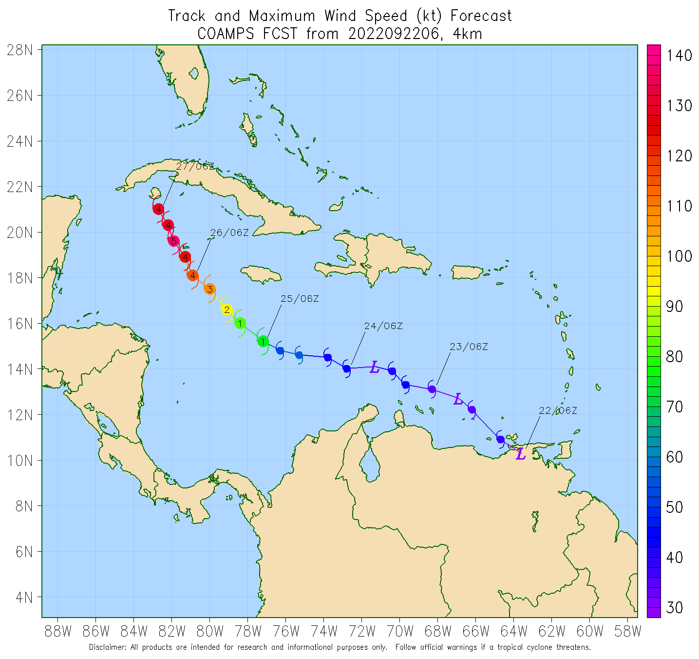
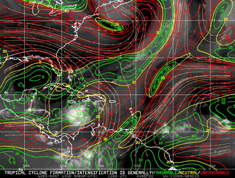
Well, the COAMPS getting nuts again. Ironically, this is the only model that captured the current structure of the storm as it emerged from Venezuela

-
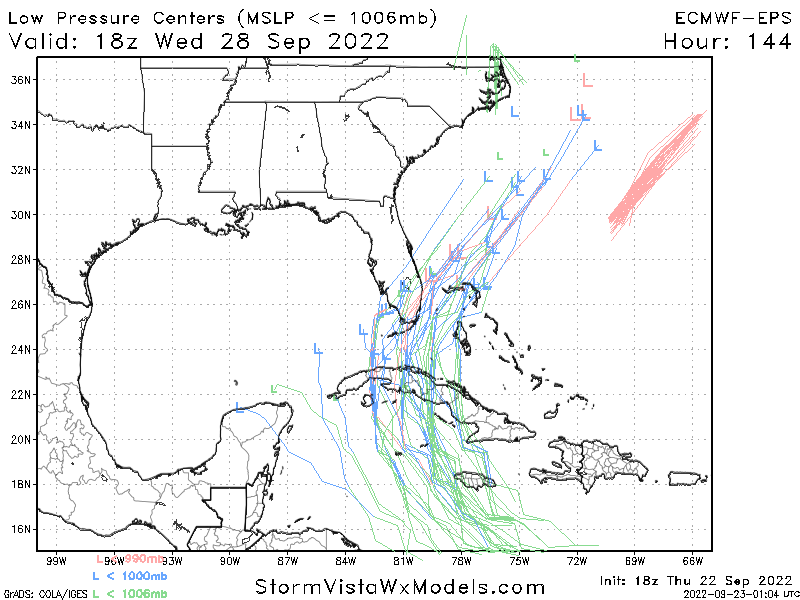
New run on the left
-
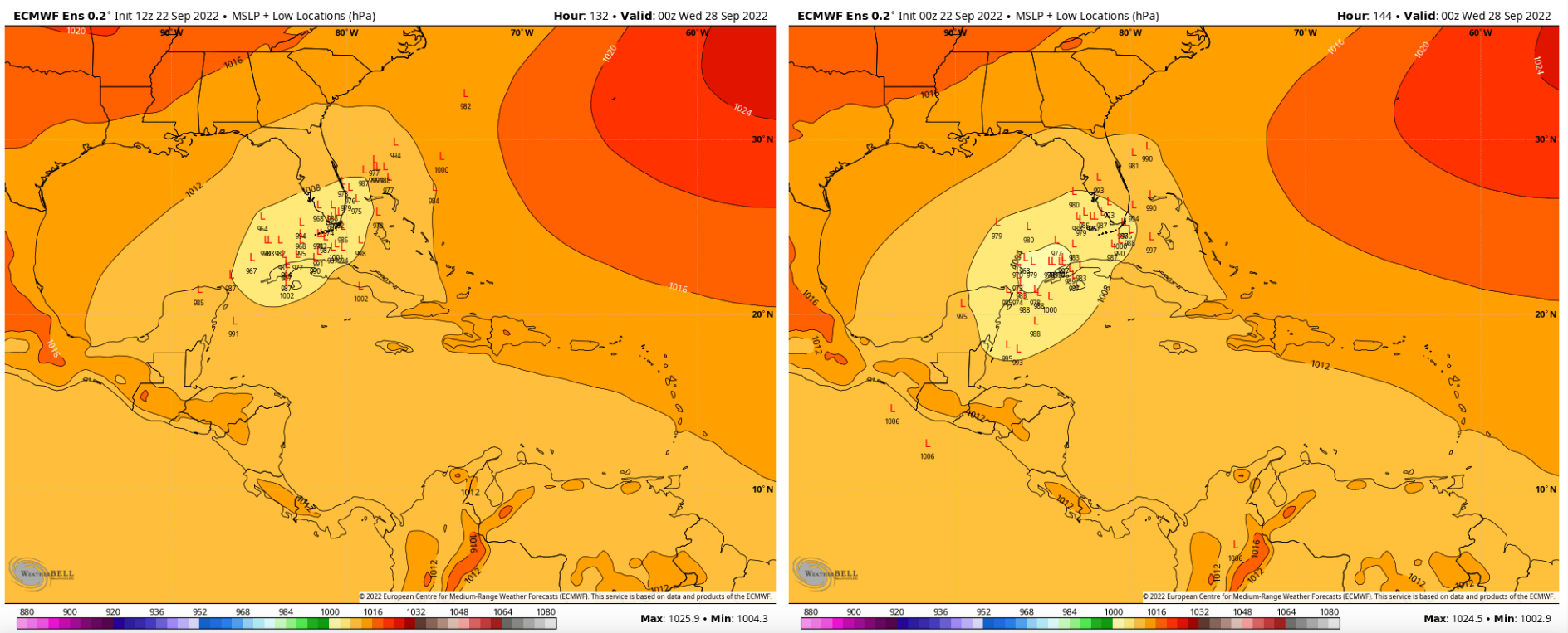
Pretty good shift on the 12z EPS
-
I may have to eat some crow here. The circulation with 98L actually looks like it's tightening up.
-
Too late for them to lower odd, but I absolutely agree. Best shot for significant development will be if/when this gets past Jamaica. Everything else is basically conjecture at this point.
-
GFS still correcting weaker on the 12z so far. We're a few ticks away from burying this in Central America
-
That's honestly what I'm betting on at this point. I think continued development over the next 72 hours remains slow.