Superstorm93
-
Posts
8,256 -
Joined
-
Last visited
Content Type
Profiles
Blogs
Forums
American Weather
Media Demo
Store
Gallery
Everything posted by Superstorm93
-

2022 Atlantic Hurricane season
Superstorm93 replied to StormchaserChuck!'s topic in Tropical Headquarters
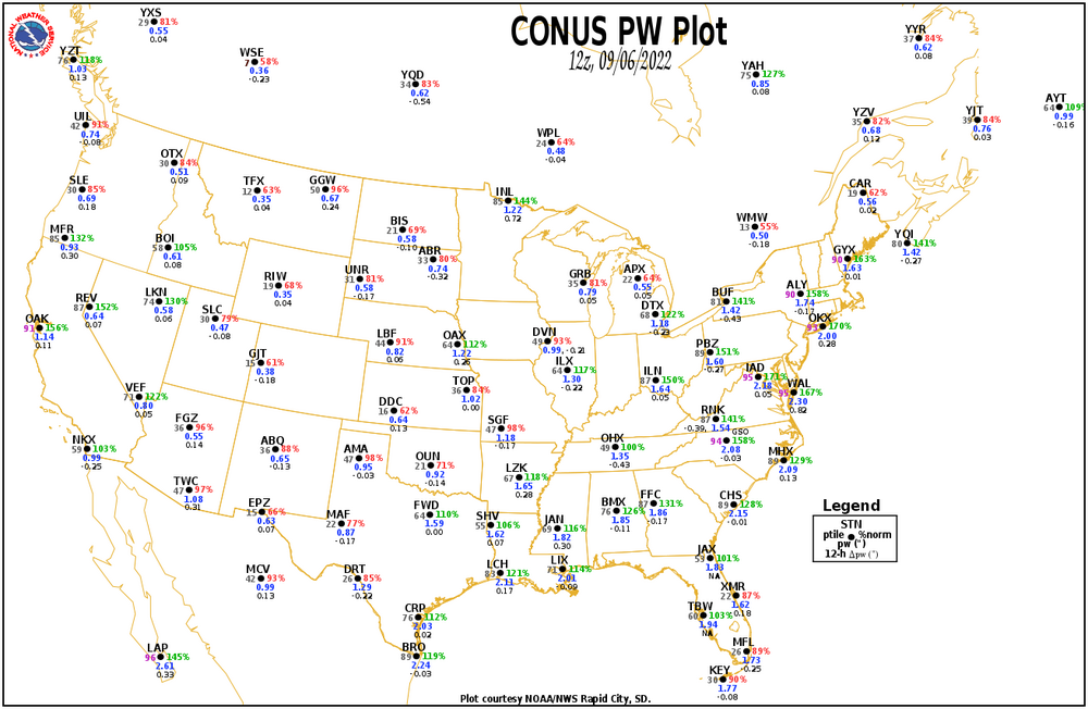
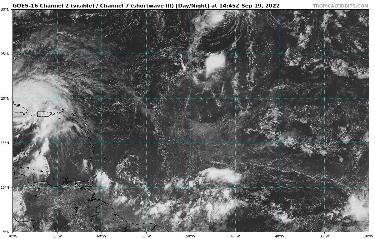
Keep an eye on this wave in the CATL. Could really get interesting as the week goes on.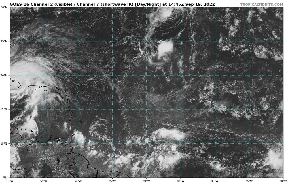
-
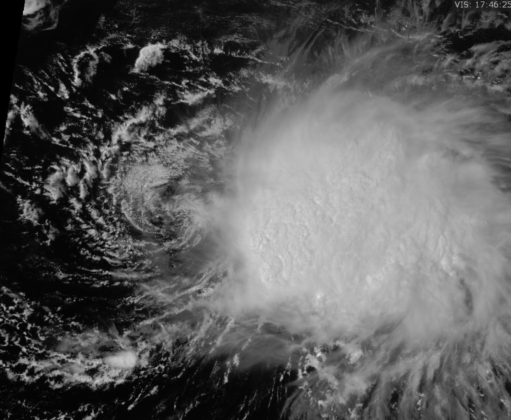
Pretty hard WNW wobble over the last few hours. Recon fixes should be rather interesting.
-
-
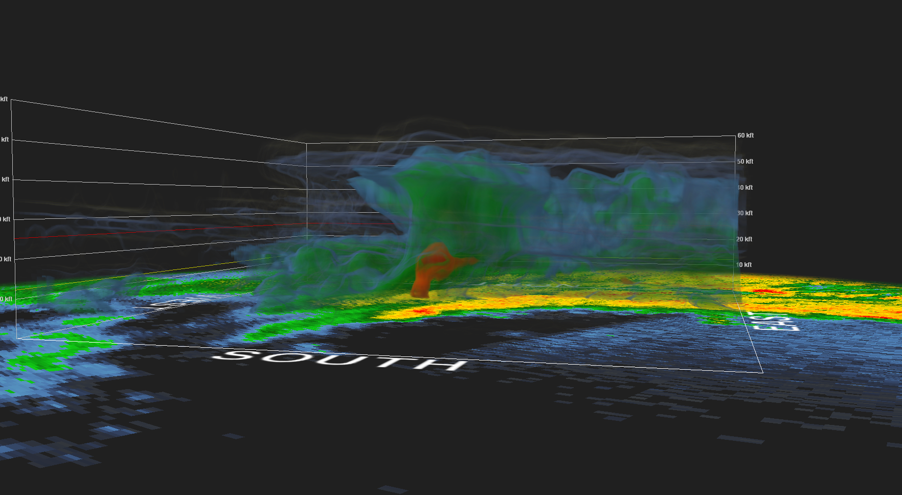
Recon taking off soon. Won't be able to get the entire RMW, but should be able to hit the center
-
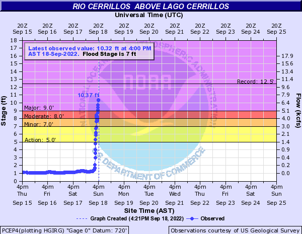
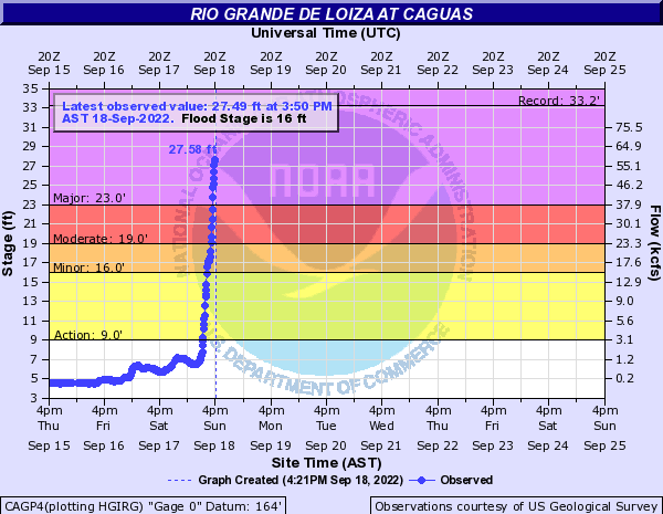
Might be breaking some records here soon.
-
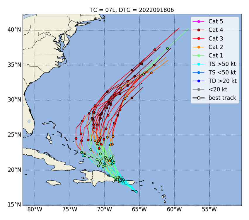
COAMPS still shows this absolutely exploding once it gets more of a favorable jet interaction
-
Have to agree that is indeed a hot tower

-
Area near the radar looks to be having power issues. Expect intermittent outages.
-
Be careful with the fish stuff. We have plenty of folks in the USVI that this may impact.
-
The ECMWF solution is possible IF the storm remains weak, IF it interacts with Hispaniola enough to slow it down, and IF the ridge can build back overhead in time. Three-way parlay anyone?
-
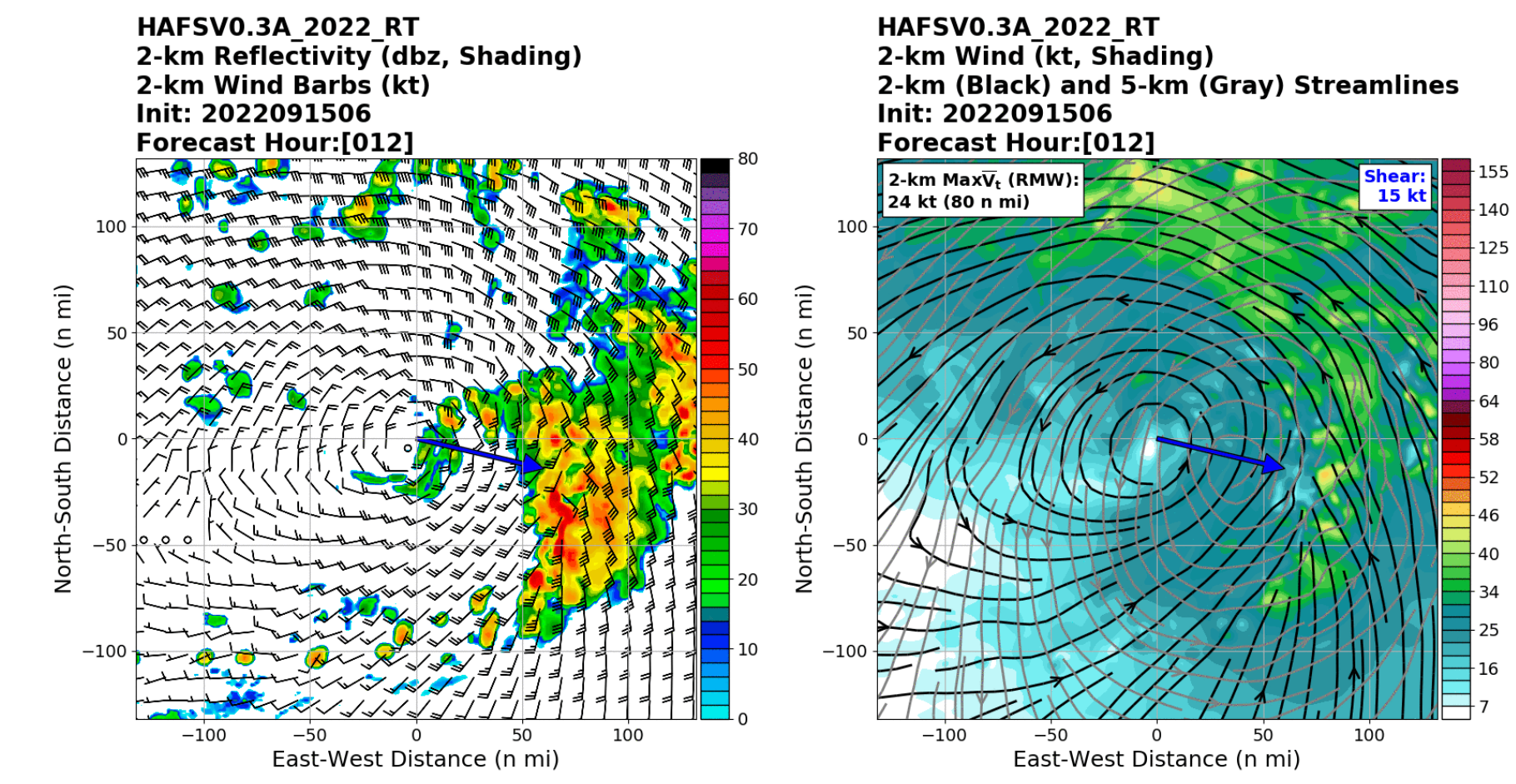
6z HAFS seems to be nailing the current structure


-
If I had a dime for every time he's brought up that storm in the last 12 years, I'd be able to retire.
-
Levi works at the JTWC now. I think he said he'll have a video out later this afternoon.
-
Yikes, HAFS (which will eventually take over for the HWRF) tilts the circulation to all hell.
-
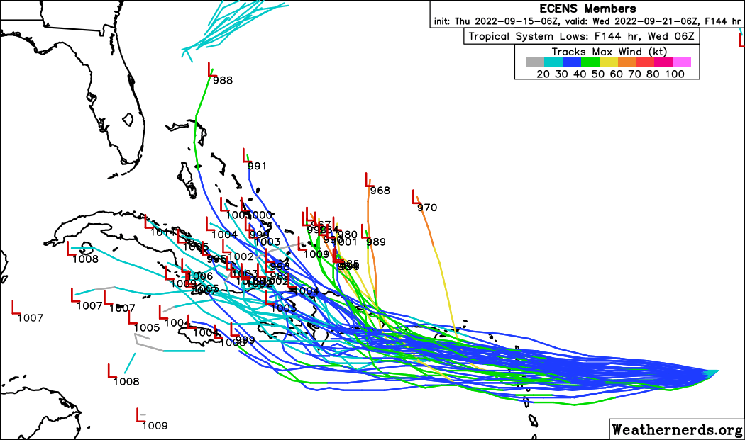
Might be hard for it to completely dissipate since this looks like a pretty large circulation now. Should struggle for at least another 48 - 72 hours.
-
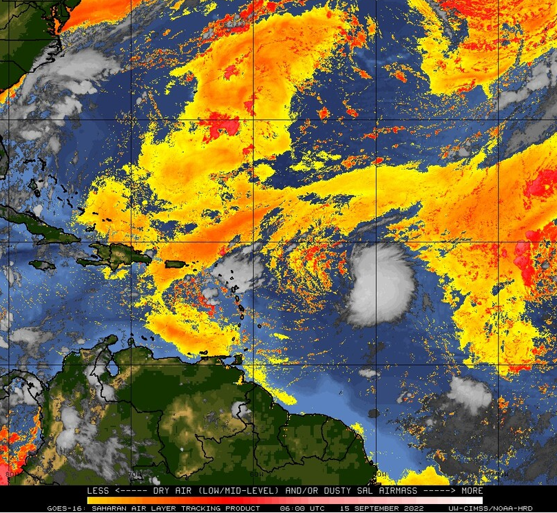
Still think this struggles on the way to the islands. Pretty hefty amount of dry air entrained on the left side of the circulation now.
-
Morning sat loops of invests always stoke the weenies. I think the best shot for this to become anything more than a marginal TC is for it to actually tighten up before the islands so that it can skirt to the north of Hispaniola. Still will likely have to fight shear along the way unless it's able to generate enough convection for an ULAC to build. Otherwise, I believe this is going to be another wave that never really gets together before getting torn apart by the Greater Antilles. 2022 really is just a different season.
-
Wake me Up....when September Ends....
Superstorm93 replied to 40/70 Benchmark's topic in New England
So close yet so far
-
Wake me Up....when September Ends....
Superstorm93 replied to 40/70 Benchmark's topic in New England
-
Wake me Up....when September Ends....
Superstorm93 replied to 40/70 Benchmark's topic in New England
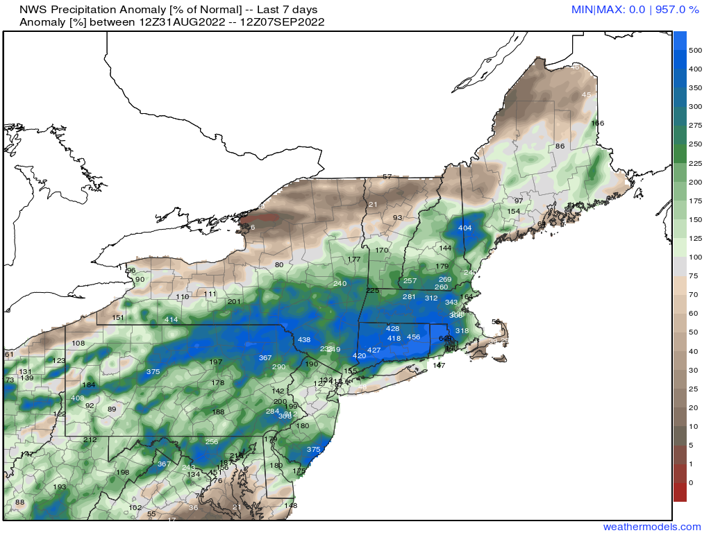
A cool 957% of normal over the last week lol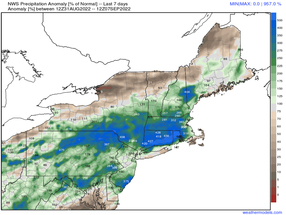
-
Wake me Up....when September Ends....
Superstorm93 replied to 40/70 Benchmark's topic in New England
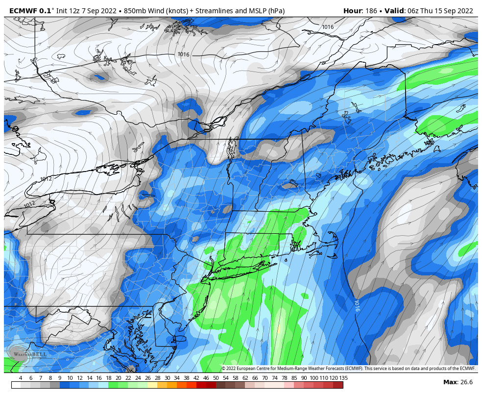
Say we do this whole flooding thing again in...a week?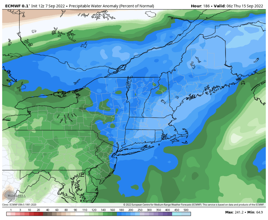
-
Departures YTD will still exist, but the actual drought impacts will surely be (somewhat) mitigated.
-
Juicy.