Superstorm93
-
Posts
8,256 -
Joined
-
Last visited
Content Type
Profiles
Blogs
Forums
American Weather
Media Demo
Store
Gallery
Everything posted by Superstorm93
-

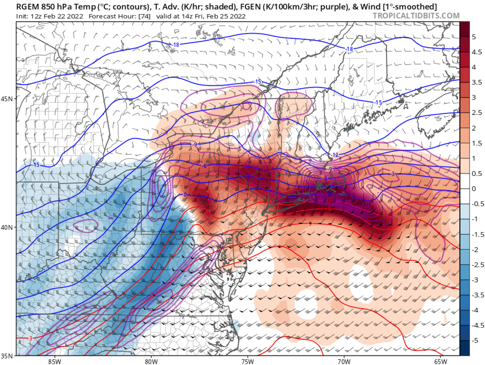
Winter storm for the 25th of February is imminent.
Superstorm93 replied to Typhoon Tip's topic in New England
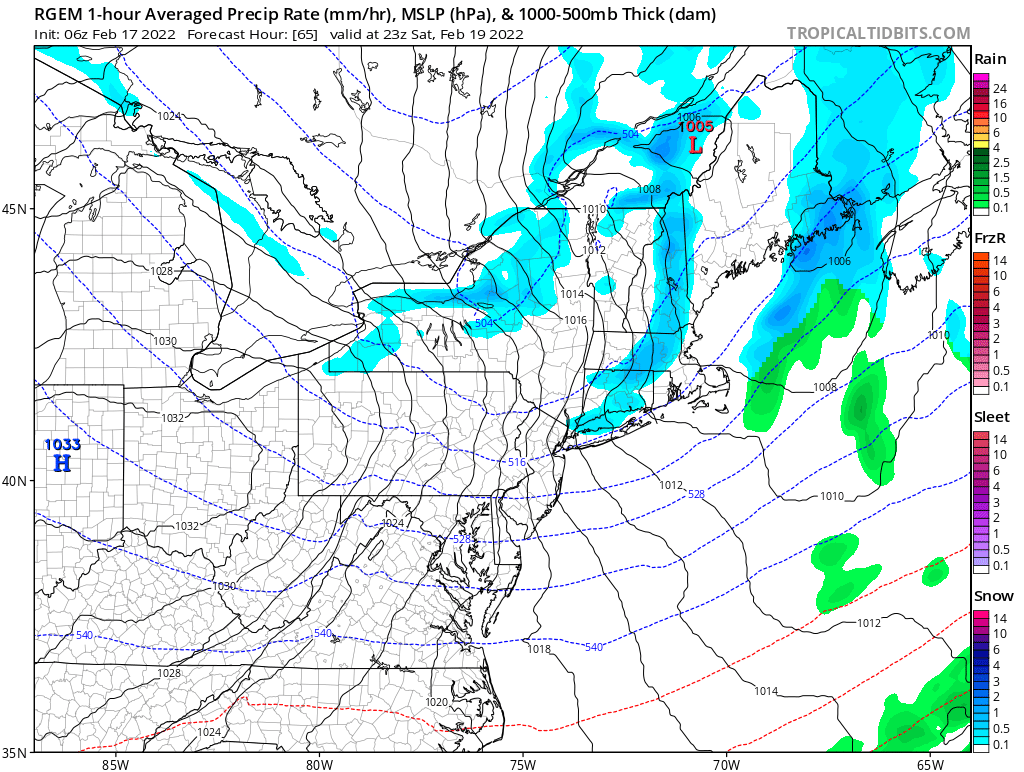
The 12z RGEM looks like a good ole plastering.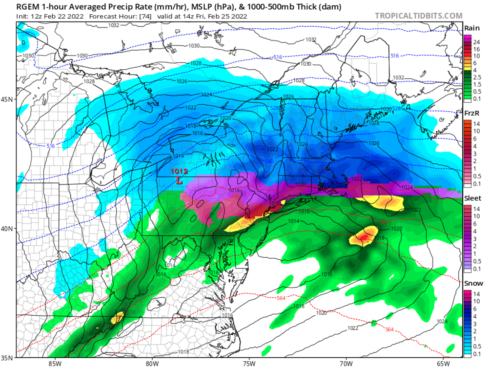
-
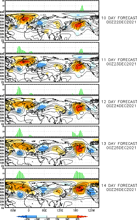
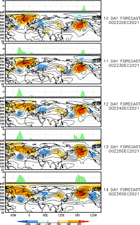
Certainly an interesting look this far out. Curious to see how the EPS handle this wave.

-
Meanwhile, we torch
-
Spicy Saturday Squalls?


-
Looks like some flakes in Sterling https://www.youtube.com/watch?v=2zZB0DmHbZ4
-
Pick yer poison.
-
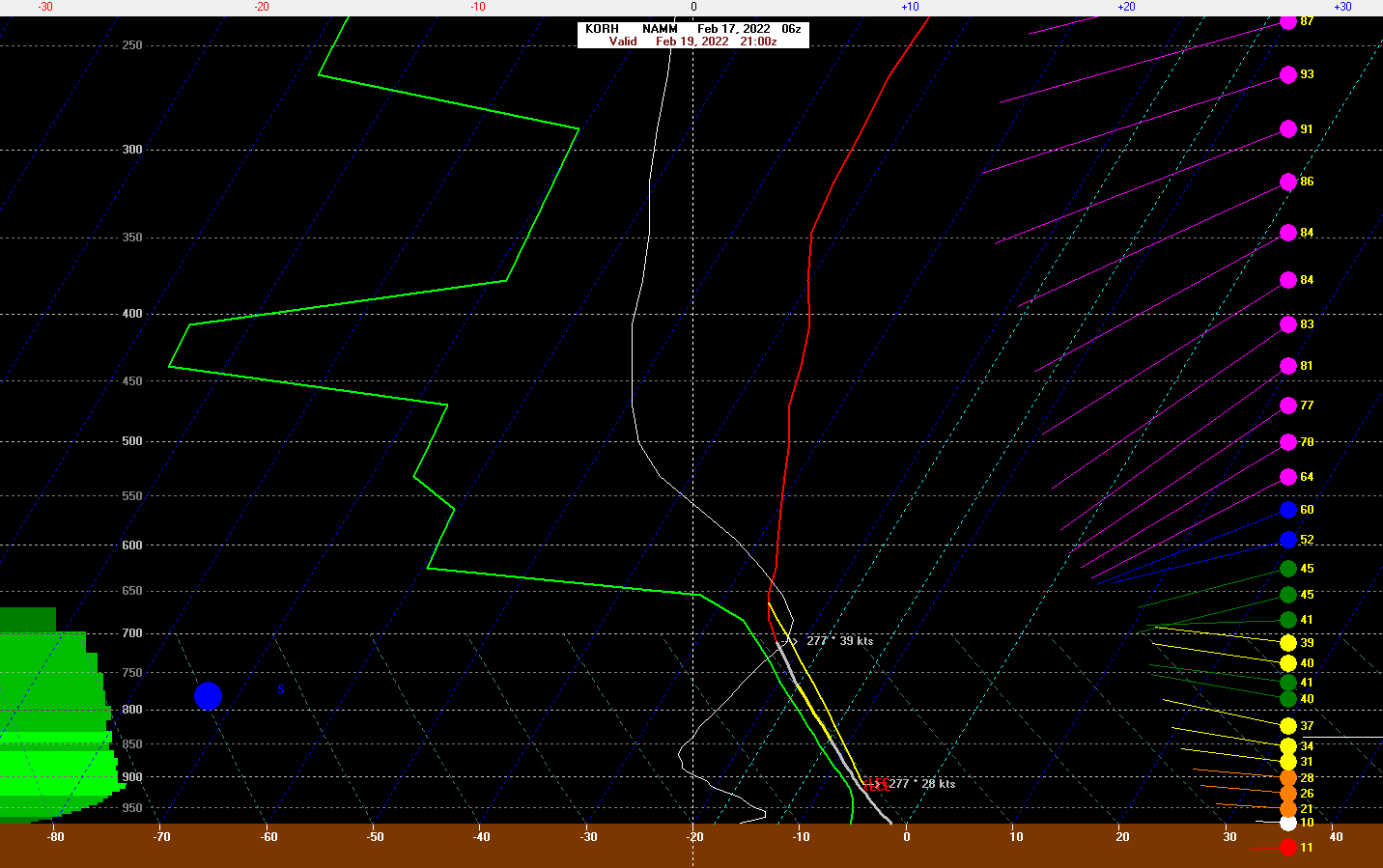
Lol would absolutely be rippin' sleet with this setup. Honestly think the ZR potential is kinda low when compared to the overall IP threat.
.thumb.png.2fb3f81f840acfb158706ea76272ef4d.png)
-
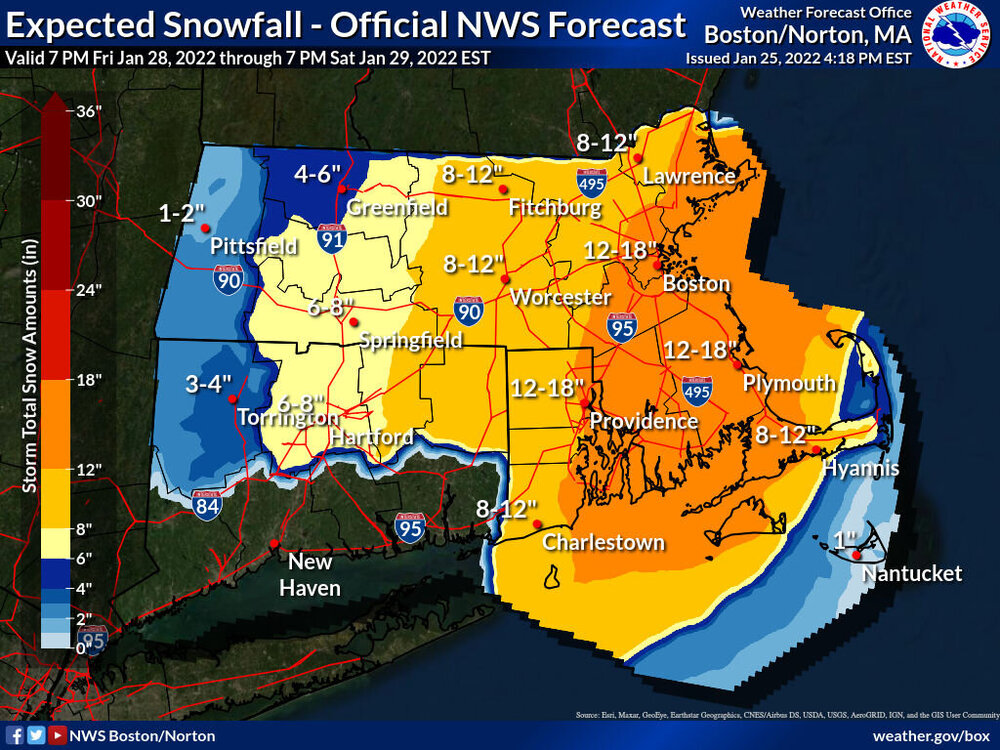
OBS/DISCO - The Historic James Blizzard of 2022
Superstorm93 replied to TalcottWx's topic in New England
Insanity -
Too soon? Boston already pulling out the numbers.
-
True, but the origin date remains 12z.
-
That's the 12z GGEM 18z only runs to 84 hours since it's the RGEM
-
Thursday AM Jan 20 Anafront snow threat.
Superstorm93 replied to Sey-Mour Snow's topic in New England
You already flipped? What's the elevation? -
Nice trends

-
Certainly nothing to sneeze at.
-
2021 Atlantic Hurricane season
Superstorm93 replied to StormchaserChuck!'s topic in Tropical Headquarters
-
I hate that this may be correct.
-
-
-
This was at 45 mph this time yesterday. Insane.
-
-
Heckuva lightning burst
-
So, who's gonna say it first?
-
And now we're up 60 knots since 8am yesterday...
-
Heck of a burst in the southern eyewall
-


.png.c40b8704b0a42b4574cbe8296bf252a7.png)