Tatamy
-
Posts
2,570 -
Joined
-
Last visited
Content Type
Profiles
Blogs
Forums
American Weather
Media Demo
Store
Gallery
Everything posted by Tatamy
-
 Where’s our Christmas torch? Lol
 -
My experience with the squall line was a 5 minute heavy shower with one bolt of lightning/ clap of thunder and a wind gust to 35 mph. FWIW my station at Fire Island measured a wind gust to 51 mph this morning. A station I follow on Block Island measured 80 mph. This storm system definitely means business.
-
Don’t feel bad. My weather station on Fire Island 100 yds from the ocean was frozen since midnight. It only thawed a couple of hours ago. I have a weather station and have seen it freeze however to have one at the ocean front and see this happen was quite unusual. It’s very rare that the wind is light enough for this to happen at the ocean front.
-
Anyone have information on snow amounts on Fire Island or the barrier beaches?
-
Saturday night/Sunday 12/13-12/14 Jawn
Tatamy replied to Ralph Wiggum's topic in Philadelphia Region
Storm is done here. 6” final total. -
Storm is done here. 6” final total.
-
Hi Res models have been hitting on the potential with this system for west of the city for a couple of days now. HRRR, RRFS, and RAP in particular were aggressive with this system. Overperformer for those areas.
-
Been coming down steadily here. 2.5 inches new OTG. 31 degrees.
-
Moderate snowfall 12/14/2025 WWA up for most of the area
Tatamy replied to WeatherGeek2025's topic in New York City Metro
Steady light snow. 32/27. Visibility 3/4 mile -
Saturday night/Sunday 12/13-12/14 Jawn
Tatamy replied to Ralph Wiggum's topic in Philadelphia Region
We have just a few snowflakes as well. 34/24 -
Moderate snowfall 12/14/2025 WWA up for most of the area
Tatamy replied to WeatherGeek2025's topic in New York City Metro
Light snow breaking out just south and west of Harrisburg. -
Moderate snowfall 12/14/2025 WWA up for most of the area
Tatamy replied to WeatherGeek2025's topic in New York City Metro
My station out at Fire Island popped up to the 40s earlier. Since 2:00 PM when the wind subsided and backed around from SW to W the air temperature has dropped 6 degrees to 36 and the DP down 4 degrees to 31. No big ocean warming looks to happen at this point. -
Moderate snowfall 12/14/2025 WWA up for most of the area
Tatamy replied to WeatherGeek2025's topic in New York City Metro
I saw one of these gradient type events two years ago with the I78 death band. Four miles separated 6” amounts from 10” amounts. You cannot underestimate these gradient events. -
Moderate snowfall 12/14/2025 WWA up for most of the area
Tatamy replied to WeatherGeek2025's topic in New York City Metro
Stations right along the south shore of LI have just seen a jump in temperatures to the mid 30s along with a wind shift to the south. Not sure how this plays into some of the forecasts calling for precipitation starting as rain in immediate coastal areas. -
500 mb chart. Shows the expected location of the jet streams and disturbances within.
-
Light to moderate snow falling. It’s a pretty scene here currently. Sticking to all surfaces. Globals and the NAM FTW on this one.
-
E PA/NJ/DE Winter 2025-26 Obs/Discussion
Tatamy replied to LVblizzard's topic in Philadelphia Region
Interesting. I am in Bethlehem Twp and it’s snowing steadily with a coating on the ground. -
E PA/NJ/DE Winter 2025-26 Obs/Discussion
Tatamy replied to LVblizzard's topic in Philadelphia Region
Check out the current feed on the traffic cams along 78 west of Allentown. It’s precipitating only it’s not rain. -
Current observation at Wakefield is Heavy Snow with 1/4 mile visibility. They have a WSW with expected totals between 3-6”. Looks like the corridor between Richmond and Newport News gets the JP.
-
12/3 Snow/Sleet/Mix Bag of Everything Discussion/OBS
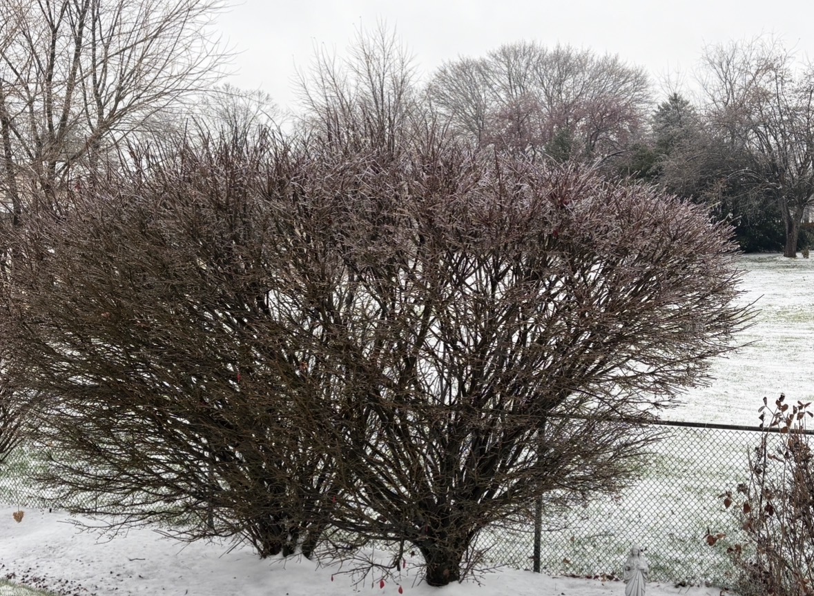
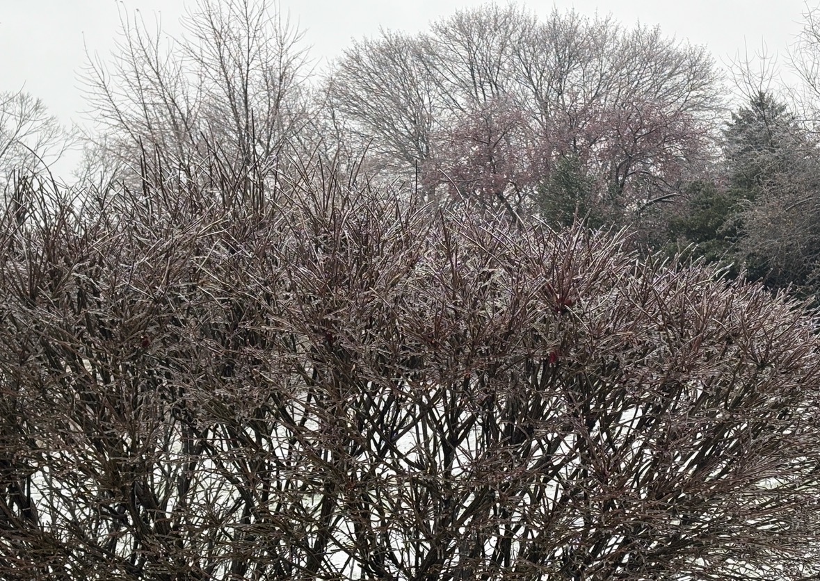
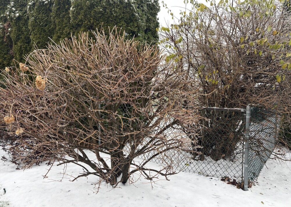
Tatamy replied to Mikeymac5306's topic in Philadelphia Region
Some photos of the icing that occurred at my location.

-
12/3 Snow/Sleet/Mix Bag of Everything Discussion/OBS
Tatamy replied to Mikeymac5306's topic in Philadelphia Region
Freezing rain 31/30 -
12/3 Snow/Sleet/Mix Bag of Everything Discussion/OBS
Tatamy replied to Mikeymac5306's topic in Philadelphia Region
Mix of snow/sleet/freezing rain. 31/29 -
Mix of snow/sleet/ freezing rain. 31/29
-
12/3 Snow/Sleet/Mix Bag of Everything Discussion/OBS
Tatamy replied to Mikeymac5306's topic in Philadelphia Region
Mix of snow and sleet currently. Now have 1.0” new OTG. 30/28