Tatamy
-
Posts
2,585 -
Joined
-
Last visited
Content Type
Profiles
Blogs
Forums
American Weather
Media Demo
Store
Gallery
Everything posted by Tatamy
-
I experienced the storm in East Northport. The things that I remember about it are the consistently low visibility that lasted through out that day. It averaged between 1/8 to 1/4 mile sometimes less all day. The flakes were quite small probably because of the strong winds whipping in off LI Sound. I measured 30” in that storm. I didn’t see a storm like that again until 2016 when I also measured 30” where I am in Bethlehem, PA.
-
My money is on Blutarsky.
-
79 was 8-12” in the Metro with more to the south and west. No changeover. That was the last time that I know of when LI Sound partially froze over.
-
Strongly agree. The AI models have done exceptionally well over the past few days consistently showing the OTS solution.
-
This is definitely one for the coastal people. Plenty of snow on the ground here too. I hope it does come together for those to the S and E.
-
I am in Bethlehem, PA. I have enough snow lol. You guys on the coast can have this one.
-
I think just 50 miles will do a lot of good for people on the coast.
-
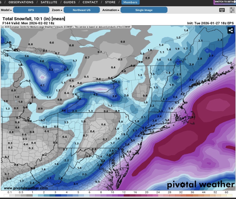
18z EPS mean

-
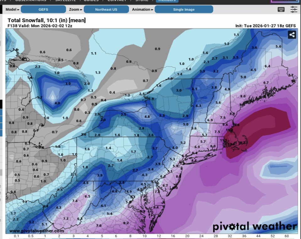
18z GEFS mean

-
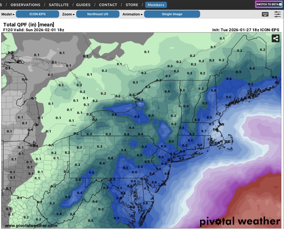
Icon EPS mean 18z

-
The 06z Euro OP is OTS.
-
06z EPS is east of previous runs
-
Thanks for sharing!
-
There was 17” inches where I was. I was a junior in HS at the time and had never seen something of that nature that I was old enough to remember. The 70s and 80s were lean times for snow lovers in the NY area. Snow changed to mixed precipitation during the day before it ended. My only source of weather info at the time was WINS and WCBS plus TV news at night. People have it so much better today.
-
I got 30” on LI
-
I do the same thing in my yard. Even with pre-existing snow cover you can usually find an ice crust on its top under the new snow cover in order to obtain a measurement.
-
We are getting a burst of light snow now. I would agree with it producing a coating to a half inch in places.
-
Back and forth between heavy sleet and snow. 9.5” total. 8/6
-
Have been going between heavy sleet and snow. Storm total 9.5”. 8/6
-
Snow/Sleet mixture here as well. 9/7
-

E PA/NJ/DE Winter 2025-26 Obs/Discussion
Tatamy replied to LVblizzard's topic in Philadelphia Region
Heavy sleet in Bethlehem Twp. 9/8. Snow/sleet total so far 8.5” -
8.5” with heavy sleet. Transitioned at 13:10. 9/8
-
Snow mixed with some sleet pellets here in Bethlehem Twp. 9/6
-
Up to 7” here. Watching the sleet line approach from Berks Cty.
-
Up to 7” now. Sleet line should be here within the hour.