Tatamy
-
Posts
2,583 -
Joined
-
Last visited
Content Type
Profiles
Blogs
Forums
American Weather
Media Demo
Store
Gallery
Everything posted by Tatamy
-
Same here.
-
You’re in a better place. Enjoy!
-
Light rain 36/33
-
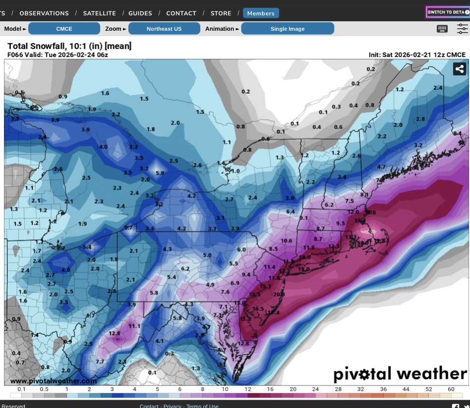
12z HRRR concurs with the Delaware River cutoff for the big snows.
-
Steady light snow. Visibility 3 miles. 33/31
-
It’s an interesting forecast where I am near the Delaware River with only the short term Mesos calling for big snows here (12-18”) whereas the globals and some mesos are calling for 8-12”. The IVT will be the key out here for me and other NW areas. The cutoff will be right through my general area I believe.
-
Regarding the output from the RDPS, it’s similar to the run at 12z. This is the CMC ensemble run from 12z. If someone can explain the difference between these I would be interested to know.

-
Orographic lift
-
I own one on Fire Island.
-
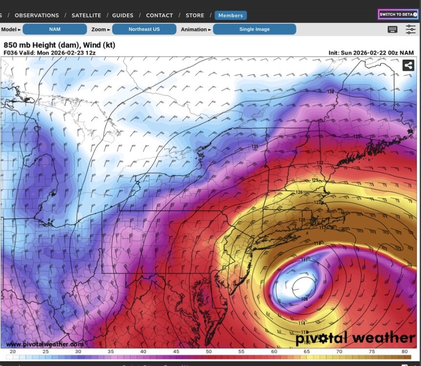
This might be part of the answer. Check out this 850 mb jet.
-
I personally experienced winds of this force in February 1983 on the north shore of Suffolk Cty. and had good equipment to measure it. It has happened before and can happen again.
-
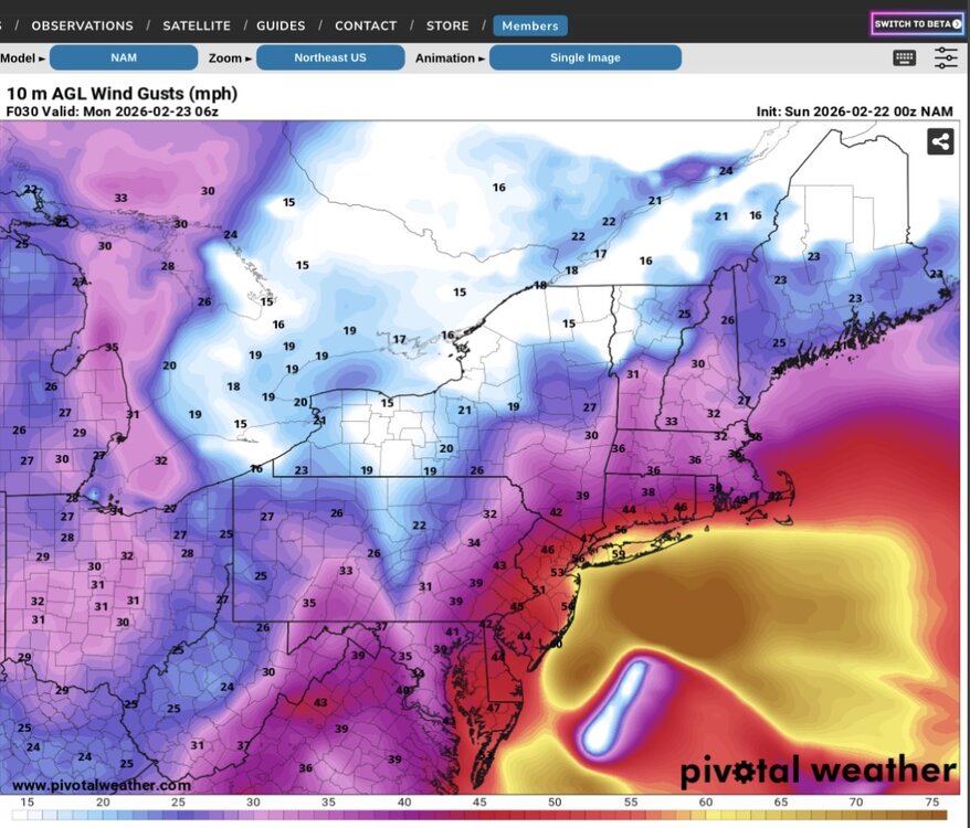
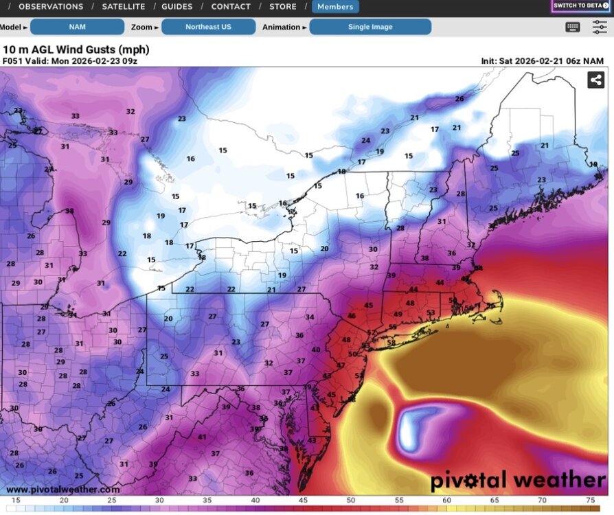
3K NAM has 9 hours of wind gusts to at least 55 MPH at Farmingdale.
-
Make sure your generators are ready to go. Farmingdale is progged to have wind gusts of at least 59 mph for 9 hours.
-
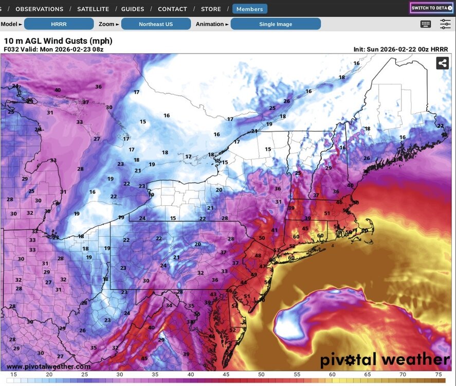
There’s a lot of people that don’t understand how different this storm will be as modeled when compared to other coastal storms that provided a lot of snow to the area. I am telling family out on LI to think of this as a hurricane that brings snow. The modeled intensity speaks for itself. I also introduced them to a new word for their vocabulary- Bombogenesis. The map below with the expected winds off the latest HRRR run speaks for itself. And yes it does have an eye.
-
Feb 1983 - Measured many hours of snow accompanied by wind gusts to 50 - 65 mph. Location- East Northport. Equipment- Downeaster Models are forecasting similar winds on LI. I have a Davis Vantage Vue on Fire Island and will be watching the reports there with great interest.
-
The difference is this event will have an IVT. Boxing Day did not.
-
Mt. Holly will need to issue Blizzard warnings for the Jersey coast and adjacent areas and should do so ASAP.
-
The GFS has also showed these winds in previous runs. Upton knew this was on the table and made the decision to issue the warning in order to give people time to prepare. Food stores will be insane today.
-
Wild stuff. The coastal areas are going to be hit really hard with both the winds and flooding.
-
It’s called Bombogenesis.
-
NAM Wind gusts Those are hurricane force wind gusts on eastern LI. The other visible feature is an inverted trough that helps to extend the precipitation field into western and NW NJ. This is one for the meteorology textbooks.
-
That deform band does look interesting.
-
I think we’ve had two today.
-
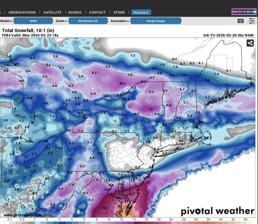
Have to love the NAM. So entertaining. We’ve gone from this at 06z to close to 30” in spots in our area in 2 runs. I think it’s outdone itself.
-
Water temps south of LI and east of NJ range from 36 - 38. This is close to the seasonal minimum and actually below normal. Coastal areas are in a different world as compared to early December (water temps then are usually still in the 50s) regarding ocean warmth being poised to flood inland.