Tatamy
-
Posts
2,585 -
Joined
-
Last visited
Content Type
Profiles
Blogs
Forums
American Weather
Media Demo
Store
Gallery
Everything posted by Tatamy
-
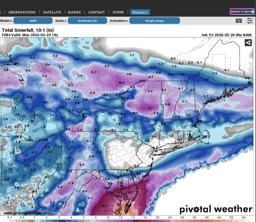
Have to love the NAM. So entertaining. We’ve gone from this at 06z to close to 30” in spots in our area in 2 runs. I think it’s outdone itself.
-
Water temps south of LI and east of NJ range from 36 - 38. This is close to the seasonal minimum and actually below normal. Coastal areas are in a different world as compared to early December (water temps then are usually still in the 50s) regarding ocean warmth being poised to flood inland.
-
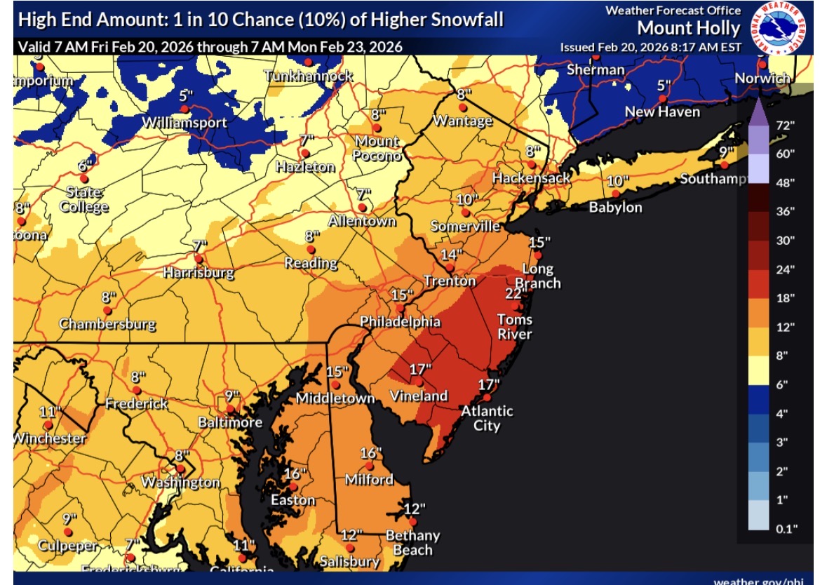
This is Mt. Holly’s high end forecast (10% chance of verification).

-
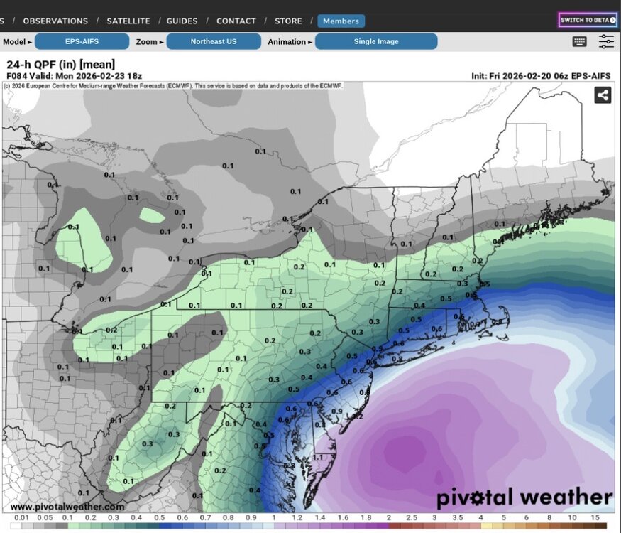
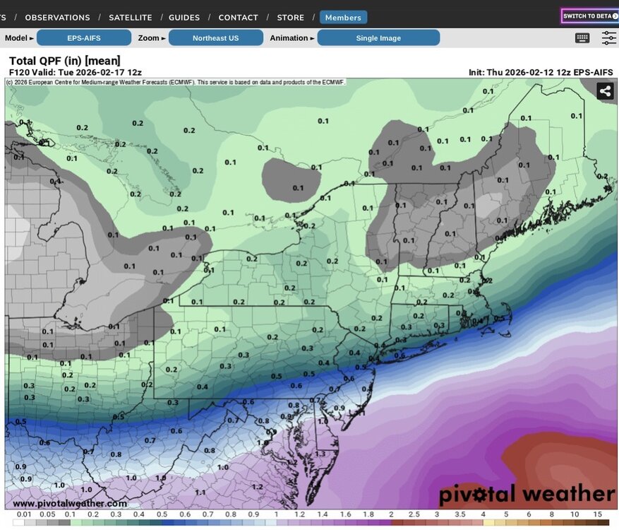
06z EPS AIFS
-
Looks just like the 06z GEFS
-
06z NAM has zip. 06z Ukie has rain from the city south at 66 hours. It’s like these models are all in separate worlds.
-
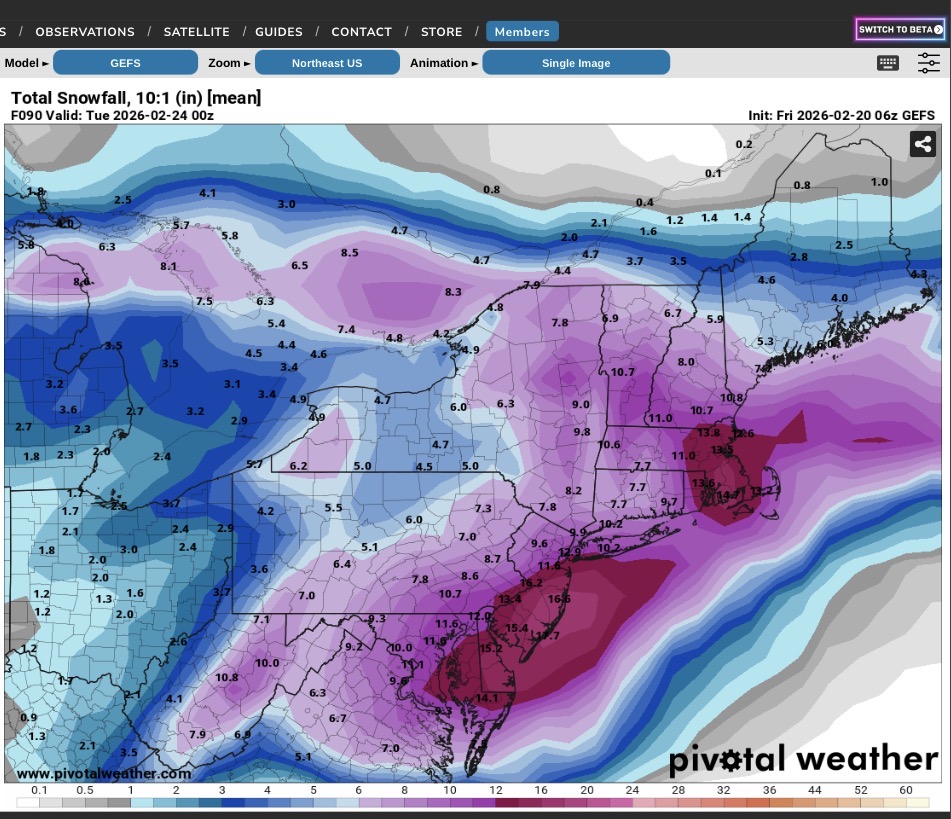
06Z GEFS

-
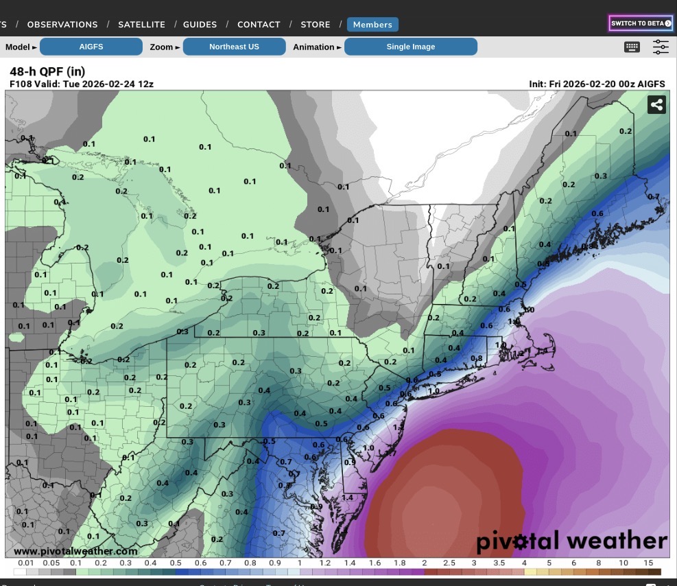
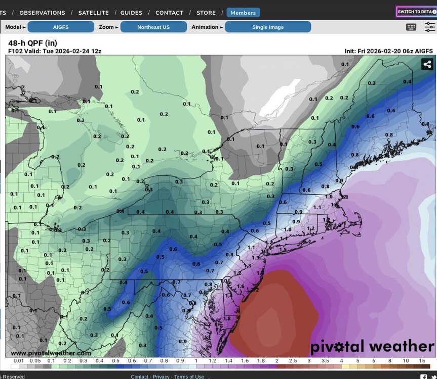
GFS AI brings 1 - 1.5” QPF across the area (less well N&W). It’s been showing a relentless push to the NW with higher precip amounts.
-
This could require hurricane force wind warnings for the coastal waters. Tidal flooding would be a big problem with this scenario.
-
06z AI GFS
-
0Z AI GFS

-
No one seems interested in it…
-
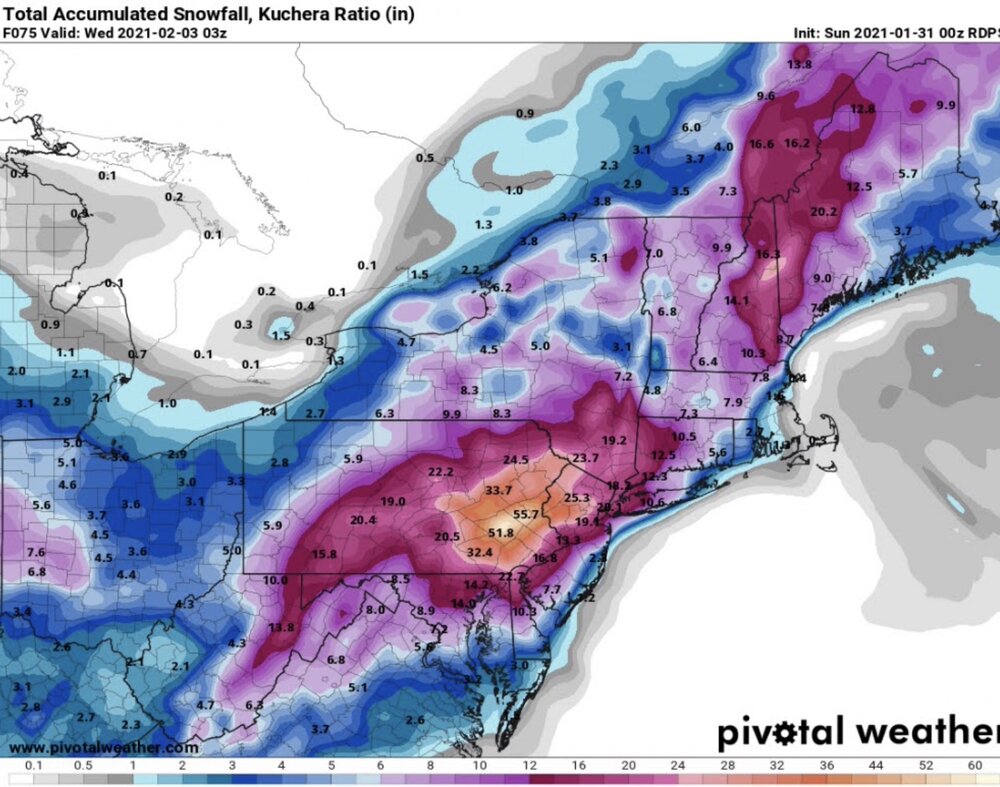
Have to careful with some of the real end outcomes coming out in the models. GDPS is calling for 30”+ for my area. In 2021 it did something similar (RDPS) only it called for 50” so there is an history with that model. Actual storm amounts ranged from 24-36” where I am.
-

-

Early Monday morning 2/16 last minute event OBS/Discussion
Tatamy replied to The Iceman's topic in Philadelphia Region
2” -
Storm total 2” on all surfaces.
-
Been getting steady light to at times moderate snow here. 1.3” new OTG. 31/30
-
Steady very light snow. 36/28. Expecting about an inch here.
-
Do you know how to read and interpret a computer model?
-
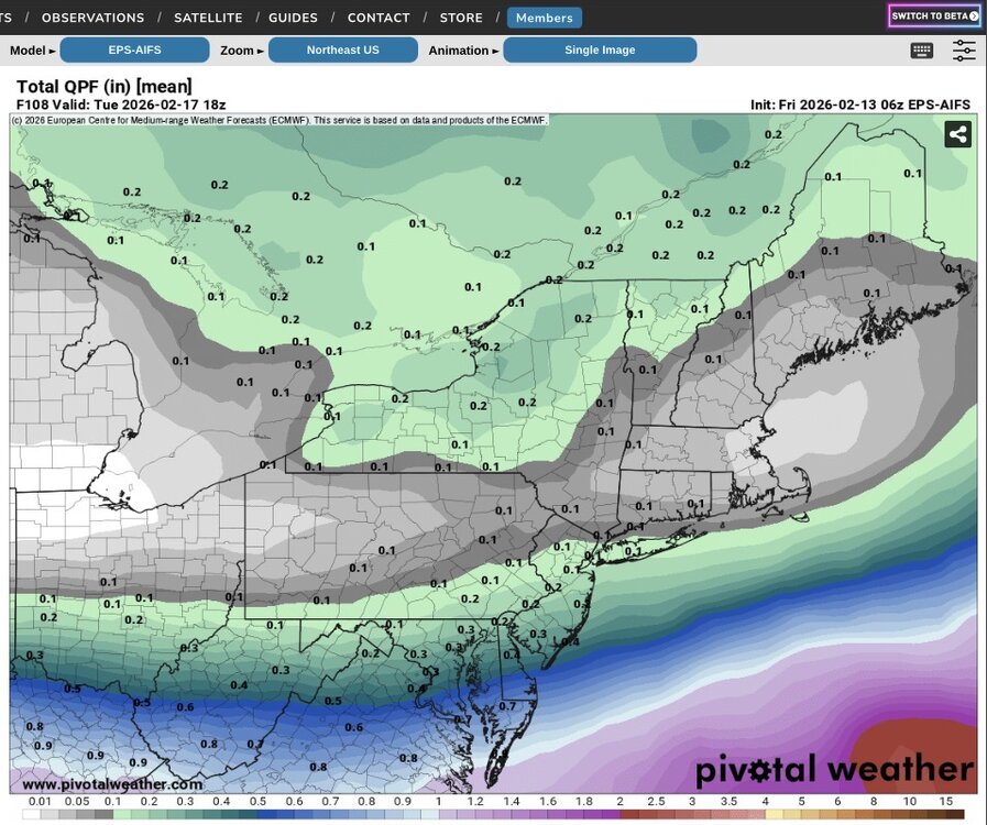
Here are the 06z and 12z runs of the EPS-AI.

-
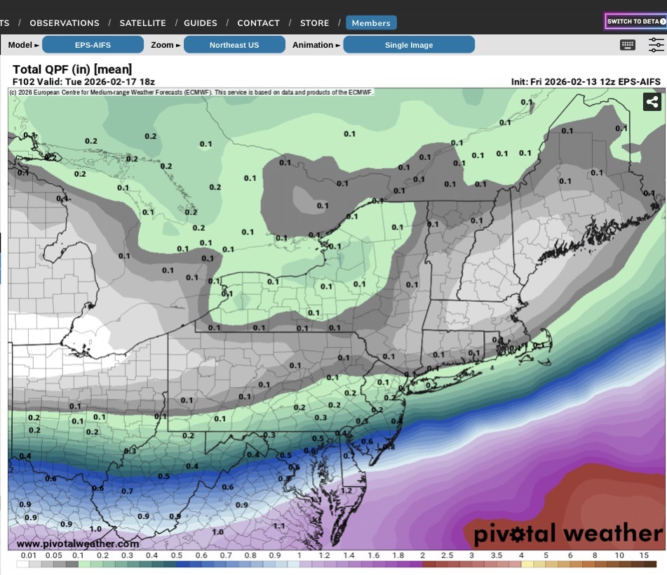
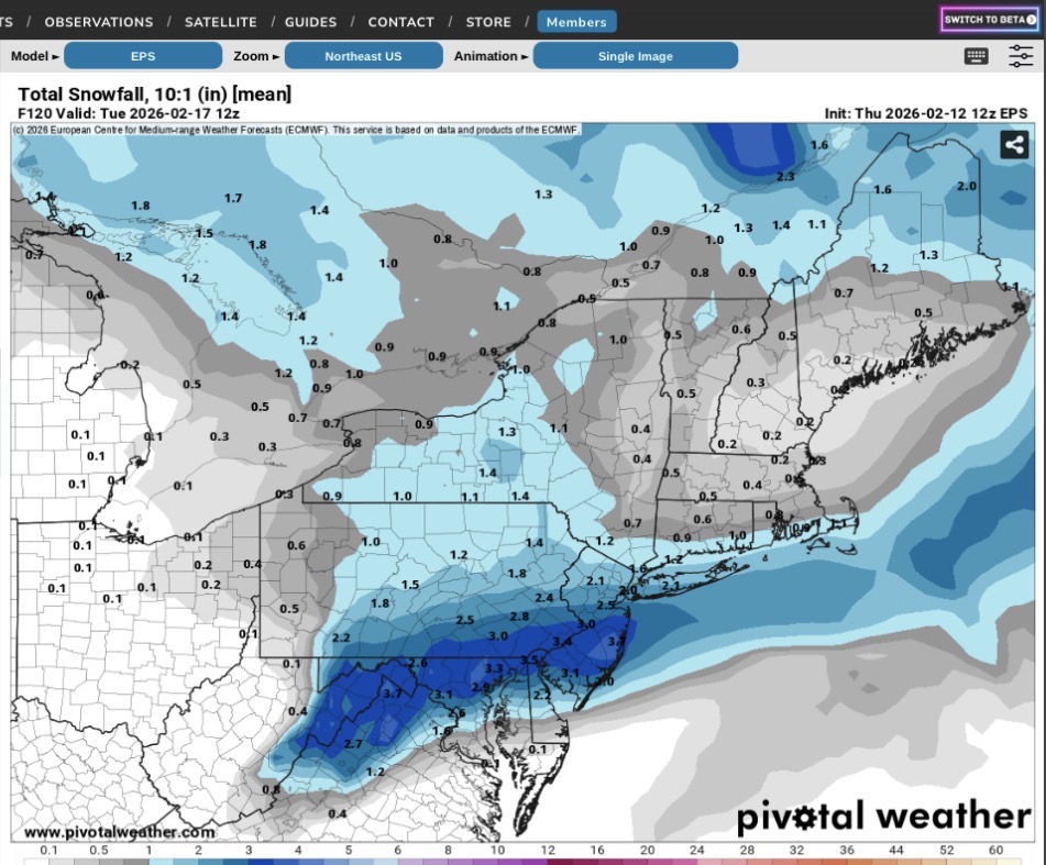
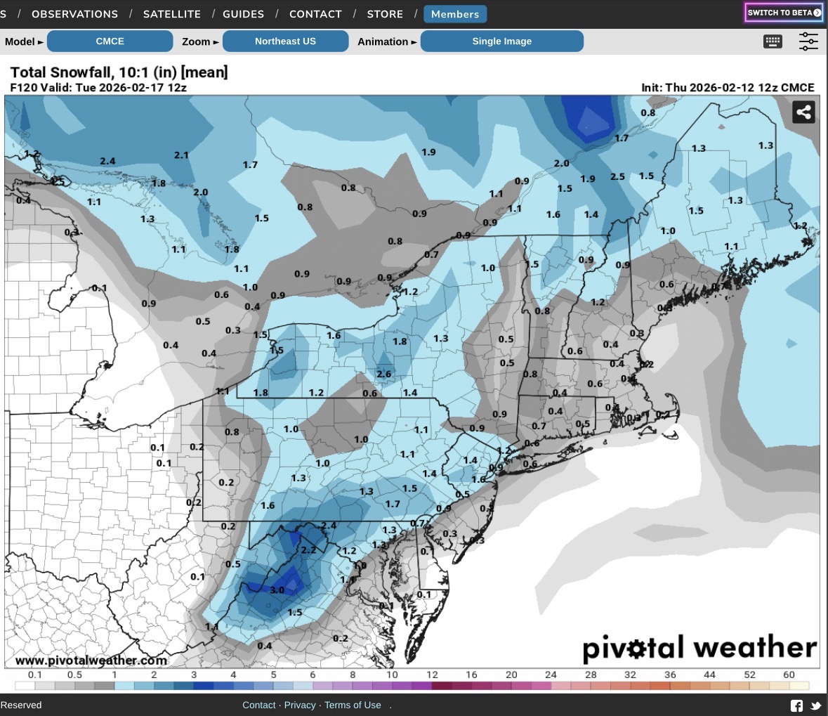
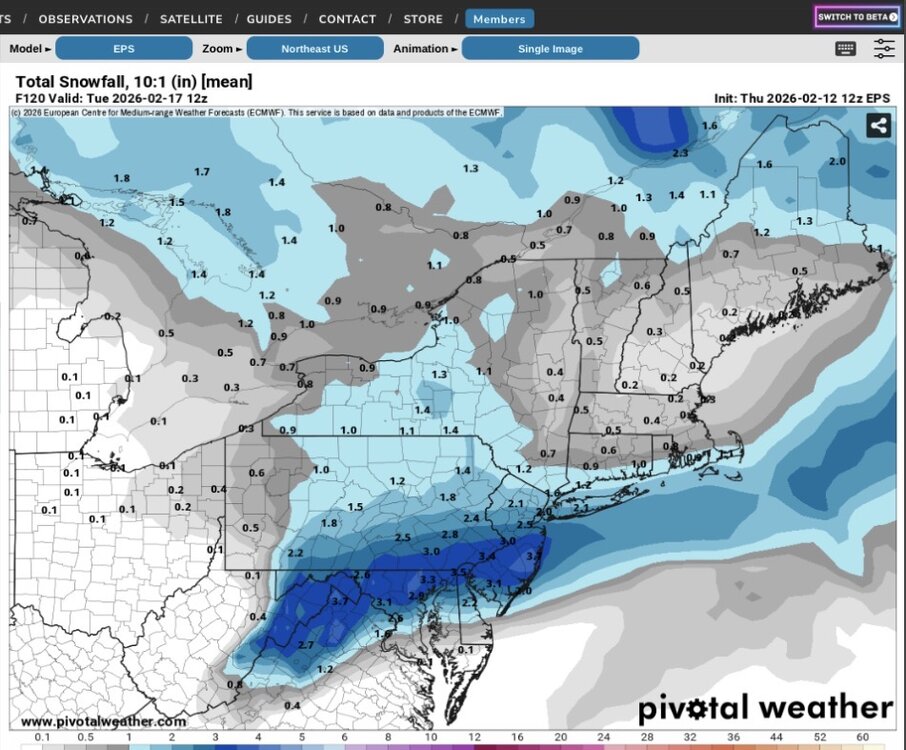
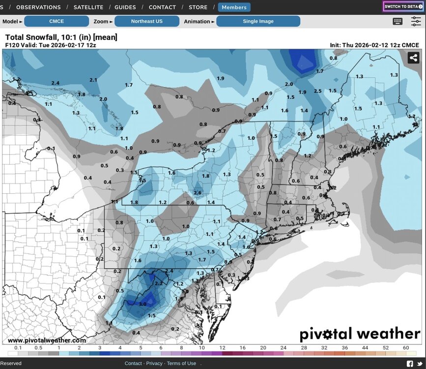
I am posting the 12z ensemble guidance below from the EPS, CMCE, and EPS AIFS. The EPS AIFS has actually been quite consistent with its precip field in recent runs.
-
Places north and west could do okay however it’s borderline near the coast. Interesting run.
-
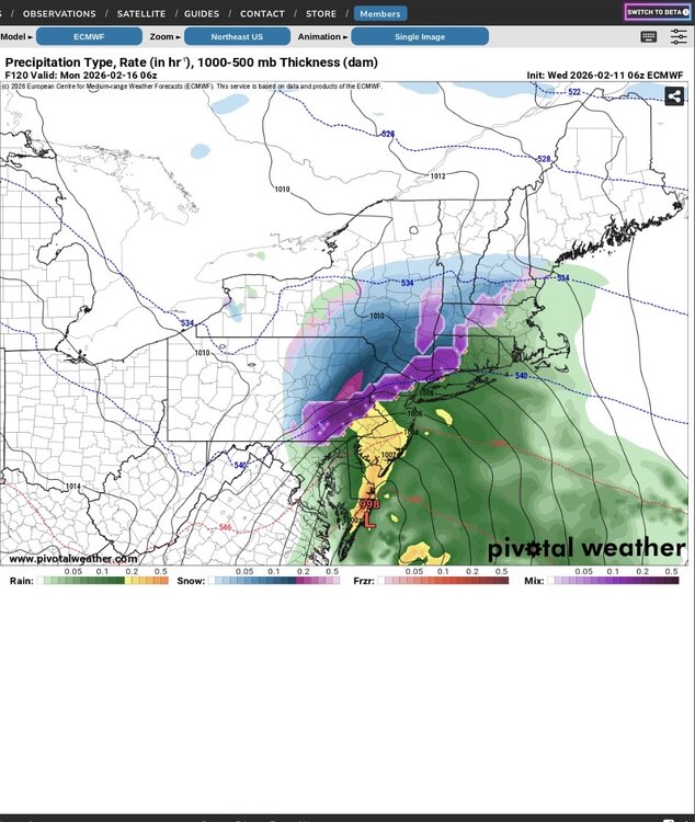
06z Euro - the coast rains
-
That visibility there is 1/4 to 3/8 mile so this is moderate to heavy snow that has been falling there for most of the afternoon.
-
I am surprised that there is not ice on LI Sound. Last time that I saw that was February 1979 during the week prior to PD1.