batmanbrad
-
Posts
319 -
Joined
-
Last visited
Content Type
Profiles
Blogs
Forums
American Weather
Media Demo
Store
Gallery
Everything posted by batmanbrad
-
2026 Mid-Atlantic Severe Storm General Discussion
batmanbrad replied to Kmlwx's topic in Mid Atlantic
whoa that cell near Manassas sure got itself together in a hurry... could be heading for DC? -
2026 Mid-Atlantic Severe Storm General Discussion
batmanbrad replied to Kmlwx's topic in Mid Atlantic
WPC just issued an MPD for our area - warns of heavy rain leading to possible flash flooding: https://www.wpc.ncep.noaa.gov/metwatch/metwatch_mpd_multi.php?md=0499&yr=2026- 2,597 replies
-
- 1
-

-
- severe
- thunderstorms
- (and 7 more)
-
2026 Mid-Atlantic Severe Storm General Discussion
batmanbrad replied to Kmlwx's topic in Mid Atlantic
for those hoping for at least drought-denting rainfall, WPC shares some decent possibilities in their latest ERO/ERD: ...Central Appalachians to Northeast U.S... Surface low currently analyzed over the western Ohio Valley will gradually lift to the east-northeast with an expectation for the low center to exit off the northern Mid Atlantic coast, dragging a cold front through the Mid Atlantic and Ohio Valley and lifting a warm front ahead of the disturbance. The current indications are for convection to spawn over the eastern Ohio Valley by the early- afternoon as mid-level ascent and increased surface forcing aided by the cold front and area of low pressure will trigger convective initiation just upstream of the terrain in WV and western PA. This area of thunderstorms will migrate eastward, entering a favorable environment within a modest warm sector as you move east of the Appalachian front. Shear profiles across the Mid Atlantic are anticipated to be greatest north of the Mason Dixon, however shear magnitudes are still capable for enabling stronger mid-level mesocyclones to materialize and hold as far south as I-66 leading to prospects for heavier thunderstorms to hold across the urban corridor extending from northern VA up through NYC and western LI. HREF probs for >1" are pretty high for both the neighborhood and EAS fields meaning there's a consensus for areas of heavy rainfall to impact much of the Mid Atlantic with the most pronounced signatures into the Central Appalachians and the urban centers, both are which are susceptible to flash flood concerns. Antecedent soil moisture is dry, so the initial burst of rainfall will be beneficial to those areas not tied completely by urban infrastructure, however, there's a sufficient signal in the QPF means to maintain the previous SLGT risk inherited for the region as 00z CAMs maintained their depictions on a multi-round cycle of convection moving into the area with pockets of 2-3+" forecast across portions of the aforementioned areas. -
2026 Mid-Atlantic Severe Storm General Discussion
batmanbrad replied to Kmlwx's topic in Mid Atlantic
does look clear esp. over MoCo as of now, though there are some clouds to the west so unless those dissipate as they move out of the mountains, we'll probably have intervals of both clear skies and some cloud cover: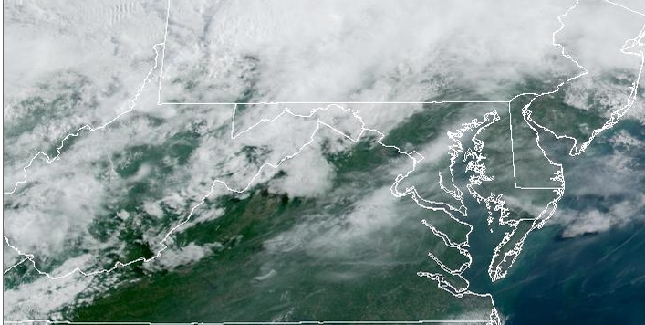
- 2,597 replies
-
- 2
-
-
- severe
- thunderstorms
- (and 7 more)
-
2026 Mid-Atlantic Severe Storm General Discussion
batmanbrad replied to Kmlwx's topic in Mid Atlantic
not much change in the newest SPC day 2 outlook for our area, they held the TOR prob at 2% and mentioned too much uncertainty about degree of destabilization to warrant upgrading to 5% -
2026 Mid-Atlantic Severe Storm General Discussion
batmanbrad replied to Kmlwx's topic in Mid Atlantic
noting we've been put in a SLGT for Sunday as well by SPC -
2026 Mid-Atlantic Severe Storm General Discussion
batmanbrad replied to Kmlwx's topic in Mid Atlantic
SPC did keep the 30 wind area in their 9AM update, but did shift it a bit E/SE, otherwise few changes - as you say, we'll see if anything improves on the CAMs otherwise many of us may (again) be disappointed. -
2026 Mid-Atlantic Severe Storm General Discussion
batmanbrad replied to Kmlwx's topic in Mid Atlantic
I can see some gust front/outflow boundaries pushing out ahead of that line -
2026 Mid-Atlantic Severe Storm General Discussion
batmanbrad replied to Kmlwx's topic in Mid Atlantic
so far the line of storms coming out of WV and western MD seems to be holding together pretty well - wondering what it will do when it comes over the mountains and hits the pea soup air over us right now. If it keeps moving quickly it'll hit before we completely lose sunlight... -
currently right underneath that cell moving through the Germantown/Gaithersburg/Laytonsville area, not much T&L but big time downpour going on for the last 10-15 minutes (and counting), with more behind it this might be flash flood territory if it doesn't move out soon?
-
current radar trends are supporting the earlier thinking that most of the major activity will be north of DC...
-
2026 Mid-Atlantic Severe Storm General Discussion
batmanbrad replied to Kmlwx's topic in Mid Atlantic
SPC issued another MD for our area, seems to indicate things are continuing to ramp up somewhat: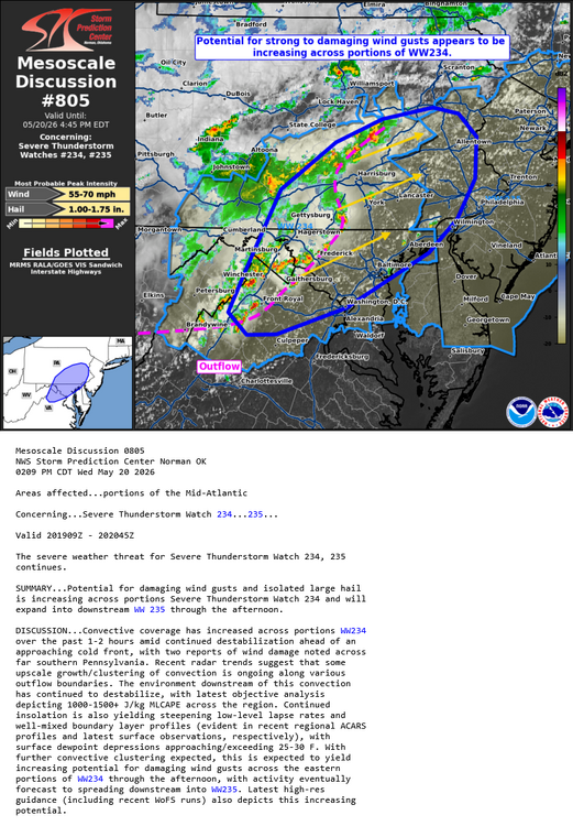
- 2,597 replies
-
- 2
-
-
- severe
- thunderstorms
- (and 7 more)
-
Radarscope showing some increase in hail size, POSH's up to 40-50% on some of those cells out west including the one you mention.
-
2026 Mid-Atlantic Severe Storm General Discussion
batmanbrad replied to Kmlwx's topic in Mid Atlantic
alerted on Radarscope of an MCD issued for our area, 80% chance of a blue box coming. -
2026 Mid-Atlantic Severe Storm General Discussion
batmanbrad replied to Kmlwx's topic in Mid Atlantic
The latest forecast for me (Gaithersburg) STILL has no mention of severe for tomorrow, doesn't mention thunder at all! I checked the point-and-clicks for several other cities/counties in our area... nada. -
2026 Mid-Atlantic Severe Storm General Discussion
batmanbrad replied to Kmlwx's topic in Mid Atlantic
the next D2 outlook from SPC will be out in about 45 minutes. Since the previous discussion had mentioned upgrade possibilities existed (but not at the time for our zones), wondering if they will get any more aggressive with their probabilities. -
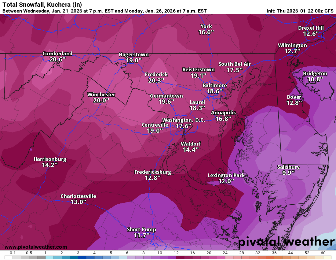
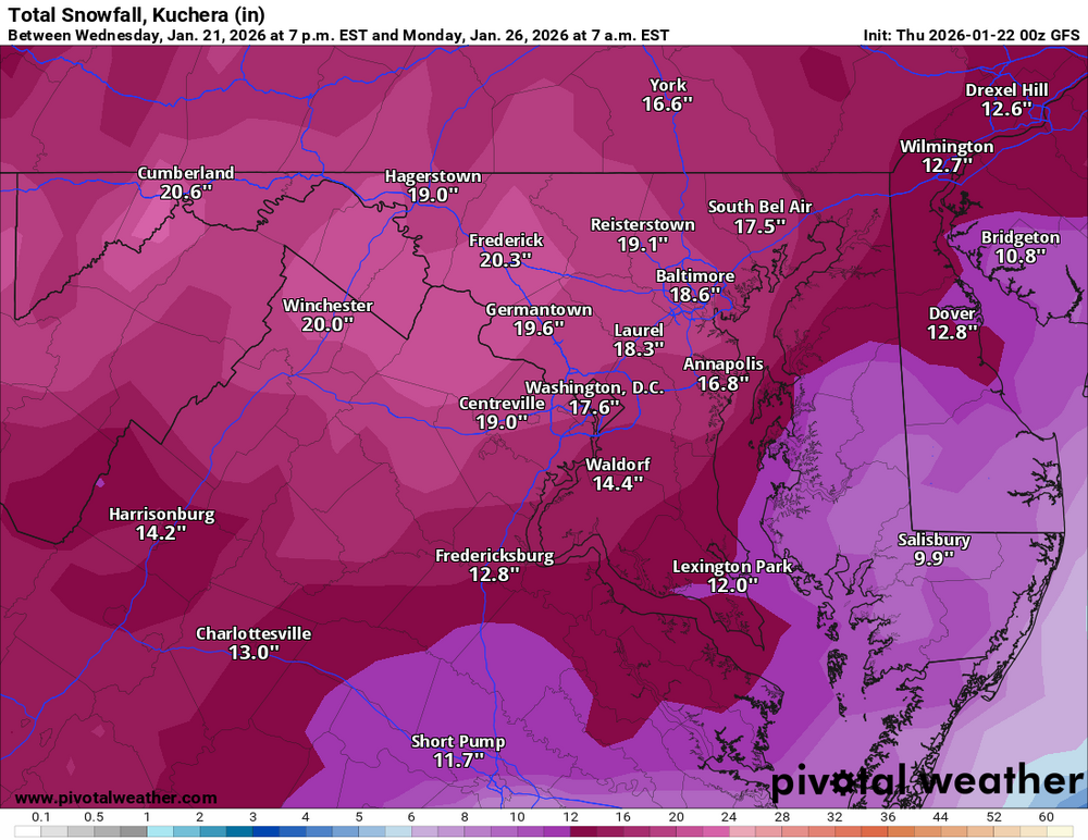
northern DE, NJ, most of eastern NY, and central/southern New England really score well on this GFS run.
-
kinda like the old Timex watch commercials... we need Euro to take a licking and keep on ticking... (in the proper direction). if we need 200 mile jump and it ticks the right way 25 miles at a time for 8 model runs... that'll work
-
part of afternoon AFD from Sterling - still keeping everything on the table while pointing out the 12Z shift in most (non-GFS) models towards an OTS solution: KEY MESSAGE 3...Monitoring the potential for a coastal system this weekend. We continue to monitor the potential for snow associated with a coastal low this weekend. Nearly all model solutions show a strong coastal low forming, but there`s still considerable uncertainty regarding both where that low will track, and what impacts we will experience locally. Potential outcomes range anywhere from a storm that tracks well out to sea with little impact locally, to a storm that tracks closer to the coast and produces heavy snowfall across the region. The general flow pattern forecast by models has many of the synoptic features associated with Mid-Atlantic snowstorms, with ridging along the West Coast, troughing along the East Coast, ample cold air in place at the surface, and then downstream blocking over the North Atlantic. However, the trend with incoming EPS and GEPS trended significantly downward with probabilities for snow, ultimately showing a further southeast and out to sea track. The 12z GFS shows the potential snowier solution, and GEFS probabilities for snow trended upward. Spatially speaking, probabilities are highest for snow in all guidance the further southeast you go. In our area, southern Maryland would have the greatest chance at seeing snow. It`s worth noting that the flow pattern at upper levels preceding this storm is highly complex. The primary disturbance that will ultimately contribute to the development of the system is actually located over Newfoundland currently and will rotate westward around an upper low centered over Hudson Bay, before turning southward and digging out the trough that will eventually provide the forcing for the development of the coastal low. As this disturbance turns southward, it will also be influenced by an upper low over Alaska and a building ridge over the West Coast. Given the high complexity of these interactions, it may take another 1-2 days for models to settle into a higher confidence solution, and as a result, the door is still open for large forecast shifts.
-
this kinda reminds me of the movie Spaceballs... suck, suck, suck!
-
not sure where in Gaithersburg you are, but after shoveling my driveway just as the flip to sleet occurred over here just west of Laytonsville (a few miles north of the airpark), I just went back out again and had to shovel close to 2"+ of sleet... that was much harder than the 6"+ of light powder. In a couple of hours I'll have to do it all over again with the rate of sleet falling now. At least I didn't wait until it was all over - 3-4" of sleet might be too much for this OF to get rid of.
-
Pingers made their arrival a little after 8:30AM here on the NE side of Gaithersburg, near Laytonsville. crude tape measurement on driveway was about 6.5 just as the changeover started. Sleeting quite steadily now, hoping for minimal ZR later.
-
thought of you - the JebWalk possibilites would be endless if that even just comes close to verifying...
-
take it and run with this...
-
Not likely to be before the changeover since the time says it's through 1PM on Monday... still not bad for the ICON though.