

NorthShoreWx
-
Posts
5,517 -
Joined
-
Last visited
Content Type
Profiles
Blogs
Forums
American Weather
Media Demo
Store
Gallery
Everything posted by NorthShoreWx
-
Snowfall NYC subforum Jan 6 and OBS if needed
NorthShoreWx replied to wdrag's topic in New York City Metro
2pm North Smithtown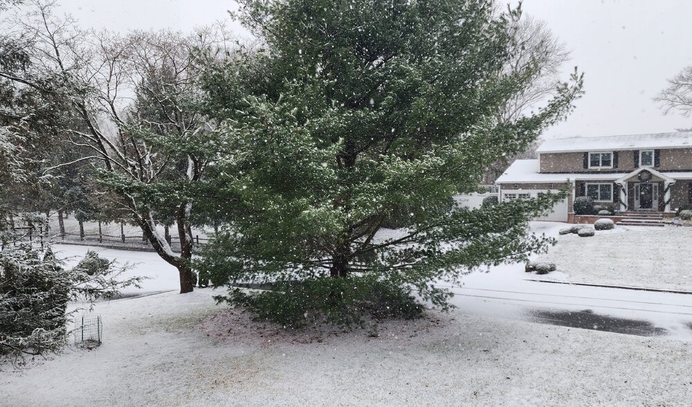
-
Snowfall NYC subforum Jan 6 and OBS if needed
NorthShoreWx replied to wdrag's topic in New York City Metro
28⁰ with steady light to moderate snow here. 0.5" so far which, all joking aside, really is overachieving for this one. -
Snowfall NYC subforum Jan 6 and OBS if needed
NorthShoreWx replied to wdrag's topic in New York City Metro
Just saw a couple of small snowflakes. This storm is overachieving here. -
Snowfall NYC subforum Jan 6 and OBS if needed
NorthShoreWx replied to wdrag's topic in New York City Metro
Roughly the northernmost 50 miles of those radar echos are virga. -
Snowfall NYC subforum Jan 6 and OBS if needed
NorthShoreWx replied to wdrag's topic in New York City Metro
It's in the top 10 -
Jan 11th-12th Super Bomb or Super Bummed?
NorthShoreWx replied to Rjay's topic in New York City Metro
- 993 replies
-
- 6
-

-

-
- metsfan vs snowman
- bomb
- (and 2 more)
-
Snowfall NYC subforum Jan 6 and OBS if needed
NorthShoreWx replied to wdrag's topic in New York City Metro
I give it an honorable mention because of the preponderance of torchy cutters in between cold spells. But for the epic Ohio Valley blizzard (the cutter of all cutters), 77-78 would be a slam dunk for my top pick here. -
Snowfall NYC subforum Jan 6 and OBS if needed
NorthShoreWx replied to wdrag's topic in New York City Metro
Since winters that are great early, great late, have the longest continuous periods without significant thaws, etc. tend not to overlap, the ranking is difficult. My top 4, in chronological order: 77-78 95-96 10-11 14-15 Each was outstanding in ways that the others didn't necessarily display. The total snowfall for those 4 winters was over 290" -
Snowfall NYC subforum Jan 6 and OBS if needed
NorthShoreWx replied to wdrag's topic in New York City Metro
Total snowfall for 09-10 and 10-11 was similar here, but we had in the vicinity of a 20" snowpack (peak 26") for weeks in 2011. Until early February 2011 the hits just kept coming one on top of another. So 2010 was pretty decent, but 2011 gets the nod here. -
Snowfall NYC subforum Jan 6 and OBS if needed
NorthShoreWx replied to wdrag's topic in New York City Metro
Our 30 minutes of snizzle here was epic. -
Thanks for reminding me that I don't miss them.
-
January 4, 2018:
-
Depending on how you collated the stats, they could be overlooking the fact that there was that much snow from nickel and dime events falling during some of the "KU winters".
-
This is offensive
-
The one constant in the past several days of modeling the Monday event is that the skiing in West Virginia is going to be very good.
-
A few stray snowflakes in the air here. I wouldn't even call it a flurry, but being the diligent reporter that I am...there you go. 39⁰
-
Snowfall NYC subforum Jan 6 and OBS if needed
NorthShoreWx replied to wdrag's topic in New York City Metro
I can only think of 3 off the top of my head. It was brutal, although there were a couple of decent winters on the island that were BN in NYC. -
Holy crap. I don't think we had that much lightning the past 2 summers combined. I'm entertaining and didn't notice if it was hailing, but the place was rocking.
-
Well, what time? I need to plan my travel.
-
Congrats Florida https://www.tropicaltidbits.com/analysis/models/?model=gfs®ion=seus&pkg=asnow&runtime=2024122906&fh=384
-
0.91" 2-day total here. 53/53 now. nice and soupy...typical late December wx for recent years,
-
Dew point?
-
50 in North Smithtown. Quite wet. Elevation 122
-
I'm already missing summer 2023
-
30/27 here 10 miles NW ISP


