NorthShoreWx
-
Posts
5,516 -
Joined
-
Last visited
Content Type
Profiles
Blogs
Forums
American Weather
Media Demo
Store
Gallery
Everything posted by NorthShoreWx
-
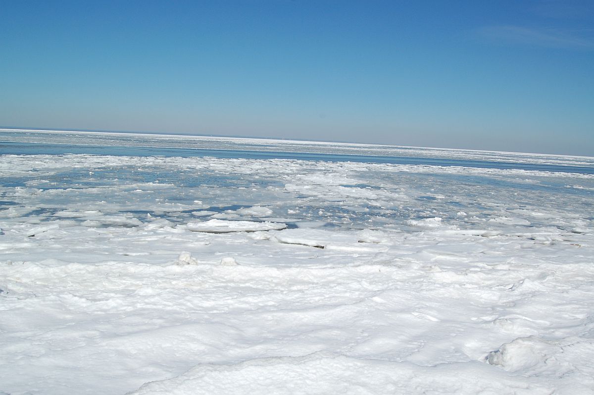
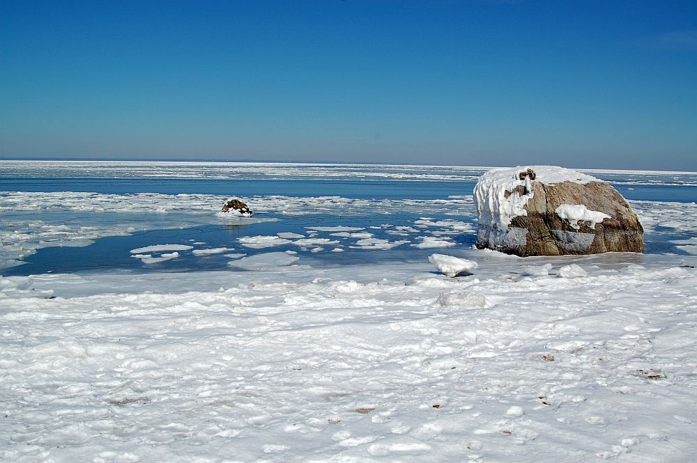
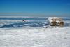
Long Island Sound / Smithtown Bay, February 2015
-
I guarantee it would have a lot more sound-effect rain. Maybe an extra 10 or 20 miles would boost some snowfalls, but I'm not sure it would offset all of the negatives.
-
Thanks. It's a cool graphic that I hadn't seen before. That's a good scenario that you mentioned with the DC example. It would probably be interesting this month with the greatest departures to the SW.
-
Is there any useful visualization from overlaying the tracks of multiple endpoints?
-
It was raining on the beach and snowing on top of the bluff.
-
(but yes)

-
Not at all. That was 150 feet higher and a half mile from the beach.
-
Jan 11th-12th Super Bomb or Super Bummed?
NorthShoreWx replied to Rjay's topic in New York City Metro
Looks like tomorrow nights NAM run.- 993 replies
-
- 9
-

-

-
- metsfan vs snowman
- bomb
- (and 2 more)
-
I've seen it go from snaining on the beach in Sunken Meadow to heavy snow with a few inches on the ground just beyond the KP bluffs. That's about a 5 minute walk. It was quite a walk.
-
Central Park Jan 77 mean 22.1, snow 13.0, precip 2.25 Jan 09 mean 27.9, snow 9.0, precip 2.98 Nov 76 41.7⁰,T, 0.64" Nov 08 45.8⁰, T, 1.61" Dec 76 29.9, 5.1", 2.29" Dec 08 38.1, 6.0", 6.62" Feb 77 33.5⁰, 5.8", 2.51" Feb 09 36.7⁰, 4.3", 0.93"
-
Not exactly, but a little bit of similarity. There was a few days of very cold and a couple of smaller snowfalls (in NYC; there was a larger one in central Suffolk), but it wasn't the same wall to wall sort of icebox/ snowcover.
-
Jan 11th-12th Super Bomb or Super Bummed?
NorthShoreWx replied to Rjay's topic in New York City Metro
I think this situation absolutely requires a really futile and stupid gesture be done on somebody's part.- 993 replies
-
- 3
-
-

-
- metsfan vs snowman
- bomb
- (and 2 more)
-
Neither the GFS nor the Euro are snowy, but the 12z/7 Euro is noticeably colder over the next 2 weeks with the coldest at the end of the model run. If the EC is right, it's going to end up a very cold January. This winter will not come anywhere near challenging 1977, but a little refresher for those even younger than me: Aside from the record cold, especially during January in the Midwest and East, 76-77 featured at best average snowfall in this area and maybe below average. The biggest snowfall might have approached 6" but we had near end to end snow cover. If you only look at the snowfall records it looks like just another lame 70s winter with no extra days off from school (unless your school heated with natural gas). So if the Euro delivers on mostly below 0⁰C weather and a smattering of light snowfalls, count your blessings after the previous 2 winters. If you enjoy pond hockey on the coastal plain, you could finally get another chance at it this winter. You just might need to clear a little bit of fluffy snow off the ice first.
-
Jan 11th-12th Super Bomb or Super Bummed?
NorthShoreWx replied to Rjay's topic in New York City Metro
I'd wait until the frameable 0Z/10 NAM run comes out Thursday evening and then cancel. I've already ordered a nice frame. -
Jan 11th-12th Super Bomb or Super Bummed?
NorthShoreWx replied to Rjay's topic in New York City Metro
They should have said 100" then the attempt at expressing humor and maybe a wee bit of frustration would have been more obvious. I'm ok with their post. -
Not here.
-
When the wind is just right, places downwind of the lake get buried in discarded coffee cups and white claw cans.
-
Jan 11th-12th Super Bomb or Super Bummed?
NorthShoreWx replied to Rjay's topic in New York City Metro
They definitely seem better than ever. When they're not perfect every Statler and Waldorf on the board starts blowing raspberries to express whatever it is they are trying to express. At least they have someplace to express themselves.- 993 replies
-
- 1
-
-
- metsfan vs snowman
- bomb
- (and 2 more)
-
Jan 11th-12th Super Bomb or Super Bummed?
NorthShoreWx replied to Rjay's topic in New York City Metro
This is a myth. 21" was the maximum snowdepth in NYC during a 3 day storm in 1888; the record shows an entire day of snowfall that added 0. Also look at snowdepths from elsewhere around the region (not BOS, which got skunked). Plenty of cool old photos remain if you search for them. You don't have to take my word for it. Ask RC, he was there at the postage stamp- 993 replies
-
- 2
-
-
- metsfan vs snowman
- bomb
- (and 2 more)
-
Jan 11th-12th Super Bomb or Super Bummed?
NorthShoreWx replied to Rjay's topic in New York City Metro
Started 1:30 pm in Syosset and ended at 7am on Saturday the 12th. Listened to description of the snow getting into NYC for several hours before it finally started in NE Nassau.- 993 replies
-
- 1
-
-
- metsfan vs snowman
- bomb
- (and 2 more)
-
Snowfall NYC subforum Jan 6 and OBS if needed
NorthShoreWx replied to wdrag's topic in New York City Metro
14.6" here last winter. 8.6" was the winter before. But your point is well taken. PS, 0.7" today. 3.6" season total -
Snowfall NYC subforum Jan 6 and OBS if needed
NorthShoreWx replied to wdrag's topic in New York City Metro
They're getting what we got. The south Jersey stuff is headed OTS. -
Snowfall NYC subforum Jan 6 and OBS if needed
NorthShoreWx replied to wdrag's topic in New York City Metro
The short range models over the past couple of days, and even most of the global runs were pretty dead-on about the current snowfall. I agreed with you that the northern part of the modeled snow shield was going to be mostly virga and probably get shunted offshore southwest of here. We'll end with over 1/2 inch... pretty soon. -
Snowfall NYC subforum Jan 6 and OBS if needed
NorthShoreWx replied to wdrag's topic in New York City Metro
Coming down hard in Cutchogue: -
Snowfall NYC subforum Jan 6 and OBS if needed
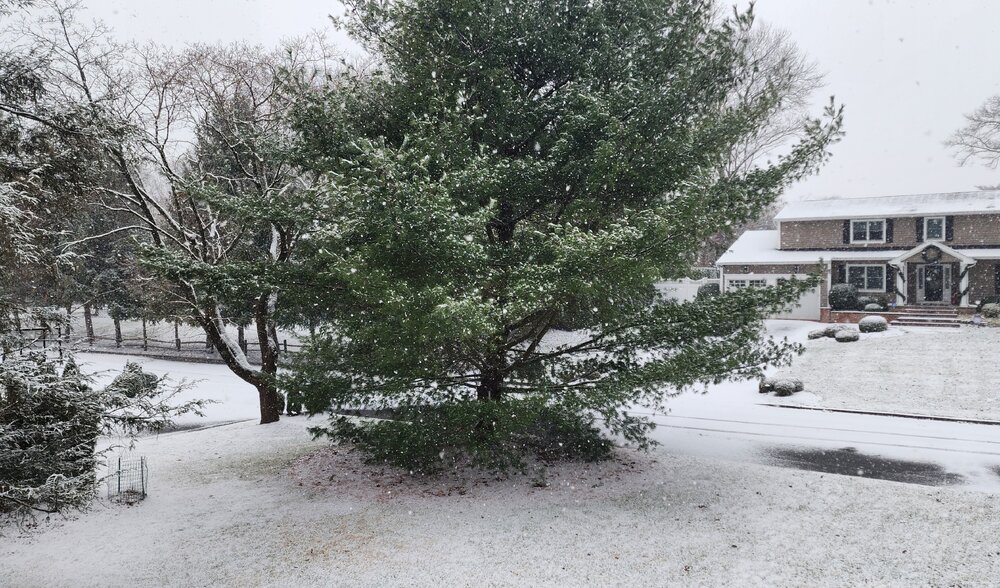
NorthShoreWx replied to wdrag's topic in New York City Metro
2pm North Smithtown