nrgjeff
-
Posts
4,261 -
Joined
-
Last visited
Content Type
Profiles
Blogs
Forums
American Weather
Media Demo
Store
Gallery
Everything posted by nrgjeff
-
I'm trying to keep the faith. I want to think the GFS could score a coup. Until the energy gets onshore, I'm afraid I have to go with the Euro and all that frickin' ice.
-
We need a little help from the Northern stream per the GFS. If Chatty gets that warm nose aloft, without the usual surface push, it's lights out! Dynamic cooling will help those already mostly sleet. No help with the saturated freezing rain soundings. I prefer the GFS for more snow here, but even that's bad for MS/AL.
-
Nah that happened with the +Bz on what could have been the aurora of the half century. Canadian still Quebec 1998s us. Euro isn't as destructive but still a lot of ice. GFS is now getting back into more ice. NWS has the 50/50 odds around I-40 which seems reasonable. Obviously, I'm praying hard for all snow. Yeah the forecast differences are with the two pieces of energy. Does the northern stream block or does the WAA punch through the line? (football metaphor) Southeast Tennessee, we'll definitely take this 12Z GFS. Looks like mostly snow and several inches of it.
-
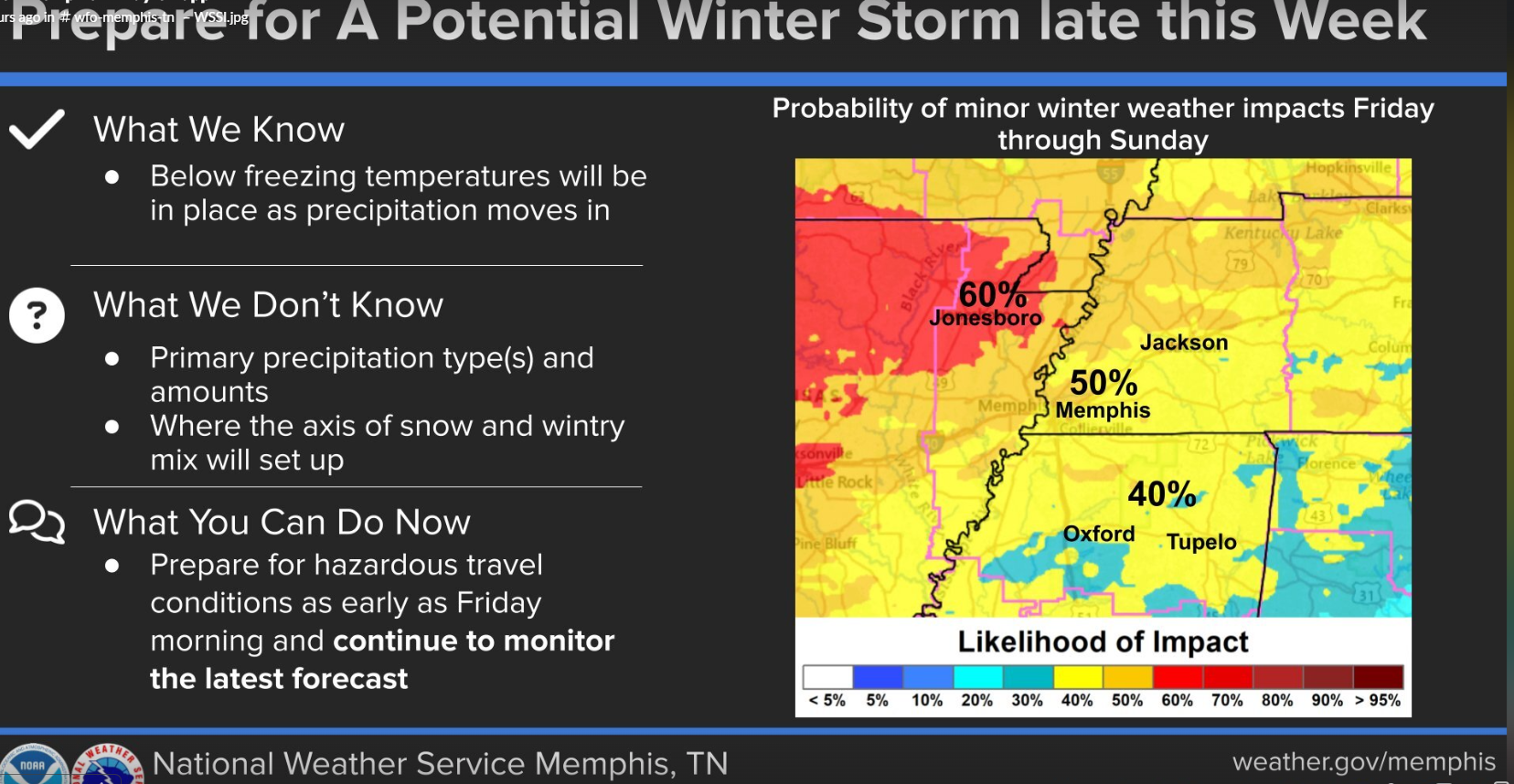
Looks like most NWS offices are up to near 40% chance of moderate impact - in line with the WPC charts above. Impressive that MRX talks like that Day 6. I have to comment on BAMWX. I've heard they are also into natural gas. If one is eager to buy, gotta jawbone the other way to get sellers. See my signature - cynical as hell. One thing I'm not cynical about - this system is very likely going to stay South. Too much cold. Too much HP. Too much trough aloft.
-
From Twister(s), love it! Could be. Anyway I gotta sign off and wrap up a couple things. Cross our fingers for mostly snow.
-
That Euro has ice in southeast Tenn. But probably most of it is snow that run, after dynamic cooling takes hold. Trouble is verbatim it's a half inch ice first. Then probably 6 inches of snow. oof! Yup, see John below, this is thread worthy. We'll especially need a storm thread if we are also talking about the end of the month in this thread.
-
That's the phased Miller A I refer to a few posts ago. Would be a true bomb! But this 12Z Euro is a combo of that HP anchoring and dynamic cooling (for this weekend). These models are a frickin' buffet line!
-
12Z Euro has a little more dynamic cooling of the column to get the change to snow; but, only after still depositing a bunch of ice. Little steps.. but verbatim it's still trouble. In other news Space Wx Prediction Center has a G4 watch for tonight. While staying up all night watching wx models, don't forget to check the northern sky.
-
Right on the MEM public site, front page not experimental. 50% six days out. That's like SPC dropping a Moderate+ Day 3. I'm not one to get the hype train rolling ahead of Day 3, esp not Day 5, but this one is pretty likely. Despite some path differences all the globals are locked in on a major winter storm in the South.

-
Thank you! Yeah all the WFOs have that experimental graphical hazards. It's so damn clunky I rarely look. Perhaps this is the week I change my behavior. Thanks again @jaxjagman My next goal in life is to reel in 3 inches of snow. Not 3 weeks without power!
-
Yeah I don't see it on NWS Chat or by Email. Are they even public? If they are for EMs they must have a new VIP list that doesn't include me, ha! In other news, end of the Canadian is a full latitude double/triple phase classic Miller A bomb!
-
CMC is goin' Quebec 1998 on us. I doubt it'll happen, but the Euro remains concerning. I prefer GFS runs.
-
18Z Roundup. GFS is a nice moderate snow in a couple pieces of energy. Euro remains a crippling ice storm. No Canadian at 18Z but 12Z was ice. Ensembles just blend out everything. We either have a beautiful snow or a Ukraine winter without power.
-
Well the 12Z EC drops a Quebec ice storm on Mississippi and Alabama next weekend. We have a week for it to change. Otherwise MS / AL grid is gonna look as bad as Ukraine's. Guess we'll take natural causes over a terrorist Holodomor, but still..
-
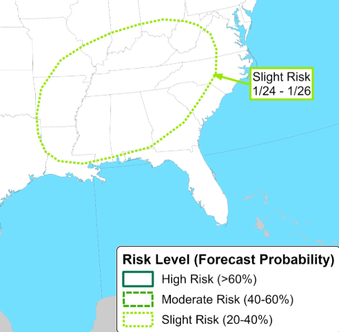
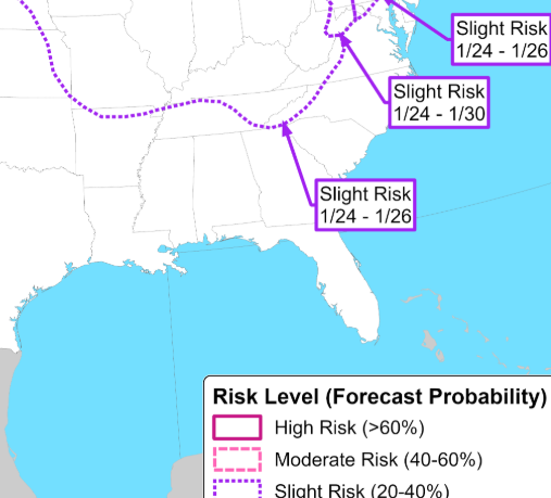
Wow lots of heavy ice forecasts coming out from NWP but thankfully all well out in the extended. We can't have that crap! They are on different days on different models; some north of here, some right on us. If that happens it'll be a huge slap in the face. Other options range from heavy rain to cold and dry. It's beyond Day 7. Of course we hope for all snow.
-
Sometimes the ECMWF acts like he who shall not be named.
-
Life moves pretty fast. -Ferris Bueller Rain Snow
-
I'm punting this weekend locally. Still looks good Plateau and Mountains. End of January modelling just came in significantly colder. Confidence increases on another cold snap. We'll see if we can get a storm, but the cold looks pretty likely.
-
So far I consider AI models other tools in the tool belt. They are not any better at daily forecasting, but they are as good. Just depends on the system and set-up. AI has been known to catch long-range pattern changes first. But when we get to storm mode, they are just other models. Then when we get inside a few days I prefer high resolution stuff. Remind me to avoid the Southeast except the Mountains thread which is pretty good. We need GaWx back in here so I don't have to wander into the SE abyss for his thoughts.
-
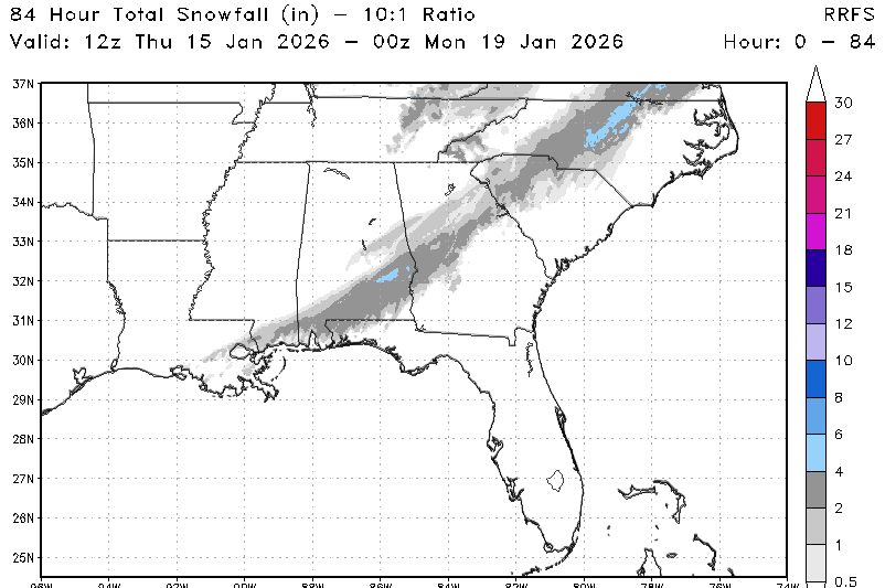
And just like that the 12Z RRFS lines up with the GFS south. (Blanks Chatty.) I think they will get their snow in contrast to the Euro No. Euro might be a higher resolution but some of the GFS code still captures small perturbations. Euro is king of the extended, but we are getting into the time period when the GFS is useful. More granular discussion, RRFS splits the difference between the NAM right up on the Apps and the GFS closer to the coast. RRFS makes sense for a central GA to Piedmont snow. Should I just goto the Southeast forum? Nah, Tennessee still has the Friday night Saturday am snow showers, lol! Plus the Southeast forum is like a Super Walmart on a Saturday afternoon.
-
Wow we got model tracks anywhere from buried near the Gulf Coast and marginal temps, to almost up to Chattanooga and plenty cold enough. 06Z RRFS has a couple inches at KCHA - a 60% hatched risk for major disappointment. Truth may be somewhere in between. I'd be happy for those in central GA central SC, and the NC Piedmont. Maybe their groaning would subside for a couple weeks, lol!
-
I'll take Spann 100X there. Though I feel like that AI version was too beefy for Tenn. Spann has been amazing through the past week. Anyway this late weekend event looks like it'll satisfy some Southeast weenies. We'll see what the initial waves bring for Tenn. Probably the usual Upper Plateau, Mountains and a few spots north of I-40 east of the Plateau. ' Chattanooga can pretty much forget about it! Maybe some flurries but nothing will stick in town.
-
Well the Euro didn't cooperate. Ukie somewhat. Icon No. Should be good skiing in the mountains both TN and NC. I've lost interest in much else. I'll be back tomorrow though.
-

When was this hurricane photo taken?
nrgjeff replied to CurlyHeadBarrett's topic in Outdoor and Weather Photography
Floyd popped into my mind with the satellite resolution. Floyd was supposed to bring Armageddon from Florida to Maine. Biggest hype storm ever up to that point. It did real damage to the Carolinas, but it did not end the entire East Coast. -
for the weekend: Canadian indeed pushes more chips onto the table. Setting up for disappointment in southeast Tenn. It's like after a blown save (good GFS a few days ago) you get a couple baserunners, but it's two outs so I'm not hopeful.