cleetussnow
-
Posts
3,129 -
Joined
-
Last visited
Content Type
Profiles
Blogs
Forums
American Weather
Media Demo
Store
Gallery
Everything posted by cleetussnow
-
And that is how you spell an anomaly, which a top ten cold month is.
-
We haven’t, but places in the western US certainly have. Our time will come
-
Kinda looks like a washout. Sucks
-

July has arrived ... the Meteorologically defined mid summer month
cleetussnow replied to Typhoon Tip's topic in New England
My wife had a deer situation in Chappaqua NY last year. A bunch of cars were stopped on a road and traffic was stopped. My wife noticed a deer lying down in front of the first car, clearly hurt bad. Everyone from the cars were looking at the deer and paralyzed with fear about what to do. She asked someone if they had a knife, and some guy produced one, and she proceeded to cut the deer's throat and put it out of its misery on the spot. The horror in the eyes of the Chappaqua-ites! For context, my wife is a school teacher, Bio, Chem, and Forensics, and her parents are both veterinariens. I also gave her her own deer-slaying knife. -
Yucca was about to open in the mid 2000s then got spiked for environmental reasons. I guess it was built on a fault line. In the meantime, the waste material from Indian Point for example is stored at Indian Point, also on a fault line. All nuclear power plants in the US store their waste on site which will be the case essentially for everyone's lifetime who are posting here now. There is no solution for the waste. NYC traded Indian Point power for a damn project power plant in Canada and we are reliant ~20% on that now. This is great, except the waste is still there on the fault. Doesn't make a lot of sense to me. Anyway, NYC is plugged in via extension cord under Lake George to our grid. The Indians in the area of the damn claim the waters as some kind of ancestral lands, and there are already court cases about the project and water flow, and the native fish that the damn disturbs. Its just a matter of time before that gets shut down IMO and NY will not have a plan if the courts go against the project. We have a lot of natural gas in this state, but we won't tap it. Hell, it's illegal to add a natural gas line to a home that doesn't already have one in my county. So I have to use electric for my stove and my furnace is oil. I have few options. I think this is a way to ensure the NY power projects get more business $$$ from electric heavy appliances as opposed to some environmental concern. Otherwise oil furnaces would be banned. Oil furnaces in new construction is a thing here.
-
My town is under a state of emergency due to flooding, north of HPN.
-
We saw he show from the lower hudson valley. We were hoping to see a sunset but got the lightening instead
-
The only reason I am optimistic for the upcoming winter is because its the only winter we are getting this year.
-
Yes weatherwise, and also winter isn’t ruined yet. There is still hope for snow unlike January when everyone has chucked in the towel at least once already.
-
Should have stated it's a theory - I don't know either if it is true or not.
-
The coup was a sham: Wagner forces moved out of the lines in the south -> toward Moscow -> then WEST toward KYIV and are now located north of KYIV. This movement of a very large and dangerous force was done quickly, unmolested, and informationally safe under the cover the 'rebellion.' I'll note here that the Wagner forces were not obliterated in an airstrike while they were sitting ducks on a highway. The movement was too easy. The idea that Putin is weak is propagated witlessly in the media and possibly within Western intelligence services (unless they are playing along to protect their own thinking). Rather Putin has moved a set piece in a masterstroke and is firmly in command of the situation. Did Ukraine fall for it? Are they prepared to defend KYIV? Did they pull reserves from the south to cover the flank during this crisis? Hmmm....time will tell.
-
Maybe no other army leaders went along (who said they would) with the rebellion and Wagner group was alone. For self preservation, Prighozen backed down. Happens in these putsch situations. People talk tough then get cold feet. Perhaps Prighozen will turn in the reluctant generals to Putin?
-
Nevermind the coup is over.
-
This is the third putsch in russia in my lifetime. The record of success is ‘mixed’ If this one works out, I wonder if Putin heads to exile as a guest of Ji Jinping. Maybe not. Ji would not want the hassle. He will be hard at work trying to secure relations with whoever the new boss is. As a sidenote, Belarus just became a nuclear power. This matters since I bet the brush fire spreads there and who knows what that asshole will do, especially if Putin exiles there. Lots off things to contemplate, including Putin holding on. He will be vicious in his reprisal campaign. If people take to the streets its ova for Putin. I doubt a Tiananmen replay at red square.
-
It is….in the climate forum.
-
Lightening struck my neighbors cherry tree 3 yrs ago. It a barrel 6 feet in diameter. Split it to the roots. I was in my home office and it sounded and felt like a bomb went off. Shook my house. I looked and saw half of it falling to the ground. Tree was detonated. I have stacks of it still - we split it up and divided it among the helpers. I do not remember seeing anything blackened. Could have done, but I didnt see it.
-
Extended summer stormlover74 future snow hole banter thread 23
cleetussnow replied to BxEngine's topic in New York City Metro
Not baltimore -
suns out
-
at least you can see the sun now.
-
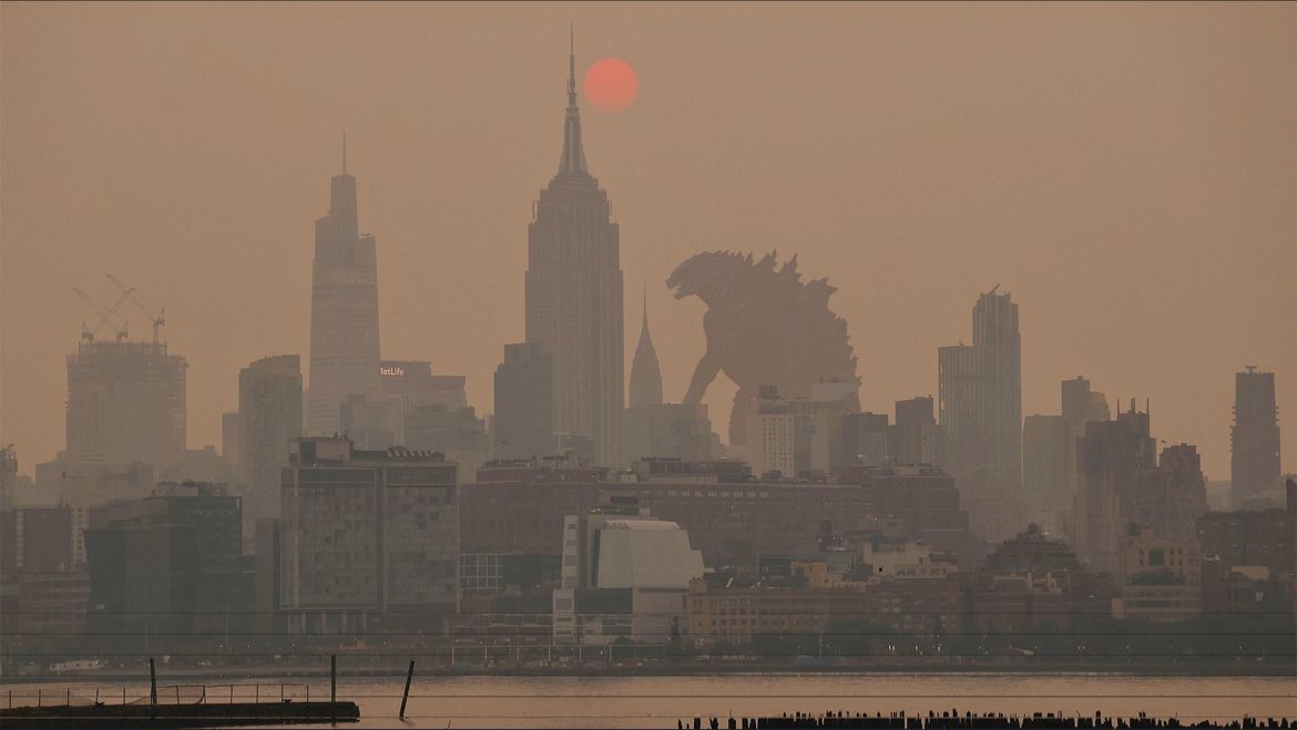
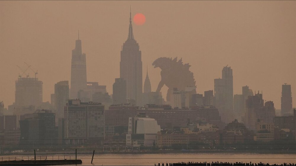
NYCs air is worse than the air in Toronto - which is in the country that is on fire. Dang. I keep thinking about like Chernobyl or something where there is a radiological disaster, and this is how the radiation would propagate, only you could not see it or smell it.
-
It would never be snow next, I can assure you of that.
-
I got pea size hail from it.
-
I got hail. pea size hail rn.
-
Wind really whipped up here in Westchester. I can see dark clouds to my northeast and have been hearing thunder from the same direction. I probably just experienced about a 35 MPH gust.
-
NWS issued a SWS, said ping pong hail and 60 MPH winds here. Saw neither but we had a few boomers and flashes. Its all past HPN heading south. more later looks like.