

SnoSki14
-
Posts
16,212 -
Joined
-
Last visited
Content Type
Profiles
Blogs
Forums
American Weather
Media Demo
Store
Gallery
Everything posted by SnoSki14
-
Surprised no one's talking about this. Really nice western ridge ahead of this with cold supply in the east Classic phase change in the tellies as well. -NAO/AO rising, + PNA
-
Maybe but the reports back up those warnings.
-
Some Thoughts on the Winter 2021-22 Outlook
SnoSki14 replied to OHweather's topic in Weather Forecasting and Discussion
He's going to say snowless torchy winter ever year. It's like JB saying cold, snowy winter every season. Eventually they'll end up correct though JB less so given today's climate. I suppose this year has more potential to go wrong than other years. A warm 11/12 style winter wouldn't surprise me given how much negatives there are to overcome. -
I feel like the northeast is about to become a secondary tornado alley in several years. I still couldn't believe the look & strength of the tornadoes in NJ this summer.
-
Yeah really.
-
Models will correct colder as we get closer to December. Active pacific jet is muddling the model data. The run to run model shifts are jarring and anyone thinking the forecast is set in stone is fooling themselves. So far the Nina has remained coupled.
-
That PNA rise is big. Hopefully it stays on the models.
-
At least the Alaskan vortex goes away. Looks like a gradient pattern.
-
Are you waiting till your house says 50F
-
Meh we always get 70s in November. Nothing special. Maybe if it was 80F
-
We'll need some western ridging otherwise it won't be great. Atlantic blocking is a must otherwise it'll look like 2001. It's gonna be another tough year with models I think.
-
Must be a concrete jungle. We've had multiple freezes already in central NJ and seen 20s at least twice.
-
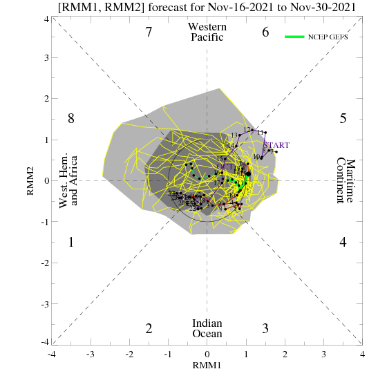
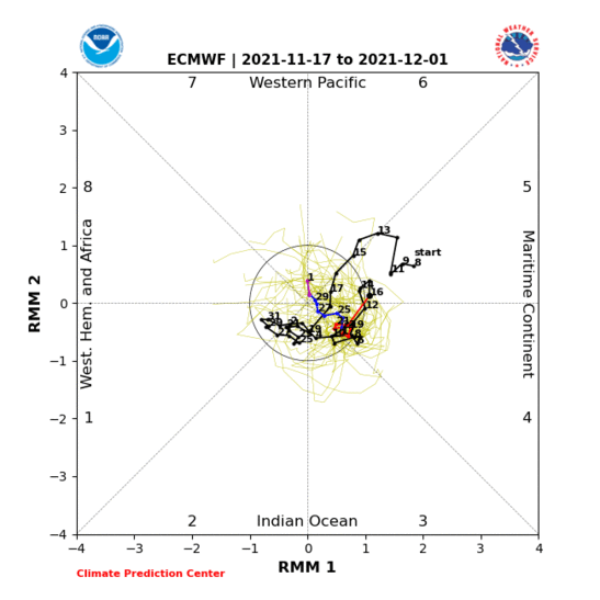
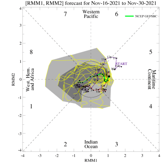
Did he even look at the MJO forecasts. Majority show the MJO going to 7-1
-
Down to 29F, tied for coldest night so far this season. Should get a little bit lower before things moderate.
-
What a bizarre scenario this would be. Reminds me of that 2010 storm where we snowed and SNE rained
-
Source region is cold despite +EPO You don't need Arctic air for snow. Blocking showing up late November into December is great for snow chances. You do want some spikes in western ridging though. A +EPO with a western trough is no bueno.
-
Models seeing the -NAO is a very good sign though. That'll guarantee some snowy chances at least.
-
Yeah it's a nice look. Love how's it's been trending in that direction too.
-
See you during the next warm-up
-
He's like the anti-JB. He'll post anything to force a warm/snow-free winter narrative. But sure if you go warm/snow-free every winter you'll be right eventually and yes pretty much any winter these days will be AN temp wise...no big surprise there.
-
Big gusts coming in last half hour near Somerset
-
Nickel sized hail for me. Never seen this before
-
Looking to see how warm we get ahead of this. Usually warmer temps imply stronger mixing. Already 59F
-
Important to watch the western US. You could have lower pressures near Alaska and still get cold if there's ridging out west. You'll rarely get a good pacific in a Nina but PNA could still pop from time to time.
-
Yeah the source region looks pretty cold for latter November into December. That automatically makes it more likely that some of that cold will drain south. Personally I would bet on a near normal if not colder early winter.


