Ephesians2
-
Posts
584 -
Joined
Content Type
Profiles
Blogs
Forums
American Weather
Media Demo
Store
Gallery
Everything posted by Ephesians2
-
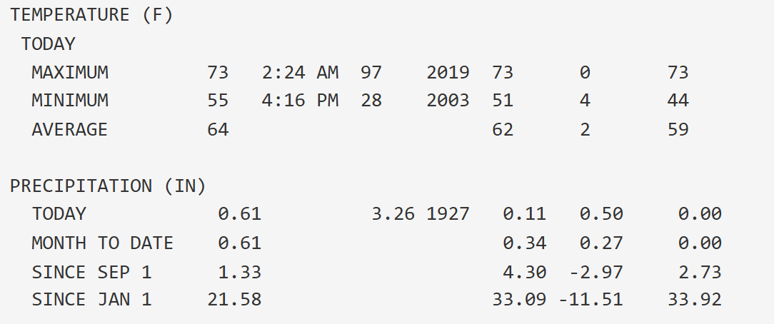
About 12 inches below normal precip YTD and still in D2 down here. Hopefully this knocks about 2 inches or so off the deficit. It is awfully dry in a lot of places.
-

2026-2027 Record-breaking El Nino
Ephesians2 replied to Stormchaserchuck1's topic in Weather Forecasting and Discussion
-
I'll take it.
-
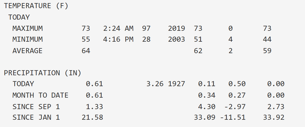
Not off to a good start. NWS forecast for "a half to three quarters of an inch" overnight - actually still completely dry. Month to date precip? 0.3".
-
2026-2027 Record-breaking El Nino
Ephesians2 replied to Stormchaserchuck1's topic in Weather Forecasting and Discussion
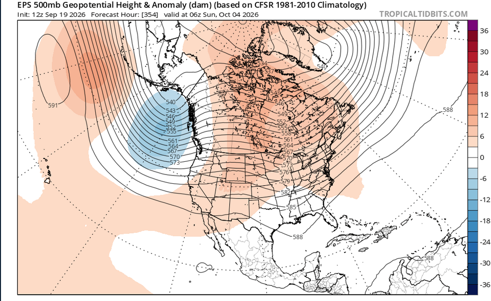
The Eternal Nina of 2016-2026 continues.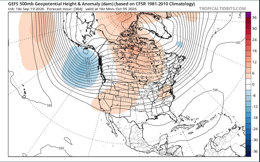
-
2026-2027 Record-breaking El Nino
Ephesians2 replied to Stormchaserchuck1's topic in Weather Forecasting and Discussion
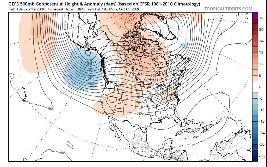
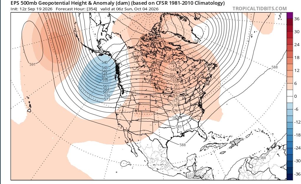
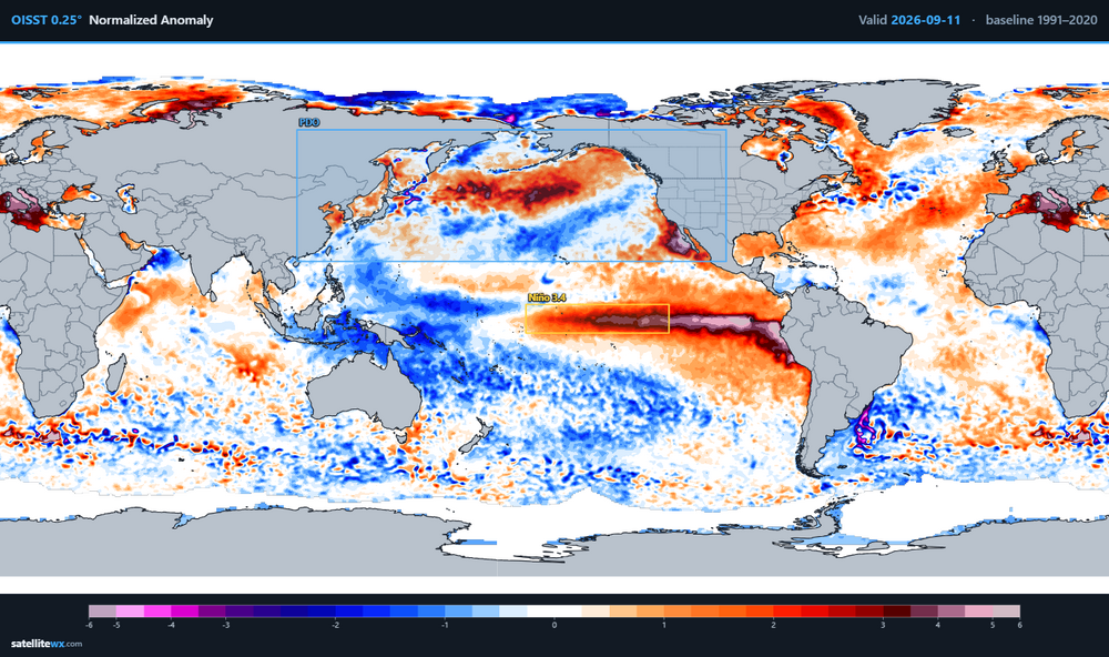
is that ridge south of the aleutians a nino pattern? -
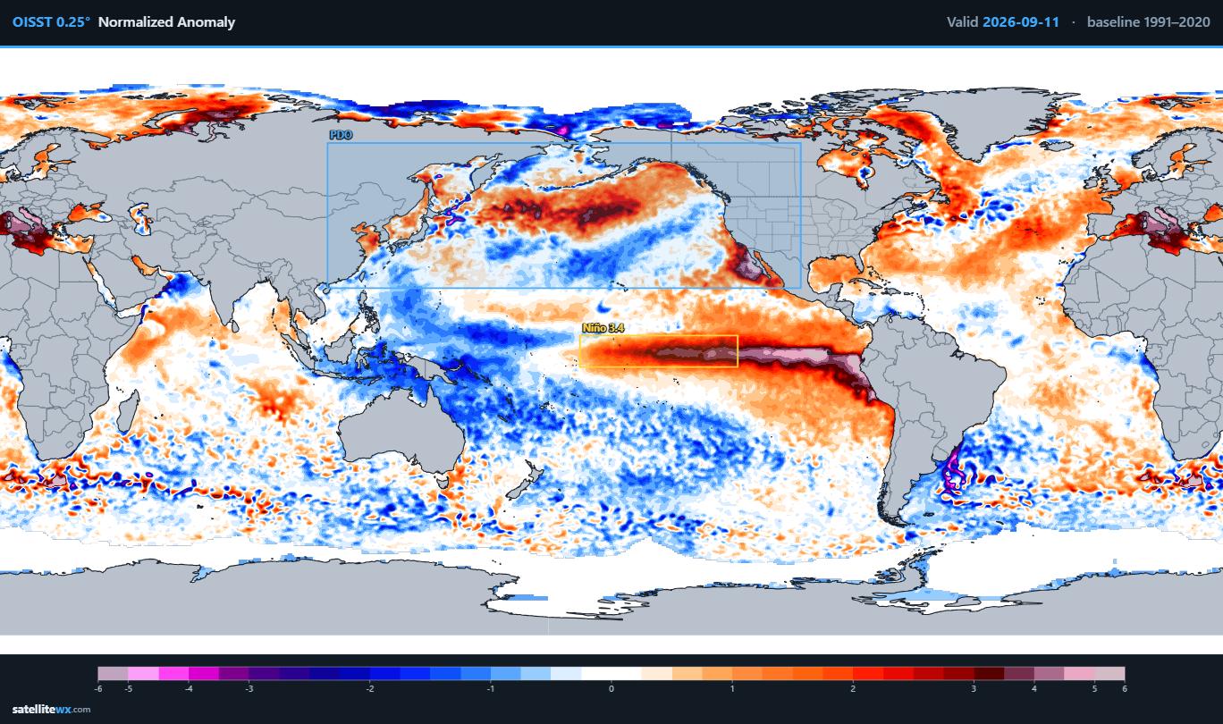
already pretty neutral looking, we'll almost certainly have a positve PDO by November/December. We also got a pretty good pacific pattern the last two winters even with Nina/-PDO
-
2026-2027 Record-breaking El Nino
Ephesians2 replied to Stormchaserchuck1's topic in Weather Forecasting and Discussion
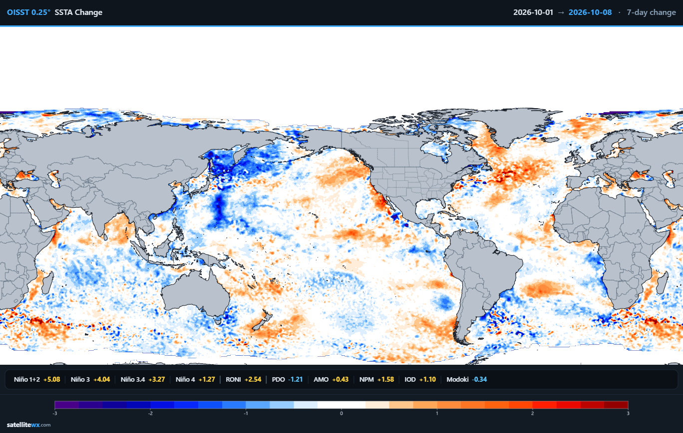
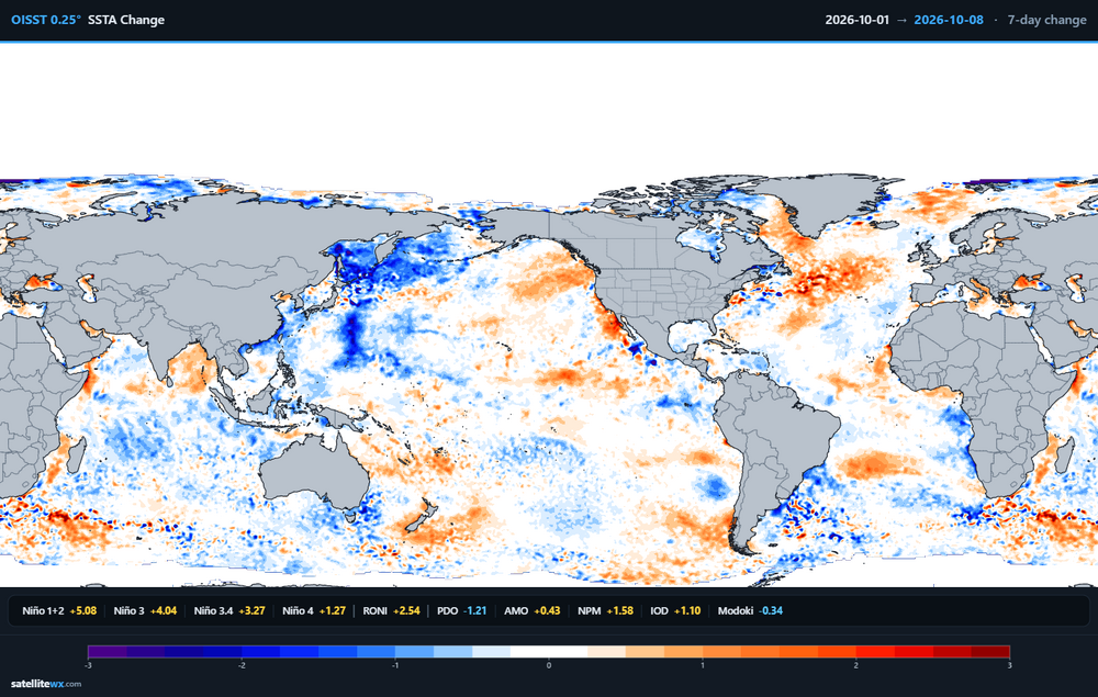
The warm pool definitely isn't as extreme as it was a month ago -
2026-2027 Record-breaking El Nino
Ephesians2 replied to Stormchaserchuck1's topic in Weather Forecasting and Discussion
Not sure what you mean. It's part of the -PDO that has been around for years and was why 2023-24 was so weird. Hopefully we see that warm blob actually break down into the fall. -
2026-2027 Record-breaking El Nino
Ephesians2 replied to Stormchaserchuck1's topic in Weather Forecasting and Discussion
If you really squint you can see the warmth around Japan dissipating a bit -
Is that ridge from NW of Hawaii to Japan normal for a Nino? Or is that due to the PDO and really warm water in that area?
-
Enjoy https://www.instagram.com/reel/DcRGIBvuVJ_/?igsi=MXpwNDJyOTdid3c5
-
2026-2027 Record-breaking El Nino
Ephesians2 replied to Stormchaserchuck1's topic in Weather Forecasting and Discussion
implies a bad Pacific, which I think is more likely than not unless the PDO reverses -
Sorry, I meant underperformed based on what would expect if you were given the 500mb composite in advance, not expectations. Bad patterns were total shutouts and mediocre patterns became bad winters. 2018-19 is the only one that I think "luck" might have been in our favor - the Pacific was awful that year.
-
I think there's been a lot of "bad luck" the last few winters. Relative to what you'd expect with the overall pattern: 2017-18: underperformed (Dec and Jan produced very little for most of the forum) 2018-19: near expected 2020-21: MAJOR underperformance for most of the forum. 2021-22: near expected 2023-24: near expected 2024-25: slightly underperformed 2025-26: underperformed 2016-17, 19-20, and 22-23 were all awful seasonal patterns but you could argue they underperformed because they could have been like 4-8 inch seasonal totals, not total shutouts. Like even 2011-12 had a 7 inch fluke storm down here that missed DC. Hopefully we finally get the flukes to break in our favor this winter.
-
2026-2027 Record-breaking El Nino
Ephesians2 replied to Stormchaserchuck1's topic in Weather Forecasting and Discussion
-
2026 Mid-Atlantic Severe Storm General Discussion
Ephesians2 replied to Kmlwx's topic in Mid Atlantic
Charlottesville is the storm magnet this month. Seems like every time I check the radar to see if I am finally getting rain down here, there is a cell over Charlottesville.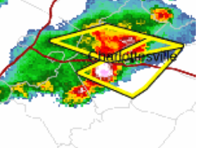
- 2,562 replies
-
- 1
-

-
- severe
- thunderstorms
- (and 7 more)
-
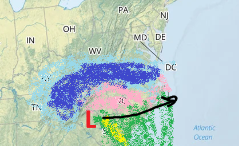
**evil laughter**
-
2026-2027 Record-breaking El Nino
Ephesians2 replied to Stormchaserchuck1's topic in Weather Forecasting and Discussion
2024 was too weak to overcome the nina/-PDO base state. my gut feeling is warm too, but not in the way 2024 was, when we had almost a nina-like pacific pattern. that winter wasn't that wet in the MA/SE either. -
You guys did well in 1997-98 if I recall. I would definitely rather have some elevation this winter.
-
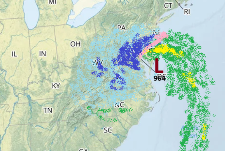
It's coming.
-
2026-2027 Record-breaking El Nino
Ephesians2 replied to Stormchaserchuck1's topic in Weather Forecasting and Discussion
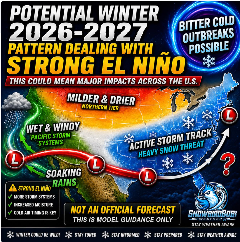
This is literally the same outlook everyone posts on youtube every single year. Not to mention - I'm trying to figure out why the northern plains are "Polar Vortex", the Rockies are snowy, the Midwest is "Arctic Blasts", the southern plains into the southeast is the ever-present "Battle Zone" --- but the mild corner is specifically most of Kansas and Nebraska, a fourth of Iowa, and half of Missouri. What pattern would produce that? I'm not sure. Perhaps somewhere had to be mild. -
2026-2027 Record-breaking El Nino
Ephesians2 replied to Stormchaserchuck1's topic in Weather Forecasting and Discussion
Ah yes, "Heavy Snow Threat" in Orlando. Thanks, AI slop.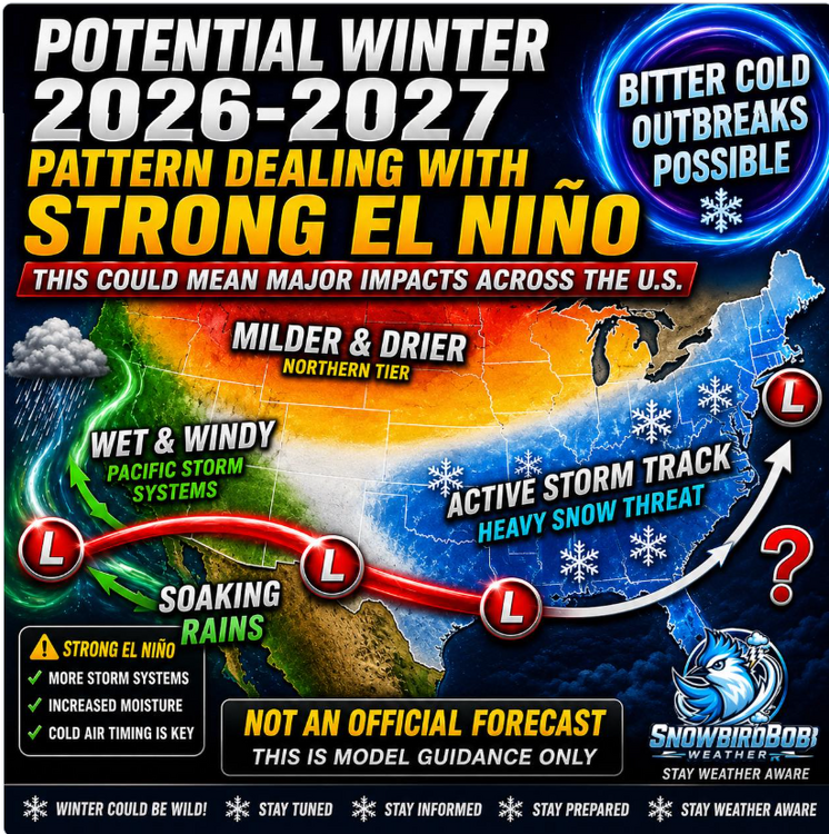
-
Big Heat (and storms?) Week into July 4th Weekend
Ephesians2 replied to yoda's topic in Mid Atlantic
94/72 in Lynchburg, VA. The airport tends to run low, still at 91. I'm curious if we will have our first 100 degree day since 2012. Point and click had 100, 101, and 102, but we don't do extreme heat well due to our elevation and lack of a real UHI leading to cooler nighttime temperatures (70 this morning).