Ephesians2
-
Posts
559 -
Joined
Content Type
Profiles
Blogs
Forums
American Weather
Media Demo
Store
Gallery
Everything posted by Ephesians2
-
Well, it would probably double most people's snow climo, right... ?

-
Pretty much all done with the snow/sleet pack down here.
-
 With such a small sample size I doubt there's much of a relationship here. Does the first image look much different from a Nino composite?
 -
Richmond Metro/Hampton Roads Area Discussion
Ephesians2 replied to RIC Airport's topic in Mid Atlantic
I just want 2-4" of wet snow, the kind that sticks to all the trees, and we can call it a winter. I had three separate "Trace" events this past week, plus the 0.2" last weekend. Overall it's been a pretty good winter though. -
Richmond Metro/Hampton Roads Area Discussion
Ephesians2 replied to RIC Airport's topic in Mid Atlantic
06z NAM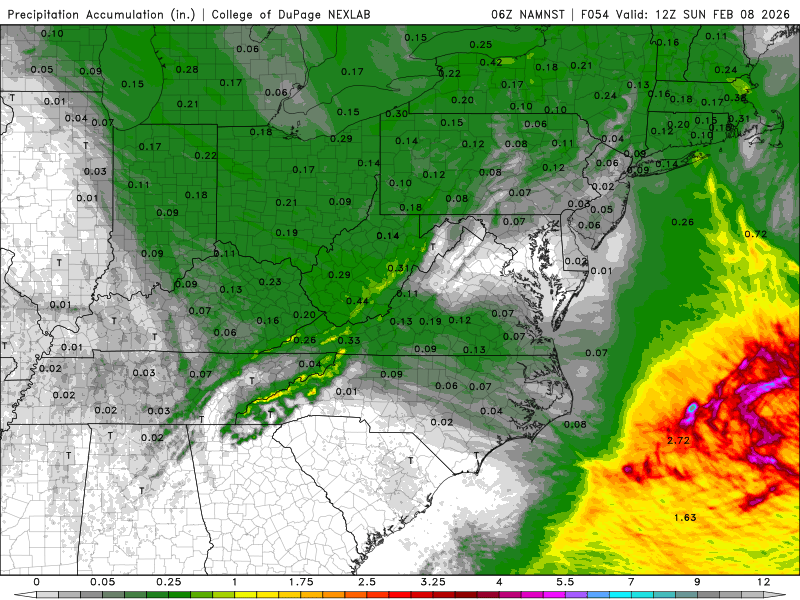
-
Richmond Metro/Hampton Roads Area Discussion
Ephesians2 replied to RIC Airport's topic in Mid Atlantic
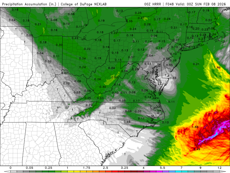
Yeah models are looking surprisingly decent for tomorrow for Central VA. Both NAM and HRRR have at least 0.10" QPF. Might be nice for areas that missed out on the last two threats -
Richmond Metro/Hampton Roads Area Discussion
Ephesians2 replied to RIC Airport's topic in Mid Atlantic
-
I got a trace of sleet on the sidewalk overnight
-
now all rain
-
started as sleet here in Lynchburg a few minutes ago, 35 degrees
-
Anyone have the 18z Euro/Euro AI?
-
Richmond Metro/Hampton Roads Area Discussion
Ephesians2 replied to RIC Airport's topic in Mid Atlantic
Yeah the follow up wave is our only shot at our latitude This is the type of thing that can trend north and juice up in the short-medium range, though, imo. Might get a 1-3" deal out of it. -
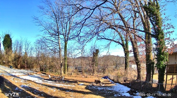
01.31.2026 - 0.2" Total 12.7"
-
The Jan 31 Potential: Stormtracker Failure or 'Tracker Trouncing
Ephesians2 replied to stormtracker's topic in Mid Atlantic
reports of 6-12 inches just 50 miles to my south current total: 0.2" oh well I was so close -
Richmond Metro/Hampton Roads Area Discussion
Ephesians2 replied to RIC Airport's topic in Mid Atlantic
yeah, but just barely. it's actually been snowing at incredibly slow rates since about 7:00 this morning. Only a dusting though, it's just been that dry. -
Richmond Metro/Hampton Roads Area Discussion
Ephesians2 replied to RIC Airport's topic in Mid Atlantic
yeah... we were so close now watch whatever happens middle of next week be a DC-Baltimore special and miss us by the same amount to the north at least we got the December events! -
Richmond Metro/Hampton Roads Area Discussion
Ephesians2 replied to RIC Airport's topic in Mid Atlantic
Yes, slightly so. Not what we need in Central VA but it is so, so close. -
Richmond Metro/Hampton Roads Area Discussion
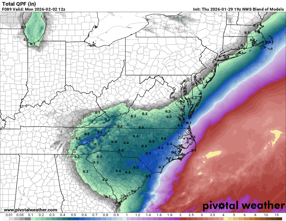
Ephesians2 replied to RIC Airport's topic in Mid Atlantic
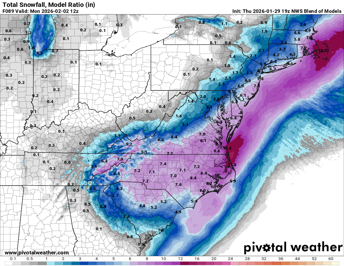
For RIC it has 7" of snow on 0.2" precip But where it is REALLY broken is along the northwest fringe, as you can see there is basically no QPF but the NBM is still showing accumulating snow.
-
Richmond Metro/Hampton Roads Area Discussion
Ephesians2 replied to RIC Airport's topic in Mid Atlantic
the NBM is unfortunately broken. its ratios are wildly overstated - I know there have been discussions of 15-20:1 ratios, but the ratios the NBM uses at least on the weatherbell maps are like 40:1, 50:1, or even more in some situations -
Richmond Metro/Hampton Roads Area Discussion
Ephesians2 replied to RIC Airport's topic in Mid Atlantic
It's trended NW a bit with the upper low. the problem is we have other features trending in the wrong direction -
It would seem like suppression is not the concern if that depiction holds. This week we have a strong PNA ridge. Not the case in that map.
-
Richmond Metro/Hampton Roads Area Discussion
Ephesians2 replied to RIC Airport's topic in Mid Atlantic
We are so close in Central VA to either a near total whiff or a widespread warning level event. -
Richmond Metro/Hampton Roads Area Discussion
Ephesians2 replied to RIC Airport's topic in Mid Atlantic
Yeah we have three different surface lows on the GFS. Really weird depiction that robs a lot of moisture. Despite a bit of improvement at 500mb its going to be about the same as 06z with respect to snow -
Richmond Metro/Hampton Roads Area Discussion
Ephesians2 replied to RIC Airport's topic in Mid Atlantic
At 36h the GFS is a tick west at 500mb. If the CAMs are right about this second Bermuda low it won't matter. But worth noting -
Richmond Metro/Hampton Roads Area Discussion
Ephesians2 replied to RIC Airport's topic in Mid Atlantic
RGEM trending in the wrong direction. Drier, more progressive.