Ephesians2
-
Posts
559 -
Joined
Content Type
Profiles
Blogs
Forums
American Weather
Media Demo
Store
Gallery
Everything posted by Ephesians2
-

Richmond Metro/Hampton Roads Area Discussion
Ephesians2 replied to RIC Airport's topic in Mid Atlantic
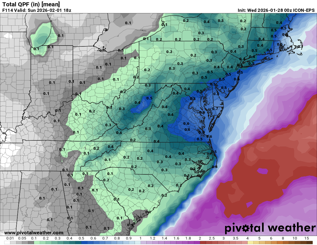
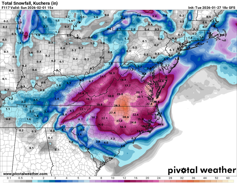
It's more the ratios. The NBM is broken with respect to the ratios - the QPF would be better to look at. I saw in the Mid Atlantic forum that some areas had 40:1 ratios. -
The Jan 31 Potential: Stormtracker Failure or 'Tracker Trouncing
Ephesians2 replied to stormtracker's topic in Mid Atlantic
12z GEFS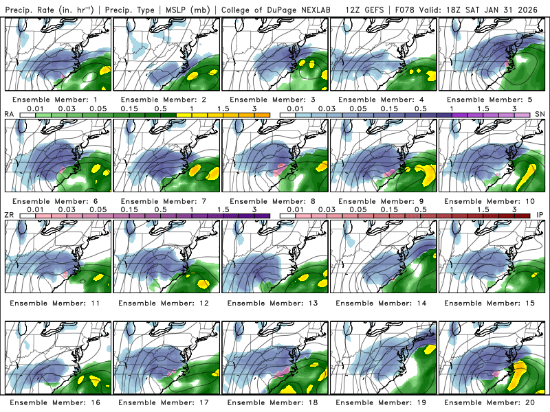
-
The Jan 31 Potential: Stormtracker Failure or 'Tracker Trouncing
Ephesians2 replied to stormtracker's topic in Mid Atlantic
within striking distance
-
The Jan 31 Potential: Stormtracker Failure or 'Tracker Trouncing
Ephesians2 replied to stormtracker's topic in Mid Atlantic
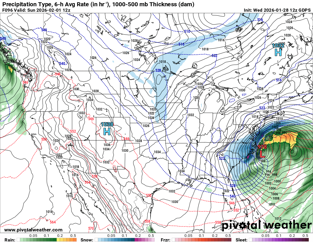
At 90h the northern extent of the snow is EZF compared to Hampton Roads on the 00z run -
The Jan 31 Potential: Stormtracker Failure or 'Tracker Trouncing
Ephesians2 replied to stormtracker's topic in Mid Atlantic
CMC at 84h - a bit west and more negatively tilted compared to 00z still has the two surface lows idea but the one on the coast is stronger compared to 00z and the one offshore is weaker precip shield is slightly NW of 00z -
Richmond Metro/Hampton Roads Area Discussion
Ephesians2 replied to RIC Airport's topic in Mid Atlantic
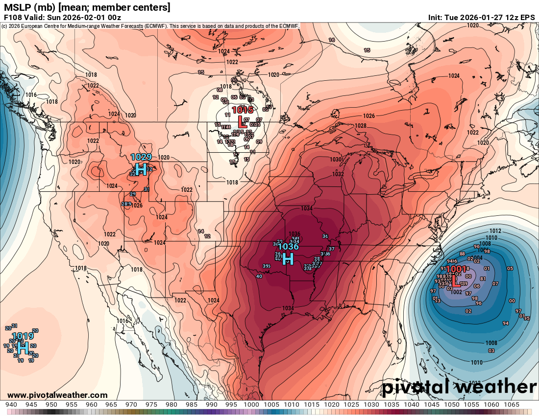
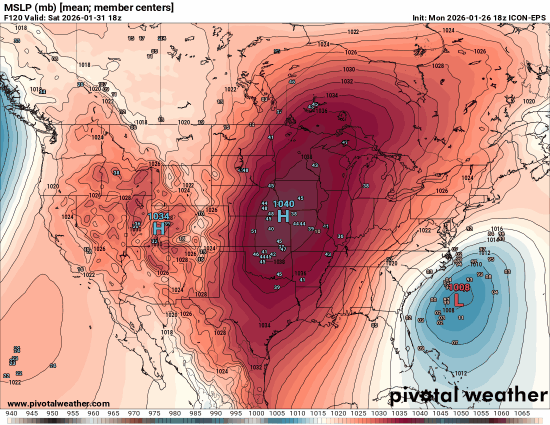
Closed low over the TN Valley PNA ridge centered around Boise West based NAO block
-
Richmond Metro/Hampton Roads Area Discussion
Ephesians2 replied to RIC Airport's topic in Mid Atlantic
00z GFS will be at least a hold -
The Jan 31 Potential: Stormtracker Failure or 'Tracker Trouncing
Ephesians2 replied to stormtracker's topic in Mid Atlantic
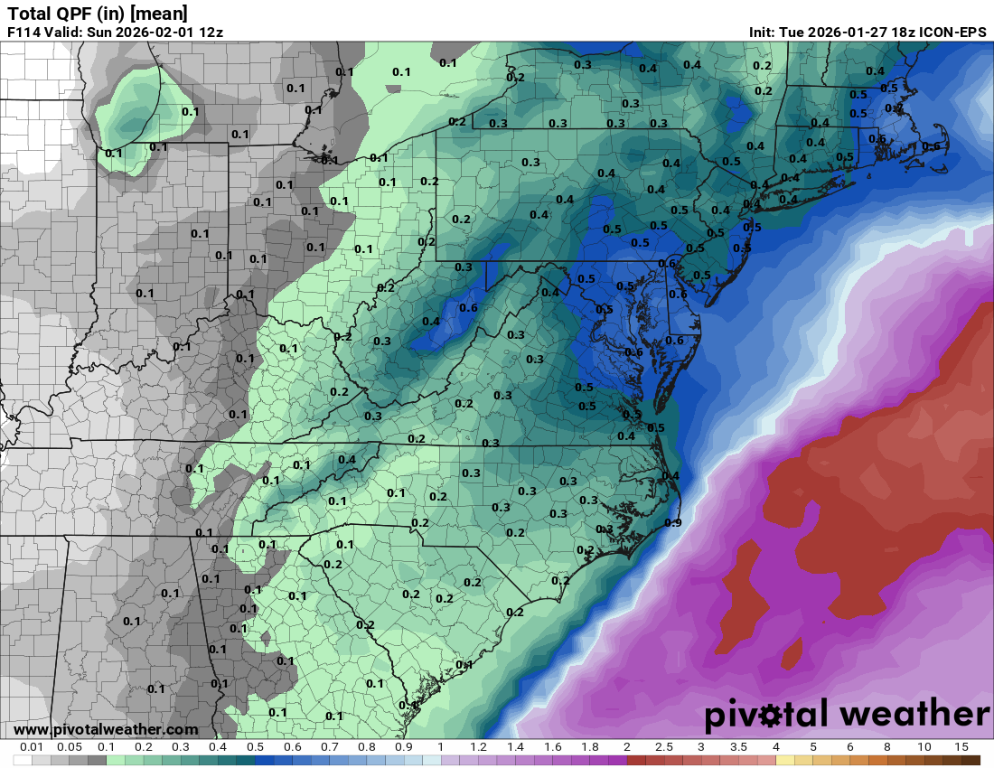
here is mean QPF and individual members it looks like there are fewer big hits in the individual members compared to 18z but QPF actually ticked up a bit on the mean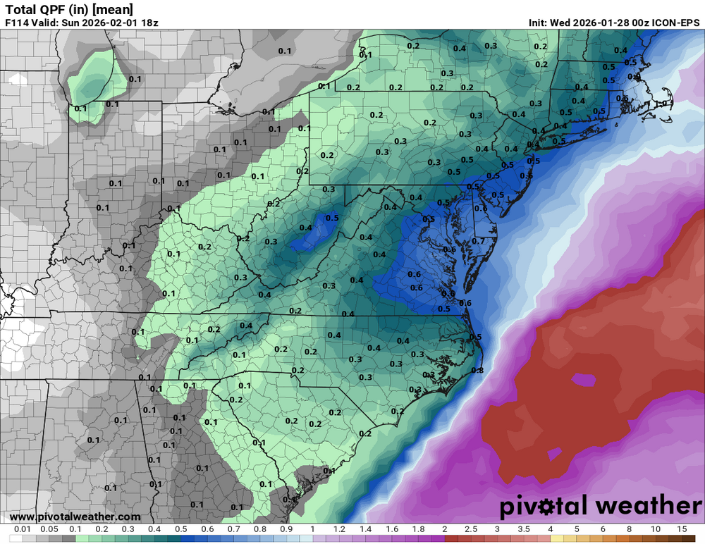
-
The Jan 31 Potential: Stormtracker Failure or 'Tracker Trouncing
Ephesians2 replied to stormtracker's topic in Mid Atlantic
So at 72h... the RGEM looks even further west with the NS energy than even the GFS/NAM EDIT: it is flatter in front though
-
The Jan 31 Potential: Stormtracker Failure or 'Tracker Trouncing
Ephesians2 replied to stormtracker's topic in Mid Atlantic
Yeah at 72h it is definitely east of its last run -
The Jan 31 Potential: Stormtracker Failure or 'Tracker Trouncing
Ephesians2 replied to stormtracker's topic in Mid Atlantic
light snow breaking out in the southern half of the forum on 00z NAM 75h... -
I think there's a reason why model verification scores are based on 500mb, not surface depictions. That just wouldn't happen IRL.
-
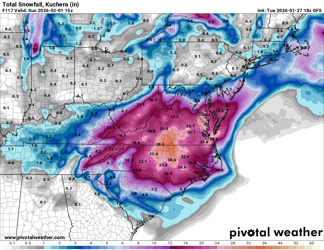
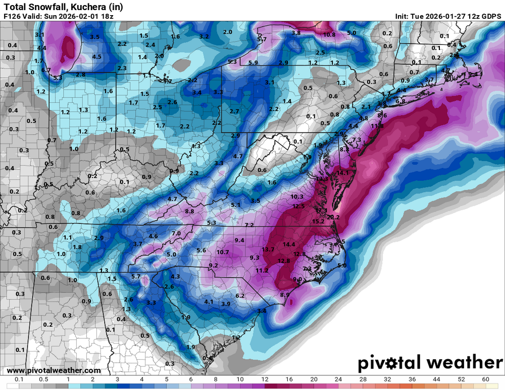
If it actually did play out in the way the GFS advertises, it would seem to me like it would trend north, and the DC/Maryland people would get 18-24" while Richmond to MBY gets 8-12" Just climo.
-
Snow map is basically identical to 12z
-
even more negatively tilted than 12z
-
Yeah it has some BIG hits mixed in...

-
FWIW... the ICON ensemble has a noticeably larger number of lows along the coast compared to 12z. Not sure it follows the op's idea of splitting the energy.
-
the #1 rule of looking at model trends: The trends I like will continue. The trends I don't like are flukes.
-
That's from 12z NAM Not like it matters, but 18z NAM looks east in its fantasy range
-
It is more consolidated which is what we would expect. At this range I think they tend to follow the op
-
Not what we need but it's improved from 06z and 00z.
-
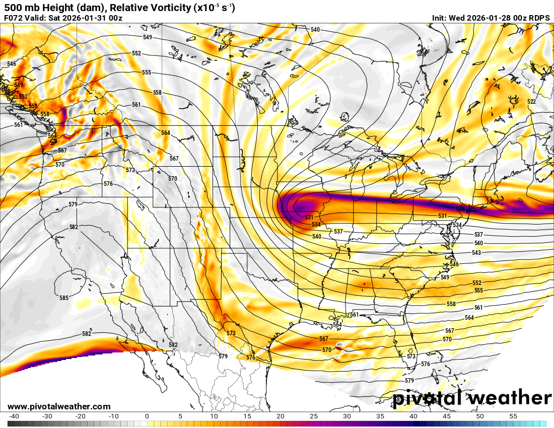
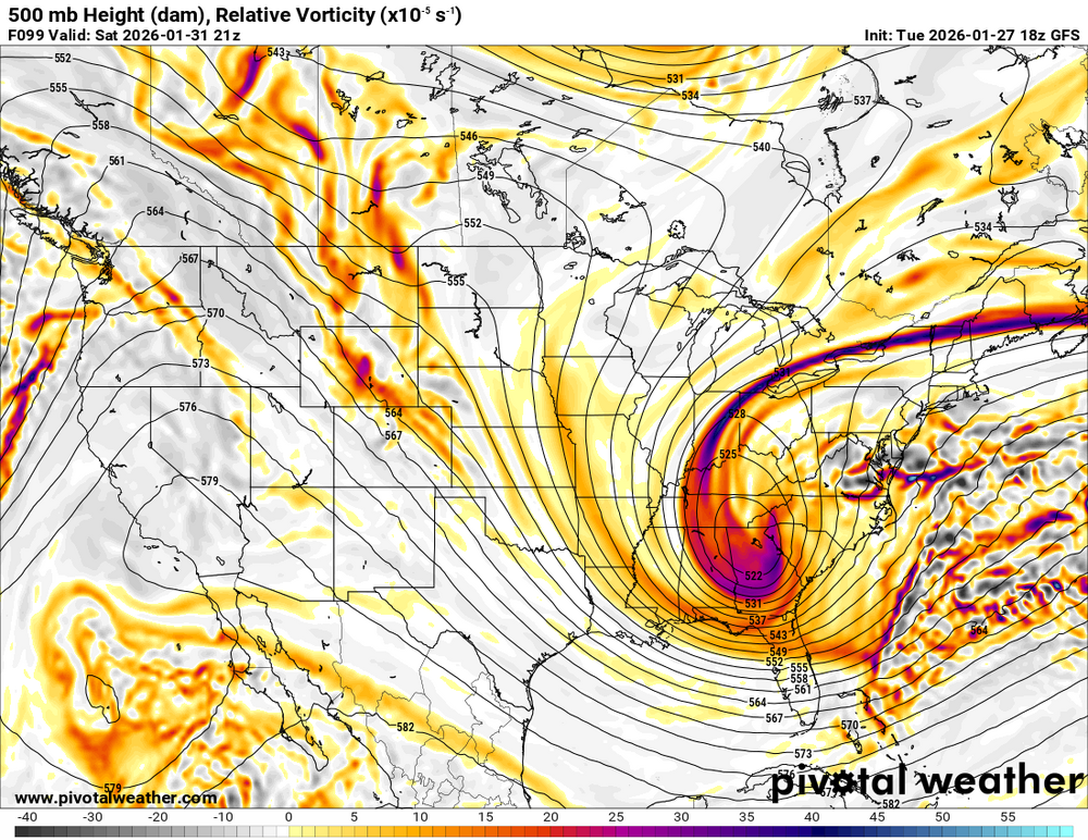
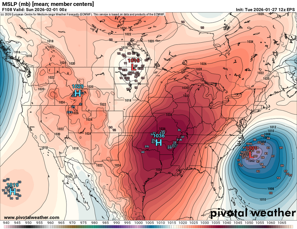
EPS mean a bit west of 12z with the 500mb low at 102h. Looks more amped too.
-
Looking at 108h on the 12z Euro, I see: - surface low 100 miles west of 06z - 996 mb on the 12z, 1004 mb on the 06z Also at 102h, I see a 500mb low that is over 100 miles southwest of 06z, as well as being less positively tilted and better organized. What am I missing? Sure it's not enough, and not as good as the runs from a couple of days ago, but I don't think it's time to throw in the towel yet.
-
-
102h- closed off low over east TN Looks like it's about 50 miles east across the board