binbisso
-
Posts
889 -
Joined
-
Last visited
Content Type
Profiles
Blogs
Forums
American Weather
Media Demo
Store
Gallery
Everything posted by binbisso
-
Sun July 11-Mon July 19 Pockets of FF/SVR and a modest heat wave
binbisso replied to wdrag's topic in New York City Metro
lost power last night at 2am as a huge tree fell across the street from my house Onto the power lines thankfully Mount Vernon DPW has cleared the tree and con ed is in the process of fixing the lines- 382 replies
-
- 1
-

-
- flash flooding
- severewx
- (and 1 more)
-
SVR-PRE (ELSA) potential NYC subforum Tue-Fri morning July 6-9, 2021
binbisso replied to wdrag's topic in New York City Metro
Same here. Bronx river Parkway and saw mill river Parkway both closed hutch soon to follow -
72* /68 now with TS and heavy rain
-
Thst amazing even Newark only made it to 87*. 80* today for my high. 5* below forecast high.
-
My point and click forecast for the next 7 days is -3. my highest daytime temperature the next 7 days is 86*. Normal is 85*. Saturday and Sunday morning lows into the sixties and highs around 80. If forecast is reasonably accurate only 2 90* days thru the first 15 days of July. I'll take that any year!
-
SVR-PRE (ELSA) potential NYC subforum Tue-Fri morning July 6-9, 2021
binbisso replied to wdrag's topic in New York City Metro
56 mile an hour wind gust at teterboro and 48MPH at Newark -
See my post above. And I agree I wouldn't bet against the WAR At this time of year.
-
I think what happens in the East will depend on what elsa does. If she can remain strong tropical system as she heads up into the Canadian maritimes amd Greenland She could alter the 500 MB pattern And consequently a trough in the East. A week or non existent Elsa Better chance the WAR rears it's ugly head.
-
I'm not seeing any signs of the WAR on long range guidance from July 8th through the middle of the month.. There looks to be a trough in the East With normal to slightly below normal 850s. have to remember the normal high in Central Park is 85 and 87 at Newark so a high temperature Of 90 and 92 respectively is only plus 5 and I would not consider that hot During peak summer climo.
-
Newark hit 101* between hours
-
Sarcus is it possible to add white plains to the list. Also is there a defect with Gauge at Newark? How are they more than doubled any other site att even places well south and southwest of there?
-
86* for my high temp. today. I believe I only have 2 - 90+* days thus far. I am +1* for June. Up to today the weather has been quite spectacular from the beginning of met spring and through the first 27 days of met summer save memorial weekend.
-
Yea I agree and maybe it will become a new normal. I was in Japan in 2013 and about 1 to 2% of the population wore masks. It was strange to see then. Just odd to see so many people still wearing one inside here in NY with 70% vaccinated and the lowest infection rate in the country
-
I haven't posted here but have been following over the last year. Really good information in this thread.. I have a question. Why would someone who is fully vaccinated wear a mask? The science says you are protected especially against severe disease. Most places here in NY now have masks optional for vaccinated people yet 9 out of 10 people I encounter still wear one inside. Is it out of fear or overly cautious because it's definitely not about the science. It's baffling to me as I feel people do not want to get back to some sense of normal.
-
OBS and nowcast 10A-5P both Mon and Tue 2/22-23
binbisso replied to wdrag's topic in New York City Metro
Ripping In Mount Vernon approaching 1" sticking on all surfaces -
OBS and nowcast 10A-5P both Mon and Tue 2/22-23
binbisso replied to wdrag's topic in New York City Metro
Started as a few raindrops now moderate snow 35゚ in Mount Vernon -
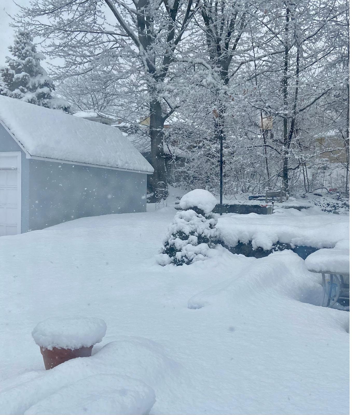
8" yesterday 30" in a week. Just below my seasonal norm. 39" for the season Westchester County ny. Give me a la nina with blocking any day of the week and twice on Sunday.
-
Obs and nowcast Super Bowl Sunday 4A-6P Feb 7, 2021
binbisso replied to wdrag's topic in New York City Metro
Where are you located? Great storm for so. Westchester! -
Obs and nowcast Super Bowl Sunday 4A-6P Feb 7, 2021
binbisso replied to wdrag's topic in New York City Metro
Approaching 8" here still snowing lightly.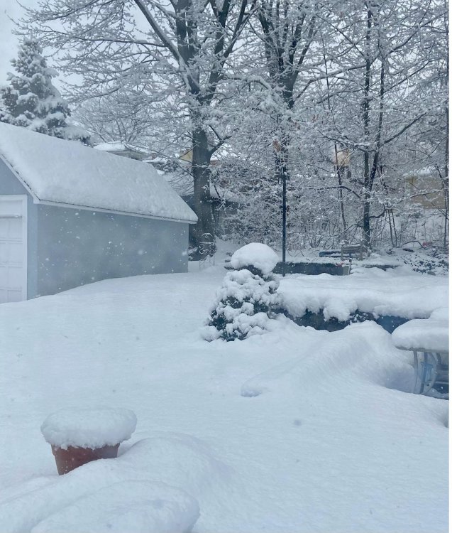
-
Obs and nowcast Super Bowl Sunday 4A-6P Feb 7, 2021
binbisso replied to wdrag's topic in New York City Metro
-
Obs and nowcast Super Bowl Sunday 4A-6P Feb 7, 2021
binbisso replied to wdrag's topic in New York City Metro
Just under 7". Still snowing moderately. Fantastic storm -
Correct me if I am wrong but our snowiest winters are la nina's? 95/96, 2010/2011, 2020/2021?. If true give me a LA Nina Winter with blocking any day. El Nino are to warm especially in our new climate.
-
Obs and nowcast Super Bowl Sunday 4A-6P Feb 7, 2021
binbisso replied to wdrag's topic in New York City Metro
Just under 3" here in Mount Vernon New York cotton balls falling from the sky it hasn't let up since it began around 9:00 a.m. -
Obs and nowcast Super Bowl Sunday 4A-6P Feb 7, 2021
binbisso replied to wdrag's topic in New York City Metro
I wonder if national weather service was correct that models were under doing QPF On the Northwest side of system it wasn't supposed to be snowing this hard until around noon according to the models -
Obs and nowcast Super Bowl Sunday 4A-6P Feb 7, 2021
binbisso replied to wdrag's topic in New York City Metro
This has to be 2 inch an hour rates right now. Eyeballing it almost 1" in 30 minutes absolutely ripping