George BM
-
Posts
3,048 -
Joined
-
Last visited
Content Type
Profiles
Blogs
Forums
American Weather
Media Demo
Store
Gallery
Everything posted by George BM
-
Briefly moderate snow here. The aggregates were actually over 1/2" in diameter at one point. Still SN- atm. Herndon, VA.
-
MBY Snow totals Winter 2024-2025 11/21/2024: T (A brief gusty rain/graupel shower around 6pm.) 11/22/2024: T (Flurries/light wet snow fell between 10am and 11:45am before mixing with and changing to light rain by 12:30pm.) 12/01/2024: T (Flurries off and on during the 4pm and 5pm hour.) 12/05/2024: T (Mixed light rain/snow between 4:30-5am w/ another brief light rain//snow mix between 7:30-7:40am.) 12/15/2024: T (A few ice pellets starting around 11:30am, then mixing with and changing to an off and on drizzle of rain/snow (intensified briefly into a light rain/snow mix during the 1pm hour). This lasted until after 3pm when precip again intensified into a light rain/snow mix before changing to all rain by 3:40pm.) Snow totals IMBY as of December 16, 2024: T
-
12/15 Possible I81 event. First inch of the season out here?
George BM replied to clskinsfan's topic in Mid Atlantic
Ice pellets in Herndon. At least another trace. -
Five feet in NJ.
-
Lol it feels like a heatwave out there at 63F currently.
-
Looks like a good sunset is incoming.
-
*Nerd Post Alert* : Sunset in Baltimore is at 4:43pm from November 30th through December 13th. That would make Dec 6th and 7th the median dates meaning either the 6th or 7th features the earliest sunset. At Dulles Int'l Airport the earliest that the sun sets is at 4:47pm from December 1st through December 11th. That would make Dec 6th the median date. I'm getting the same median dates for the earliest sunset everywhere I look with the 6th winning over the 7th. Therefore, the absolute earliest sunset occurred today on the 6th. There will be a few more seconds (probably 1-3 seconds) of evening light tomorrow... not that anyone other than a super ultra weenie nerd like me would notice.
-
Todays sunset is the earliest one of the year. Starting tomorrow we gain evening light.
-
MBY Snow totals Winter 2024-2025 11/21/2024: T (A brief gusty rain/graupel shower around 6pm.) 11/22/2024: T (Flurries/light wet snow fell between 10am and 11:45am before mixing with and changing to light rain by 12:30pm.) 12/01/2024: T (Flurries off and on during the 4pm and 5pm hour.) 12/05/2024: T (Mixed light rain/snow between 4:30-5am w/ another brief light rain//snow mix between 7:30-7:40am.) Snow totals IMBY as of December 5, 2024: T
-
A mix of rain and snow here atm with this squall.
-
MBY Snow totals Winter 2024-2025 11/21/2024: T (A brief gusty rain/graupel shower around 6pm.) 11/22/2024: T (Flurries/light wet snow fell between 10am and 11:45am before mixing with and changing to light rain by 12:30pm.) 12/01/2024: T (Flurries off and on during the 4pm and 5pm hour.) Snow totals IMBY as of December 4, 2024: T
-
IAD got down to 19F.
-
Now I got flurries. A trace on the first day of Meteorological winter. Nice.
-
Welcome to Meteorological winter! A nice wintery start!
-
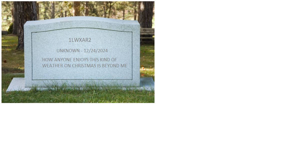
December 24, 2024 2:45pm est. Baby Yoda: The fun part of this afternoon’s disco. What a fun Christmas coming up! “…A powerful and sharp shortwave trough will dive into WV and VA as it begins to take on a negative tilt and close off. Strong difluence aloft will rapidly lower surface pressure over southern VA as a surface low deepens rapidly. Lift from the negatively tilted s/w trough will allow snow to develop over much of the region through the night becoming heavy by the morning. With the deepening low to our south NE winds will be on the increase gusting up to 40mph over the Greater DC metro by morning. As the low continues to deepen through the morning as it moves into the southern/central Chesapeake Bay very heavy snowbands will overspread the area as wind gusts increase to over 50mph with the strong pressure gradient courtesy of the 1040+ mb surface high over the northern New England/ SE Canada region. That same cold high will keep temperatures in the upper teens and lower 20s meaning windchills will be in the lower single digits. Snowfalls rates will increase to 3”+/hr leading to whiteout conditions. The heaviest snow and strongest winds will occur between noon and 6pm local time with 2-4”+/hr snowfall rates and 50-60+mph wind gusts with temps falling into the 15-20F range. Afterwards, snow will taper off from west to east through the evening and into the overnight hours ending by mid-evening along the I-81 corridor and during the overnight hours near the Chesapeake Bay. Snow totals will range from 18-24” along the I-81 corridor to 30-40” in eastern MD…” 1lwxar2: @Baby Yoda How anyone enjoys this kind of weather on Christmas is beyond me. Bob Chilidogs: @1lwxar2 McGee’s Mustache: @1lwxar2 Sad. Dr. Reaper: @1lwxar2


-
Looks like DCA has gotten down to at least 31F.
-
MBY Snow totals Winter 2024-2025 11/21/2024: T (A brief gusty rain/graupel shower around 6pm.) 11/22/2024: T (Flurries/light wet snow fell between 10am and 11:45am before mixing with and changing to light rain by 12:30pm.) Snow totals IMBY as of November 25, 2024: T
-
Revenge of the fifth. Let's make it happen.
-
LOL my neighbor just started mowing their lawn. Probably wants less grass blades sticking up in the off-chance of any grassy accumulation. Got to have as wintry a look as possible.
-
That didn't take too long. Seeing small flakes now. There's my two days of 'T's in a row.
-
I'm next.
-
Just had a brief gusty rain/graupel shower here. (Herndon, VA) Trace.
-
Nice downpour here in Herndon now.
-
Just had a lightning strike and thunder.
-
There's the Wind Advisory for tonight. URGENT - WEATHER MESSAGE National Weather Service Baltimore MD/Washington DC 555 PM EST Wed Nov 20 2024 DCZ001-MDZ004>006-008-011-013-014-016>018-503>508-VAZ040-053-054-501- 505-506-526-527-210600- /O.EXB.KLWX.WI.Y.0018.241121T0100Z-241121T0600Z/ District of Columbia-Frederick MD-Carroll-Northern Baltimore- Cecil-Southern Baltimore-Prince Georges-Anne Arundel-Charles-St. Marys-Calvert-Northwest Montgomery-Central and Southeast Montgomery-Northwest Howard-Central and Southeast Howard- Northwest Harford-Southeast Harford-Rappahannock-Fairfax- Arlington/Falls Church/Alexandria-Northern Fauquier-Western Loudoun-Eastern Loudoun-Northwest Prince William-Central and Southeast Prince William/Manassas/Manassas Park- 555 PM EST Wed Nov 20 2024 ...WIND ADVISORY IN EFFECT UNTIL 1 AM EST THURSDAY... * WHAT...West winds 20 to 30 mph with gusts up to 50 mph expected. * WHERE...Portions of DC, central, north central, northeast, northern, and southern Maryland, and northern and northwest Virginia. * WHEN...Until 1 AM EST Thursday. * IMPACTS...Gusty winds will blow around unsecured objects. Tree limbs could be blown down and a few power outages may result. * ADDITIONAL DETAILS...Expect winds to suddenly increase this evening between 8 PM to 11 PM. PRECAUTIONARY/PREPAREDNESS ACTIONS... Winds this strong can make driving difficult, especially for high profile vehicles. Use extra caution. && $$