

Paleocene
-
Posts
2,050 -
Joined
-
Last visited
Content Type
Profiles
Blogs
Forums
American Weather
Media Demo
Store
Gallery
Everything posted by Paleocene
-
ICON looks a bit weird and disorganized, IDK why I look at that model. Makes me upset 9/10 times.
-
I have a dentist appointment Weds AM. Will I have to reschedule?
-
Next wave lining up for a hit, lol. classic weenie HH run
-
5 days away, but we'll be watching the sleet line on a setup like this. And tracking during the soup
-
Juicy
-
mine just popped 93
-
-
We like ike
-
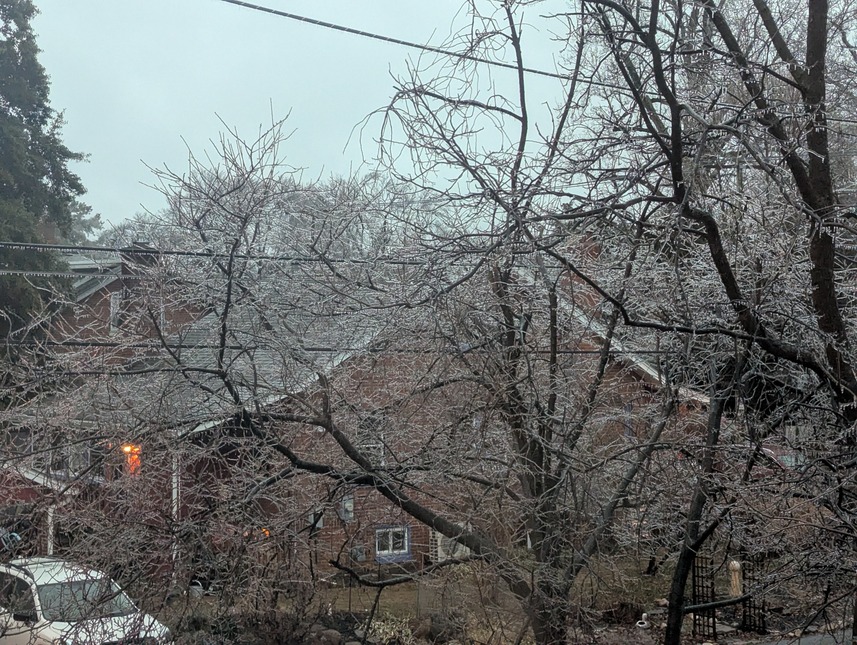
Trees glazed here in silver spring at about 320' feet ASL. moco sticking with two hour delay, good call. Not as embarrassing as a straight up rain day.
-
4th wave after the 3rd wave? Lol, weenie run here.
-
Missed many pages. Are we raining?
-
3k NAM looks similar. Shows more on the ridges which tracks with experience with ice storms
-
-
https://www.americanwx.com/bb/profile/21931-folks/
-
Cool temperature dynamics this morning. On the sunnier streets in my neighborhood, it is probably 10 to 15° warmer than the cool valley streets where the cold air is collecting. Over a couple hundred feet up a hill, I went from cold and wearing a hat and gloves to needing to take all of that off. Feels like the urban heat island will torch today.
-
Time to cancel school in Montgomery county time.
-
Literally 3/50 members with nothing in that window. Bananas!
-
Buried. Yes please
-
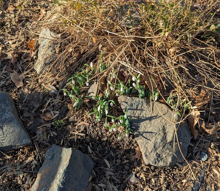
@Its a Breeze @winter_warlock found these blooming snowdrops in my neighborhood this afternoon. Feb 1st! South facing yard, near a street.
-
Mod/heavy rain
-
A fair point! I just get nervous starting in early March about warmth. Maybe snowquester memories there? I acknowledge that probability of snow isn't really that much different between Feb 20-Feb 28 and March 1 - March 10. But after that down here... meh. I'm ready for spring. Personal preference.
-
It would be a killer way to end this season if we got a forum-wide big dog in the feb 15-28th period.
-
-
Getting absolutely cooked and scorched in July.
-


