

Paleocene
-
Posts
2,050 -
Joined
-
Last visited
Content Type
Profiles
Blogs
Forums
American Weather
Media Demo
Store
Gallery
Everything posted by Paleocene
-

January Medium/Long Range: A snowy January ahead?
Paleocene replied to mappy's topic in Mid Atlantic
OK, more than I thought on the 102 hour panel. GEFS mean. -
January Medium/Long Range: A snowy January ahead?
Paleocene replied to mappy's topic in Mid Atlantic
GEFS low positions for 12z Sat. And mean snow, probably a bit more coming but dont feel like waiting for the panel to load: -
January Medium/Long Range: A snowy January ahead?
Paleocene replied to mappy's topic in Mid Atlantic
CMC snow. A tick southeast 50+miles, and less broad/generous with QPF -
January Medium/Long Range: A snowy January ahead?
Paleocene replied to mappy's topic in Mid Atlantic
Eastern shore special. -
January Medium/Long Range: A snowy January ahead?
Paleocene replied to mappy's topic in Mid Atlantic
Well, whatever we do get out of the gulf is headed toward some nice cold air. Friday AM temps: -
January Medium/Long Range: A snowy January ahead?
Paleocene replied to mappy's topic in Mid Atlantic
GFS running. Let's get our forum-wide 3-6" ! -
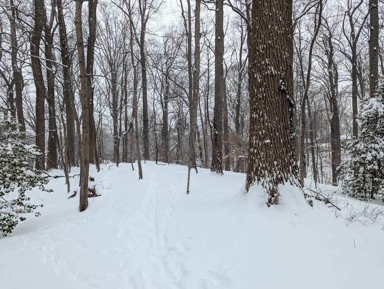
A rare blue-sky arctic day around here. Local weatherbug reports 27F, with 15mph wind gusts. Snow blowing off the trees and whipping around. Montgomery County ignoring plowing the tertiary residential streets. Deep winter feel, 10/10.
-
Final tally (after some compaction in the afternoon) was about 7" in my yard. That's averaged across several spots at 8am today. I cleared the driveway around 4pm yesterday and there was probably another 1-1.5" on there, but it had blown around a bit so hard to get an accurate measurement. That's near downtown Silver Spring.
-
Moco has also skipped my street and neighboring small residential streets thus far. I don't mind (working at home)
-
Close, up on a hill in a park above the creek. Off Dale drive
-
January Medium/Long Range: A snowy January ahead?
Paleocene replied to mappy's topic in Mid Atlantic
Eager to see GEFS low positions. This one on the op ticks close in to NYC. -
Wow radar filling in great. Very light snow in Silver Spring, just went on a pre sunset jebwalk. Probably 6.5" on grass. Deep in spots! Great storm.
-
January Medium/Long Range: A snowy January ahead?
Paleocene replied to mappy's topic in Mid Atlantic
84 hour NAM so this is likely pointless but the southern energy was held back more compared to the GFS. -
January Medium/Long Range: A snowy January ahead?
Paleocene replied to mappy's topic in Mid Atlantic
Anyone else extrapolating the NAM -
I posted earlier, but my kid's district (Montgomery County MD) already closed. IDK about baltimore metro area.
-
January Medium/Long Range: A snowy January ahead?
Paleocene replied to mappy's topic in Mid Atlantic
Yep. Go enjoy it while you can! That would suck and is unlikely...but never say never around here. -
Nice. I'm only ~ 5 miles north of you and we've had flakes here and there in the last 3 hours.
-
Montgomery County MD Public Schools closed for tomorrow.
-
Yeah, I'm up to moderate snow. Looks beautiful again. I hope I have to shovel for the third time. 8am, 12pm, 4pm.
-
January Medium/Long Range: A snowy January ahead?
Paleocene replied to mappy's topic in Mid Atlantic
EPS low pressures GEFS -
Nice, a little southern arm of that band is about to go over me... Yep, right on schedule, some light snow resumed. Moderate size flakes
-
January Medium/Long Range: A snowy January ahead?
Paleocene replied to mappy's topic in Mid Atlantic
UKIE attempting something CMC-like, not sure if it will turn the corner at all. Some snow for southern VA -
Agreed. I moved to immediate DC metro in 2010 (post big storm winter). From 2010-2018, your area smoked our area every year. Since 2019, we've done better in a few storms. Just random chance @Maestrobjwa
-
January Medium/Long Range: A snowy January ahead?
Paleocene replied to mappy's topic in Mid Atlantic
The best long-range model tracking days are when it's snowing! #traintracks #snowtown -
January Medium/Long Range: A snowy January ahead?
Paleocene replied to mappy's topic in Mid Atlantic
So if we average the GFS and CMC, we get nuked. Right?


