Paleocene
-
Posts
2,050 -
Joined
-
Last visited
Content Type
Profiles
Blogs
Forums
American Weather
Media Demo
Store
Gallery
Everything posted by Paleocene
-

September vibes - Last 90s for some, 1st frost for others
Paleocene replied to tamarack's topic in New England
Good friend is getting married on Nantucket, Saturday. How screwed are we? Flying up this afternoon from DCA. -
Good friend of mine is getting married on cape cod next week. Hope the Euro is right about that stout HP
-
Even in the UHI, this is noticeable. My part of Silver Spring is a lot of hills and stream valleys, and last night we noticed this when we walked down into the Sligo Creek valley (about 200ft ASL) from our house (which is about 330ft ASL).
-
Friends in town from Colorado this morning: what is this weather? We do not have this weather.
-
Very gross out for a mid-day walk today, but the high 90s in late august are more tolerable than early july. thanks, sun angle.
-
We flew home from Bangor Maine today and the weather here was basically the same as there (5 degrees warmer). That is rare!
-
Stunner of a morning out there!
-
And, ludicrous to discuss op runs at range, but the euro keeps it well out to sea, which indicates the uncertainty.
-
Way out there, but GEFS shows potential landfall on the NC/SC coast at 200+ hours. Shows up on the op GFS 12z too.
-
I am an employee there. We get texts and emails. Not a good look
-
Tropical Storm Debby: Mid-Atlantic Impacts
Paleocene replied to WxWatcher007's topic in Mid Atlantic
Parts of my backyard became little ponds pretty quick. Clean gutters were overflowing... it was dumping. But we've had much worse in the last years I've been here. -
Tropical Storm Debby: Mid-Atlantic Impacts
Paleocene replied to WxWatcher007's topic in Mid Atlantic
HEAVY rain in the band ripping through DC right now. -
Tropical Storm Debby: Mid-Atlantic Impacts
Paleocene replied to WxWatcher007's topic in Mid Atlantic
Some more consistent rain in the last hour or so in my neck of the woods (northern inside the 495 beltway world). -
Tropical Storm Debby: Mid-Atlantic Impacts
Paleocene replied to WxWatcher007's topic in Mid Atlantic
Looks like a heavy but fast moving band is about to roll through silver spring, sprinkles have begun. -
EPS and GEFS both have interesting looking waves coming off Africa towards the Antilles in the next few days. Op runs show storms that curve north and avoid CONUS. Active period coming up?
-
Tropical Storm Debby: Mid-Atlantic Impacts
Paleocene replied to WxWatcher007's topic in Mid Atlantic
Dry so far in Silver Spring but the skies have darkened after clearing around 12pm. -
Tropical Storm Debby: Mid-Atlantic Impacts
Paleocene replied to WxWatcher007's topic in Mid Atlantic
The always exactly 100% correct 12z NAM: -
Breeze and some clouds making it slightly less awful today
-
Tropical Storm Debby: Mid-Atlantic Impacts
Paleocene replied to WxWatcher007's topic in Mid Atlantic
This is a good look on the Euro. . Big story - how far east or west? Shenandoah looks nuked here Edit - pretty far west for the big dump of rain: Last image, 48-hour QPF: -
Nice (dry) evening at Dolly Sods. 70 ish
-
80 degrees in Canaan heights WV at about 3000 feet. Overcast moving in, maybe some rain in a bit. The stretch to get out here on US-48 was pretty desolate. Dry as a bone!
-
Picked this weekend intentionally to head up to the Davis/Dolly Sods/Canaan area to beat the heat. Looks like we'll do that, with temps in the 80s... but no escape the dew points from the swamps of hell. Oh well, can't complain, I'm sick of 90s!
-
Five minute shower in silver spring, maybe a tenth?
-
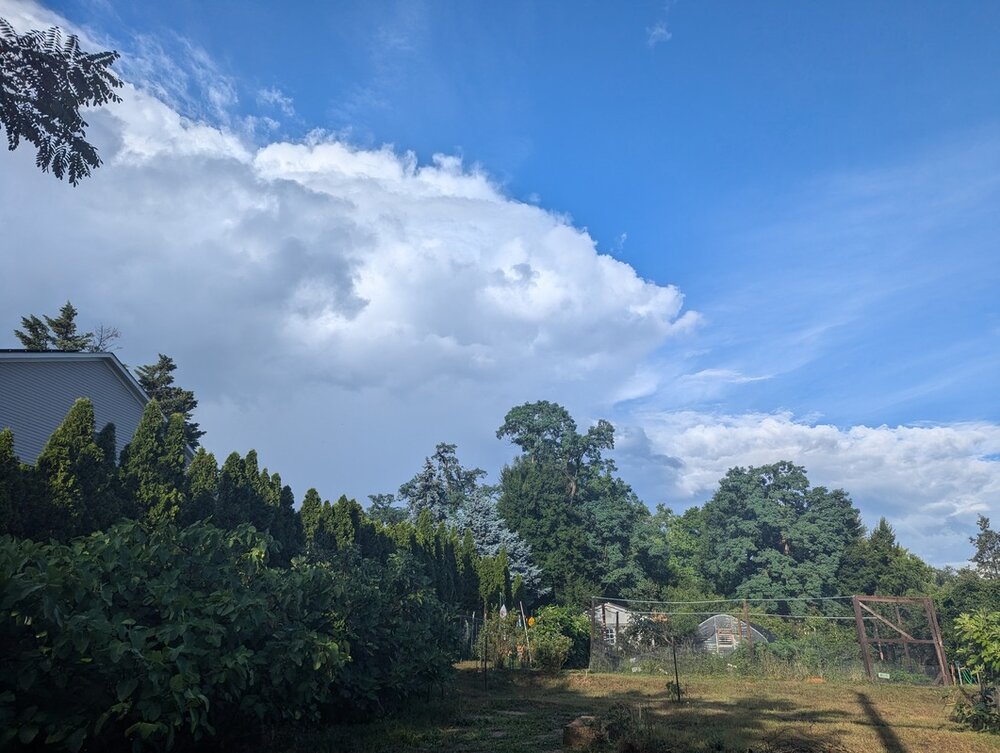
We've eked out around 1" in my area of Silver Spring in the last 4 days. perhaps enough for me to have to mow my lawn this weekend? haven't done that since mid-june. there are browned out trees all around this area which is a rare summer sight.
-
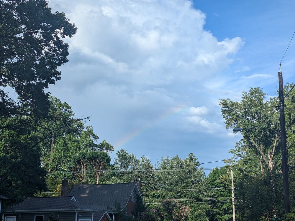
This cell just dumped on silver spring for ten minutes. Headed NE. And a show at the end!