Paleocene
-
Posts
2,050 -
Joined
-
Last visited
Content Type
Profiles
Blogs
Forums
American Weather
Media Demo
Store
Gallery
Everything posted by Paleocene
-
that sound when you are walking around outside... tragic
-
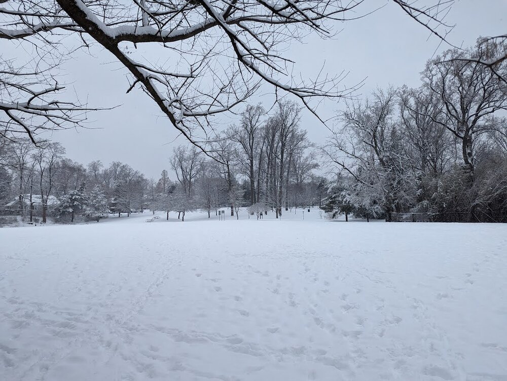
Heavier returns coming in now in Silver Spring - this was the local park at about 9AM. week here inside the beltway - roads covered twice!
-
Unofficially measured 3" at 9am IMBY near down Silver Spring. Still coming down, might be able to hit 4". That would match my obs from Mon/Tues.
-
Silver Spring MD is a SNOW TOWN
-
https://www.weather.gov/epz/research_papers_vptb_csi
-
Agreed. Luckily MoCo schools closed for tomorrow. So did Prince George's.
-
PSU fringed
-
Damn, I was at an all day work event and couldn't check. We are fully in business, I see. LFG!
-

Jan 19th Snow on Snow: the this always works until it doesn't thread
Paleocene replied to psuhoffman's topic in Mid Atlantic
long range HRRRR is booty cheeks -
we fail
-
Jan 18-19 Storm Threat: Bob Chill made me do it
Paleocene replied to stormtracker's topic in Mid Atlantic
At this stage, can we pull out weenie handbook rule #725 and say "at this stage it's appropriate to rely on mesos rather than globals" and ignore global runs that don't paint the DC metro area blue? -
Jan 18-19 Storm Threat: Bob Chill made me do it
Paleocene replied to stormtracker's topic in Mid Atlantic
Even here in UHI melt-town, there is still snow clinging to tree branches. That is so rare here. My snowpack in the yard has barely changed...high temps below freezing...kids get another day sledding... this is the january dream, even without more to come. Another 2" is icing on the cake if it happens. Let's go RGEM/ICON, come on GFS. -
MCPS just closed for a sun day
-
Jan 18-19 Storm Threat: Bob Chill made me do it
Paleocene replied to stormtracker's topic in Mid Atlantic
RGEM ^ ICON below -
Jan 18-19 Storm Threat: Bob Chill made me do it
Paleocene replied to stormtracker's topic in Mid Atlantic
bazinga- 684 replies
-
- 15
-

-

-
Just want to reiterate how much of a win this storm was for the fall line crew. We have gotten burned a lot in marginal events over the years, so it is awesome to see a storm where it's cold and the snow sticks to the roads. Seriously, the snow never sticks to the roads here. But this was last night around 10pm after rates picked up in my neighborhood. It was gorgeous - the kind of rainbow, light scattering pixie dust flakes we barely ever see because we usually get cold slop. And it's still cold today! 10/10 storm even if all I ended up with was 4".
-
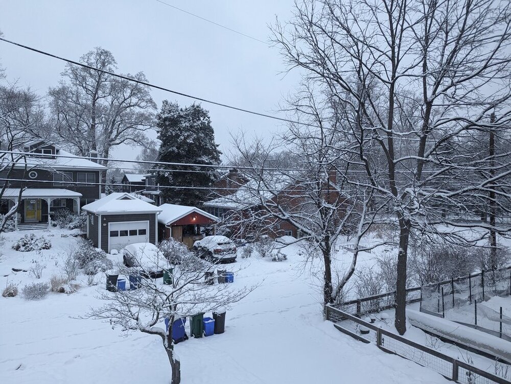
Measured 4" on the grill and in the yard at 8am today near downtown silver spring.
-
lol "its raining in georgetown" is going to be the new "NE maryland pummeled!!!"
-
Rare that we see the Google traffic map look slow for the whole region. Snow sticking to the roads everywhere! Drive safe if you have to go out.
-
Closing in on two inches in silver spring, enough to sled! First time in the neighborhood since 2022... Fifth grader is happy.
-
Snow has gotten a bit heavier in Silver Spring, but the rates were too low to keep the roads covered since this AM. Piling up on grassy surfaces a bit. The HRRR is booty cheeks and I toss.
-
Wayne Ave in silver spring had approximately two tons of sand salt mix on it. All clear. Side roads not so much. Very fine light snow now.
-
Decent pixie dust coating in silver spring
-
Jan 15-16 Storm Threat Thread: The Return of Hope??
Paleocene replied to stormtracker's topic in Mid Atlantic
Is that map based on population density? Or road density?