Paleocene
-
Posts
2,054 -
Joined
-
Last visited
Content Type
Profiles
Blogs
Forums
American Weather
Media Demo
Store
Gallery
Everything posted by Paleocene
-
Local stations picked up between .1 - .2 last night in a thundershower. Nice, just planted some herbs yesterday.
-
Are we back to the old weekend rain rule?
-
gonna be very green in these parts next week.
-
tulip poplars as street trees is nuts lol.
-
Yeah sorry NW crew, so far the force field about 20 miles NW of i-95 is strong. Hope it breaks later. Been sitting under moderate rain here for 3+ hours
-
Moderate rain here inside the beltway since just before 9am. Good ol' fashioned soaker
-
https://www.msn.com/en-us/general/general/the-u-s-just-had-its-windiest-start-to-spring-in-nearly-50-years/ar-AA1CvYrA at least it's windy ... everywhere?
-
From my driveway
-
Yeah, barely anything overnight but actual rain now in silver spring. Yellow pollen puddles everywhere
-
Steamy out there
-
Little April shower just rolled through silver spring, enough to get roads wet and things dripping.
-
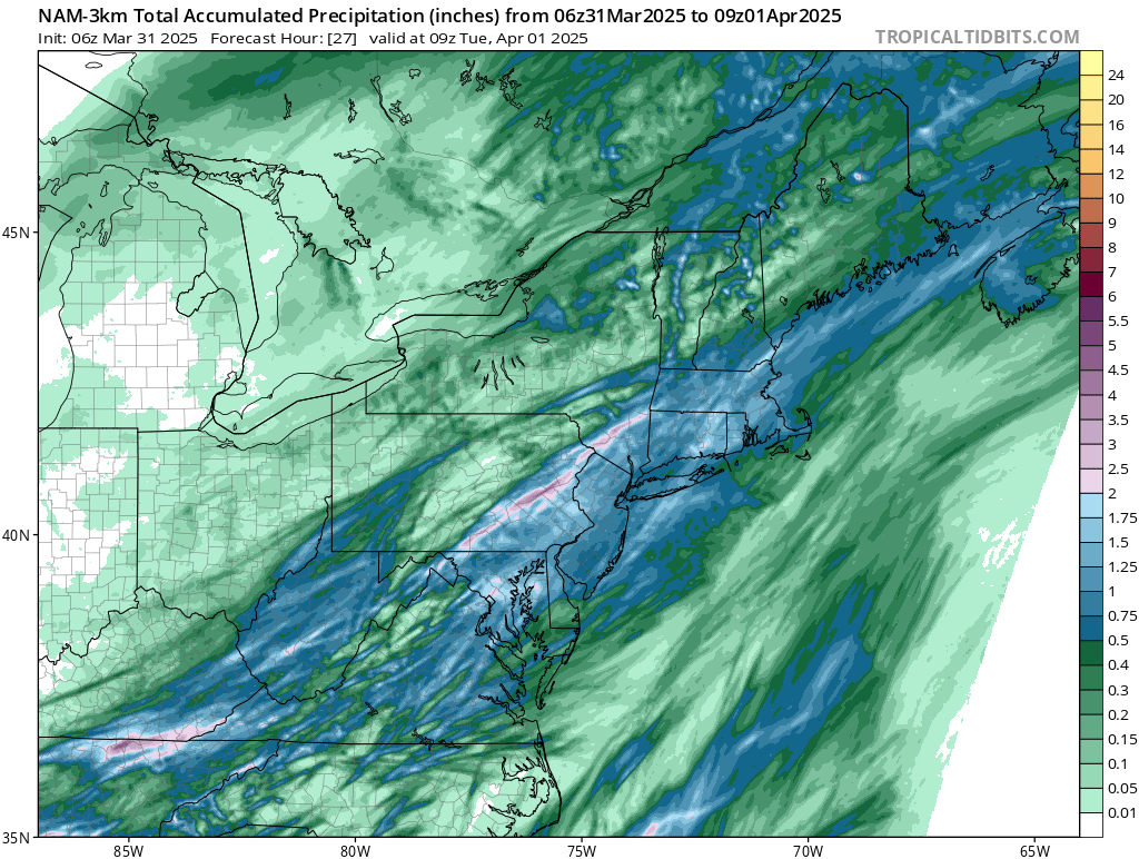
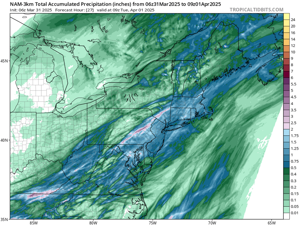
That matches what the short range models were showing this time yesterday. About 0.75 - 1.25 forecast thru the dc/balt metro areas. I got an inch, pretty satisfied with that.
-
Rain and a bolt or two here in the metropolis
-
Looks like decent agreement on the models for a stormy, rainy evening. hoping the 1" totals are widespread.
-
Great weekend, if a tad warm. Was pleasant to be outside and get stuff done in the garden. @Yeomanmy crops are doing just okay. Hope it rains tomorrow.
-
Getting fringed by rain in Silver Spring. Damp, but no real appreciable rain yet. Hope it pokes back NW a bit.
-
Not here
-
Kids playing rec soccer at local parks, kicking up clouds of dust like we live in Amarillo. Rain is so 2010s
-
That line just missed me in silver spring. Formed overhead lol
-
HRRR likes east of 95. Bay Special
-
Active period coming up. Buckle in.
-
About 0.6" average at local cocorahs which seems right. It really poured for a bit last night and woke me up. Hoping for more later this week so I don't have to water the veggie sprouts...
-
Crispy out there in the woods.
-

2025 Mid-Atlantic Garden, Lawn, and Other Green Stuff Thread
Paleocene replied to mattie g's topic in Mid Atlantic
Thanks! Should have clarified. I have a garden enclosure that is netted to keep deer and varmints away. The vegetable beds are there, in those big raised steel pre-assembled garden bed things. I was just covering the ground around those beds inside the enclosure with the wood chips, because it was previously scraggly crab grass and creeping vines. Now I won't have to weed whack it. The beds themselves have topsoil and compost. -
2025 Mid-Atlantic Garden, Lawn, and Other Green Stuff Thread
Paleocene replied to mattie g's topic in Mid Atlantic
Mulch. Sticking it to big mulch, done paying for that crap. Bought my house a couple years ago and the previous owner let the yard and garden go ignored, so I have a ton of garden beds that are just weeds. It's going around trees, around azaleas, covering areas around my vegetable garden beds, etc. Burying it all in wood chips. For free!