
Kentucky
-
Posts
409 -
Joined
-
Last visited
Content Type
Profiles
Blogs
Forums
American Weather
Media Demo
Store
Gallery
Everything posted by Kentucky
-
January 15th-17th 2024 Arctic Blast/Snow Event
Kentucky replied to John1122's topic in Tennessee Valley
This would be a rug pull for the ages, for SE KY -
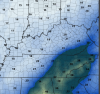
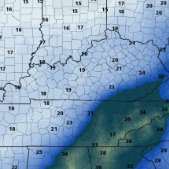
URGENT - WINTER WEATHER MESSAGE National Weather Service Jackson KY 205 PM EST Sun Dec 17 2023 KYZ044-050>052-058>060-068-069-080-085>088-104-106>120-180500- /O.NEW.KJKL.WW.Y.0006.231218T1600Z-231219T0900Z/ Fleming-Montgomery-Bath-Rowan-Estill-Powell-Menifee-Rockcastle- Jackson-Laurel-Whitley-Knox-Bell-Harlan-Elliott-Morgan-Johnson- Wolfe-Magoffin-Floyd-Lee-Breathitt-Knott-Owsley-Perry-Clay-Leslie- Letcher-Martin-Pike- Including the cities of Flemingsburg, Camargo, Jeffersonville, Mount Sterling, Owingsville, Morehead, Irvine, Ravenna, Clay City, Stanton, Frenchburg, Brodhead, Mount Vernon, McKee, Annville, London, Corbin, Williamsburg, Barbourville, Middlesboro, Pineville, Cumberland, Harlan, Sandy Hook, West Liberty, Paintsville, Campton, Salyersville, Prestonsburg, Wheelwright, Beattyville, Jackson, Hindman, Pippa Passes, Booneville, Hazard, Manchester, Hyden, Jenkins, Whitesburg, Inez, Coal Run, Elkhorn City, Pikeville, and South Williamson 205 PM EST Sun Dec 17 2023 ...WINTER WEATHER ADVISORY IN EFFECT FROM 11 AM MONDAY TO 4 AM EST TUESDAY... * WHAT...Snow squalls and showers developing. Total snow accumulations of up to one inch most places, though up to a couple of inches are expected above 1500 feet. The snow squalls of Monday afternoon into the evening will be accompanied by westerly wind gusts of up to 35 mph leading to times of low visibility. * WHERE...Portions of east central, northeast, south central and southeast Kentucky. * WHEN...From 11 AM Monday to 4 AM EST Tuesday. * IMPACTS...Plan on slippery road conditions at times, along with reduced visibility. The hazardous conditions could impact the evening commute. Caution is urged for travellers Monday afternoon into Monday night. * ADDITIONAL DETAILS...Most places will see only light snow amounts on grassy and elevated surfaces, but brief snow accumulations from any heavier snow showers would lead to driving impacts. PRECAUTIONARY/PREPAREDNESS ACTIONS... Slow down and use caution while traveling. Consider postponing travel Monday afternoon and evening. The latest road conditions for Kentucky can be found by visiting https://goky.ky.gov. && $$ GREIF
-
.30 of Rain in Corbin.
-
Some much-needed rain in Corbin, 1.07 for today.
-
March 3 High Wind and Severe potential
Kentucky replied to Holston_River_Rambler's topic in Tennessee Valley
Kentucky got smashed, hardly any rain in Corbin (0.04) Long duration, wind event here -
Historic Christmas Cold & maybe snow?! Dec 23rd-30th
Kentucky replied to Wurbus's topic in Tennessee Valley
Back to 0, high of 6 in Corbin today -
Historic Christmas Cold & maybe snow?! Dec 23rd-30th
Kentucky replied to Wurbus's topic in Tennessee Valley
-
Historic Christmas Cold & maybe snow?! Dec 23rd-30th
Kentucky replied to Wurbus's topic in Tennessee Valley
I'd say around an inch, side roads are solid ice underneath from the .10 rain prior. -
Historic Christmas Cold & maybe snow?! Dec 23rd-30th
Kentucky replied to Wurbus's topic in Tennessee Valley
Imagine this will be quite the streamer event for Eastern Kentucky. -
Historic Christmas Cold & maybe snow?! Dec 23rd-30th
Kentucky replied to Wurbus's topic in Tennessee Valley
Frozen Tundra, solid dusting of snow with good layer ice underneath. 20 degrees now, wind straight ripping. -
Historic Christmas Cold & maybe snow?! Dec 23rd-30th
Kentucky replied to Wurbus's topic in Tennessee Valley
That escalated quickly, Snow in Corbin -
Historic Christmas Cold & maybe snow?! Dec 23rd-30th
Kentucky replied to Wurbus's topic in Tennessee Valley
Wind picking up, pouring the rain 44 degrees -
Historic Christmas Cold & maybe snow?! Dec 23rd-30th
Kentucky replied to Wurbus's topic in Tennessee Valley
-
Historic Christmas Cold & maybe snow?! Dec 23rd-30th
Kentucky replied to Wurbus's topic in Tennessee Valley
Temperature gradient across Kentucky http://www.kymesonet.org/ -
Historic Christmas Cold & maybe snow?! Dec 23rd-30th
Kentucky replied to Wurbus's topic in Tennessee Valley
-
December 2022 Medium/Long Range Pattern Discussion Thread
Kentucky replied to Carvers Gap's topic in Tennessee Valley
12z GEFS through 240- 582 replies
-
- 8
-

-
- snow
- freezing rain
- (and 4 more)
-
Snowed in Corbin, this morning.
-
March 11th-13th Winter Weather Event. Winter's last gasp?
Kentucky replied to Windspeed's topic in Tennessee Valley
All sleet up here, down to 35 -
March 11th-13th Winter Weather Event. Winter's last gasp?
Kentucky replied to Windspeed's topic in Tennessee Valley
-
18z HRRR
- 99 replies
-
- 3
-
-

-
- ice
- freezing rain
- (and 1 more)
-
yeah, would really like to see some model support other the GFS.
-
Anyone have the Euro ice map?
-
January 28th-29th Clippers/NW Flow Obs/Last Minute Forecasts.
Kentucky replied to John1122's topic in Tennessee Valley
Squall Acquired -
January 28th-29th Clippers/NW Flow Obs/Last Minute Forecasts.
Kentucky replied to John1122's topic in Tennessee Valley
I've finally given up on that to my west, appears my best chances are now from the north.
