
Kentucky
-
Posts
409 -
Joined
-
Last visited
Content Type
Profiles
Blogs
Forums
American Weather
Media Demo
Store
Gallery
Everything posted by Kentucky
-
 2" on elevated surfaces in Corbin, temp never actually dropped to below freezing until the snow was winding down.
 -
Wet snow in Corbin
-
38 in Corbin, has changed over to snow in Somerset. Good luck and happy new year everyone.
-
-
-
Took out a round bale of hay to the field yesterday, was so dang muddy. Was thinking how difficult it must be for power restoration crews. And that was before the rain...
-
Overachiever here yesterday, roads are solid ice this morning
-
insane what a difference 10 miles makes in the weather here, alot of backup has arrived to help restore power.
-
same, was mostly rain here at 26. was still among the biggest snows of the season here
-
I'll never doubt the warm nose ever again, someone must have got dumped on around here. 33 now
-
right, freezing rain coming down at a decent clip - 27
-
heavy mix at 26
-
75 - Exit 25
-
Come on in
-
Alot of ice was around today, alot of snow and ice will be around tomorrow. Forecasted highs tomorrow were only like 33-34? They missed big on highs today here.
-
Huge bust on forcasted temps here, and I'm loving it. Happy you were able to cash in.
-
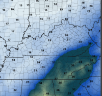
I don't see this changing to rain, but very challenging area to forecast.
-
exit 25
-
Just started here shouldn't be much longer, really coming down now
-
Strike that, moderate snow now at 26 degrees
-
Just a few flurries here, but I consider that progress
-
Few flakes falling now
-
Down to 26 here, Dewpoint of 20


