
Kentucky
-
Posts
409 -
Joined
-
Last visited
Content Type
Profiles
Blogs
Forums
American Weather
Media Demo
Store
Gallery
Everything posted by Kentucky
-
Down to 28
-
Temps rocketed from 16 to 29, then hit a brick wall. I do not see the forecasted high of 34 happening, unless it happens at 11:59 pm. Might be the biggest snow of the season here, with the worst timing ever. lots on ice on the trees, wont take much.
-
JKL now saying 4-8 inches, I'll believe it when I see it. I do have power again
-
16 this morning to 23 now
-
-
-
They just can't keep the power on here, substation issues. Thankfully I have a natural gas and generator, Not big enough to run the furnace or space heater though.still a frozen tundra, ice on everything, snowed pretty much all day yesterday. Hoping to avoid any ice at all. Very old power grid and poorly maintained. 16 degrees, 11 Dewpoint
-
I'm already in, and still without power...
-
https://poweroutage.us/area/state/kentucky Might be a while. Not the easiest terrain to restore power #Verizon
-
Nearly 50% without power in Whitley, they rolled by hours ago looking for the source, I didn't know.that was a thing in 2021.
-
JKL ISW sadly verified, just lost power. Trees been cracking all night long. Was quite the downpour near the end. The entire show accumulated on trees.
-
Up to 31 now, from 28
-
right, non stop. heavy ice accumulation just a couple hundred feet up from me. Mountain above me was covered with rime 2 days ago, its still piling up.
-
So here we go, I might have spoken too soon...
-
 Don't see this everyday, 43 on black mountain. https://www.kymesonet.org/
 -
precip went NW, 29 now. We have ice but nothing like forcasted just yesterday. Ice have moved all the way into central kentucky. I don't even know if mesonet sites would help in this situation. But it sure isn't over yet....
-
Happy about the busted ice forecast here, that's 2 back to back bust by JKL, need more kymesonet sites here.
-
27 - Freezing Rain/Sleet
-
Reaching out from jkl, hope it starts as snow and not ice.
-
Still a good thumping otw, wonder what the ice totals are on east side?
-
I was blown away with how fast it got slick. Freezing fog/mist all day. It mist non stop today, all below freezing. Got dark and got slick quick. Mountain was white, only a couple of hundred feet up from me. Rime?
-
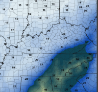
That cutoff is sharp, always is.
-
30 now in Corbin
-
Euro making moves towards ukmet?


