WestTennWX
-
Posts
89 -
Joined
About WestTennWX

-
Starting to blossom quickly. I was watching a FB live out of NWS PAH earlier and it's the first time I've heard a met say he was worried, and worried for us. I've got a safe room stocked and ready, a bit unnerved here though.
-
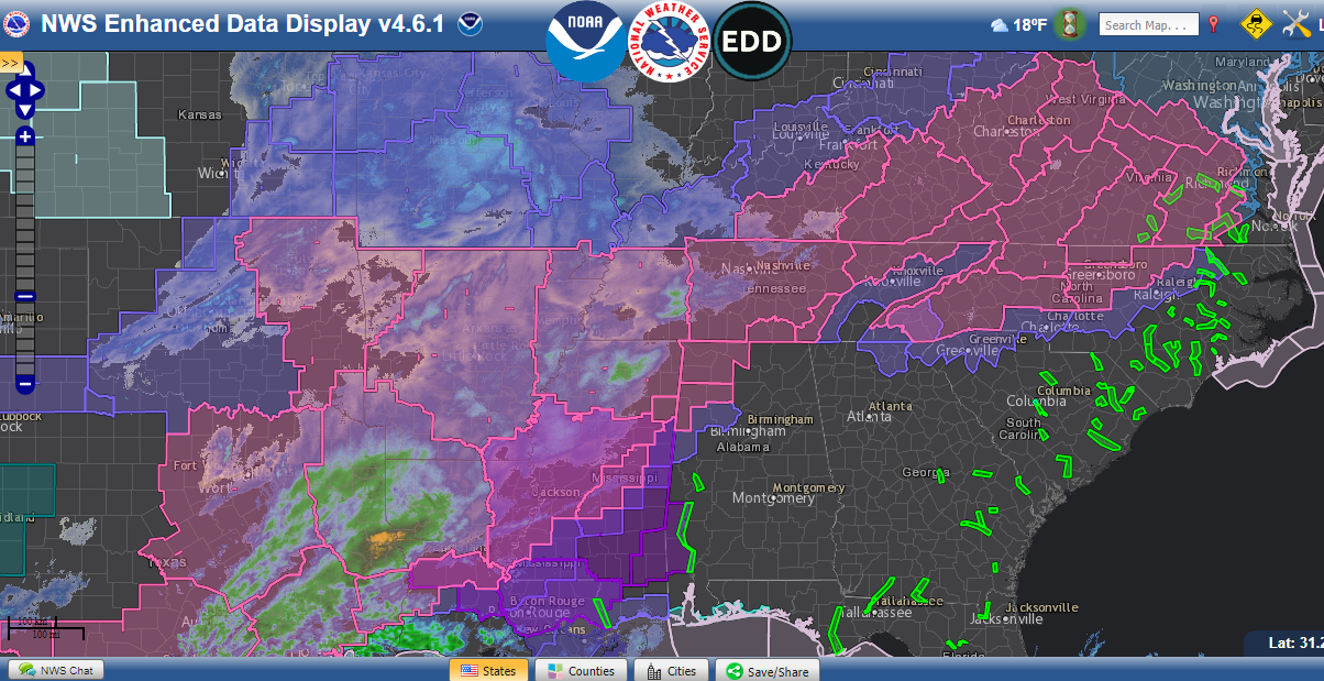
Ominous line to our west here in Union City. Dew points are starting to climb, 57 now.

-
January 2nd and 3rd Severe Weather Threat
WestTennWX replied to DanLarsen34's topic in Central/Western States
I just had that conversation with a family member. Those clusters are headed my way in 2 to 3 hours. Gotta be up at 4 am and its hard to sleep in this kind of setup. HRRR has a nice line coming in about 3 am as well in my area. Shear will be on the uptick and I would imagine there will be a few QLCS spinups along that line. -
January 2nd and 3rd Severe Weather Threat
WestTennWX replied to DanLarsen34's topic in Central/Western States
New Tornado warned cell near Georgetown.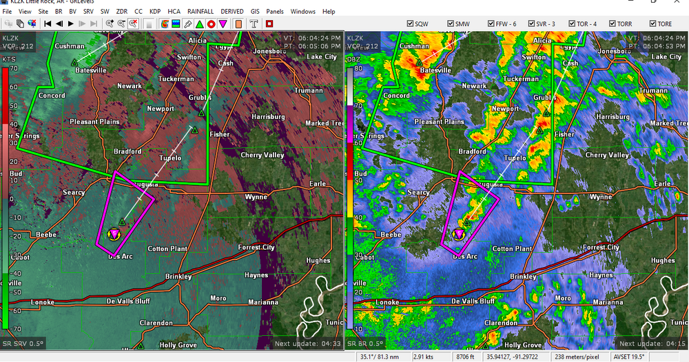
-
January 2nd and 3rd Severe Weather Threat
WestTennWX replied to DanLarsen34's topic in Central/Western States
That is insane considering the arctic blast that we just experienced only a week ago. Dewpoint here (NW TN) has been holding at 66 for a few hours now. Temp hit 70 this afternoon, and a week ago we had wind chills approaching 30 below. -
January 2nd and 3rd Severe Weather Threat
WestTennWX replied to DanLarsen34's topic in Central/Western States
Local met just posted an interesting stat regarding flooding potential. Going to be a long night for a lot us either way.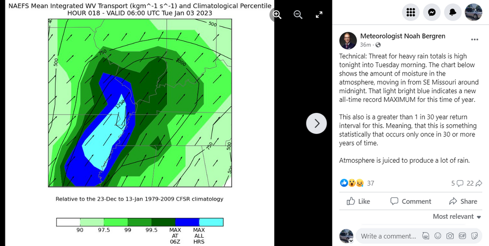
-
11/29/22 MDT Outlook Issued -- Regional outbreak possible.
WestTennWX replied to CryHavoc's topic in Central/Western States
Far NW Tennessee here....one thing I can say is as we approach the 1 year anniversary of the December 10th tornado, storm awareness has increased substantially, to the point of storm anxiety in many cases. Schools have made decisions to cancel games, close early, etc. ahead of this event, ( a good call IMO). Given a year ago I'm not sure that would have happened. Many communities have yet to rebuild and people in this area are just on edge. Curious to see how far north the instability gets tomorrow. Could be a higher end event in NW TN and West KY if we get those dewpoints up...plenty of shear to be tapped into. Glad this thread is somewhat active. -
TN valley heavy rain/flooding week of whenever
WestTennWX replied to janetjanet998's topic in Tennessee Valley
Pretty much a worst case scenario for that area. I live about 50 miles west and have been down that way a few times, it is indeed a flood plain. No way would I rebuild there. This area has a past history of flooding, but what made this exceptional was the massive amount of rain upstream. Residents keep referring to it as a tidal wave. -
TN valley heavy rain/flooding week of whenever
WestTennWX replied to janetjanet998's topic in Tennessee Valley
There is a tragedy unfolding in Humphreys county as we speak. 15 now confirmed dead, and dozens still missing. Many of the dead and missing are children. Not a lot of media coverage on this, unfortunately. Some of the photos coming out of Waverly are just breathtaking. NWS Nashville recorded a record shattering 17.02 inches of rain in a 24 hour period. Some of the worst Flash Flooding I have ever seen. https://www.radionwtn.com/2021/08/22/death-toll-climbs-many-missing-in-flood-emergency-area-first-responders-on-scene/ https://www.newschannel5.com/news/photos-heavy-rainfall-causes-severe-flooding-in-middle-tennessee#id33 -
Pretty nasty line that moved through West TN about 4 am. Over 8 thousand without power in my area. I'd estimate 60-70 mph gusts
-
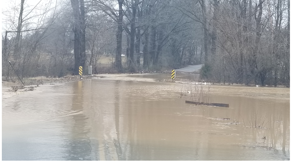
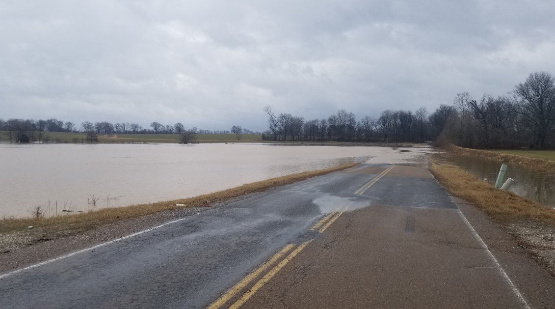
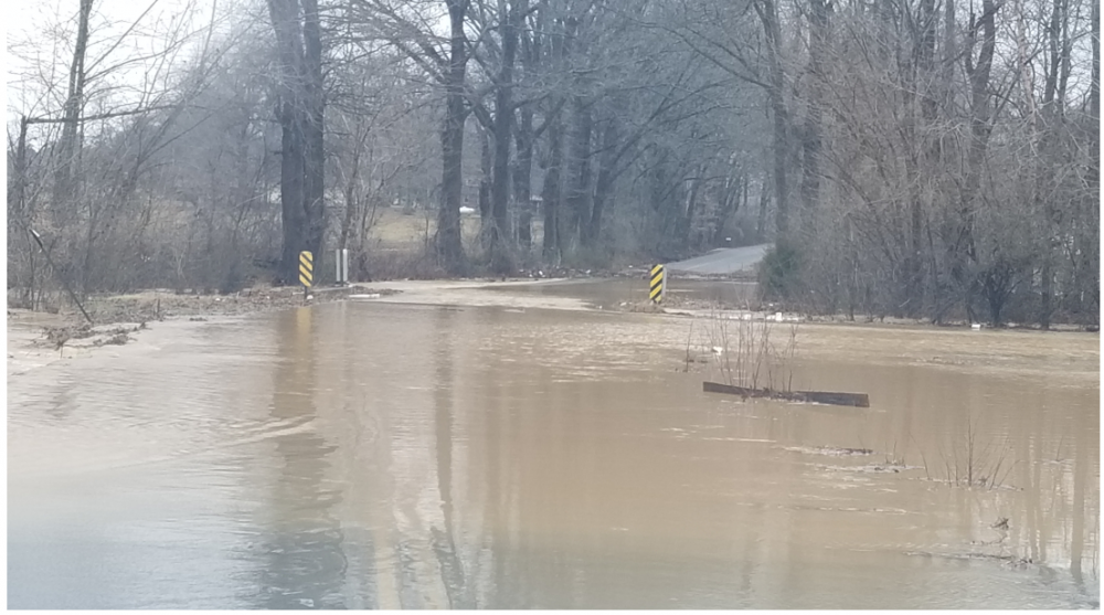
Picked up over 3 and a half inches of rain this morning in Obion County. Several reports of culverts and bridges washed out as well. Snapped these around 9 am.

-
Same here in Union City, picked up an inch so far...coming down at a pretty good rate too. If we avoid any dry slot/dry air, we could pick up a few more inches
-
Official totals have been bumped down here in far NW TN with the SE trend. An impressive string of advisories/warnings with this one too. Hopefully some of you guys will cash in
-
2/14- 2/16 Winter Storm and Arctic Cold
WestTennWX replied to WestTennWX's topic in Tennessee Valley
Clouds cleared out overnight here allowing the temps to really bottom out. Minus 1 this morning, -9 wind chill -
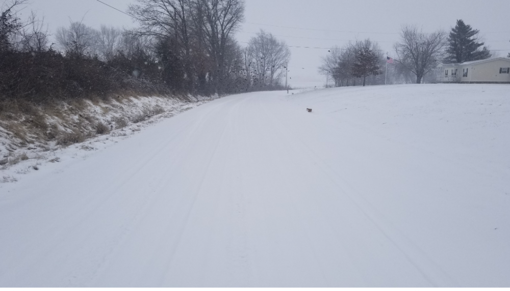
Presidents Day Snowstorm OBS Thread 2/15/21
WestTennWX replied to AMZ8990's topic in Tennessee Valley
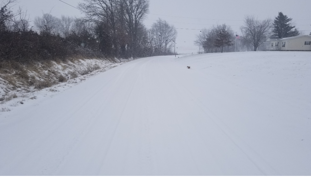
Snow starting to wind down here. Kind of hard to tell here but this photo was taken in the road in front my house. Going to be a fun commute in the morning!