alexj7
-
Posts
42 -
Joined
-
Last visited
Content Type
Profiles
Blogs
Forums
American Weather
Media Demo
Store
Gallery
Everything posted by alexj7
-
It's crazy I've had nothing this year. Every single event is a miss.
-
I’ve lived in Maryland 4 years and I swear Frederick gets hit 10x for every one storm I get in North Rockville. I’ve yet to have lightning this calendar year besides some distant rumbles. Looks like more of the same.
-
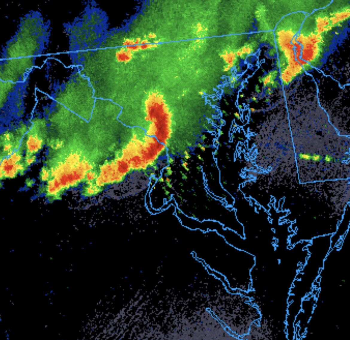
Good amount of lightning over Leesburg now, looks like more firing up there.
-
Not seeing a lot of breaks in the clouds yet except way out west: https://www.meteoblue.com/en/weather/maps/washington-d.c._united-states_4140963#coords=6.5/38.615/-77.413&map=satellite~sat~none~none~none
- 1,093 replies
-
- 1
-

-
- severe
- thunderstorms
- (and 1 more)
-
From what I remember, CMC was the first I noticed hinting at large amounts of sleet across DC metro, as early as Tuesday night last week. But that’s just one data point.
-
January 24-26: Miracle or Mirage JV/Banter Thread!
alexj7 replied to SnowenOutThere's topic in Mid Atlantic
I took apart the drain filter on my washer last year and it was disgusting. I had about 8 kids socks in there clogging it up and making it smell. Seems like a design flaw. The big design flaw was the hatch to get to the filter is on the back. Ugh. -
January 24-26: Miracle or Mirage JV/Banter Thread!
alexj7 replied to SnowenOutThere's topic in Mid Atlantic
Instagram seems to like to feed me things that are 3 days old, which ends up hilarious when I keep seeing the weather channel maps from 3 days ago. -
Jan 24-26 Weekend Snow and Sleetfest Model Thread Part Tres
alexj7 replied to H2O's topic in Mid Atlantic
Every 6 hours I check back in and the mixing is earlier and earlier. I’m seeing now around 9 AM. Unfortunately, that will really limit the ability for people to enjoy the storm. We’ll have kids home for likely two days stuck inside, and going out in sleet and freezing rain isn’t a good time. I’d much rather be on the northern fringe and get 4” of powder. -
I was also in NYC and if I remember right, that was the storm (on some other forum) where a ~40 yr veteran but retired NWS person called bust early and was eaten alive.
-
Northern Illinois really had a crazy couple of days https://imgur.com/a/uxQXMDS
- 1,696 replies
-
- 4
-
-

-
- severe
- thunderstorms
- (and 5 more)
-
Seems like the storms up by Rockville died out right on the doorstep. Still the most lightning I’ve seen all year, which is to say, not a lot. Sadly barely any rain. But on the plus side we have a nice rainbow now.
- 1,696 replies
-
- 1
-
-
- severe
- thunderstorms
- (and 5 more)
-
The Gaithersburg tornado passed about a 1/2 mile north of me. Easily the craziest cloud movement I’ve ever seen for a few minutes. They were moving every which direction. Saw some interesting rotation right as it passed Gaithersburg downtown. https://imgur.com/a/rTvadzv
- 1,696 replies
-
- 10
-
-

-
- severe
- thunderstorms
- (and 5 more)
-
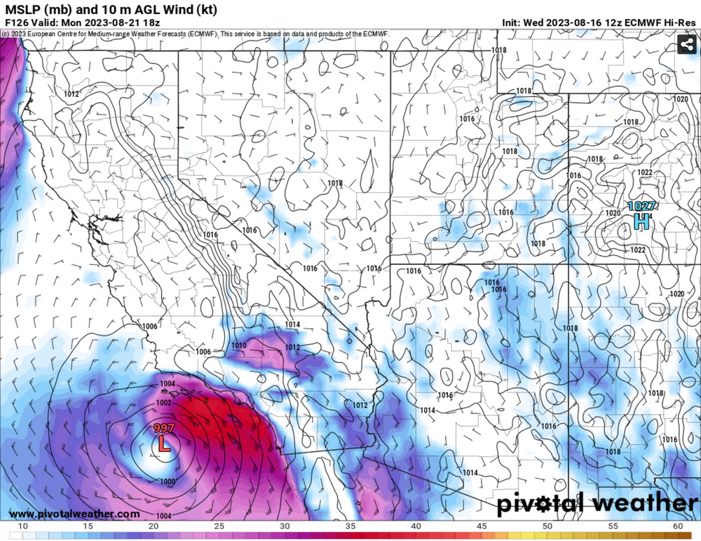
What luck! Brother is getting married Sunday night in LA area. My flight back to east coast is monday midday. I just booked a backup flight on Tuesday because this does not bode well for flights out of LAX Monday.
-
2022 Mid-Atlantic Severe Wx Thread (General Discussion Etc)
alexj7 replied to Kmlwx's topic in Mid Atlantic
The entire University of Maryland campus has had no power since 5:30 PM yesterday. Hopefully getting it back today, but the nearby neighborhoods had some major damage, especially Berwyn. Can see the bow echo was at peak form right as it hit College Park.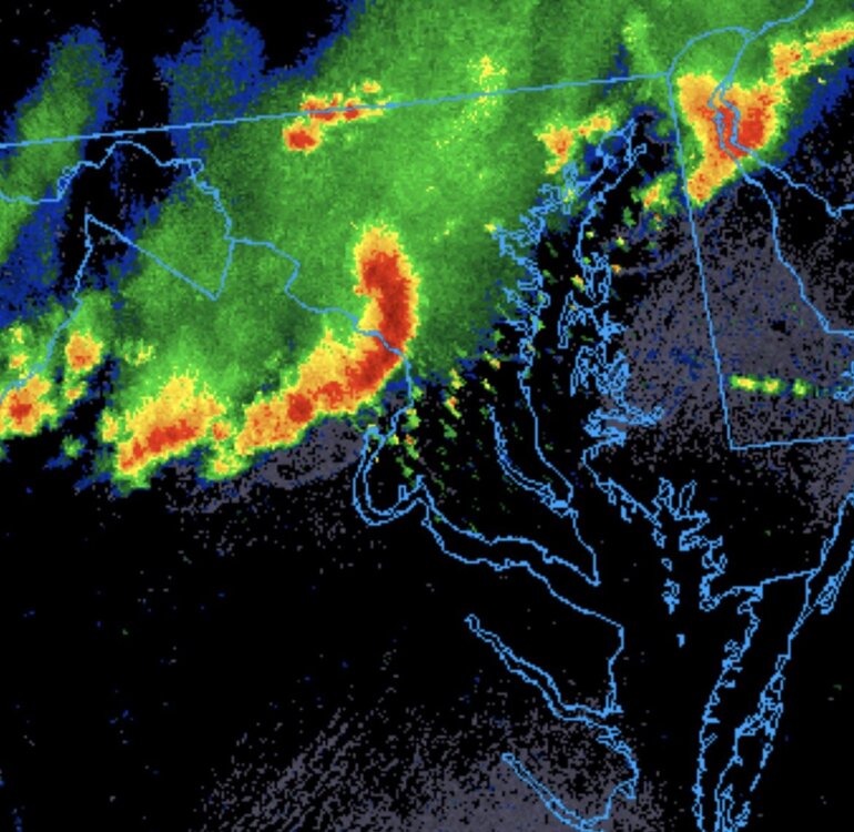
-
Obs and nowcast Super Bowl Sunday 4A-6P Feb 7, 2021
alexj7 replied to wdrag's topic in New York City Metro
I actually have more surfaces covered in snow than any point during the last storm! The wind just kills ratios and accumulation here right on the Hudson River. I could still see huge swaths of ground during the storm last time because nothing would stick. I’m like 10ft from the river so winds really crank here between the skyscrapers. -
2-7-21 Sunday 8-12 hour nor'easter snowstorm roughly 5A-5P
alexj7 replied to wdrag's topic in New York City Metro
-
2-7-21 Sunday 8-12 hour nor'easter snowstorm roughly 5A-5P
alexj7 replied to wdrag's topic in New York City Metro
3k Nam doesn't look as good for NYC. Throws 14" over Morris county but 7" over NYC due to mixing. -
2-7-21 Sunday 8-12 hour nor'easter snowstorm roughly 5A-5P
alexj7 replied to wdrag's topic in New York City Metro
Here we go again, let's hope the trend stops now! -
That makes no sense. First of all, it wasn’t really an outlier. Secondly, you can’t properly measure the snow two days later.
- 1,932 replies
-
- 2
-
-
- heavy snow
- wind damage
- (and 1 more)
-
https://www.weather.gov/source/crh/snowmap.html?sid=dvn 35.1” report out of Mt Arlington, NJ
-
Montague, NJ reported an average reading of 33" at 7 AM. They may set the NJ record of 34" in 1899. However, not sure why Boxing Day Blizzard reported amounts of 36" in NJ don't count.
-
The 3K Nam seemed to handle NYC/NJ well. Yesterday morning it was predicting some 30" maximums in Morris county and that's actually verifying. It went a little too high in South/Central NJ I believe. Here's what it predicted for NYC yesterday morning: Mon 7am: 7.1" Mon 1pm: 14.5" Mon 7pm: 18.6" Tue 10am: 21.2" Central park (Actual) Mon 7am: 5.3" Mon 1pm: 13.3" Mon 7pm: 18.3" (16.3" apparently?)
-
Long Hill Twp, NJ reported 16" at 11 AM. Some other ~15" reports near there as well (Near 78/287 intersection)
- 1,932 replies
-
- 1
-
-
- heavy snow
- wind damage
- (and 1 more)
-
Visibility is below 1/4 mile here with high winds. However, not sure the visibility will sustain this low for 3 hours.
- 1,932 replies
-
- 1
-
-
- heavy snow
- wind damage
- (and 1 more)
-
So far amounts seem slightly lower than expected for immediate NYC metro Central Park 7 AM: 5.3" 3K Nam before the storm estimated 7.1" at 7AM for Manhattan. My immediate area seems under 5" still, but it is near impossible to judge here. I can still see huge areas of bare ground due to the winds. My immediate area never accumulates snow, just too windy.
- 1,932 replies
-
- 1
-
-
- heavy snow
- wind damage
- (and 1 more)