caviman2201
-
Posts
1,992 -
Joined
-
Last visited
Content Type
Profiles
Blogs
Forums
American Weather
Media Demo
Store
Gallery
Everything posted by caviman2201
-
12/31-1/1 Possible Snow Showers/Squalls to Start 2026
caviman2201 replied to bncho's topic in Mid Atlantic
Imma be out there at 3am like Jack Skellington if NAM 3k is right... -
Sadly that was the most snow they've ever seen. They didn't believe me that we sometimes get 1ft of snow here...
-
My kids asked Santa for a blizzard... so Santa gave them a cabin and tubing tickets
-
gonna be awesome up there this weekend... I can't wait to get up there this year. My family went for the first time during the deep freeze last Jan and it was off the charts awesome with 1ft+ on the ground, snow showers for 3 days in the low 20s to upper teens... snowmobiles... lake iced over... just a winter wonderland truly sort of shocking that a place like that is so close by
-
12/14: Sunday funday? Will the south win again?
caviman2201 replied to TSSN+'s topic in Mid Atlantic
-
12/14: Sunday funday? Will the south win again?
caviman2201 replied to TSSN+'s topic in Mid Atlantic
I'm sure i'm late to the party but it looks like all 00z guidance got wetter and more widespread! -
12/14: Sunday funday? Will the south win again?
caviman2201 replied to TSSN+'s topic in Mid Atlantic
I need the JMA in my life... someone used to post that one all the time when we got desperate -
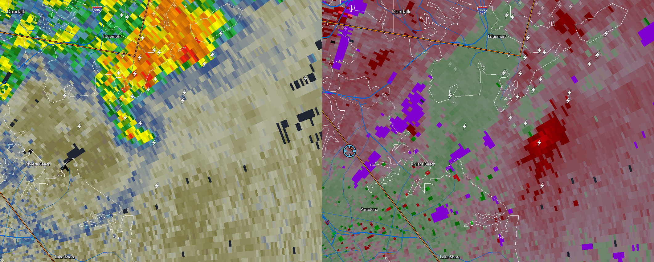
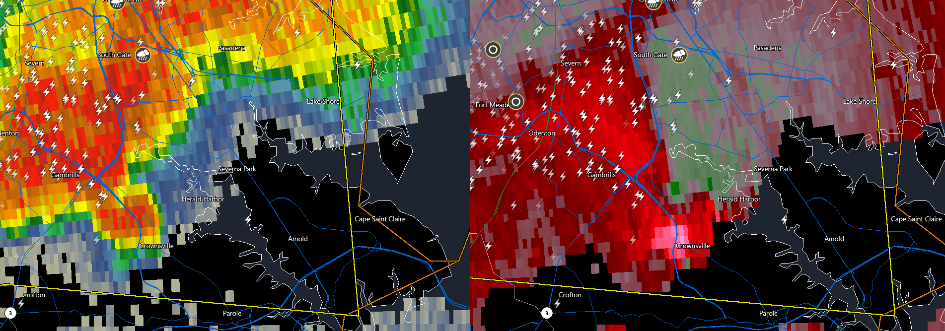
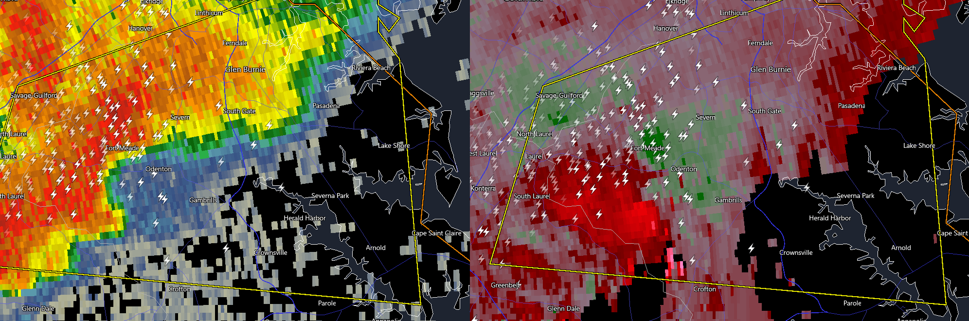
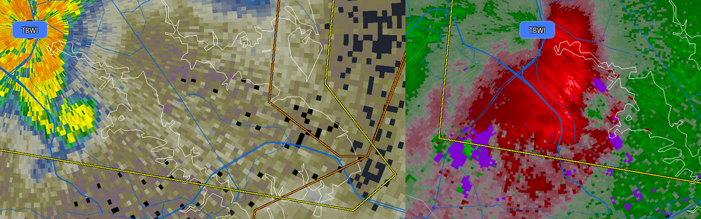
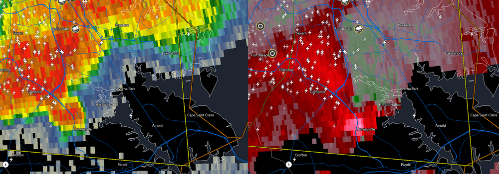
I bet this is producing a waterspout right now at the mouth of the Patapsco...

- 1,378 replies
-
- 4
-

-

-
- severe
- thunderstorms
- (and 2 more)
-
Definitely see it there. That's awesome Sent from my SM-S911U using Tapatalk
-
on the sim reflectivity? maybe i'm looking too hard for it... I was expecting to see it actually model the little 'ring' of outflow reflectivity like you can see in real radar scans
-
Had no idea even HRRR was modeling things like that... If you have a min, can you post what you're seeing? I looked and can't see it
-
Wow...
- 1,378 replies
-
- 1
-

-
- severe
- thunderstorms
- (and 2 more)
-
That really should be TOR warned IMO...
-
That Northern AACo storm looking kinda spicy...

-
It is coming around though...
-
ICON has been kind of on its own for days
-
I'd be surprised if it stays that way for long
-
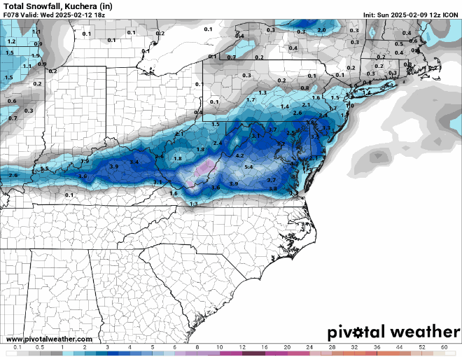
One thing thats been pretty nice this year is how the snow has been pretty evenly distributed throughout the sub. Seasonal totals from York to HGR to OKV to EZF to SBY all within 2-3" of each other and this event appears to just add to everyone's totals.
-
I fixed it dude calm down... sorry You might want to censor it in the quote too
-
we are damaged people...
-
We have now entered the most ************ part of this hobby... bickering over snow that hasn't even happened yet
-
My name is <redacted> and I am a snowaholic experiencing withdrawl... Took the family up to Deep Creek this weekend during winter for the first time... what an experience. Got up there Thurs night and there was well over a foot on the ground. Stayed at a nice little cabin with a fireplace. It was in the teens all weekend. Friday the fam and I experienced Wisp and went tubing for the first time. Sat morning we woke up, went to a little bakery for breakfast and I sat there drinking my coffee while it poured snow with temps around 19. Driving home I got to experience first hand how magical Deep Creek/the Allegheny Front is... It snowed heavily all the way up 219 with temps in the upper teens... It was snowing heavily with temps in the teens as I drove down 68 towards Frostburg... I crested Big Savage Mountain and it began to taper off noticeably... I started to see the sun shine through the clouds... the road turned from snowy to wet... as I descended through Frostburg, the snow ended completely, the sun came out and the temp spiked to the mid-upper 20s. From Cumberland to all the way home it was sunny with wet, salty roads... with temps increasing the whole way from 19 to 36... I thought this trip would satisfy my snow needs for a little while... especially right after our little storm on Monday... It didn't. I can't wait to go back up there as soon as possible.
-
Up at Deep Creek for the weekend... Around 12-15" on the ground in most places. Currently SN- and 18 at 2600ft. My first time up here in winter. Spent the day playing in the snow and tubingat Wisp with the wife and kids. Absolutely spectacular up here right now. Sent from my SM-S911U using Tapatalk
-
This stuff is pure pixie dust... its like its snowing glitter. Everything caved immediately
-
Thats next weekend... one thing at a time