Chinook
-
Posts
10,673 -
Joined
-
Last visited
Content Type
Profiles
Blogs
Forums
American Weather
Media Demo
Store
Gallery
Everything posted by Chinook
-
Hurricane strength wind gusts directly measured this morning
-
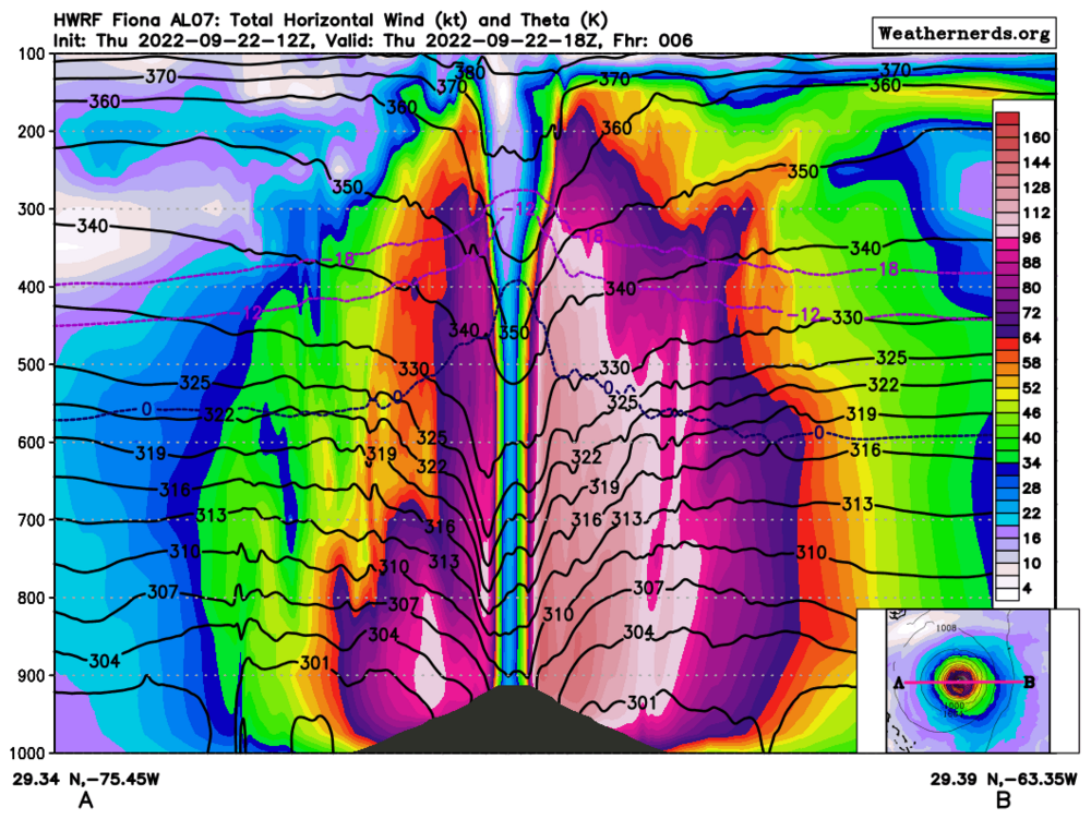
E-W cross section of Hurricane Fiona, winds (colorized), isotherms of 0C, -12C, -18C, (blue, purple) isentropic surfaces (black), The thing that looks like a hill at the middle of the picture is a little confusing. The sea-level pressures of the storm are below 1000mb, with a strong gradient down to a recon-measured 937mb, I believe. 1000mb is the bottom of the image, so it must show the 937mb pressure as a hill shape. You can see the 0C, -12C, and -18C isotherms bump up in the middle, as well as the isentropic surfaces bump down. That means that the core of the hurricane is the location where the latent heat release has warmed the atmosphere the most. And then there's the 128kt wind in the eyewall, reducing to 20kt in the eye. It does show asymmetry.
-
There will be a combo of a monsoon moisture band and a cold front moisture band. Models and NWS-WPC agree that there could be over 2" of QPF in the form of rain (or snow) west of the Continental Divide in the next several days. Chances for rainfall over 0.4" of rain at Denver look good. Wednesday will be the day when the temperatures drop to the 50s and 60's for the cities.
-

2022 Short/Medium Range Severe Weather Discussion
Chinook replied to Chicago Storm's topic in Lakes/Ohio Valley
sort of a three-supercell complex. storms dropped 2.50" hail west of Walcott IA -
2022 Short/Medium Range Severe Weather Discussion
Chinook replied to Chicago Storm's topic in Lakes/Ohio Valley
This is an awesome effective-STP for September.
-
You can run a radar loop with this web site, even many days after the storm is done https://mrms.nssl.noaa.gov/qvs/product_viewer/
-
Buoy 42085 southeast of Ponce: 39kt gusting to 49kt
-
Next quiz. Where was this taken?
.thumb.jpeg.278d00231117041dae611d498e667327.jpeg)
-
a ship has measured 48 knots (55mph) near the eyewall
-
2022 Short/Medium Range Severe Weather Discussion
Chinook replied to Chicago Storm's topic in Lakes/Ohio Valley
The 00z HRRR for tomorrow has quite a few updraft-helicity tracks in western Illinois. Other convection-allowing models have some large storms, too -
I'm really going to miss watching Monday night football/Sunday night football starting at 6:40 Mountain time. That was quite convenient for having a slightly late dinner to begin the game and then having the thing be over with at 9:40. Right now I am seeing USC start a football game, just minutes ago. Start time must have been listed at 10:30 Eastern time.
-
I think it is looking southwest towards Chasm Lake. Maybe somewhere on road 7? Wild Basin Lodge (Sandbeach Lake Trailhead) is the wrong angle.
-
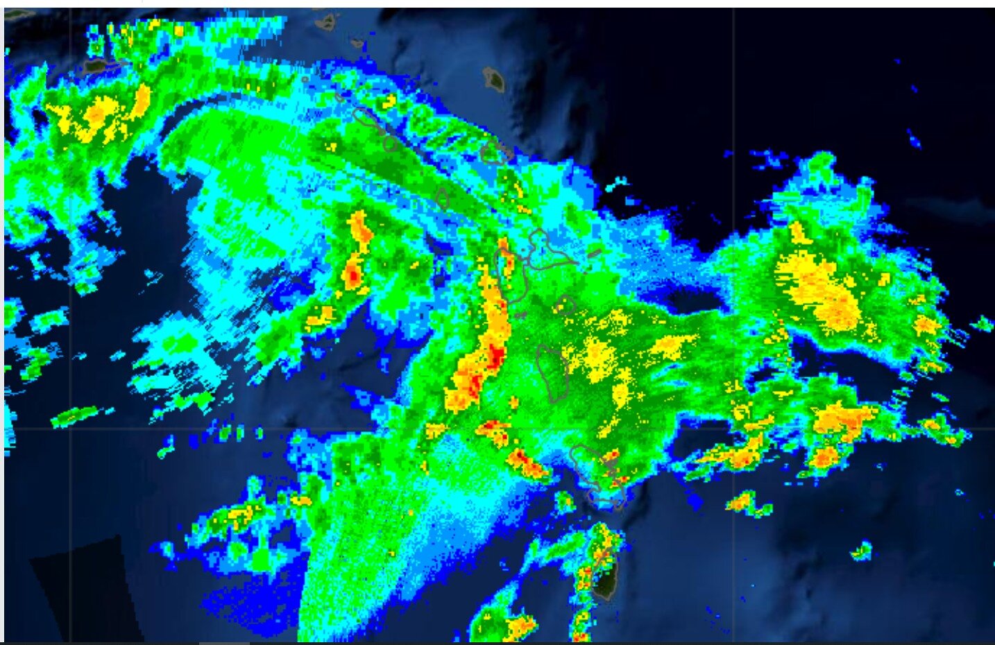
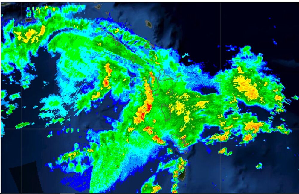
I always wanted to use the Caribbean composite radar in a situation like this (1515z)
-
Levi's Tropical Tidbits videos are back!
-
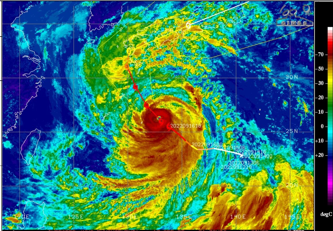
Now JTWC has analyzed this to be 135 knots, which I believe is just below Cat-5 on the Saffir-Simpson scale. Today's HWRF (12z) showed up to 130 knots at 850mb as it approaches an island close to the coast that has mountains that could feel the 130 knots.
-
Web site for composite radar in the Caribbean area https://www.barbadosweather.org/BMS_Radar_Composite_Resp.php#
-
Here is a non-tropical storm with hurricane force winds and impressively low pressures (for any time of year) to impact Aleutian Islands, and areas up to Nome. (Forecast for Nome has winds of 45mph gusting to 70mph) this storm previously had been Typhoon Merbok but transitioned to extratropical at about the time shown here:
-
Super Typhoon Nanmadol, at 130 knots, per JTWC, will max out at 135 knots soon. It will approach Japan as it weakens some.
-
beautiful morning view
-
For what it's worth, Reed Timmer has been streaming about Fiona for the last 24 minutes. I wonder what happened to Tropical Tidbits videos?
-
Typhoon Muifa is heading directly into Shanghai China soon. Typhoon Muifa, 85 knots, as per JTWC most recent analysis. Wikipedia: With a population of 24.89 million as of 2021, Shanghai is the most populous urban area in China with 39,300,000 inhabitants living in the Shanghai metropolitan area
-
A couple of the places I used to live got 0.76" to 0.78" for the September so far, including most from the last two days. Friday was about 59.6 at Fort Collins and Saturday was 53.9. I guess that's a little lower than 100.
-
surface to 700mb stacked low pressure storm report: 3.99" of rain at Oak Creek, Wisconsin. Yikes!
-
Hurricane Kay--EPAC Magic w/ Potential Impact on Southern CA
Chinook replied to WxWatcher007's topic in Tropical Headquarters
I'm amazed. The weather always finds a way to do new things. Radar based rainfall estimation shows over 3.5" to maybe even 8.5" of rain on the east slopes of the coastal range east of Tijuana.


.jpeg.8b5a5f611b7edebd925baf8811791dff.jpeg)