CAPE
-
Posts
36,292 -
Joined
-
Last visited
Content Type
Profiles
Blogs
Forums
American Weather
Media Demo
Store
Gallery
Everything posted by CAPE
-

2022 Mid-Atlantic Severe Wx Thread (General Discussion Etc)
CAPE replied to Kmlwx's topic in Mid Atlantic
Looks like betwixt and between/dying on the doorstep once again here. Been missing everything all week. -
Cooler for the first part of the week, courtesy of a surface high moving across to our north, turning the flow from the E-NE. It will warm up quite a bit beyond Wed, and as far as wet, other than some scattered/isolated showers mostly in the southern parts of the region, any significant rain potential comes with the next frontal passage on Friday. A mischaracterization to claim we are going to have a wet week upcoming.
-
About time.
-
Topped out at 93 here. Currently 91.
-
92/65
-
Say out of the heat, drink beer, watch the Preakness. Enjoy.
-
69 currently. It has been pretty dry here with significant rain staying just to the north the last few days. Thinking temperature here might be a tad higher but humidity a bit lower today as a result.
-
Oh I would never pass it up other than the price lol. It is complex and damn good. Just wish I could find an original but I guess they haven't brewed it lately. Can buy an aged one which costs 16 bucks. Worth it though.
-
It's good. Defo can taste the sherry notes. I still like the original WWS the best, followed by the BBA one.
-
This is me as well. Only way I can enjoy an aged one is to buy one that is aged lol.
-
Yes only 10 days from June, sun angle is undeniably an 'issue'. But alas we will see hand wringing over it around here next February(as usual) should there be a threat of snow.
-
83 here after a high of 86. Clouds around so temps were held down a bit.
-
2022 Mid-Atlantic Severe Wx Thread (General Discussion Etc)
CAPE replied to Kmlwx's topic in Mid Atlantic
Lookin pretty safe here too. Might get some pity showers/drizzle. Mostly a one trick pony for our region today. Pretty isolated for an ENH. -
2022 Mid-Atlantic Severe Wx Thread (General Discussion Etc)
CAPE replied to Kmlwx's topic in Mid Atlantic
Latest take on potential for tomorrow from Mount Holly- Monday continues to appear quite interesting. The mid level short wave trough that was producing thunderstorms in the middle Mississippi River Valley this afternoon will head our way. It should move up the Ohio River Valley overnight and on Monday morning. The trough is expected to begin taking on a negative tilt on Monday and its axis is anticipated to pass over our region early on Monday night. Conditions are forecast to become favorable for severe weather in our region in advance of the approaching short wave and its associated cold front from Monday afternoon into Monday evening. Mixed layer CAPE values are expected to rise into the 1000 to 1500 J/kg range as surface temperatures rise mostly into the upper 70s and lower 80s with dew point readings well into the 60s. The expected wind profiles suggest deep layer shear in excess of 40 knots with storm relative helicity rising near 200 m2/s2. Not only are damaging winds and hail forecast but we will need to watch for brief spin-ups in our area. The storms are expected to be progressive. However, with precipitable water values in the neighborhood of 1.5 inches, locally heavy and flooding is areas of poor drainage are additional concerns. -
0.40" of rain today with a high of 67.
-
Mid May to mid September, as always.
-
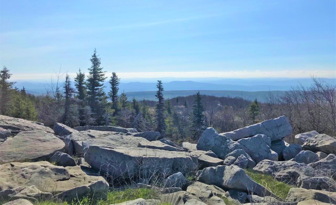
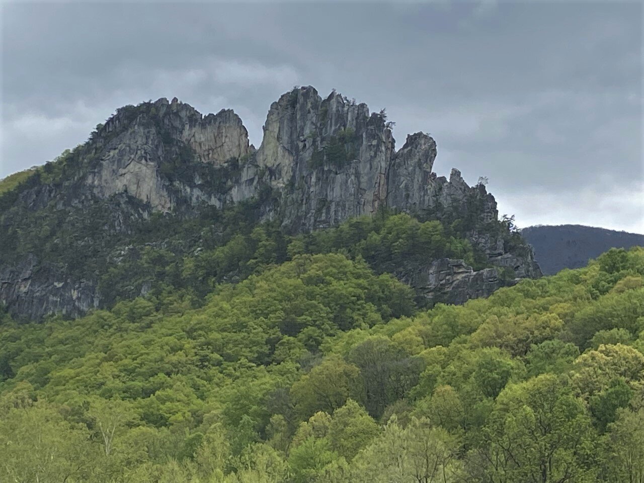
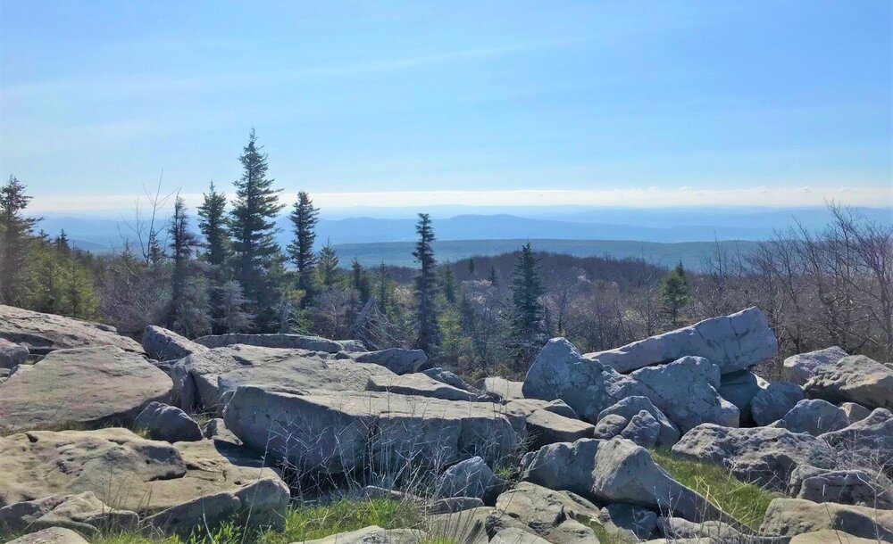
A couple more from the top of Seneca Rocks. There is a platform at the end of the trail, but I climbed a bit higher and the second pic is looking up at the top of the rocks.
-
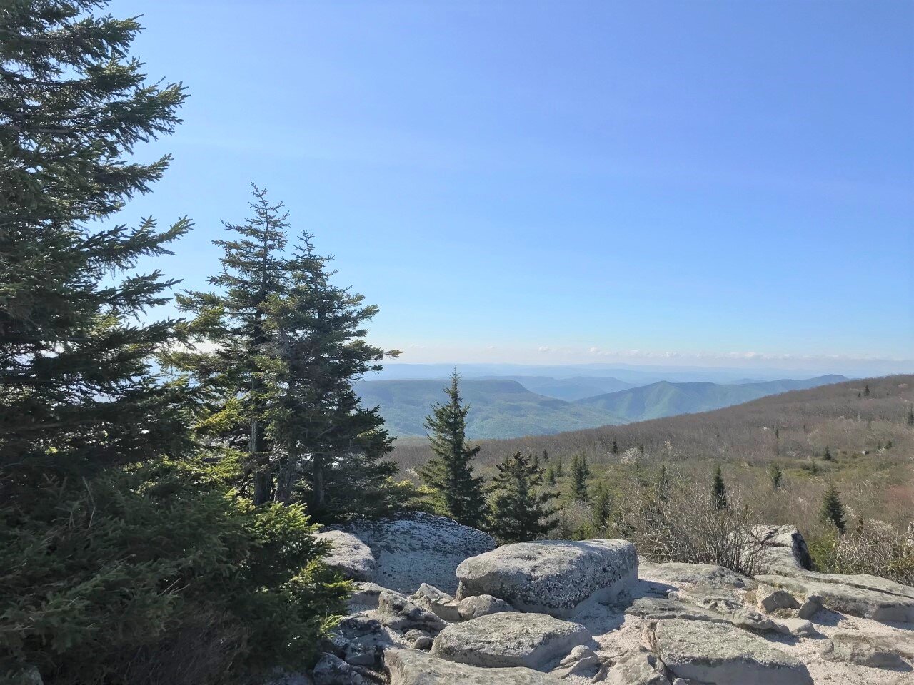
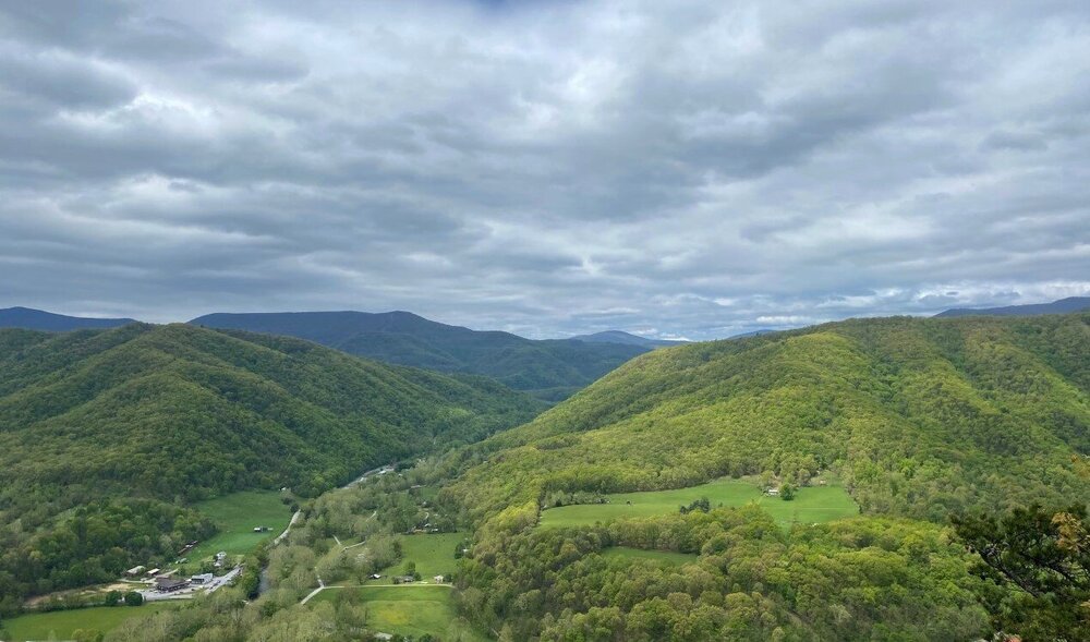
A few shots from Bear Rocks Preserve in north Dolly Sods and one from Seneca Rocks. The Seneca Rocks Hike was a good workout- not long but vertical- going from around 1500 to 2500 feet in less than 2 miles. A lot nicer heading back down. Ofc Dolly Sods is all high elevation- the shots from Bear Rocks area are from 4000 ft. Pretty rough ride up there and the Jeep looks cruddy.


-
Should be a perfect day for hiking out here. Sunny, mid 60s and breezy.
-
Off to Canaan for a few days. Top of the to do list is hiking in the Dolly Sods Wilderness.
- 249 replies
-
- 10
-

-
I have thoroughly enjoyed this Spring honestly. No complaints at all. This period could be a tad warm and humid as advertised. Only a matter of time in these parts.
-
Latest CPC ENSO update suggests a continuation of Nina with neutral conditions possible as we move through the summer months. A long way out but predictions for Fall and early winter continue to favor colder SSTs. Not looking Nino-ish at this juncture.
-
43 with a bit of drizzle. With no additional rain today, looks like the total here will be 1.15".
-
The closed low that will be shunted southward today will meander around off the SE coast and may attempt to pay us another visit next weekend as it interacts with an approaching trough/cold front.