All Activity
- Past hour
-
 tamoxifen for breast cancer prevention and alternative to tamoxifen tamoxifen bone pain http://thetrainingworld.com/resources/topframe2014.php?goto=http://nolvacare.com who should take tamoxifen or http://asresin.cn/home.php?mod=space&uid=1193911 how to lose weight on tamoxifen [url=http://maps.google.gg/url?q=https://nolvacare.com]tamoxifen moa[/url] tamoxifen and bone density and [url=https://gikar.it/user/okwxhbbmus/]lexapro and tamoxifen[/url] nolvadex gynecomastia
 -
here we go lol
-
tamoxifen for breast cancer prevention and alternative to tamoxifen tamoxifen bone pain http://thetrainingworld.com/resources/topframe2014.php?goto=http://nolvacare.com who should take tamoxifen or http://asresin.cn/home.php?mod=space&uid=1193911 how to lose weight on tamoxifen [url=http://maps.google.gg/url?q=https://nolvacare.com]tamoxifen moa[/url] tamoxifen and bone density and [url=https://gikar.it/user/okwxhbbmus/]lexapro and tamoxifen[/url] nolvadex gynecomastia
-

Septorcher 2026 Discussion - Endless Summer
powderfreak replied to Damage In Tolland's topic in New England
I’m down probably 1.5” on that graphic and couldn’t care less, ha. Nice, dry weather is perfect for enjoying the outdoors during the autumn. Even if it didn’t rain at all in the next 6 weeks, life would go on just fine. -
Its been over for months lol. Other than hopium. Blow it up and start over. Elias the gas lighter has totally fucked this organization. Hopefully the owner is smart enough to finally see it. I have my doubts.
-
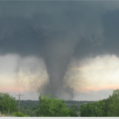
Tornado sirens are going off in Cedar Rapids.... radar indicated near the airport.
-
The issue is the marginal temps these models are depicting, particularly when we get a shot at a coastal storm. Normal/slightly above temps on the seasonals could be a signal for a bunch of chilly rain. The PSU perfect track rainstorms lol. We will likely need a -AO/-EPO to be present in order to overcome the onslaught of Pacific air into our source region and allow colder air to move southward. Not a prediction, but a potential fail mode, as we have seen before in strong Ninos. Location matters ofc. Interior at elevation may do ok. I root for Ninas here since the epic winter of 2009-10, as they have mostly produced avg to slightly above avg snowfall. Ninos have pretty much sucked since then.
-

Septorcher 2026 Discussion - Endless Summer
FXWX replied to Damage In Tolland's topic in New England
I might be misreading it, but that shows a 6-week anomaly total for most of New England in the -0.5 to -1.0 inch range. Certainly not anything overly concerning? Instead of ~4 inches of rain over the next 6 weeks, most get 3.0 to 3.5 inches? Assuming that product is close to accurate, which is always iffy. -
That is so odd...I mean, it can help to determine how favorable the set up is for a phase, and/or to come up the coast...but need H5.
-
So as of right now EWR isn't even in the top 20 for 90 degree days. Also pretty insane that 1993 had nearly as many 95 degree days as we do 90 degree days this year. Now that's hot.
-
Orioles season is finally over.
-
Yeah agree. You can’t tell a whole lot there.
-
Today's Highs: PHL: 85 New Brnswck: 85 BLM: 83 EWR: 82 JFK: 82 * missing intra hour highs TTN: 82 TEB: 81 ISP: 80 LGA: 80 NYC: 80 ACY: 80
- Today
-
Temperatures will likely peak in the lower and middle 80s tomorrow and Thursday. Another push of cooler air could arrive by Friday or Saturday. Overall, the week looks to be dry with little or no rainfall likely through at least Friday. the greatest likelihood for some showers is Thursday evening and Thursday night when a cold front crosses the region. The ENSO Region 1+2 anomaly was +4.6°C and the Region 3.4 anomaly was +2.7°C for the week centered around September 2. For the past six weeks, the ENSO Region 1+2 anomaly has averaged +4.12°C and the ENSO Region 3.4 anomaly has averaged +2.57°C. The ongoing strong El Niño, will continue to strengthen through the mid-fall. The SOI was -26.74 today. The preliminary Arctic Oscillation (AO) was +1.761 today. Based on sensitivity analysis applied to the latest guidance, there is an implied near 58% probability that New York City will have a warmer than normal September (1991-2020 normal). September will likely finish with a mean temperature near 69.9° (0.7° above normal). The Region 1+2 anomaly surpasses the all-time record of +4.5° that was set during the week centered around June 29, 1983. Supplemental Information: The projected mean would be 1.9° above the 1981-2010 normal monthly value.
-
generic propecia without rx and propecia tablets get generic propecia without insurance https://maps.google.com.pr/url?q=https://hairguardrx.shop get generic propecia priceand http://www.xunlong.tv/en/orangepibbsen/home.php?mod=space&uid=6972301 buying generic propecia no prescription [url=https://www.google.lt/url?q=https://hairguardrx.shop]propecia no prescription[/url] cost generic propecia for saleor [url=https://allchoicesmatter.org/user/zjwitaioaa/?um_action=edit]get generic propecia pills[/url] buy propecia price
-
Got some beneficial rainfall overnight. Trees look a bit happier here but still stressed. Front coming through now will drop dewpoints into the 50s finally
-
Pretty nice look for a time in mid January, as that ridge lists northward for a bit.
-
I agree it won't be as warm as 2023, but seasonal guidance will always underestimate huge monthly anomalies. Don't be surprised if we see one.
-
Depending on the model, no more than .5C in any 1 month in this area after cooling off around the same amount in August's forecasts. The Cfs2 was already much warmer at this time in 2023 as I previously posted. If we are getting a toaster oven that will seriously impact snowfall, we should know it beforehand as, imho, one of the seasonals will show it.
-
Well, to be fair, they never predict the +10 month....they have also been trending warmer.
-
Why isn't it H5? 200mb is somewhat less helpful.
-

2026-2027 Record-breaking El Nino
mitchnick replied to Stormchaserchuck1's topic in Weather Forecasting and Discussion
And the trend is our friend if you want it to keep rising..png.89aae377804879e711f063d168d46882.png)
-
Yep. None of the seasonals so far are a toaster oven.
-

2026-2027 Record-breaking El Nino
GaWx replied to Stormchaserchuck1's topic in Weather Forecasting and Discussion
Here’s the preliminary winter outlook from pro met. Chris Martz: here is my preliminary thinking. . . As y'all probably know by now because of the endless hysteria in the news cycle, we are in an El Niño, which is just the warm phase of the larger El Niño–Southern Oscillation (ENSO). This year, the developing El Niño is unusually intense, and it is expected to officially be a “very strong” El Niño by early winter at the latest. This is marked by very warm sea surface temperatures in the equatorial Pacific Ocean. The news media and the United Nations have spun this as some sort of crazy event that will “turbocharge” extreme weather all over the globe, but that's not really how it works. Now, normally in the tropical Pacific Ocean, easterly wind stress associated with the Walker Circulation imparted on the sea surface acts to pile warm water near the surface in the western half of the basin; that is, closer to Asia. This pushes the thermocline down towards the west as warm water pools up north of the Maritime Continent and east of the Philippines. But during El Niño, the easterlies weaken or temporarily reverse (westerly wind bursts), which causes that pool of warm water to slosh back east. That's what's happening right now. There are a lot of meteorological factors to consider when it comes to predicting long-range temperatures, precipitation, and storm tracks. But this year, this “very strong” El Niño will play a dominant role I think as it has in years past (e.g., 1982–83, 1997–98, and 2015–16). Those are my top post-1950 analogs, and I added 1972–73 into the mix as it behaved similarly to the others, although it was only a “strong” El Niño at peak intensity. 1827–28 and 1877–78 would have been good analogs too, but we don't have enough climate data from back then to work with. A key feature of “very strong” El Niño events is that wintertime temperatures are particularly mild relative to average. This is pronounced in the Upper Plains / Midwest and Great Lakes / Northeast. Temperatures across the Desert Southwest and Four Corners region, however, typically run below average. The southeast can swing either way, but generally winds up near “average” (and I use scare quotes there because the weather is rarely “average”). However, these exceptionally mild temperatures do not necessarily persist all winter. In fact, most of this composite is due to “blowtorch” Decembers. And I do expect December to end up 5–10°F above average in the areas you see orange and red contours in the first analog composite map I made below. But the roaring Pacific Jet typically relaxes from mid-January through mid-February, so temperatures will tumble a bit closer to “seasonable.” If this El Niño were weaker, there'd be a good chance of a frigid December in the east. But I doubt that's going to happen. As far as precipitation goes, well, there should be an active subtropical jet stream. So, air parcels moving from west-to-east will tap into Gulf moisture and then be advected northward into the southeast. I expect a lot of rain in the Gulf Coast states (Texas to Florida) and then northward up the east coast into the DMV. Similarly, the western U.S. should expect some major drought relief due to atmospheric river events. After a near-record low snowpack last winter, the ski resorts will be back in business. Elsewhere, it will likely be a bit drier than normal due to persistent high-pressure ridging over the northern flank of the country. Storm tracks are going to favor the southern states. With respect to snowfall, overall, I do expect less of it nationwide outside of high elevation areas simply due to higher-than-average temperatures. But I cannot rule out ONE crippling blizzard in the Mid-Atlantic or in the southeast. It happened in the southeast (Florida, Georgia, and Carolina coastline) in February 1973 and in the lower Mid-Atlantic (Virginia, D.C., Maryland, and southeastern Pennsylvania) in both February 1983 and January 2016. However, it did not happen in 1827–28 or 1877–78 (I checked NOAA NCEI FORT data) or in 1997–98. So, whether or not we get the “big one” remains up in the air for now. But it will be that one storm that will ultimately determine where the seasonal snowfall will stand (above / below climatology) in the southeast and Mid-Atlantic. If it occurs, many folks will get their seasonal spoonful of snow in one dumping. If it does not occur, it's just going to be a wet winter. -
HRRR has a pretty good soaker for IA and most of northern IL through tomorrow morning.