All Activity
- Past hour
-

Septorcher 2026 Discussion - Endless Summer
Chrisrotary12 replied to Damage In Tolland's topic in New England
That’s a lot of water to our west. -
Well, that was disappointing. .04"
-
0.06. Impressed how the CAMs sniffed this one out.
-
Southern MD is slipping back into drought
-

Septorcher 2026 Discussion - Endless Summer
BrianW replied to Damage In Tolland's topic in New England
Congrats on the jack 5 inches there.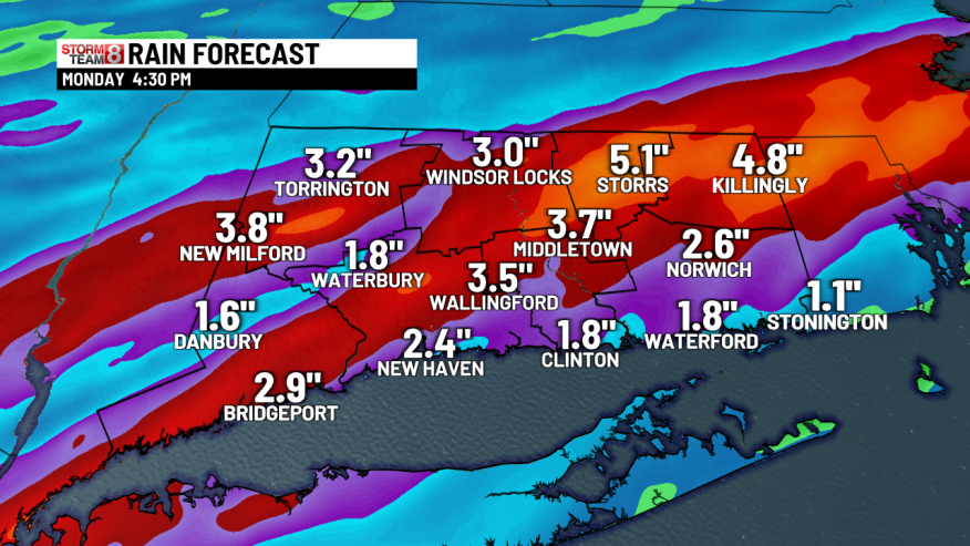
-

Septorcher 2026 Discussion - Endless Summer
Damage In Tolland replied to Damage In Tolland's topic in New England
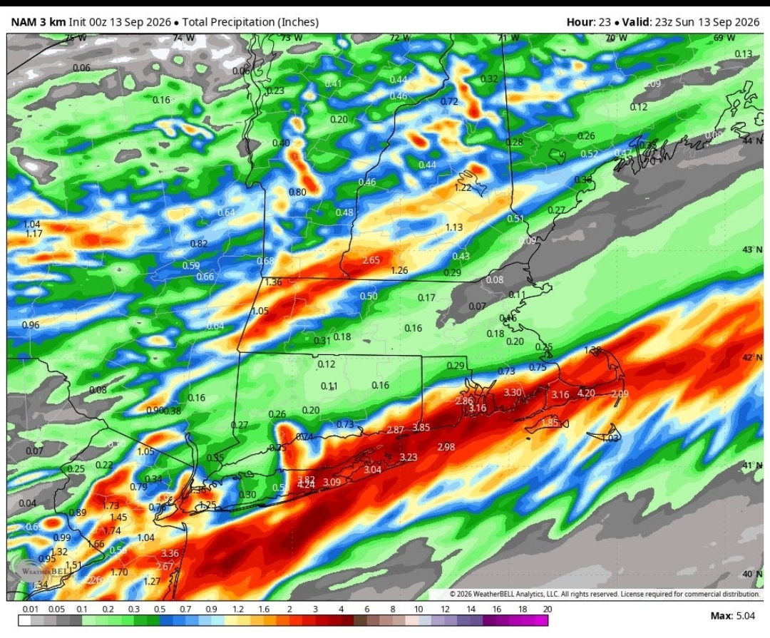
Looks like a coast special with less in between the bands. Like models show -
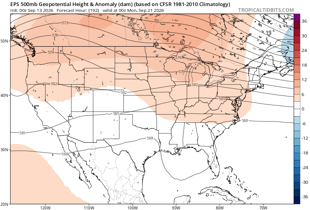
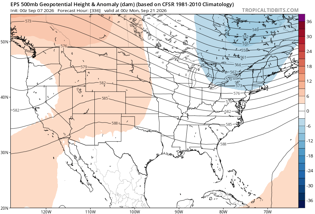
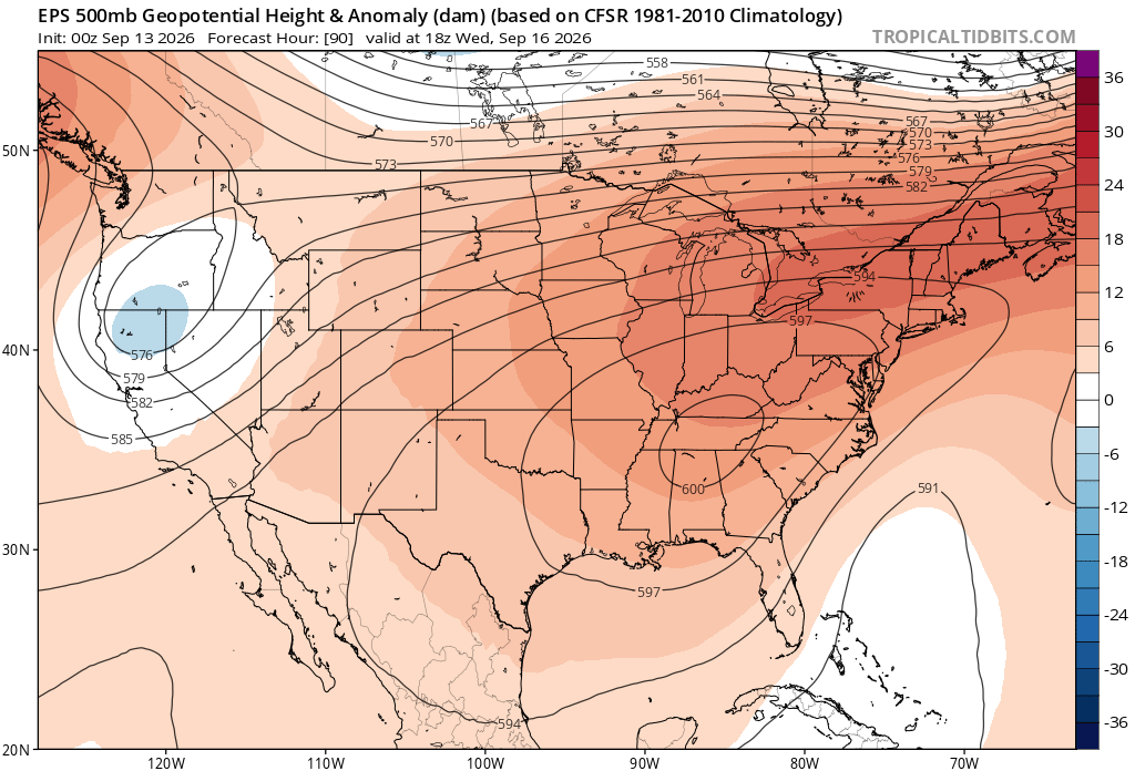
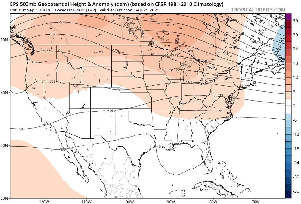
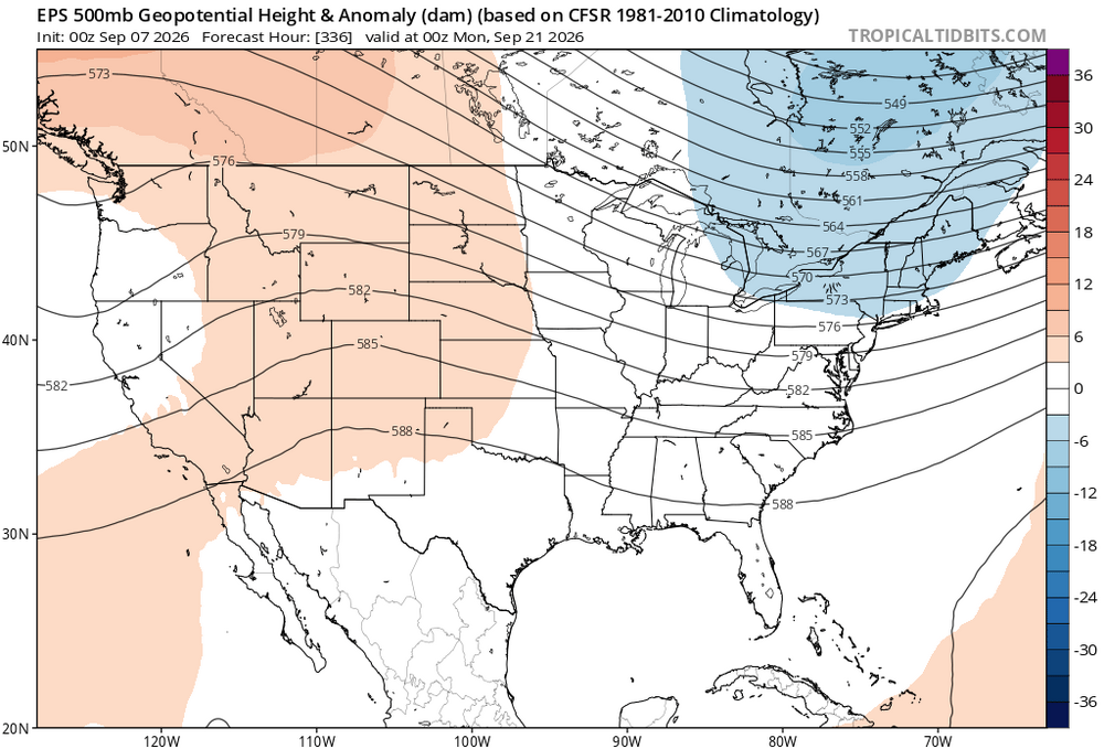
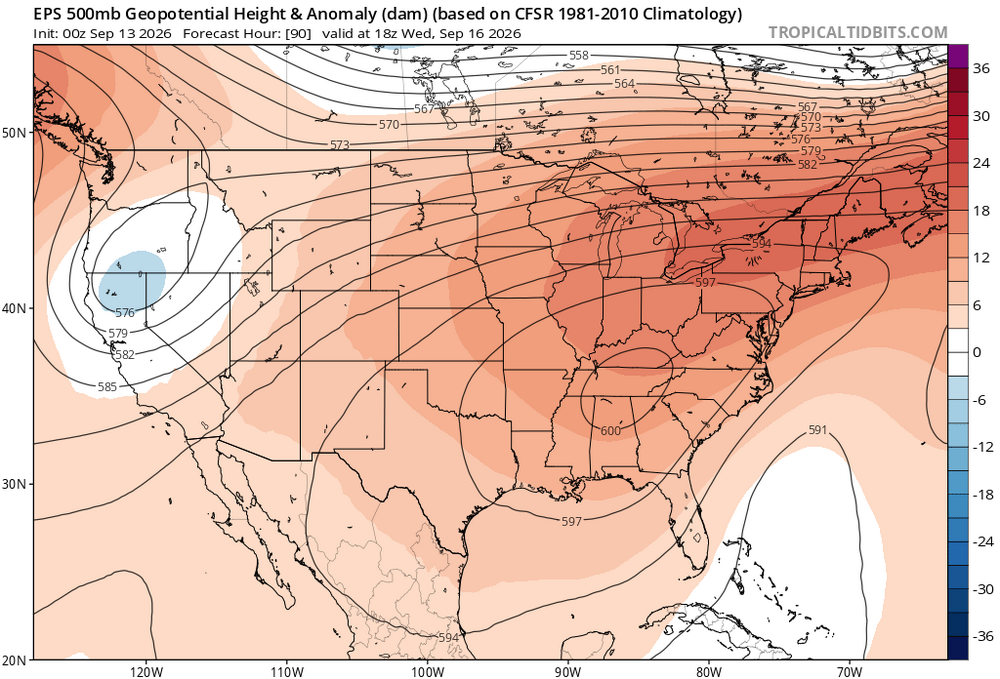
NYC isn’t considered one of the local warm spots these days due to the artificial cooling from the trees. So the mid 80s will likely be from around Philly to perhaps Newark. This record breaking 600 dm ridge really moderated the cool down which was expected to follow for late September. New run Old run
-
Heavy rain now. Hopefully the seed I laid down yesterday doesn’t all wash out. Saw that a flash flood warning was posted for southeastern Morris County down near Long Hill Township/Chatham.
-
no way am i seeing mid 80's for late next week for nyc this will bust .
-

Septorcher 2026 Discussion - Endless Summer
Sey-Mour Snow replied to Damage In Tolland's topic in New England
Look at radar -
It’s tough to find the exact locations of where the Mt Pocono observations were taken before the airport opened. So it’s possible some of those warmer readings further back in time were taken at lower elevations where it’s warmer than the current airport location. That may be why some of the earlier warm records haven’t been matched at the current airport location. Station Thread for Mount Pocono Area, PA Name Period in Thread 1 Pocono Mountains Municipal Airport 10/01/1999 to 12/31/2025 2 Tonyhanna Pocono Mountain Airport 12/01/1961 to 09/30/1999 3 Mt. Pocono 09/12/1901 to 11/30/1961 Before official automated airport observations began at the Pocono Mountains Regional Airport (KMPO) in 1999, weather observations in Mount Pocono were recorded by volunteer citizens through the National Weather Service Cooperative Observer Program (COOP). [1, 2, 3] These historical records for Mount Pocono date back to 1901. Under this cooperative network, dedicated local residents, meteorologists, and property owners used equipment provided by the weather bureau to manually record daily maximum and minimum temperatures, snowfall, and rainfall from their own properties or local stations within the community. This long-standing cooperative network is what established Mount Pocono's foundational climate archive
-
Septorcher 2026 Discussion - Endless Summer
Damage In Tolland replied to Damage In Tolland's topic in New England
Where are you seeing 1-2” here? -

Septorcher 2026 Discussion - Endless Summer
Modfan2 replied to Damage In Tolland's topic in New England
Looks like 1-2” for you and more this way and east into RI…..Would be happy if it all shifted further SE -
.08
-
Septorcher 2026 Discussion - Endless Summer
Damage In Tolland replied to Damage In Tolland's topic in New England
Wouldn’t have thought Dendy would get inches and I’d get light rain but…. - Today
-
Septorcher 2026 Discussion - Endless Summer
Damage In Tolland replied to Damage In Tolland's topic in New England
Mid-upper 80’s -
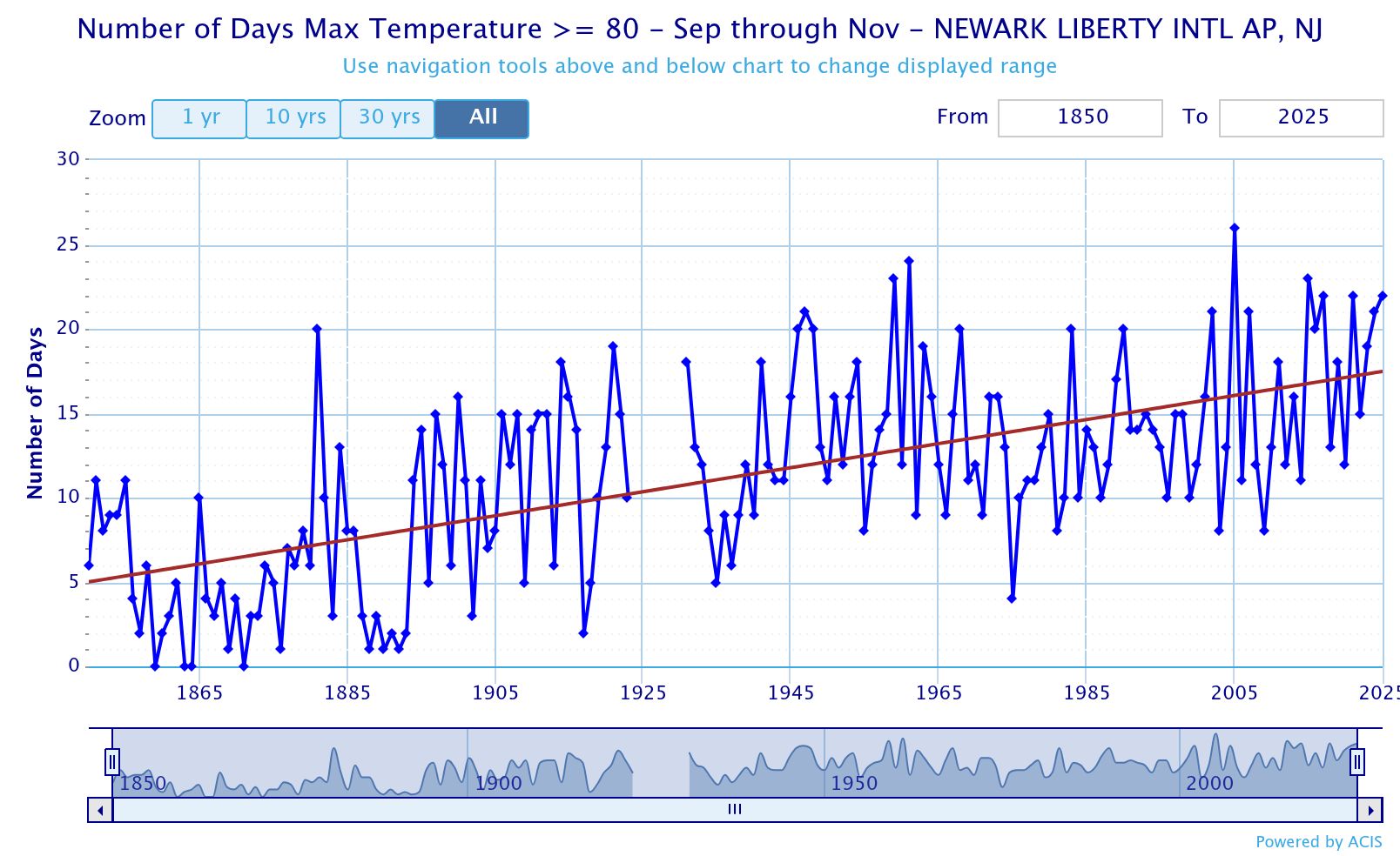
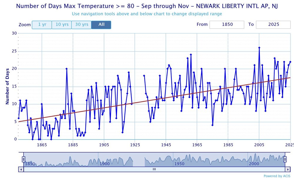
The definition we use for endless summer in the fall is highs of 80° or warmer. This year got off an early start for 80s back in March. So many locations across the region are in the top 5 for 80° days this year. The number Sep to Nov 80° days have more than tripled at the usual warm spots like Newark over their period of record. So now we just take a higher 80°+ days for granted in the fall. 2009 was the last time we had under 10 days reaching 80° during the fall at the locally warmer spots like Newark.
-

Septorcher 2026 Discussion - Endless Summer
kdxken replied to Damage In Tolland's topic in New England
Never mind. I guess the answer is yes.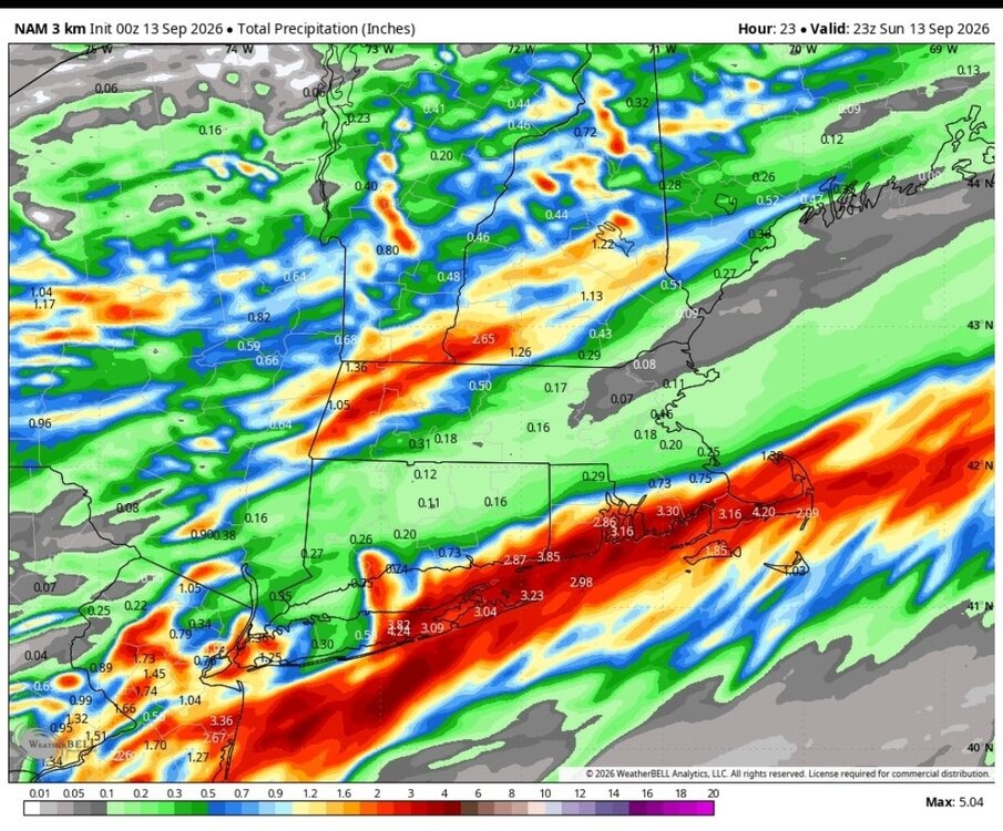
-
Septorcher 2026 Discussion - Endless Summer
kdxken replied to Damage In Tolland's topic in New England
Was the rainfall they're getting to the north modeled? I don't recall. -

Septorcher 2026 Discussion - Endless Summer
CoastalWx replied to Damage In Tolland's topic in New England
This looks like a classic PVD to Fall River flooded. Hopefully decent rain here. -
Actually got 0.15”
-
 http://mexicogenerics.com/# mexican medicine
 -
Where is all the blue for next week? That pna signal crumbling
-
pharmacy site: India Generic Store and e pharmacy india
-
What happened lol. How did that rain manage to miss. This has been an amazing summer of missing out on rain.